Alta Ski Area has reported 13″ of new snow since 4am yesterday, and there’s more on the way. There is a hazardous weather outlook for the western 2/3rds of Utah according to NOAA, and a “long duration winter storm system” is expected to move in tonight lasting through early next week.
Several winter storm systems are expected to bring periods of
accumulating snow across the region this weekend through early
next week. Snow accumulations will eventually add up to
significant amounts, mainly over the northern Utah mountains.
 -NOAA, 1/9/20
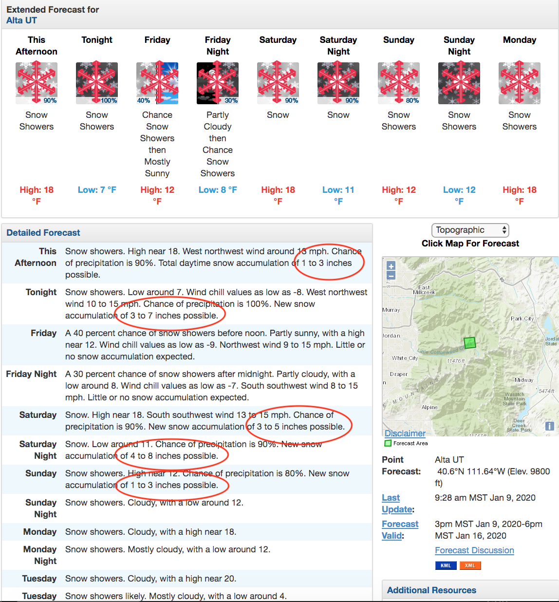
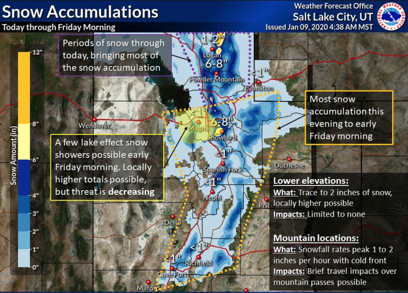
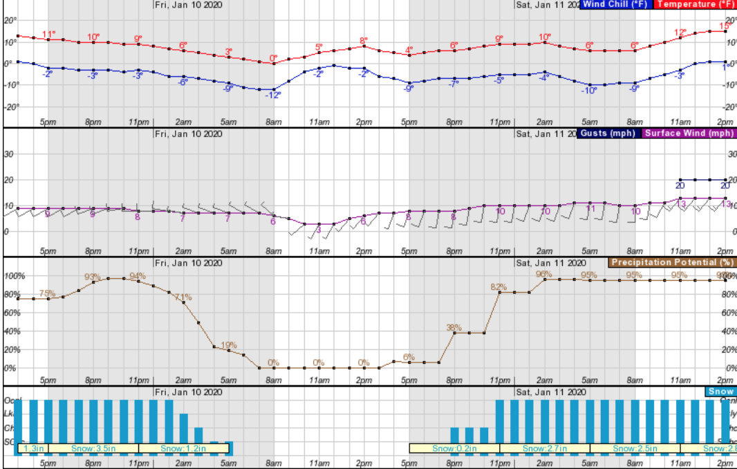
Tonight through Friday morning the Wasatch Mountains may up see up to 7″ of new snowfall with a brief break between storm systems on Friday afternoon. Lake effect in mountainous regions is possible through Friday morning.
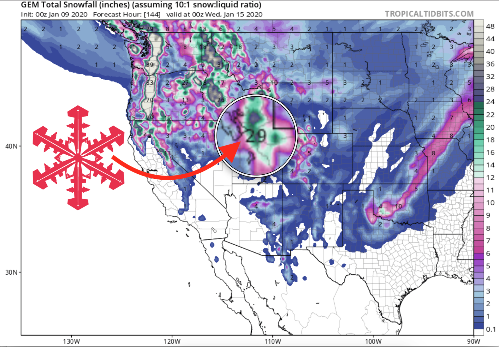
Then, several winter storms systems will move into the Great Salt Lake area and Wasatch Mountains this weekend and continue on through early next week with significant snow accumulations, according to NOAA. A storm total of 29″ is possible
A “long duration winter storm system” will impact Utah Saturday afternoon and continue on through Monday, says NOAA. After that another storm system is expected to move into the Salt Lake Area/Wasatch mountains on Tuesday lasting through Wednesday.
The best days to ski will be this Saturday and Sunday as over a foot of new snow is possible on Saturday.
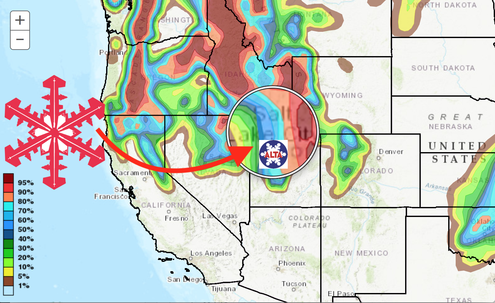
GEM Snowfall Total Model:
Other Info: