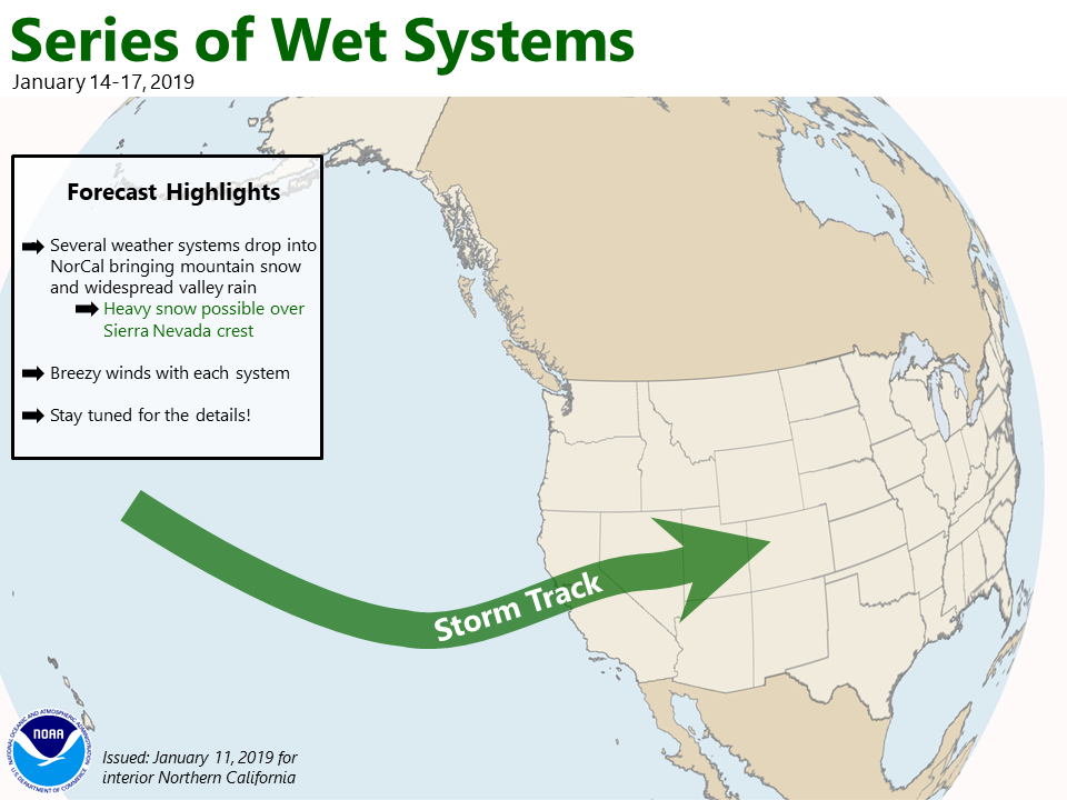
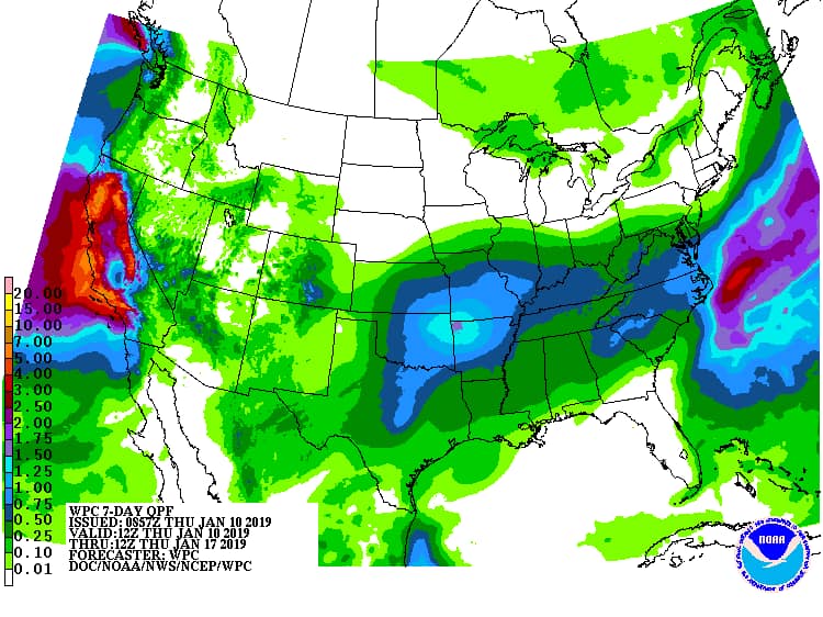
NOAA is forecasting an atmospheric river “series of storms” to bring 10-20+% of California’s annual precipitation in just one week: next week…
To put it incontext, current model runs show some locations in CA
and western NV receiving 10-20 percent of their annual
precipitation (more for southern CA) in just the next week.
- NOAA Reno, NV today
Snow levels currently look good for these storms:
Tuesday Storm Snow Levels:
Snow level contingency scenarios and model soundings are hovering near to just
above valley floors with the rain/snow line, so will maintain a mix in the
forecast for now.
- NOAA Reno, NV today
Thursday Storm Snow Levels:
At this point it looks like all snow for the mountains with much of the event being
rain for the valleys of western Nevada, however snow levels could fall to valley
floors behind a cold front late Thursday.
- NOAA Reno, NV today
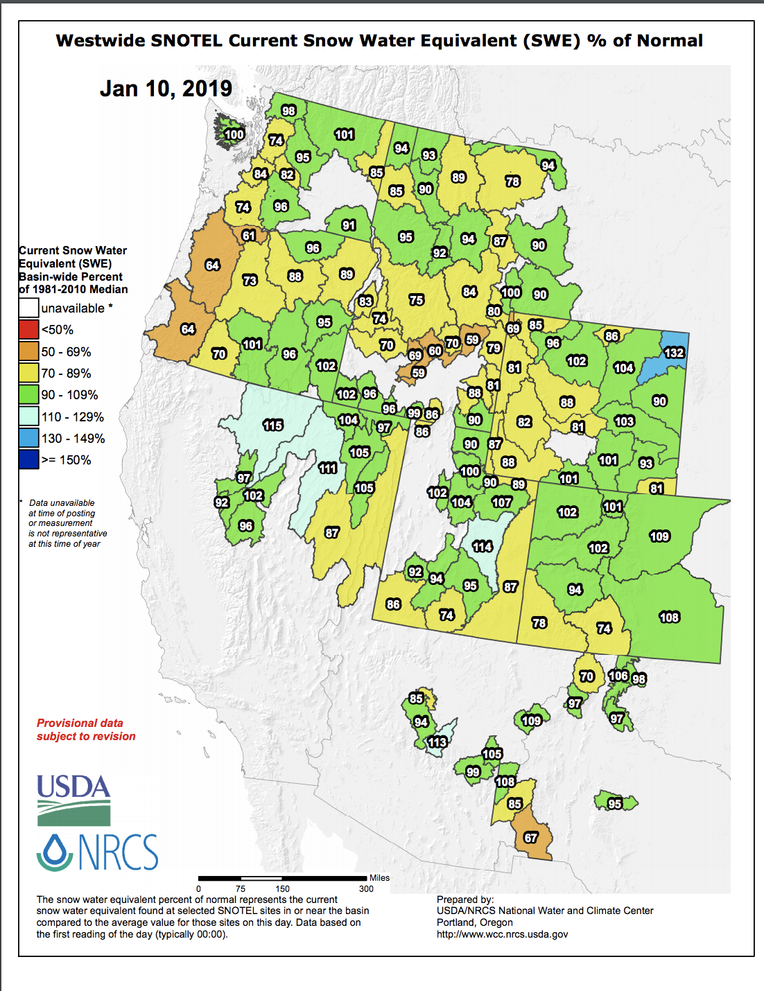
According to NOAA, the Lake Tahoe snowpack is at 92% of average to date.
Squaw Valley, CA has seen 163″ of snowfall so far this season and they are sitting on an 85″ snowpack.
Sierra-at-Tahoe, CA has seen 121″ of snowfall so far this season and is sitting on a 76″ snowpack.
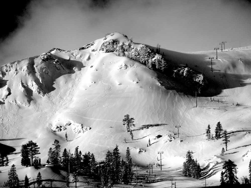
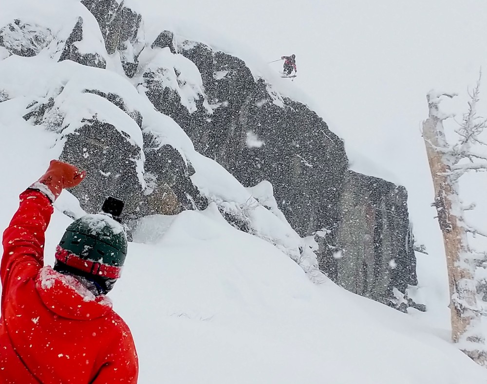
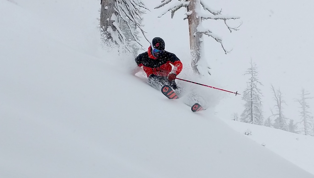
We skied Squaw the past three days and the snowpack is at our favorite level right now – the place is feature-full, playful, and not too buried.
The past two days in Tahoe were all-time…
- 1/9/19 – Squaw Valley, CA Report: Crazy-Fun, Wet, Hucking Powder Day
- 1/10/19 – Squaw Valley, CA Report: Bluebird Powder, Perfect Snowpack, Send-Fest…
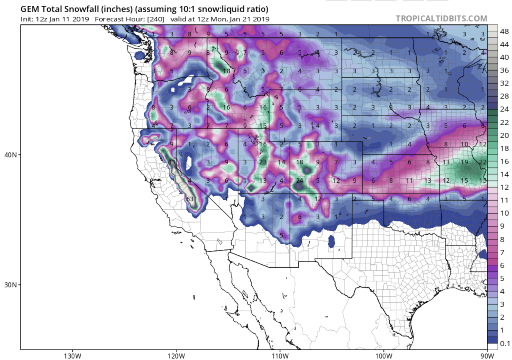
Be advised that an impressive amount of snowfall is currently being forecast in California from Tahoe to Mammoth for next week.
NOAA’s LONG RANGE FORECAST FOR LAKE TAHOE CA:
.LONG TERM...Monday Night onward...

An active weather pattern is shaping up for next week as several
storms are set to move into the west coast. Coastal landfall
atmospheric river detection progs are increasing in the 35-40N
latitude range for next week, which is a favorable placement for
the Sierra. The series of storms is likely to bring a significant
cumulative precipitation total to the region. To put it in
context, current model runs show some locations in CA and western
NV receiving 10-20 percent of their annual precipitation (more for
southern CA) in just the next week.
- NOAA Reno, NV today
FULL NOAA LONG RANGE FORECAST FOR LAKE TAHOE:
Area Forecast Discussion
National Weather Service Reno NV
225 PM PST Fri Jan 11 2019

.LONG TERM...Monday Night onward...

An active weather pattern is shaping up for next week as several
storms are set to move into the west coast. Coastal landfall
atmospheric river detection progs are increasing in the 35-40N
latitude range for next week, which is a favorable placement for
the Sierra. The series of storms is likely to bring a significant
cumulative precipitation total to the region. To put it in
context, current model runs show some locations in CA and western
NV receiving 10-20 percent of their annual precipitation (more for
southern CA) in just the next week.

The first wave for Tuesday and Tuesday night is looking more
pronounced with better south to southwest flow aloft, rather than
the southeasterly flow that was showing up in model runs yesterday.
The jet stream is also in a more favorable position to push moisture
into the Sierra and western Nevada than we have seen in previous
simulations. In the low levels, flow remains easterly, helping to
reinforce the colder low level air mass. As warmer, moist air flows
over the colder air at the surface, it could result in snow for
the lower valleys of western Nevada. This is a similar setup to
the event we saw in early December, but the big difference is that
there is not nearly as much of an established cold air mass at
the surface as with that event. Snow level contingency scenarios
and model soundings are hovering near to just above valley floors
with the rain/snow line, so will maintain a mix in the forecast
for now.

The next push of moisture on Wednesday has trended a bit farther
south, with Alpine and Mono Counties likely to see the highest
snow and rain totals from this system. Travel impacts are likely
across all Sierra passes.

There is still excellent model agreement that the storm on Thursday
will be the most robust of the series and has the best potential to
bring significant rain and snow to the region based on current
progs. At this point it looks like all snow for the mountains with
much of the event being rain for the valleys of western Nevada,
however snow levels could fall to valley floors behind a cold
front late Thursday. While the GFS has much of the moisture
exiting by this point, the EC brings one final shortwave, which
could keep snow in the forecast through midday Friday at all
elevations.

Each system has the potential to bring increased gusty winds to the
region, especially the Thursday storm, but high wind events look
unlikely at this time. This will help keep the atmosphere mixed,
meaning no long term inversions and less risk of air quality
concerns that can frequently plague the area this time of the
year. -Dawn
- NOAA Reno, NV today