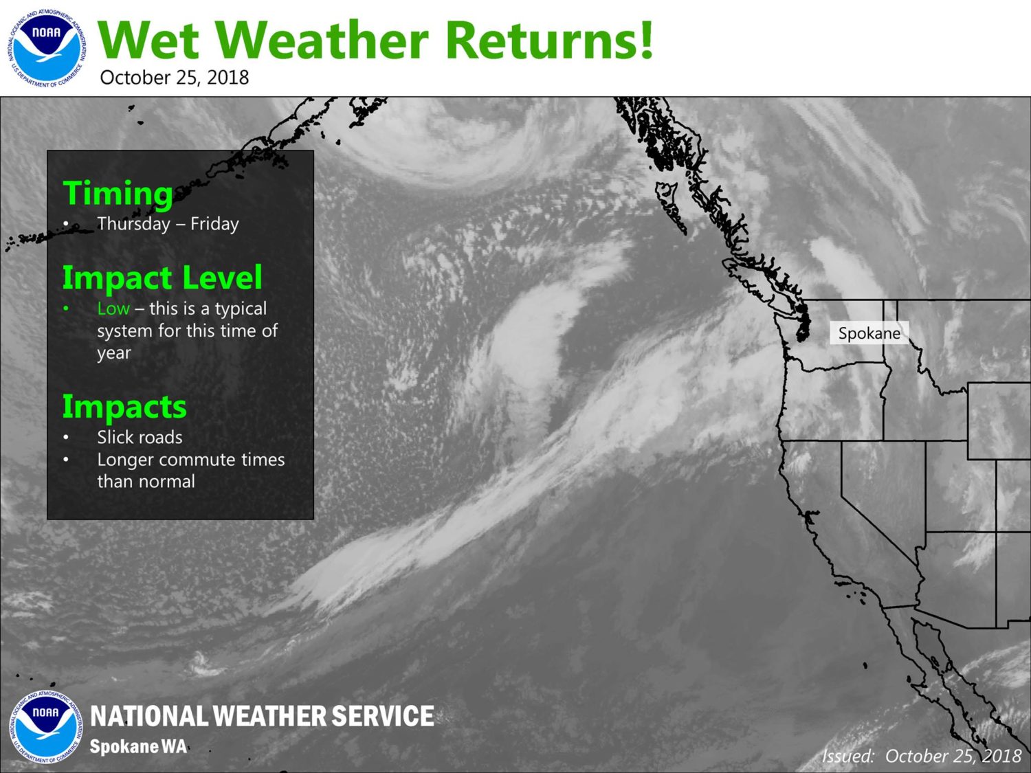
NOAA is forecasting an atmospheric river storm to hit Washington state today and tomorrow.
“An Atmospheric River is pointed at the Pacific Northwest will bring rain across the region.” – NOAA Spokane, WA today
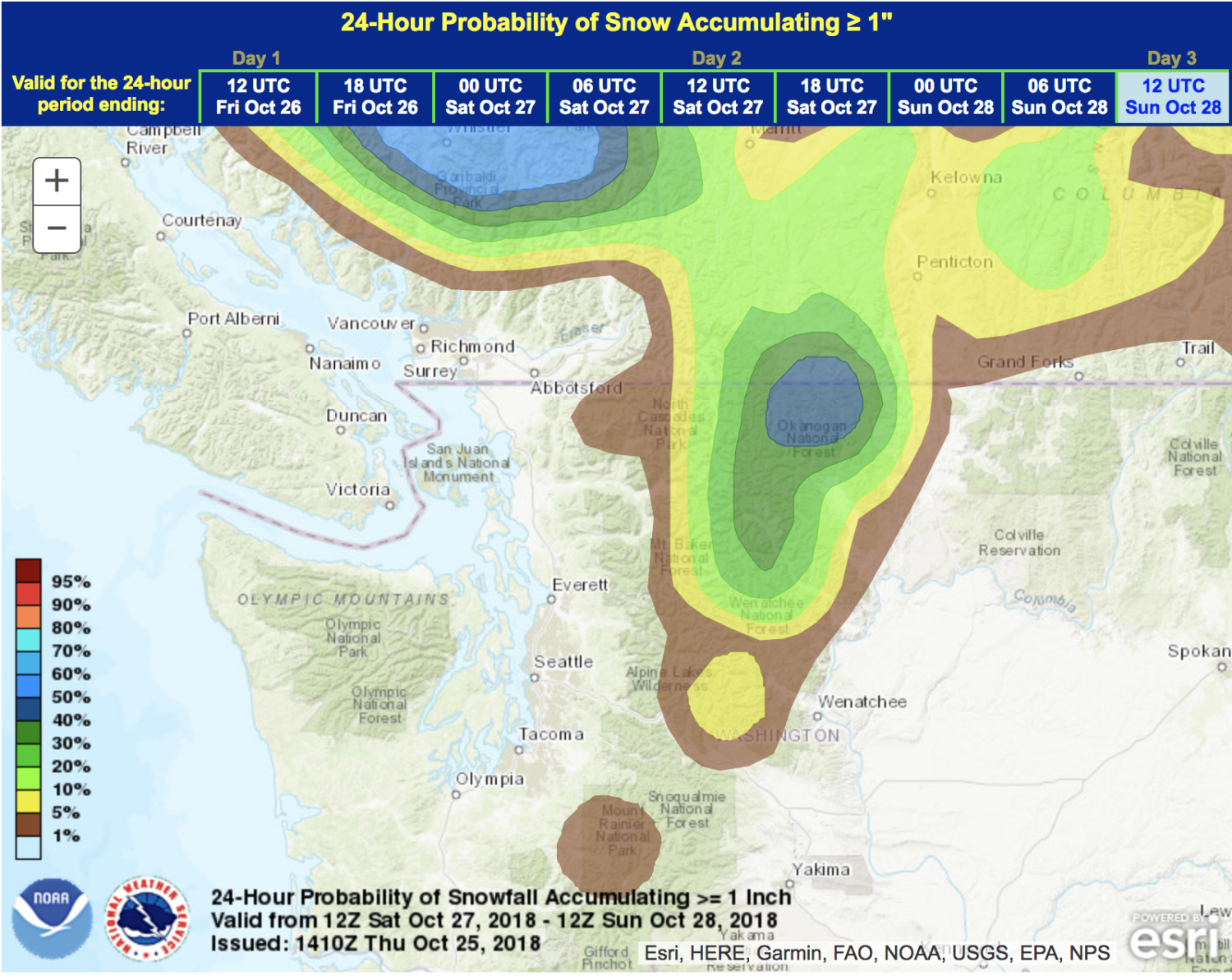
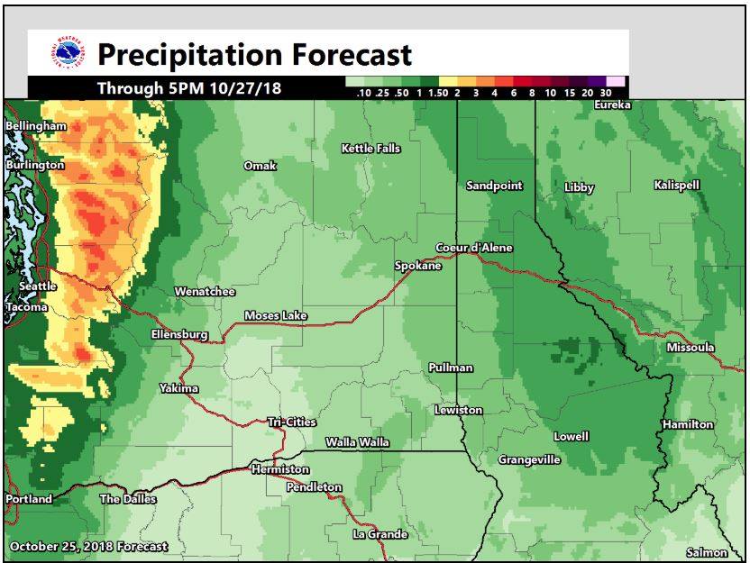
This storm is forecast to drop up to 5″ of rain in the high mountains and not much snow due to high snow levels.
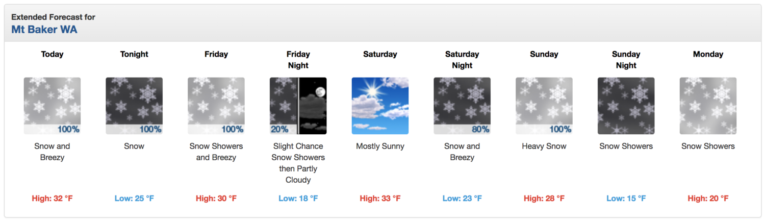
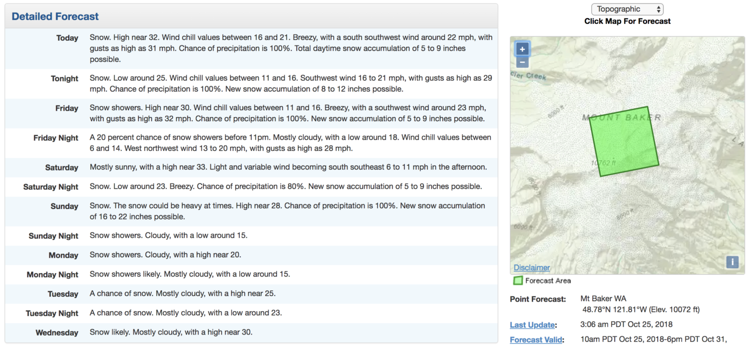
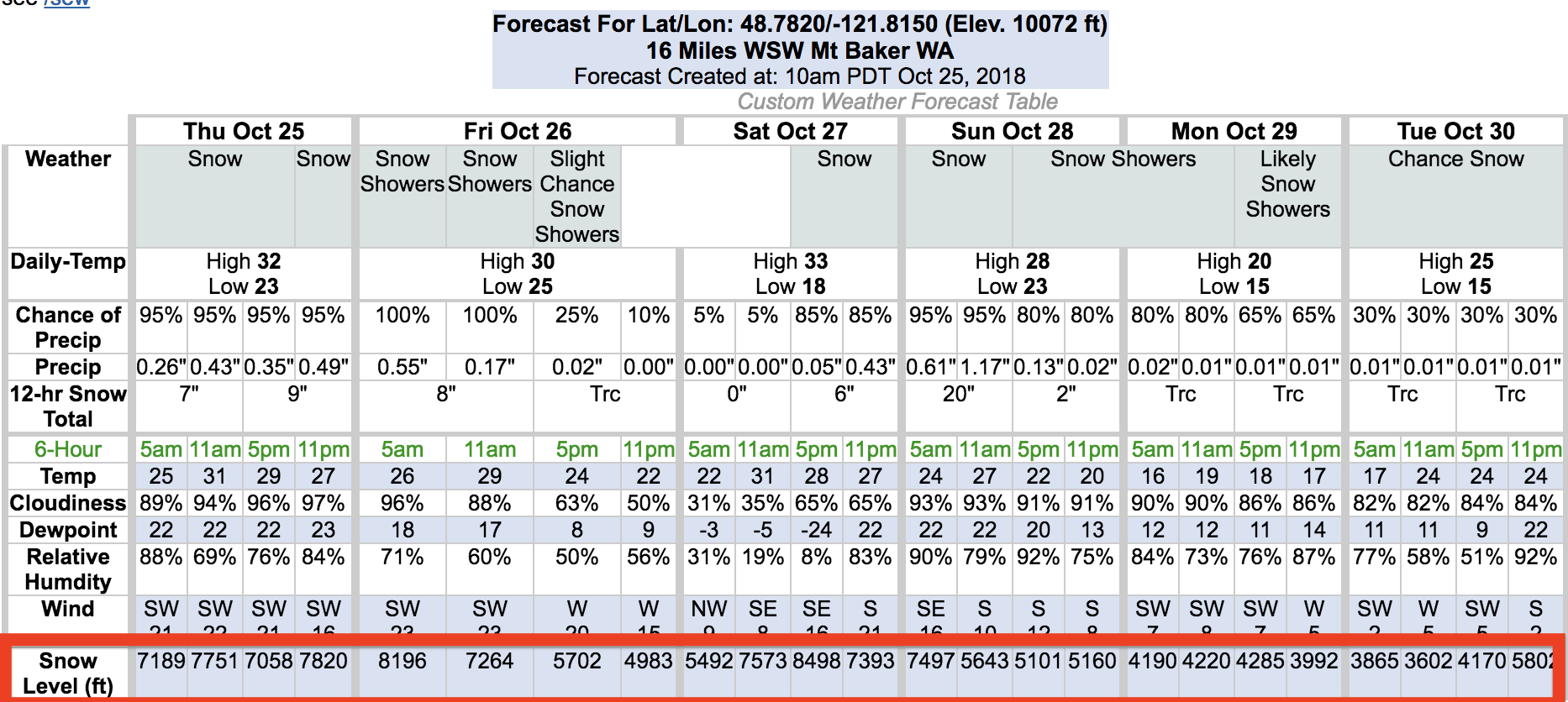
Although, 45-61″ of snow is forecast t 10,000′ on Mt. Baker, WA between today and Sunday, according to NOAA.
“Across the Pacific Northwest, a strong jet stream as well as multiple surface fronts will lead to continued chances of rain. The heaviest precipitation will occur in the coastal ranges and the Cascades, and most is expected to fall as rain, though the higher peaks could see some snow.” – NOAA, today
Snow is forecast on 10,762′ Mt. Baker, WA every day through Tuesday with snowfall levels forecast to drop as low as 4,000′ on Monday/Tuesday, but that will be well after the bulk of the precipitation has gone through.
During the bulk of the precipitation today, snow levels are forecast to be between 7,000′ and 8,000′.
During the bulk of the precipitation on Monday, snow levels are forecast to be between 5,000′ and 6,000′.
Crystal Mountain ski resort lives between 5,000′ and 7,000′.
Mt. Baker ski area lives between 3,000′ and 5,000′.
“Here comes the rain!
An Atmospheric River is pointed at the Pacific Northwest will bring rain across the region. The best chance of rain east of the Cascades will occur this evening into Friday morning.” – NOAA Spokane, WA today