August 2018 ENSO update: game show edition
By nearly all measurements, the tropical Pacific is comfortably gliding along in ENSO-neutral conditions, and forecasters expect that will continue through the rest of the summer. The chance that our old buddy El Niño will be around during the fall is about 60%, rising to 70% by winter, and the El Niño Watch is continued this month.
The Price is Right
Let’s get started with four contestants from the audience. If you’re a Pacific Ocean ENSO indicator, come on down! The latest weekly Niño3.4 index was just 0.1°C above the long-term average. This is actually a little bit lower than the previous few weeks, but it doesn’t mean that El Niño is less likely. ENSO is a seasonal phenomenon, meaning it’s an average pattern that lasts several months in a row. Weekly fluctuations are expected, and we don’t base our assessments on short-term trends like weekly changes in sea surface temperatures.
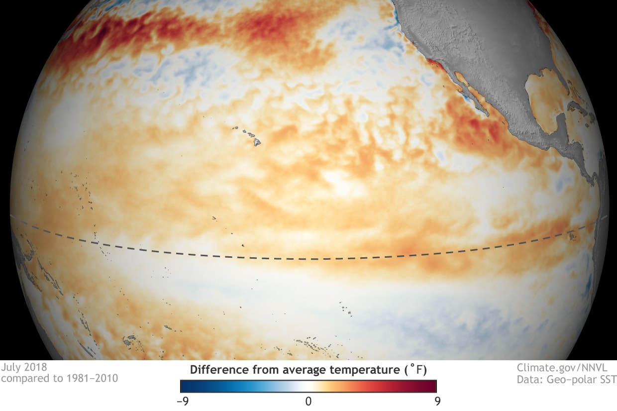
The other temperature indexes we follow in the equatorial Pacific are also near normal. This includes weekly values of 0.4°C in the Niño4 region, 0.0°C in Niño3, and 0.1°C in Niño1+2. Niño4 gets to continue into the pricing round! Have fun, Niño4; we hope you win that washing machine.
Jeopardy!
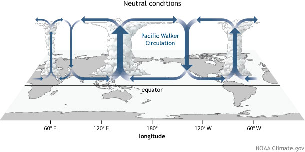
No consistent differences from average surface winds across the Pacific during August. What are neutral atmospheric conditions, Alex? (OK, so this theme may be the outer limits of my being-funny capacity.) At any rate, the Walker circulation over the Pacific Ocean is generally reflecting the lack of signal from surface water temperatures. During the month of July, there was a bit less rising air and cloudiness than average over both the central Pacific and Indonesia.
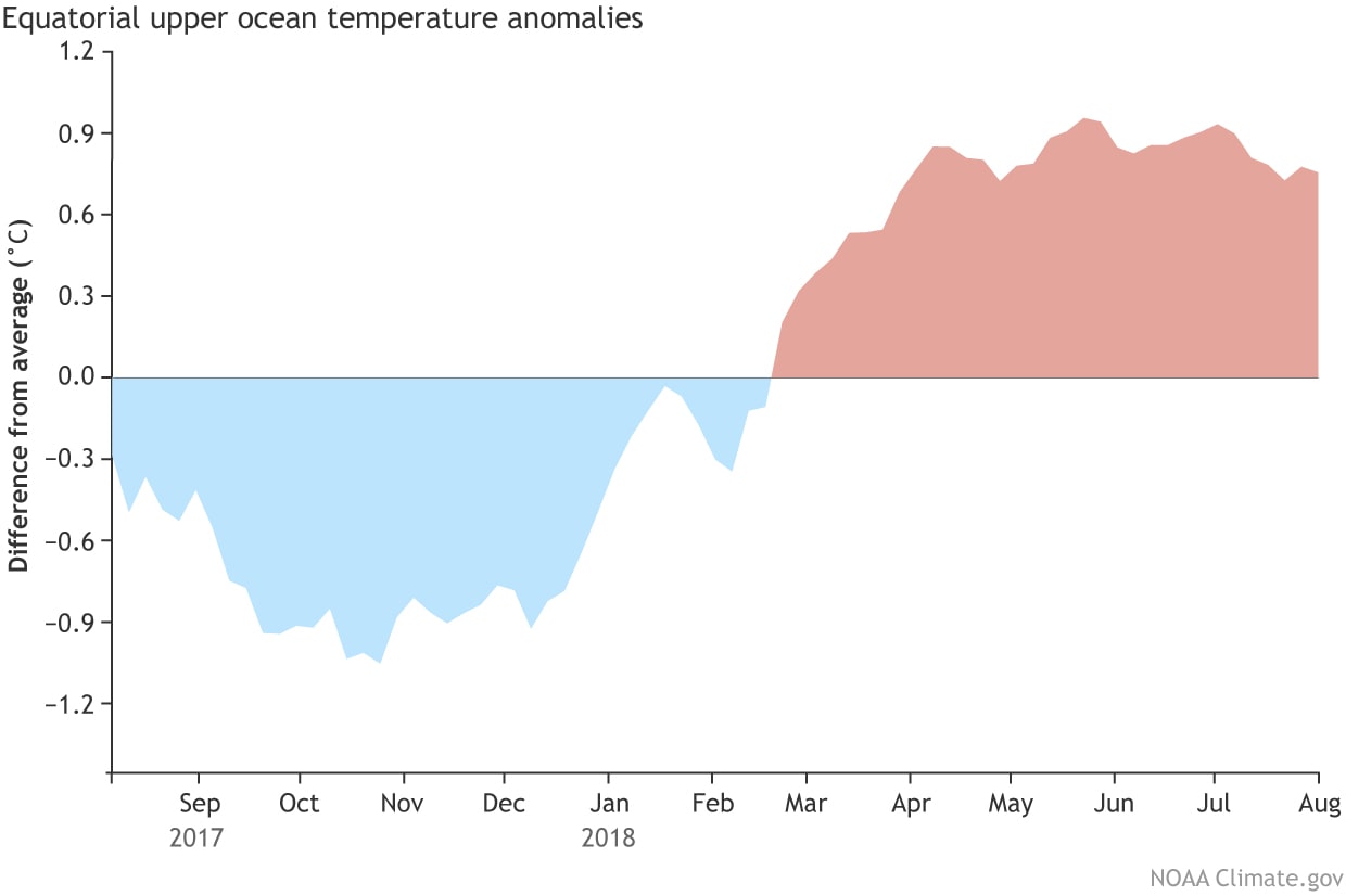
Warmer-than-average water under the surface of the tropical Pacific. What is… wait, you’ll take Stop This for 800? Oh, fine, I’ll stop. Even though the temperature anomalies (difference from the long-term average) at the surface decreased slightly over the past couple of weeks, the subsurface heat content is still elevated. The temperature under the central-eastern Pacific (between the dateline and 100°W longitude, and ~1000 feet deep up to the surface) was 0.81°C above the long-term average during July. What is the 7th warmest July subsurface temperature since 1979, Alex?
Wheel of Fortune
The near-surface winds over the tropical Pacific are very important during the development phase of El Niño. Time for our first puzzle! ENS_ IS A C_UPLED _CEAN-ATM_SPHERE SYSTEM. Want to buy a vowel? This means conditions in the ocean affect the atmosphere, and vice-versa. The normal atmospheric circulation over the Pacific (the WALKER C_RCULAT_ON) is driven by warm air rising over warm water near Indonesia, west-to-east winds aloft, descending air in the eastern Pacific, and returning east-to-west winds near the surface. Those east-to-west winds help to keep warm water trapped in the far western Pacific, continuing the cycle.
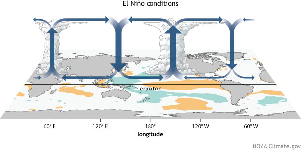
When El Niño is developing, though, short-term fluctuations in the near-surface winds can have substantial effects. A period of weaker trade winds can help build El Niño’s warmer surface waters, while a period of stronger trade winds can cool the surface and impede El Niño’s growth. It appears that the trade winds are currently weakening, and may continue to do so through the next week, likely helping push things in the El Niño direction.
Let’s Make a Deal!
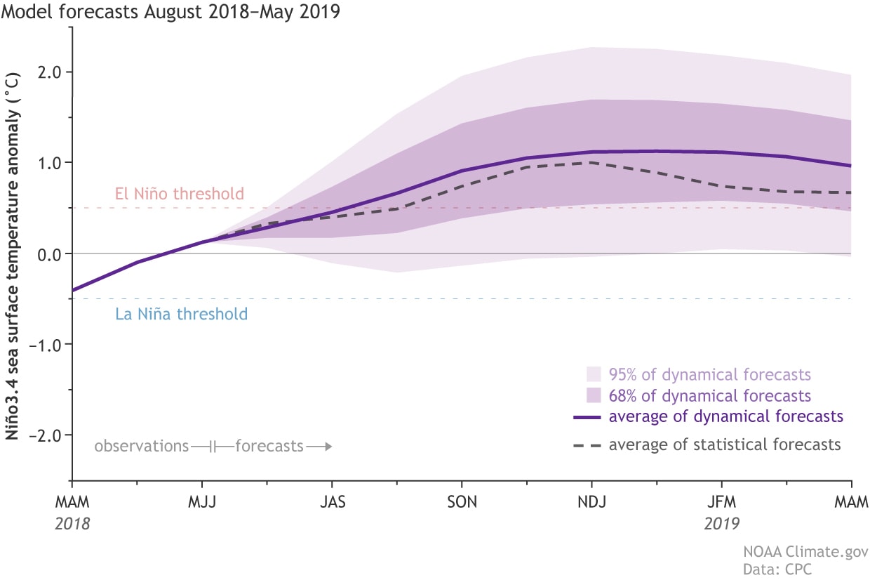
What’s behind door number 1? The latest computer models continue to predict that the sea surface temperature in the Niño3.4 region will cross the El Niño threshold (0.5°C above the long-term average) sometime in the fall. Both the statistical and dynamical computer models generally agree, adding some confidence to the ENSO forecast.
El Niño can affect the hurricane seasons in both the Atlantic and Pacific. NOAA’s hurricane forecast update comes out today, so be sure to check it out to see how the El Niño forecast factors in.
Thanks for playing!