Updated at 11:10am today:
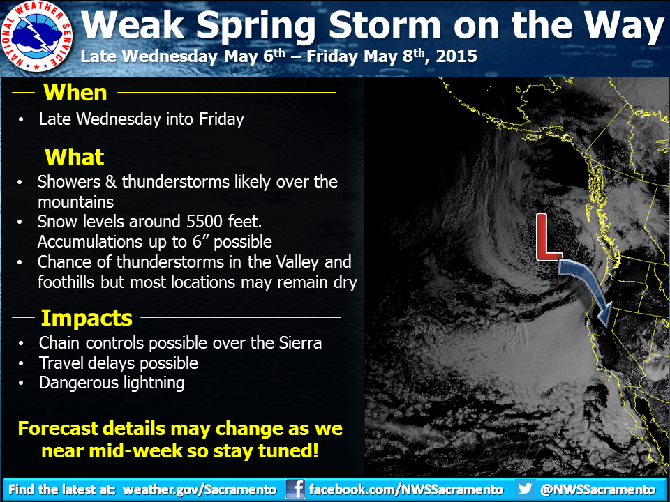
“A weak spring storm system will drop into Northern California late Wednesday into Friday. Cooler temperatures will accompany this system. There will also be the chance for showers and thunderstorms into Friday, mainly across the mountains. Snow levels will be around 5500 feet with accumulations up to 6 inches possible. There is also a chance for thunderstorms in the valley and foothills, but most locations may remain dry. Forecast details may change as we near mid-week so stay tuned!” – NOAA Sacramento
NOAA is tracking a possible large storm coming out of the Gulf of Alaska and headed straight for California’s Sierra Nevada Mountains. They are forecasting 6,000′ snow levels.
This storm should hit Mammoth as well. Mammoth is the only ski resort currently open in California.
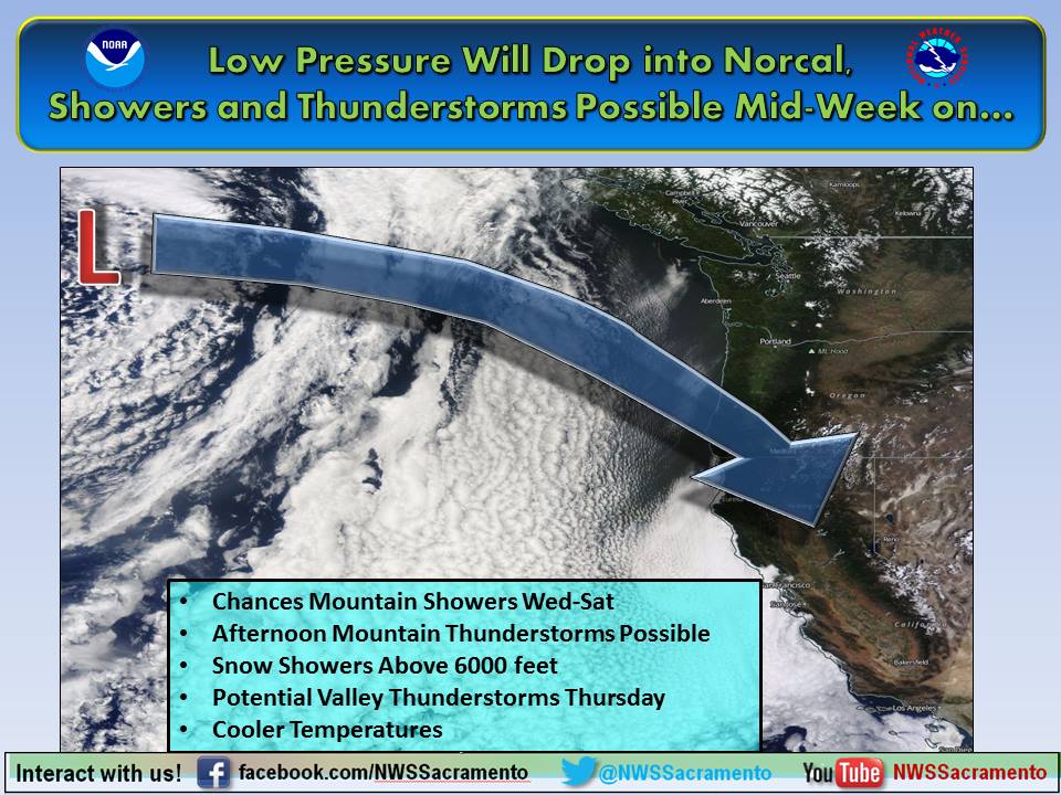
“A Gulf of Alaska low pressure system will move through Northern California mid-to-late this week. Confidence is improving that this system could bring mountain snow and some Valley showers later this week, along with cooler temperatures. Afternoon thunderstorms are also a possibility, especially on Thursday.” – NOAA Sacramento
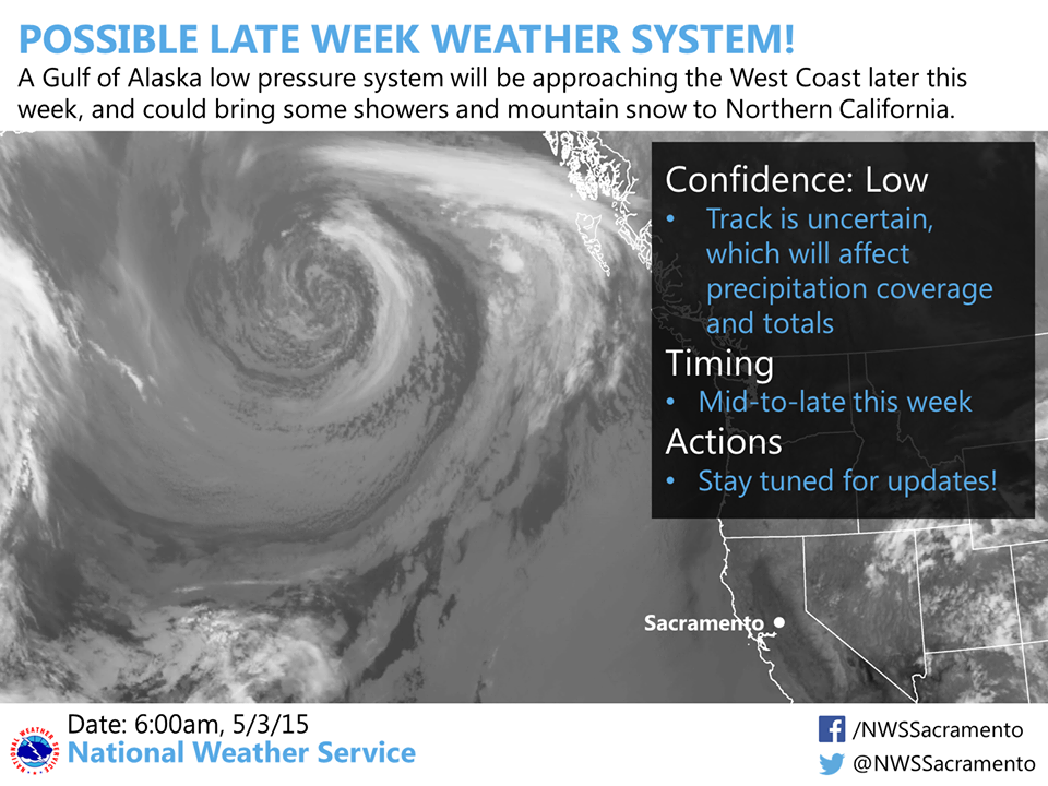
We are watching a Gulf of Alaska low pressure system that is expected to approach Northern California mid-to-late this week. Confidence is still low in the details, but the system could bring mountain snow and some Valley showers later this week. Stay tuned for further updates!” – NOAA Sacramento
Cause we really do need the precip.