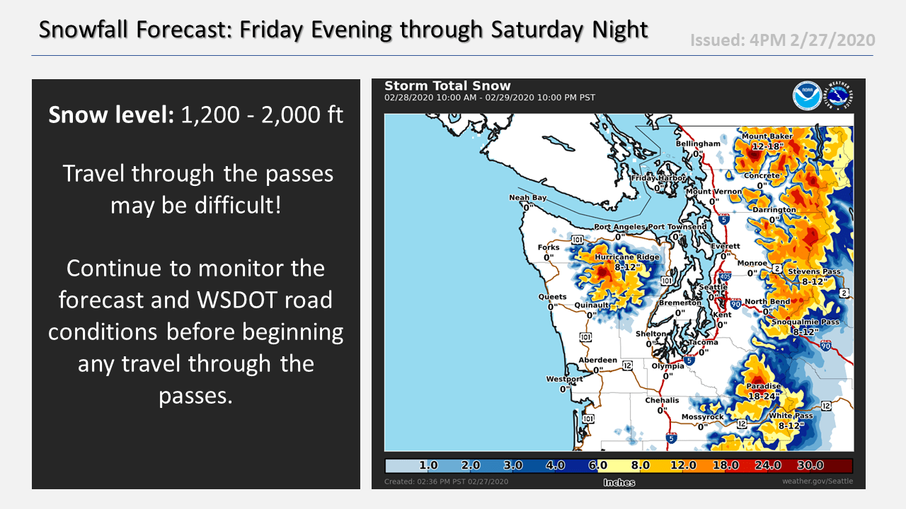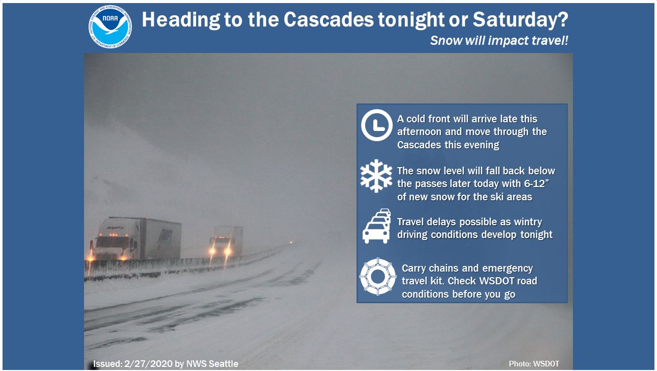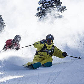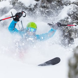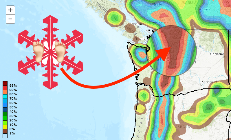
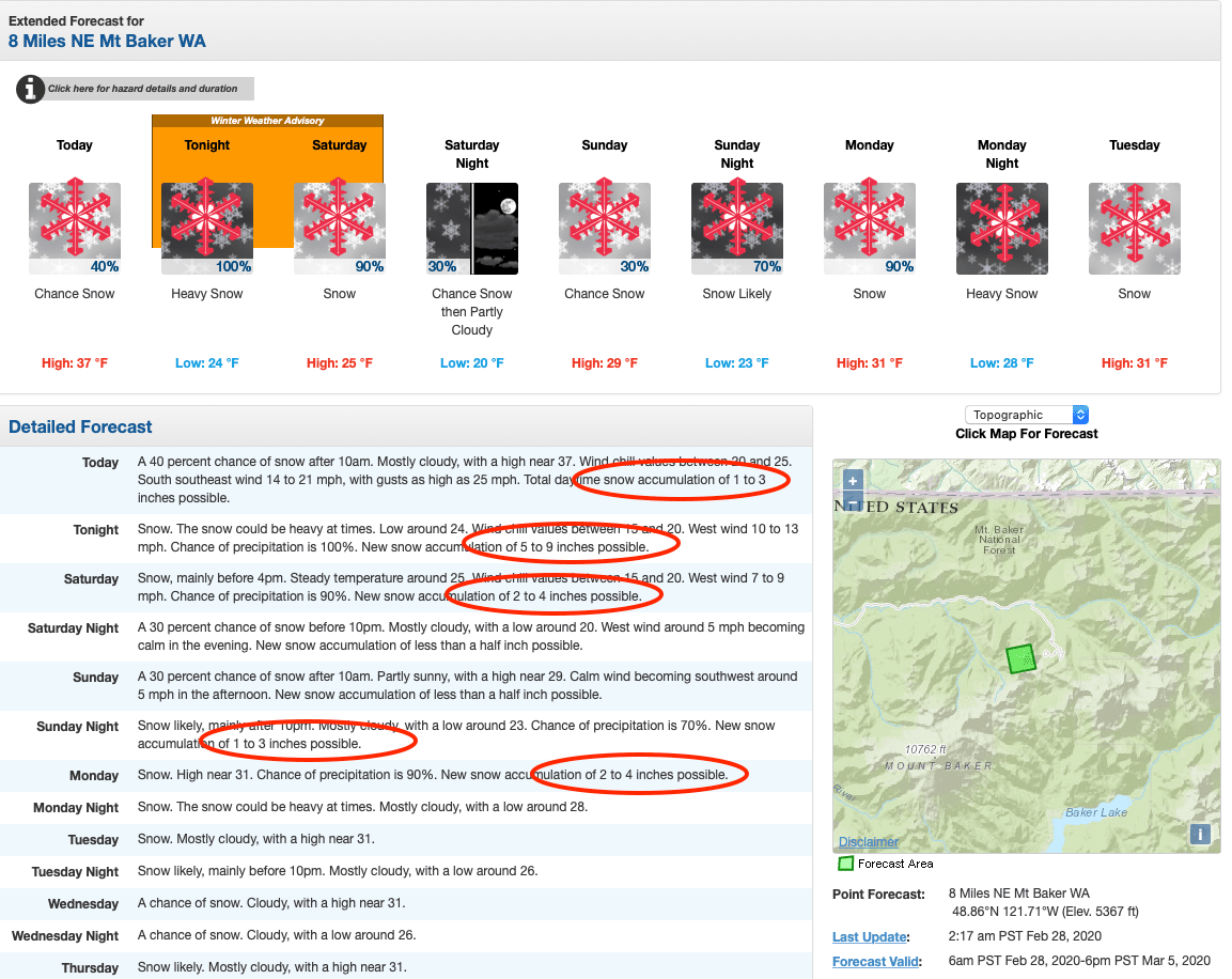
Some areas just get all the luck! Ski areas in Washington are already boasting the most snowfall, and the deepest snowpacks, this season, and it looks like they’ll be adding to those totals as an incoming storm is set to dump up to two FEET of fresh snow. A winter weather advisory is in effect this evening through Saturday afternoon.
...WINTER WEATHER ADVISORY IN EFFECT FROM 7 PM THIS EVENING TO
4 PM PST SATURDAY ABOVE 2000 FEET...

* WHAT...Snow expected above 2000 feet. Total snow accumulations
  of 2 to 14 inches with 6 to 12 inches expected at pass level.

* WHERE...Cascade mountains of Whatcom, Skagit, Snohomish, King,
  Pierce, and Lewis Counties, including the Mount Baker Ski Area,
  Stevens Pass, Snoqualmie Pass, the Crystal Mountain Ski Area,
  and Paradise on Mount Rainier.

* WHEN...From 7 PM this evening to 4 PM PST Saturday.

* IMPACTS...Travel could be difficult with compact snow and ice
  on roadways.
According to the NOAA forecast discussion this morning:
Main impact from this system is expected to be mountain snow. Snow levels will lower down to 1200-2000 feet behind the cold front with decent accumulations. Still looking like 6 to 12 inches at pass levels through Saturday afternoon. Have issued a winter weather advisory to cover likely impacts to weekend travelers. Those with
travel plans should monitor the forecast and check WSDOT road conditions before departing.
Mount Baker could see 20-24″, Stevens Pass 17-20″, and Alpental 23-26″. With the snow starting tonight, conditions should be sweet and just get better and better all weekend!
Other Info: