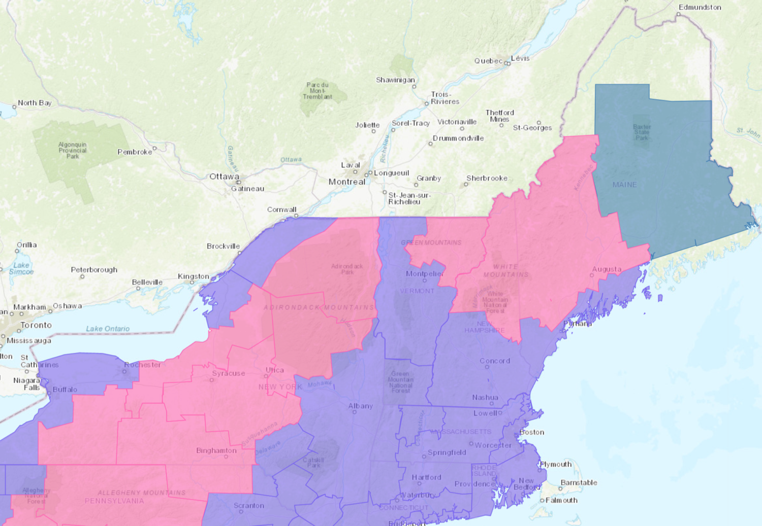
The National Weather Service has issued Winter Storm Warnings for Maine, New Hampshire, New York, and Vermont. They’re in effect Today – Friday. Heavy snowfall is forecasted to impact the area, the heaviest of which will occur tonight.
East Coast:
- 4-8+” of Snow Today – Friday
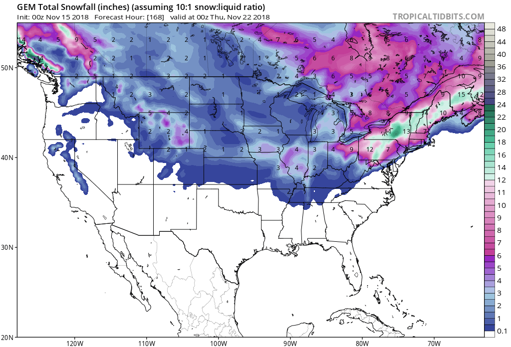
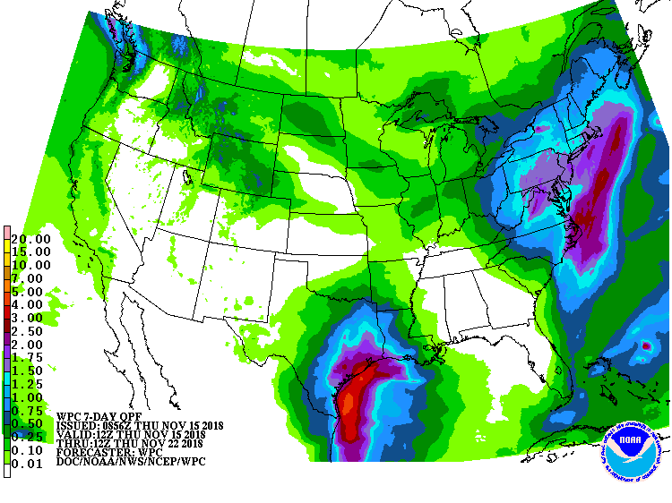
Snow is forecasted to fall at all elevations, but the heaviest accumulations will be in the mountains.
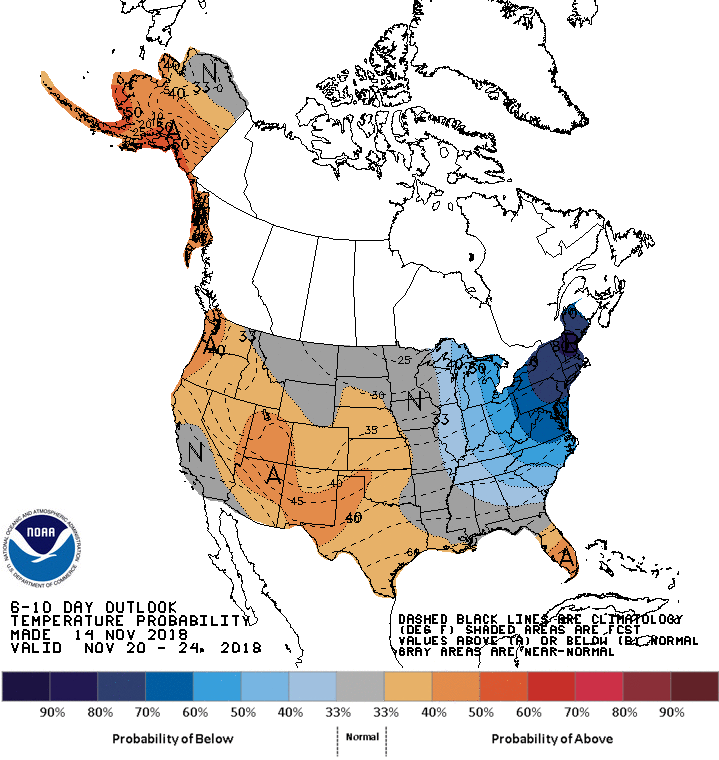
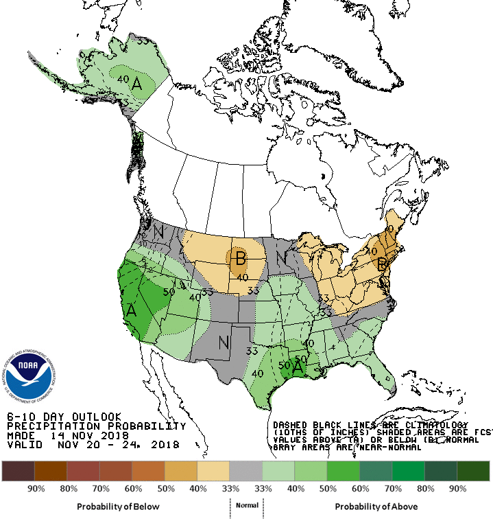
The 6-10 day forecast calls for below average temperatures and below average precipitation along the East Coast.
Additional Info:
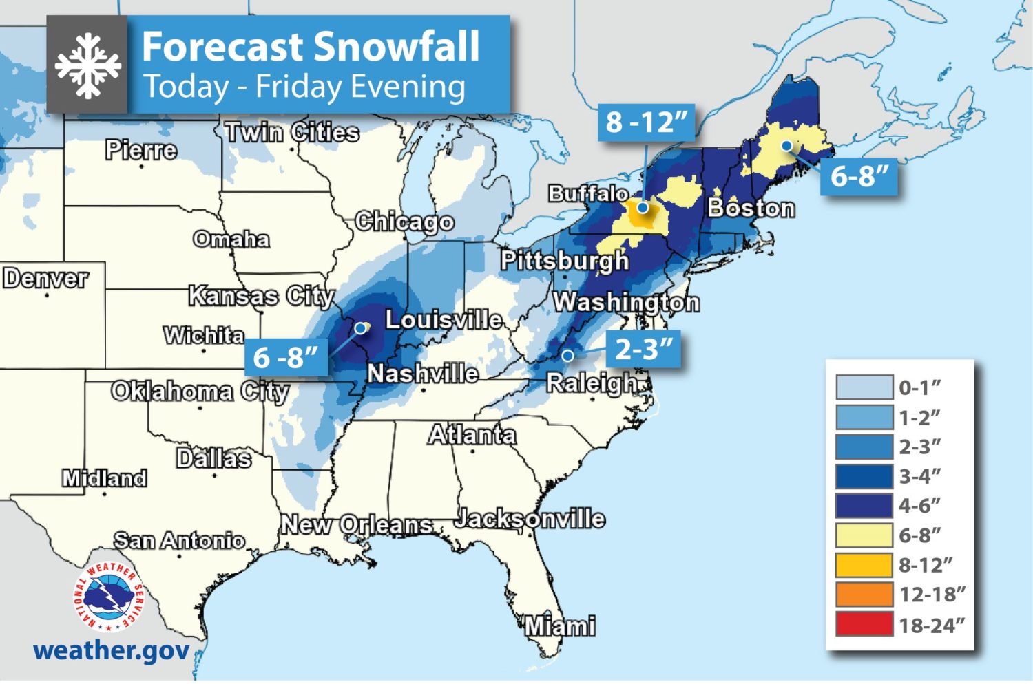
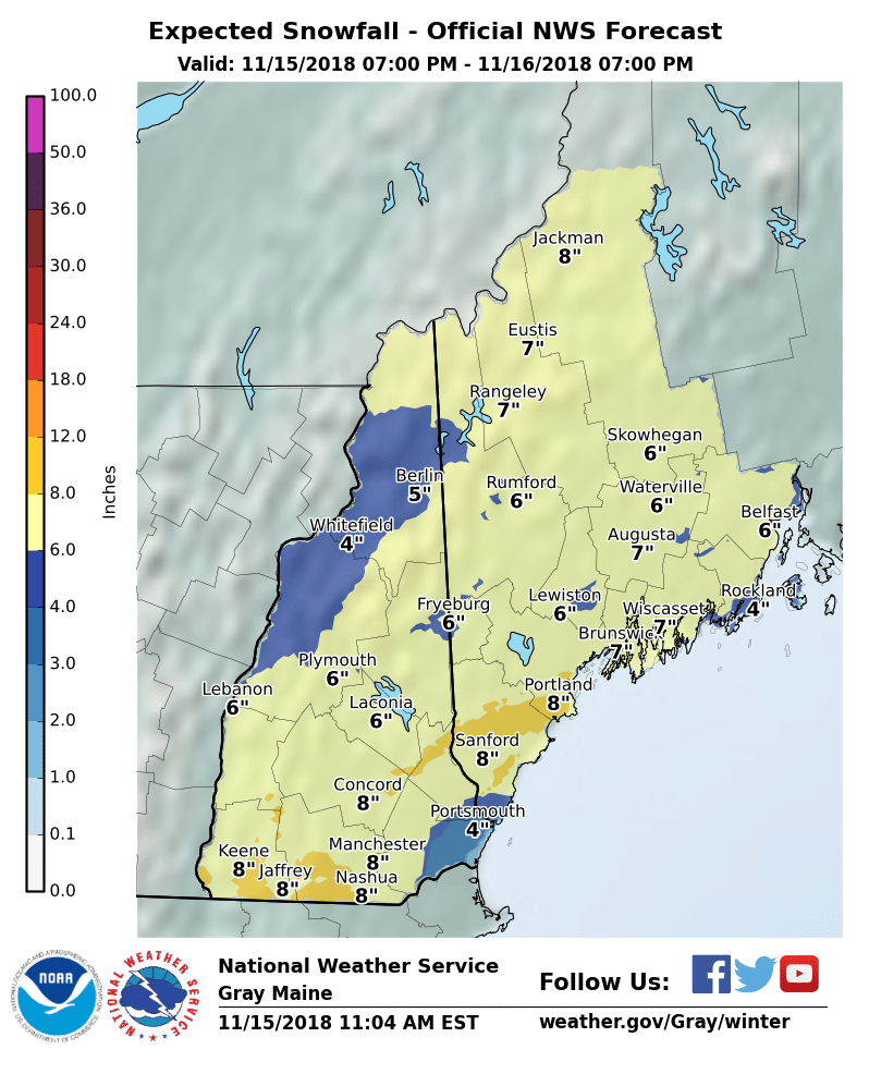
Maine: 5-8″ of Snow Tonight – Friday
* Total snow accumulations of 5 to 8 inches with a
  light glaze possible toward the end of the storm.
- NOAA Grey, ME
New Hampshire: 4-8″ of Snow Tonight – Friday
* Total snow accumulations of 4 to 8 inches
  are expected.
- NOAA Grey, ME
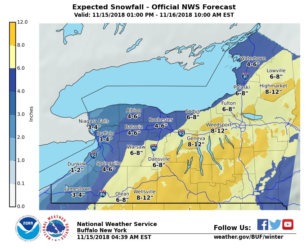
New York: 5-9″ of Snow Today – Friday Morning
* Heavy snow expected. Total snow accumulations
  of 5 to 9 inches.
- NOAA Buffalo, NY
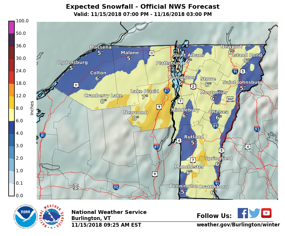
Vermont: 5-8″ of Snow Tonight – Friday
* Heavy snow expected. Total snow accumulations of 5 to 8
  inches are expected with a light glaze of ice possible.
- NOAA Burlington, VT
Winter Storm Warning:
URGENT - WINTER WEATHER MESSAGE
National Weather Service Burlington VT
328 AM EST Thu Nov 15 2018

Orleans-Essex-Lamoille-Caledonia-
Including the cities of Newport, Island Pond, Johnson, Stowe,
and St. Johnsbury

...WINTER STORM WARNING IN EFFECT FROM 7 PM THIS EVENING TO 3 PM
EST FRIDAY...

* WHAT...Heavy snow expected. Total snow accumulations of 5 to 8
  inches are expected with a light glaze of ice possible.

* WHERE...Orleans, Essex, Lamoille and Caledonia Counties.

* WHEN...From 7 PM this evening to 3 PM EST Friday.

* ADDITIONAL DETAILS...With the heaviest snowfall happening just
  before the morning commute, travel will be difficult. Plan on
  allowing extra time for the morning commute. Isolated power
  outages may be possible.