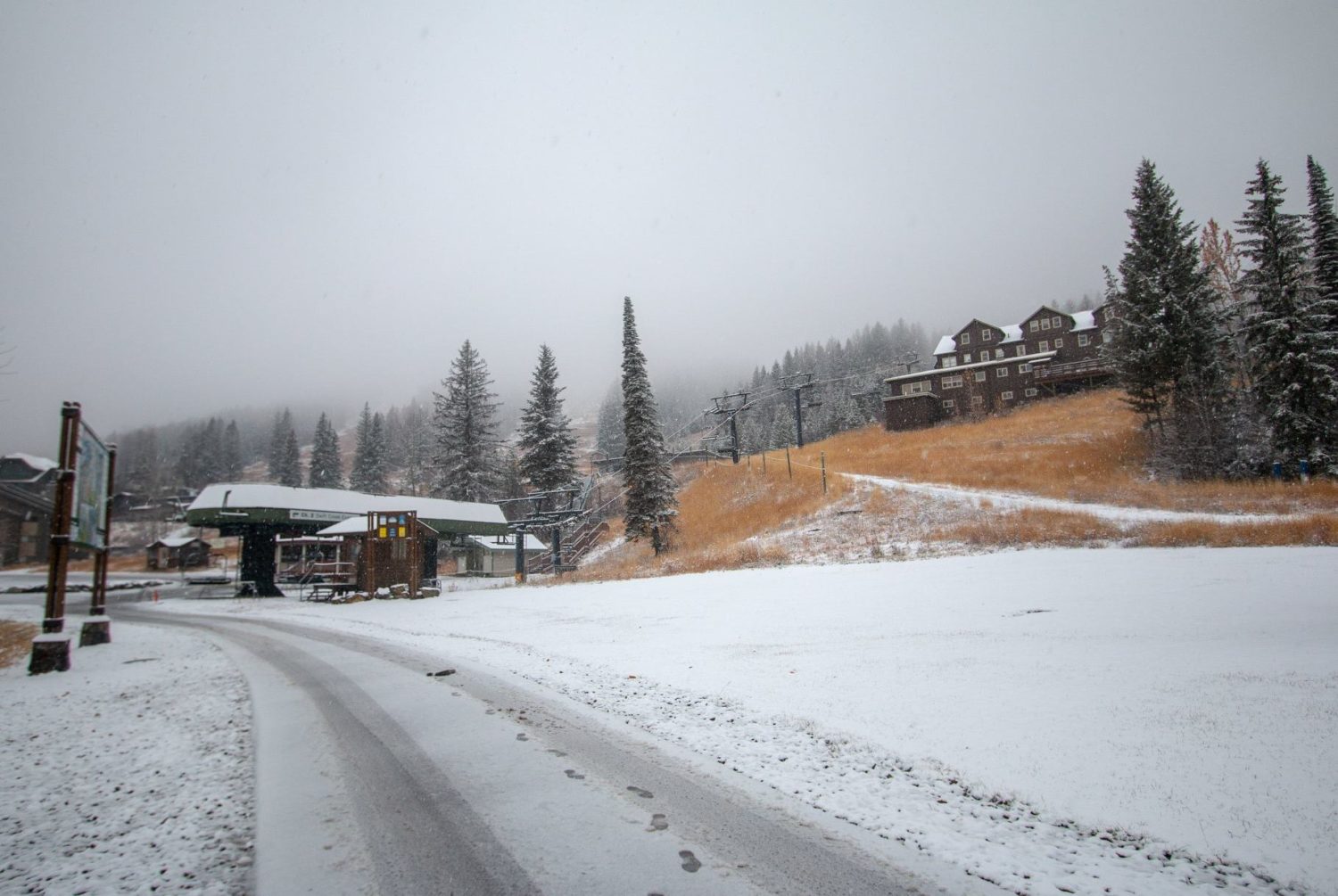
The National Weather Service has issued a Winter Weather Advisory for Montana. It’s in effect from 5:00pm this evening through 8:00am Tuesday morning. Heavy snow showers are possible throughout this time.
Montana:
- Up To 6″ of Snow Tonight – Tuesday Morning
Snow levels are forecasted to start out around 5,000ft, before dropping well below 4,000ft as the storm progresses.
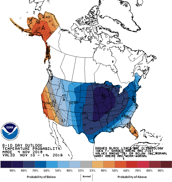
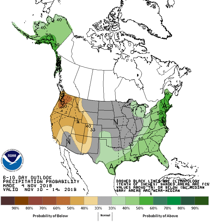
The 6-10 day outlook calls below average temperatures and below average precipitation in Montana.
Additional Info:
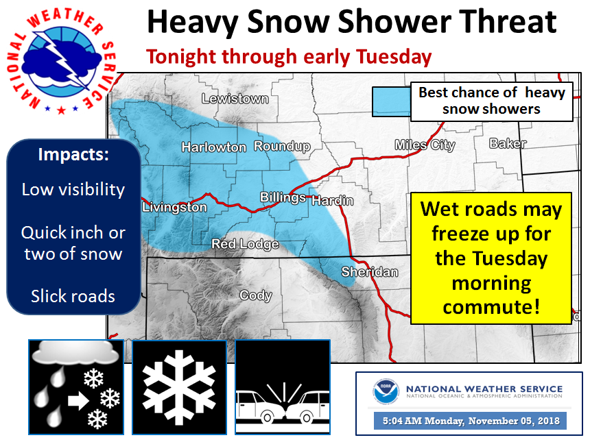
Montana: Up To 6″ of Snow Tonight – Tuesday Morning
* Total snow accumulations of 1 to 3 inches expected.
  Localized accumulation up to 6 inches possible across
  the mountains as well as central and northern portions
  of Lewis and Clark County, inlcuding Rogers Pass.
- NOAA Great Falls, MT
Winter Weather Advisory:
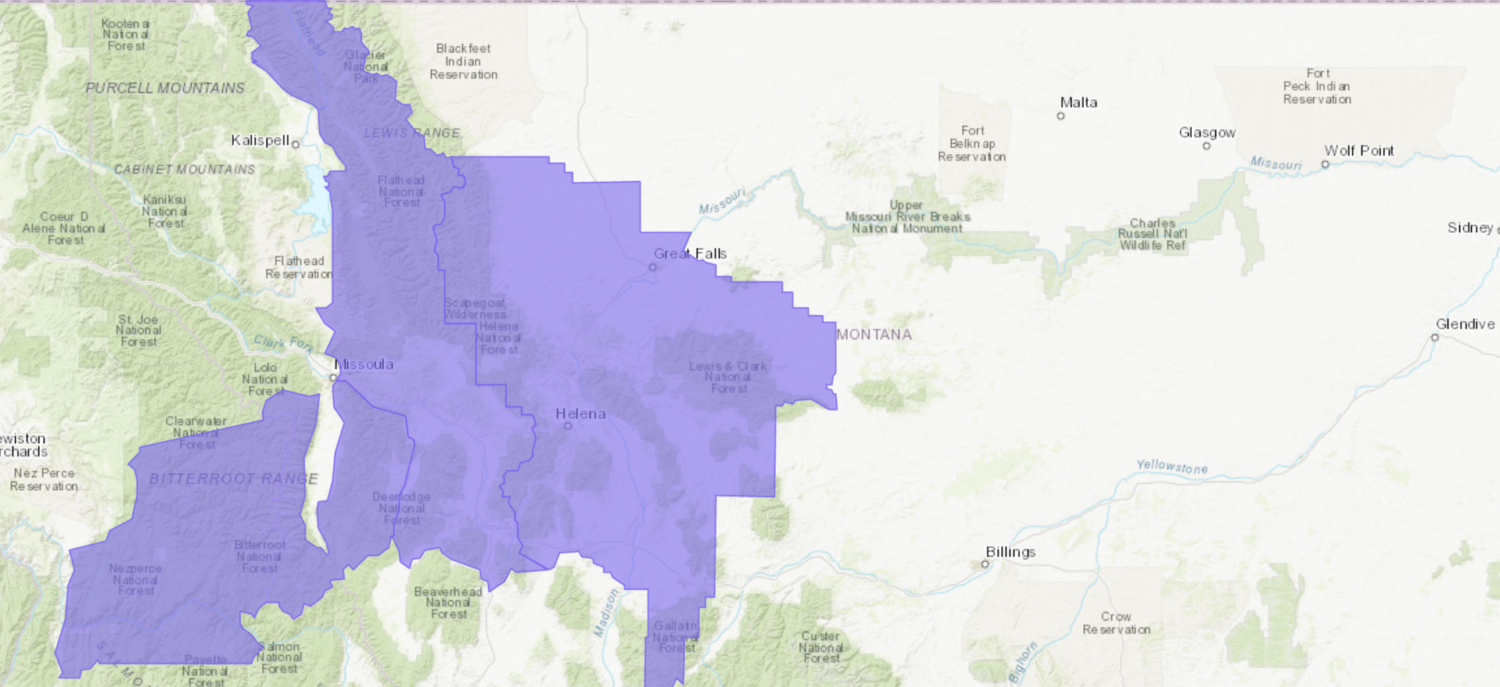
URGENT - WINTER WEATHER MESSAGE
National Weather Service Great Falls MT
934 AM MST Mon Nov 5 2018

...Periods of Accumulating Snow Tonight...

.A cool, moist and somewhat unstable northwest flow aloft will
bring snow showers to the region today. An embedded weather
disturbance will move through the region tonight for increasing
coverage of snow showers with potential for isolated locally
heavier snowfall within bands. During the overnight period,
temperatures will cool into the 20s with snow and ice covering
some road surfaces overnight and through Tursday morning`s
commute.

Cascade-Central and Southern Lewis and Clark-
Southern Rocky Mountain Front-Eastern Teton-Judith Basin-
Jefferson-Broadwater-Meagher-Gallatin-
Including the following locations: Great Falls, Cascade, Belt,
Kings Hill Pass, Helena, Lincoln, MacDonald Pass, Rogers Pass,
Bynum, Choteau, Augusta, Fairfield, Dutton, Raynesford, Stanford,
Hobson, Montana City, Boulder, Boulder Hill, Elk Park Pass,
Homestake Pass, Whitehall, Toston, Townsend, Martinsdale,
White Sulphur Springs, Bozeman, West Yellowstone,
Battle Ridge Pass, Bozeman Pass, and Targhee Pass

...WINTER WEATHER ADVISORY IN EFFECT FROM 5 PM THIS AFTERNOON TO
8 AM MST TUESDAY...

* WHAT...Snow expected. Total snow accumulations of 1 to 3 inches
  expected. Localized accumulation up to 6 inches possible across
  the mountains as well as central and northern portions of Lewis
  and Clark County, inlcuding Rogers Pass.

* WHERE...Portions of central, north central, southwest and west
  central Montana.

* WHEN...From 5 PM this afternoon to 8 AM MST Tuesday.

* ADDITIONAL DETAILS...Plan on slippery road conditions.
  Especially over mountain passes and in all areas later this
  evening as temperatures cool to the 20s.