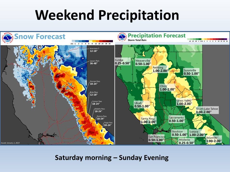
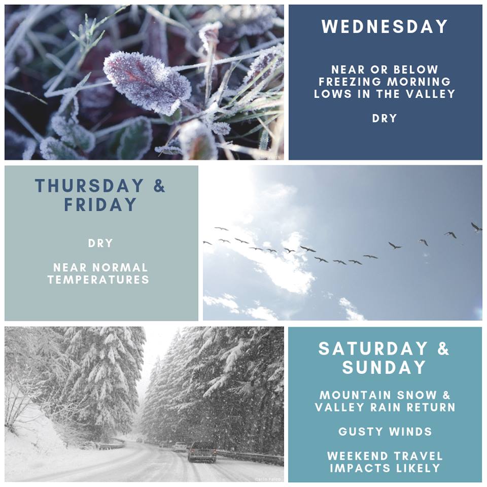
The National Weather Service is calling for multiple rounds of snow in California this weekend – next week. The first of which is forecasted to hit the area on Saturday and persist through Sunday morning. Travel impacts are likely in the high sierra.
California:
- 2+ FEET of Snow Saturday – Sunday
“A return to a wet pattern will bring rain and mountain snow this weekend. This first moderately strong storm will bring rain to the valley with enough snow in the mountains to create travel issues.”
– NOAA Sacramento, CA
Snow levels are forecasted to hover between 4,000ft – 5,000ft.
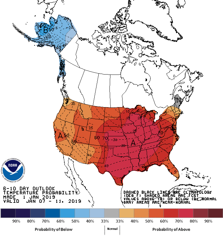
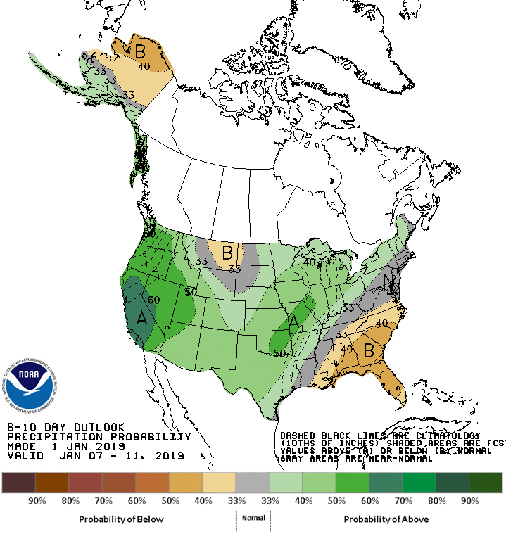
The 6-10 day outlook calls for above average precipitation and above average temperatures in California.
Additional Storm Info:
California: 2+ FEET Of Snow Saturday – Sunday
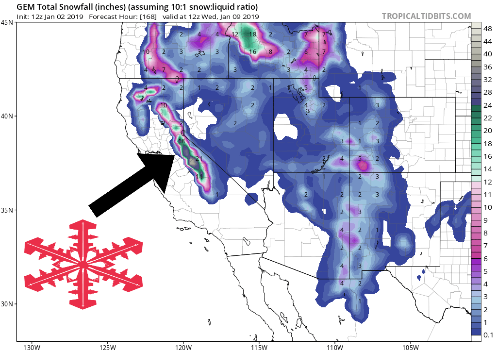
* If the storm holds together, we could see storm total snow amounts
  through Sunday morning up to a couple feet in the High Sierra,
  with 6-12 inches around Lake Tahoe level and around Mammoth Lakes.
- NOAA Reno, NV
Special Weather Statement:
Special Weather Statement
National Weather Service RENO NV
230 PM PST Tue Jan 1 2019

Surprise Valley California-Lassen-Eastern Plumas-
Eastern Sierra Counties-Greater Lake Tahoe Area-Mono County-
Mineral and Southern Lyon Counties-Greater Reno-Carson City-
Minden Area-Western Nevada Basin and Range including Pyramid Lake-
Northern Washoe County-
Including the cities of Cedarville, Eagleville, Fort Bidwell,
Portola, Susanville, Westwood, Sierraville, Loyalton,
South Lake Tahoe, Tahoe City, Truckee, Markleeville, Bridgeport,
Coleville, Lee Vining, Mammoth Lakes, Hawthorne, Yerington,
Smith Valley, Mina, Schurz, Stateline, Glenbrook,
Incline Village, Sparks, Verdi, Gardnerville, Virginia City,
Fernley, Fallon, Lovelock, Silver Springs, Nixon, Imlay, Empire,
and Gerlach

...Active weather possible this weekend and next week...

After a few days of quiet weather for the eastern Sierra and
western Nevada, the probability is increasing for a more active
weather pattern starting as early as this Saturday, continuing
into next week.

While it remains too early to discuss exact amounts of both rain
and snow, the first round of precipitation is becoming more likely
to occur Saturday and Saturday night, with snow in the Sierra and
a mix of rain and snow in the valleys. This may pose significant
travel impacts in the Sierra over the weekend.

Additional periods of mountain snow, with a mix of rain and snow
in valleys, could occur from Sunday through the middle of next
week. Anyone with travel plans this coming weekend and next week
should check back frequently for the latest forecast updates.