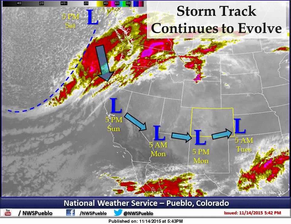
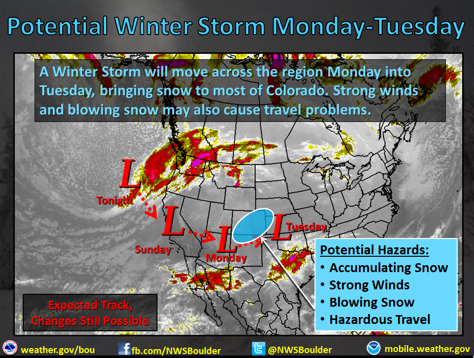
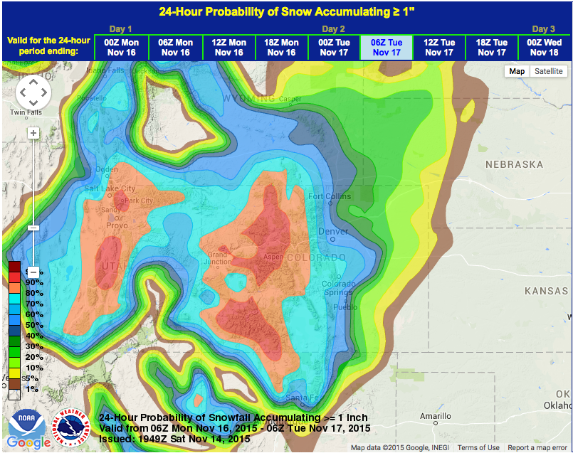
NOAA has issued a Winter Storm Wactch for Colorado that will last from Sunday evening until Tuesday morning. Up to 20″ of snowfall is forecast for the southwest quarter of Colorado including Telluride, Silverton, and Wolf Creek.
A POTENT PACIFIC STORM WILL INTERACT WITH THE SUBTROPICAL JET TO
BRING A ROUND OF ACTIVE WEATHER TO THE REGION. - NOAA Pueblo, CO today
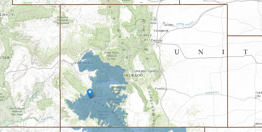
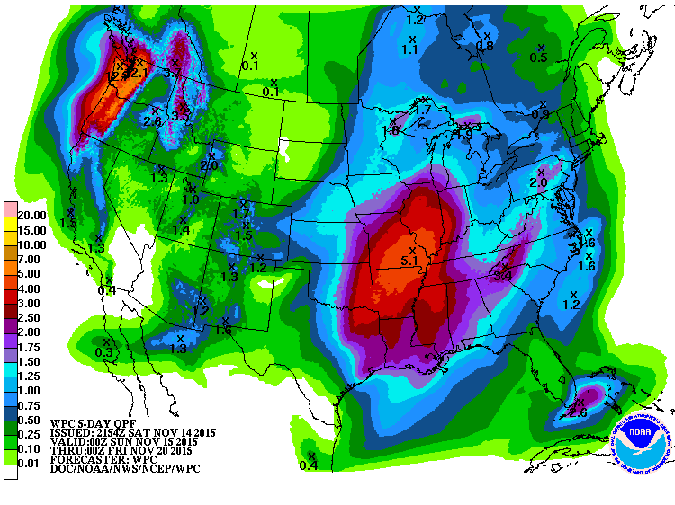
NOAA is calling for 10-20″ of snow in the mountains of southwest CO with potentially over 20″ of snow in the San Juans.
* SNOW ACCUMULATION...10 TO 20 INCHES ARE POSSIBLE BY TUESDAY
  MORNING WITH HIGHER AMOUNTS IN THE SOUTHWEST SAN JUAN
  MOUNTAINS. - NOAA Grand Junction, CO toda
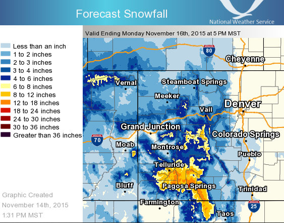
Snow levels will be around 7,000-feet during this Sunday – Tuesday storm.
FIRST THOUGHT IS SNOW LEVELS AROUND 7KFT MONDAY MORNING.
- NOAA Grand Junction, CO today
Colorado has 7 ski resorts currently open (24 ski resorts open in North America right now) but the only one open that’s under this Winter Storm Watch is Wolf Creek. Wofly is gonna have a few very big powder days next week.
SKI RESORTS OPEN in COLORADO RIGHT NOW:
- Loveland
- Arapahoe Basin
- Keystone
- Copper Mountain
- Aspen
- Breckenridge
- Wolf Creek
WINTER STORM WATCH for COLORADO:
URGENT - WINTER WEATHER MESSAGE
NATIONAL WEATHER SERVICE GRAND JUNCTION CO
136 PM MST SAT NOV 14 2015

GRAND AND BATTLEMENT MESAS-WEST ELK AND SAWATCH MOUNTAINS-
NORTHWEST SAN JUAN MOUNTAINS-SOUTHWEST SAN JUAN MOUNTAINS-

...WINTER STORM WATCH IN EFFECT FROM SUNDAY EVENING THROUGH
TUESDAY MORNING...

THE NATIONAL WEATHER SERVICE IN GRAND JUNCTION HAS ISSUED A
WINTER STORM WATCH...WHICH IS IN EFFECT FROM SUNDAY EVENING
THROUGH TUESDAY MORNING.

* LOCATIONS INCLUDE THE CITIES OF...SKYWAY...CRESTED BUTTE...
  TAYLOR PARK...MARBLE...OURAY...TELLURIDE...LAKE CITY...
  SILVERTON...RICO...HESPERUS.

* TIMING...SNOW WILL INCREASE SUNDAY EVENING AND MAY BE HEAVY AT
  TIMES ON MONDAY.

* SNOW ACCUMULATION...10 TO 20 INCHES ARE POSSIBLE BY TUESDAY
  MORNING WITH HIGHER AMOUNTS IN THE SOUTHWEST SAN JUAN
  MOUNTAINS.

* WINDS...SOUTHWEST WINDS 15 TO 30 MPH SHIFT TO NORTHWEST ON
  MONDAY AND DIMINISH MONDAY NIGHT.

* VISIBILITY...POSSIBLY RESTRICTED AT TIMES IN SNOW AND BLOWING
  SNOW.

* IMPACTS...THIS STORM HAS THE POTENTIAL TO MAKE TRAVEL DIFFICULT
  ESPECIALLY IN THE SOUTHWEST SAN JUAN MOUNTAINS.