It’s been dry in California lately.
But how dry?
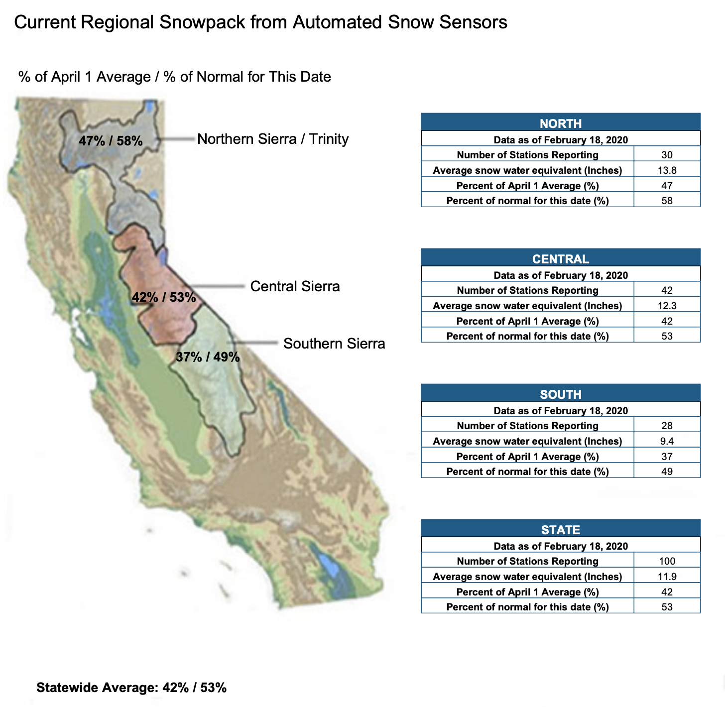
California’s statewide snowpack is currently sitting at only 53% of average to date.
NOAA puts it into context for us below.
The most shocking statistic is this:
The Sierra Nevada mountains of California have only a 1 in 6 (16%) chance of generating a “normal” snowpack by April 2020.
“Current odds of a “normal” snowpack in the Sierra by April is 1 in 6. There is always hope in March, but time will tell!”
– NOAA, Reno NV, 2/18/20
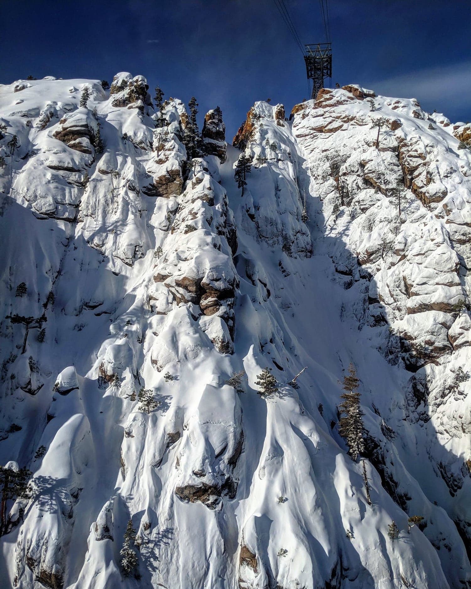
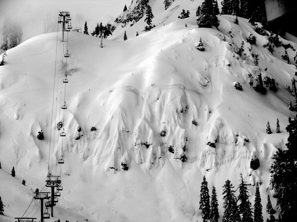
The reality is that the skiing in Tahoe has been pretty good this season with some big highlights in mid-late January and fun spring skiing in February.
- Jan 17th: Squaw Valley, CA Report: 25″ of Blower Snow in 24-Hours & Wildly Good Skiing
- Jan 23rd: Squaw Valley, CA Report: PRIVATE Powder Day on Palisades, Granite Chief Peak, Headwall!
Squaw Valley, CA has seen 207″ of snowfall this season.
Mammoth Mountain, CA has seen 162″ of snowfall this season.
Alta, UT has seen 420″ of snowfall this season.
Jackson Hole, WY has seen 407″ of snowfall this season.
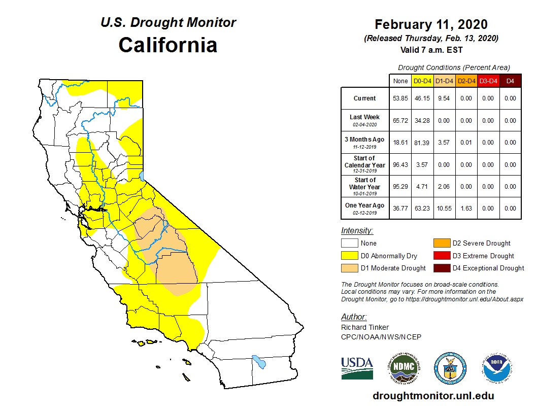
Drought conditions are now starting to creep back into California…
All of us here in Tahoe have got our fingers crossed for a BIG Miracle March, but some of the latest forecasts are now showing the first week of March being dry in Tahoe…
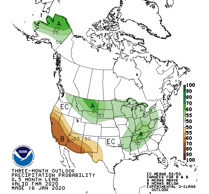
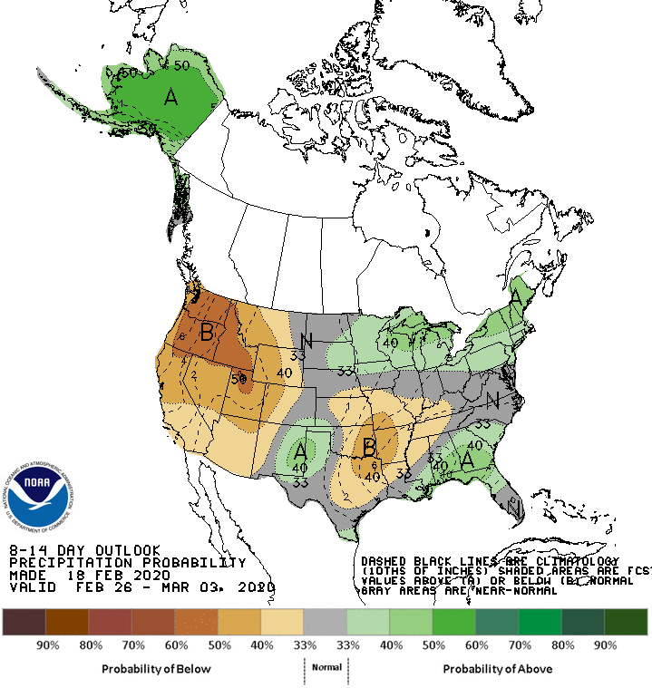
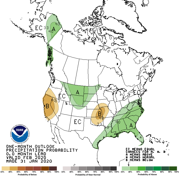
Right now all of these forecasts (imagery below) are showing below-average precipitation for California:
- 6-10 Day Outlook
- 8-14 Day Outlook
- 1-Month Outlook
- 3-Month Outlook
“We all know it has been dry recently, but just how dry? Let’s put it into context. Meteorological winter is considered Dec-Jan-Feb and on average, Reno will see 3.08” of precipitation (rain and snowmelt) and 15.5” of snow during that time. So far this winter, we have had 1.82” of precipitation and 3.3” of snow, most of which fell in December (1.69” liquid, 2.6” snow).
This makes it the 28th driest winter since 1893, and interestingly it’s also the 28th driest in Tahoe City with records going back to 1909. While there are at least some chances for precipitation in the forecast next weekend, the rest of February isn’t showing signs of any major winter storms.
Current odds of a “normal” snowpack in the Sierra by April is 1 in 6. There is always hope in March, but time will tell! Our local groundhog (aka Marmot) was too busy catching sun on the rocks outside the office to give us an answer 😉🌞”
– NOAA, Reno NV, 2/18/20
6-10 Day Outlook for California

8-14 Day Outlook for California
1-Month Outlook for California
3-Month Outlook for California