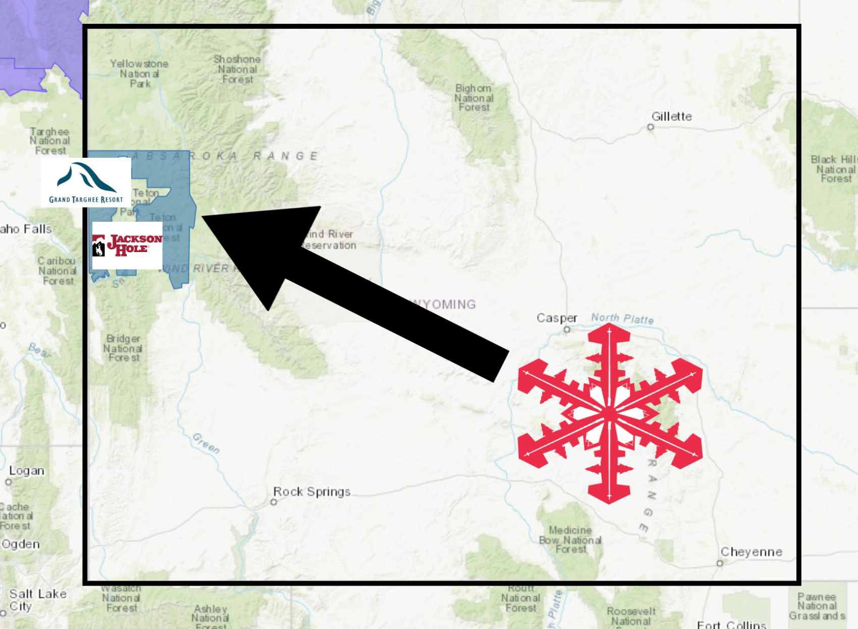
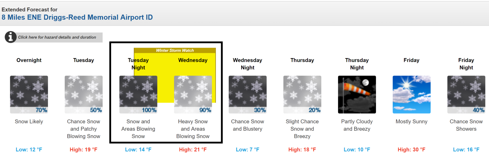
The National Weather Service has issued a Winter Storm Watch for the Tetons in Wyoming. It’s in effect from late this evening through Wednesday afternoon. Significant snowfall and substantial winds are forecasted to impact the area throughout that time.
Wyoming:
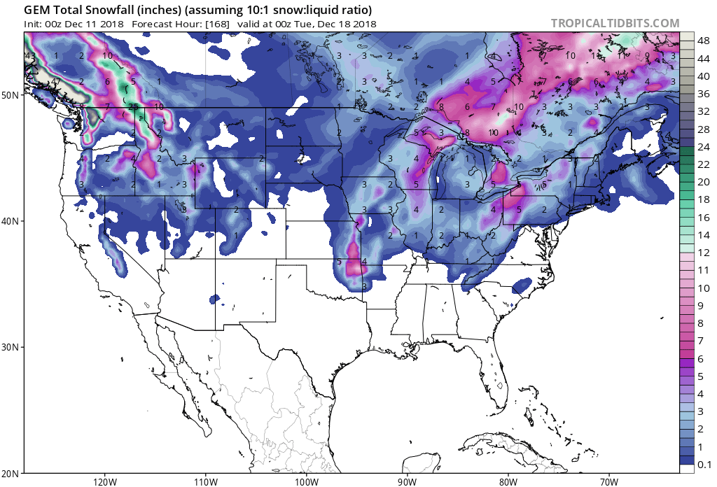
- 4-12″ of Snow Tonight – Wednesday
“A Winter Storm Watch and High Wind watches have been issued for the storm moving into the Cowboy State Tuesday evening. Heavy snow starts in the western mountains and will spread across portions of central Wyoming through Wednesday. Strong winds will accompany the front with high winds expected in the Cody Foothills and southern wind corridor. The strong winds combined with the snow/blowing snow will create hazardous driving conditions.”
– NOAA Riverton, WY
Grand Targhee Resort, WY and Jackson Hole Mountain Resort, WY already have over 115″ of snow on the season, so this storm could boost those already-impressive numbers.
Snow levels are forecasted to hover between 4,500ft – 4,000ft throughout the storm.
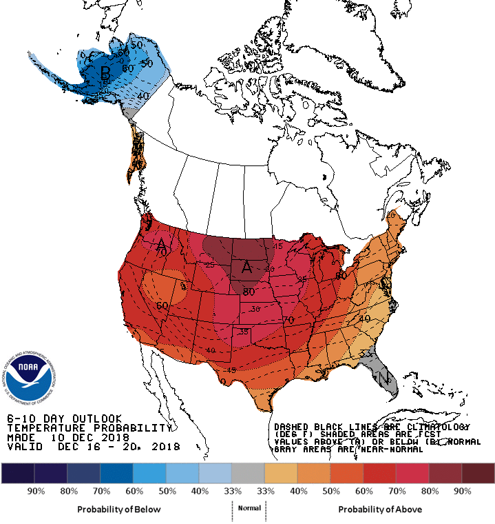
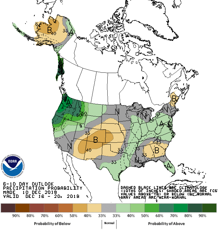
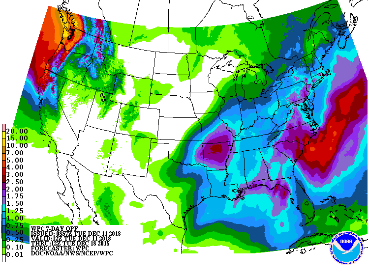
The 6-10 day outlook calls for above average temperatures and above average precipitation in Idaho.
Additional Storm Info:
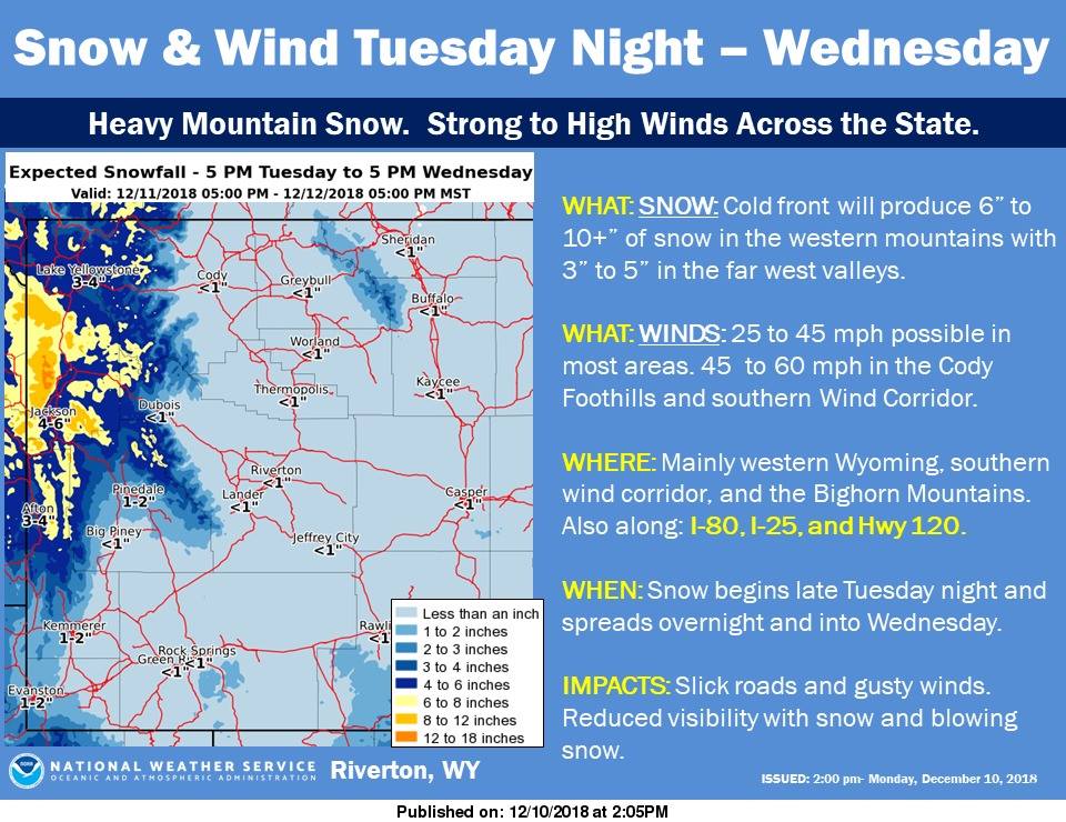
Wyoming: 4-12″ of Snow Tonight – Wednesday
* Total snow accumulations of 4 to 12 inches possible.
  Winds could gust as high as 40 mph.
- NOAA Riverton, WY
Winter Storm Watch:
URGENT - WINTER WEATHER MESSAGE
National Weather Service Riverton WY
227 AM MST Tue Dec 11 2018

...Significant Snow and Wind Expected in the Tetons tonight and
Wednesday...

.After a bout of light snow today, a much more significant storm
system will move in tonight and continue through Wednesday. This
storm system will have the potential to produce significant snow
and strong wind.

Teton and Gros Ventre Mountains-
Including the city of Alta

...WINTER STORM WATCH REMAINS IN EFFECT FROM THIS EVENING THROUGH
WEDNESDAY AFTERNOON...

* WHAT...Heavy snow possible. Total snow accumulations of 4 to
  12 inches possible. Winds could gust as high as 40 mph.

* WHERE...Teton and Gros Ventre Mountains.

* WHEN...From this evening through Wednesday afternoon.

* ADDITIONAL DETAILS...Travel could be very difficult. Areas of
  blowing snow could significantly reduce visibility. The
  hazardous conditions could impact the morning commute.