NOAA is reporting today that snow is possible in Lake Tahoe, CA/NV next week.
Snow levels may drop as low as 7,000′.
"Snow level could dip down below 7000 feet at times, which may leave a
light accumulation of snow on mountain peaks." - NOAA Reno, NV today
They are saying light snow, but snow nonetheless.
We’ll take it!
The word “snow” actually shows up in NOAA Reno, NV’s forecast discussion 4 times today!
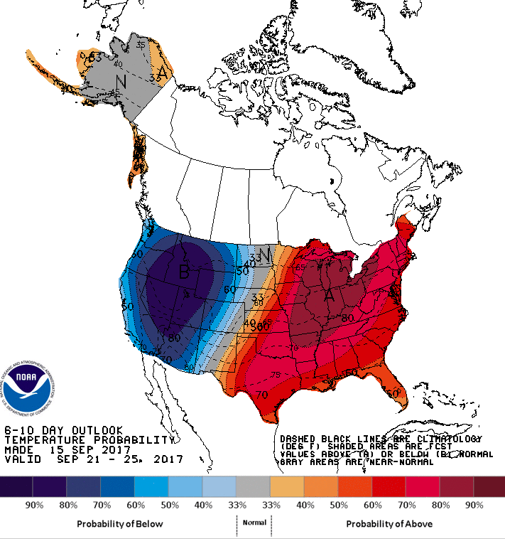
They’re saying that today was the coldest day in the past 3 months.
NOAA RENO, NV FORECAST DISCUSSION EXCERPTS:
.SYNOPSIS...

Today will be the coolest day of the past three months as dry
north flow prevails, followed by a modest warmup for the weekend.
A stronger cold front will bring increased winds Monday followed
by below average temperatures for much of next week and a chance
for showers. Light snow is possible in higher elevations, while
low temperatures may dip to near freezing in some lower valleys.
.LONG TERM...Week of September 18th...

Cooler and unsettled pattern will develop across the west for next
week. This will be caused by low pressure setting up over the
Canadian Rockies with 2 or 3 systems rotating through the Sierra and
western Nevada. Expect periods of gusty winds with each passing
system, autumn like temperatures and a threat for rain and mountain
snow.
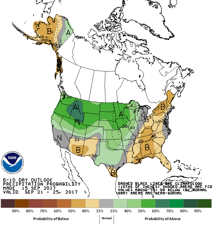
Additional systems for Wednesday-early Thursday and possibly Friday
will bring gusty winds and perhaps a better chance for showers. Snow
level could dip down below 7000 feet at times, which may leave a
light accumulation of snow on mountain peaks.
- NOAA Reno, NV today