
NOAA has issued a Special Weather Statement for the Brooks Range in northern Alaska.
Up to 8″ of snowfall is forecast! And it looks like it’s going to snow a bit all week in the Brooks Range.
It’s mid-August…
"Snowfall in the far western Brooks Range will be up to 8 inches tonight
west of Howard Pass, and Saturday night up to 6 inches of snow
is possible around Anaktuvuk Pass with lesser amounts to the
east." - NOAA Fairbanks, AK today
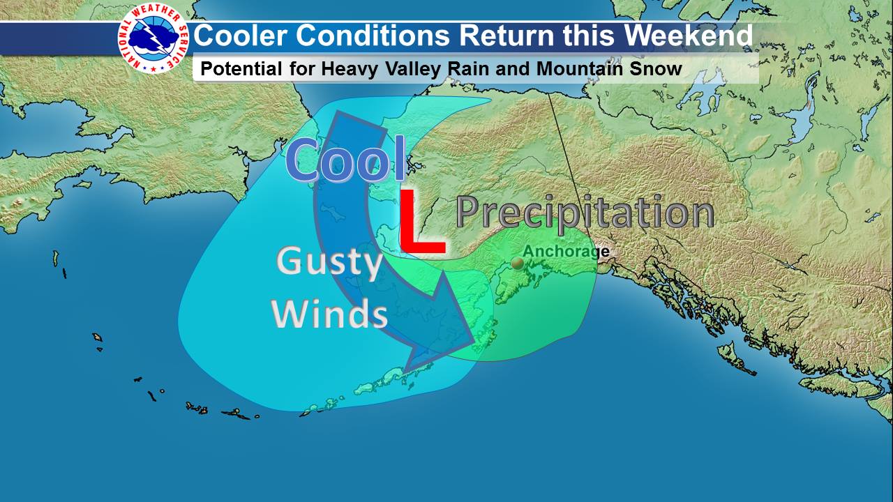
Southern Alaska will get snow, too!
“First Taste of Autumn in Southern Alaska!
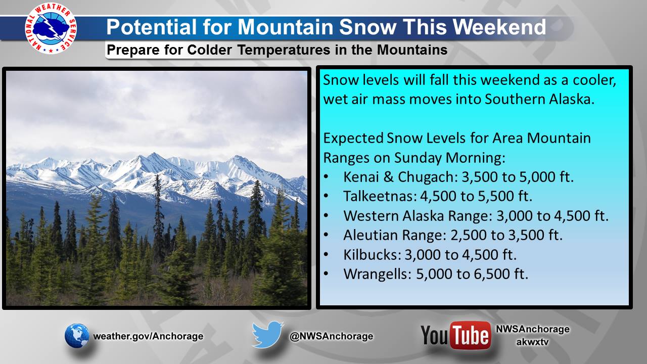
A cooler air mass will move into Southern Alaska this weekend. Gusty winds can be expected along the coast with the cooler air. Precipitation will also spread across the area, with snow levels dropping to between 2,500 and 6,000 feet by Sunday morning. Rain, heavy at times, can be expected for the lower elevations.
Those recreating in any of the mountain ranges across southern Alaska this weekend should plan for much colder conditions, including snow at the higher elevations.” – NOAA Alaska
Snow levels will drop as low as 2,500′.
"Snow levels will fall to around 2500 feet west of Howard Pass tonight,
and to around 3500 feet Saturday night to the east of Howard Pass."
- NOAA Fairbanks, AK today
Snow in AK this time of year isn’t unusual. NOAA issued Winter Storm Warnings in the Brooks Range in August each of the past two years (2015, 2016).
SPECIAL WEATHER STATEMENT FOR ALASKA:
Special Weather Statement
National Weather Service Fairbanks AK
238 PM AKDT Fri Aug 11 2017

Northwestern Brooks Range-Northeastern Brooks Range-
Including Singiluk, Umiat, Anaktuvuk Pass, Atigun Pass,
Galbraith Lake, Sagwon, and Franklin Bluffs
238 PM AKDT Fri Aug 11 2017

...Early Season Snowfall and Strong Winds in the Brooks Range
this Weekend...

A weather system over the Arctic will send cold air south this
weekend with snowfall expected in the Brooks Range.

Snowfall is expected in the western Brooks Range, and higher
elevation passes of the central and eastern Brooks Range. Snowfall
in the far western Brooks Range will be up to 8 inches tonight
west of Howard Pass, and Saturday night up to 6 inches of snow
is possible around Anaktuvuk Pass with lesser amounts to the
east. Atigun Pass and the Dalton Highway can expect some snow, but
current guidance indicates 2 inches or less in the corridor. Snow
levels will fall to around 2500 feet west of Howard Pass tonight,
and to around 3500 feet Saturday night to the east of Howard Pass.

Strong Gusty winds to 35 mph can also be expected through the
passes Saturday night.

If you are planning outdoor activities or travel plans in the
Brooks Range over the weekend, especially over Atigun Pass, you
should be prepared for winter weather conditions.
