Two storms are forecasted to roll through Tahoe this week. The first storm is forecasted to drop around a foot of snow, the second storm may drop even more.
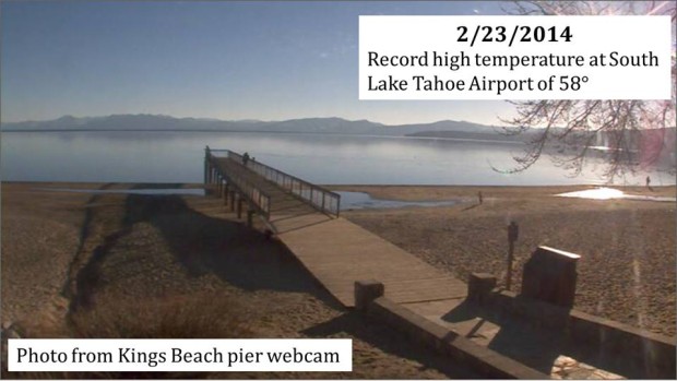
The weather has been wacky this year, but Tahoe is at least seeing some activity… even if we just had a record high of 58F in South Lake Tahoe yesterday:
South Lake Tahoe Airport hit a record high temperature of 58 degrees today. Records go back to 1968. Cooler and wetter weather expected by mid-week. – NOAA Reno, NV, Feb. 23, 2014
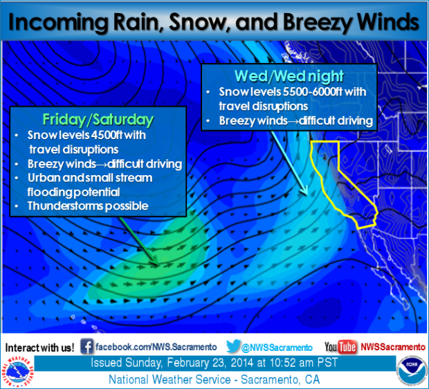
Two wet storms are on their way to California. Storm #1 Wed-Thu: Warmer with higher snow levels, but will bring widespread rain, mountain snow, and breezy conditions. Storm #2 Fri-Sat: Colder with lower snow levels, widespread rain and mountain snow, breezy conditions, and potential for thunderstorms and localized flooding. – NOAA Sacramento, CA Feb. 23, 2014
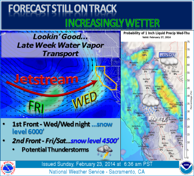
The forecast is still looking increasingly wetter late next week through the weekend. The first storm impacts northern California Wednesday into Thursday with most mountain areas having at least a 60 percent probability of 1 inch or more of precipitation. The second, and stronger storm will move onshore Friday into Saturday with potential thunderstorm activity. Moderate to strong southerly wind will likely accompany these storms. Snow levels will lower with the second storm down to around 4500 feet. – NOAA Sacramento, CA Feb. 23, 2014
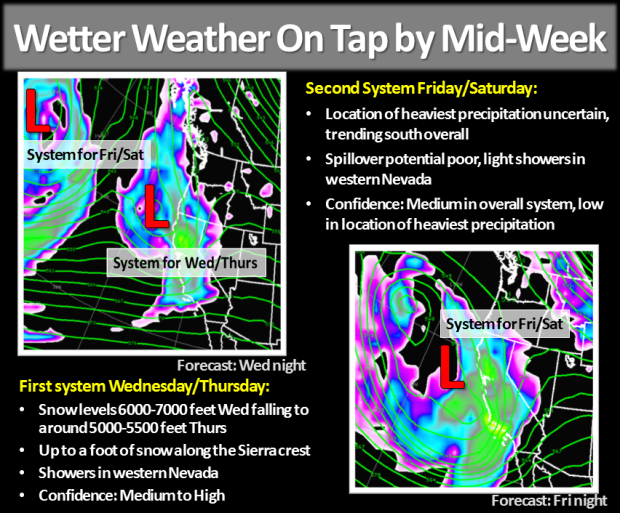
We are still looking to transition to a wetter pattern starting Wednesday of this week, but there is a bit more uncertainty with regards to the second system. The second system has been trending farther south and may end up being more of an event for the southern Sierra with snow showers in the northeastern Sierra and Tahoe Basin. Spillover potential is not impressive, with only light showers likely in Western Nevada. Keep checking back for the very latest! – NOAA Reno, NV Feb. 23, 2014


storm #2 might be the reason to make the trek down to mammoth