The most recent storm cycle in the Wasatch Mountains has finally departed, gifting Utah ski areas with upwards of 5 FEET of blower powder since last Thursday, January 9. The conditions as of late have been all time to say the least.
Now, it looks like there will be a minor break in the weather before ANOTHER storm cycle moves in late Thursday night continuing on through Friday, January 17. NOAA has issued a “Hazardous Weather Outlook” for the mountains of Northern Utah in anticipation for this storm.
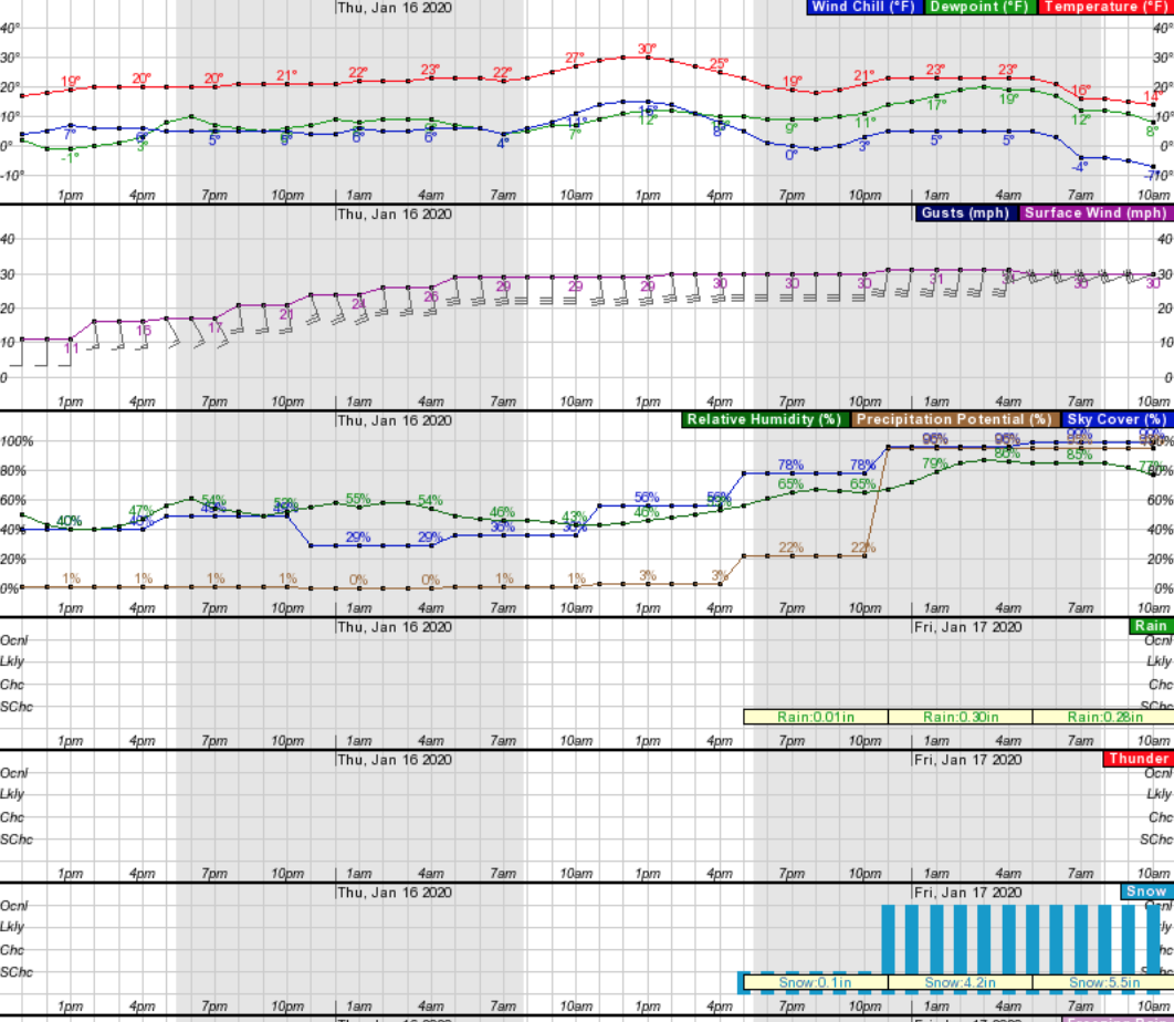
"The next storm system will impact the state Thursday night into
 Friday. Strong gusty southerly winds across the mountains and
 in western Utah on Thursday will precede the cold front which
 will bring widespread snow to the area Thursday night into
 Friday."
- NOAA, 1.15.20.
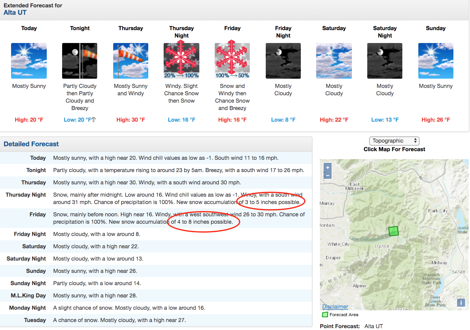
NOAA is calling for a potential 3 to 5 inches of snowfall on Thursday night followed by a potential 4 to 8 inches on Friday, leading to a possible 13″ of new snowfall by the weekend. On top of the 5 feet that Utah just got, this storm will be the icing on the cake.
Friday will be the real powder day this week. After the storm clears, partly cloudy conditions will follow on Saturday followed by bluebird conditions on Sunday. It’s going to be another good weekend of pleasant powder skiing in the Wasatch!
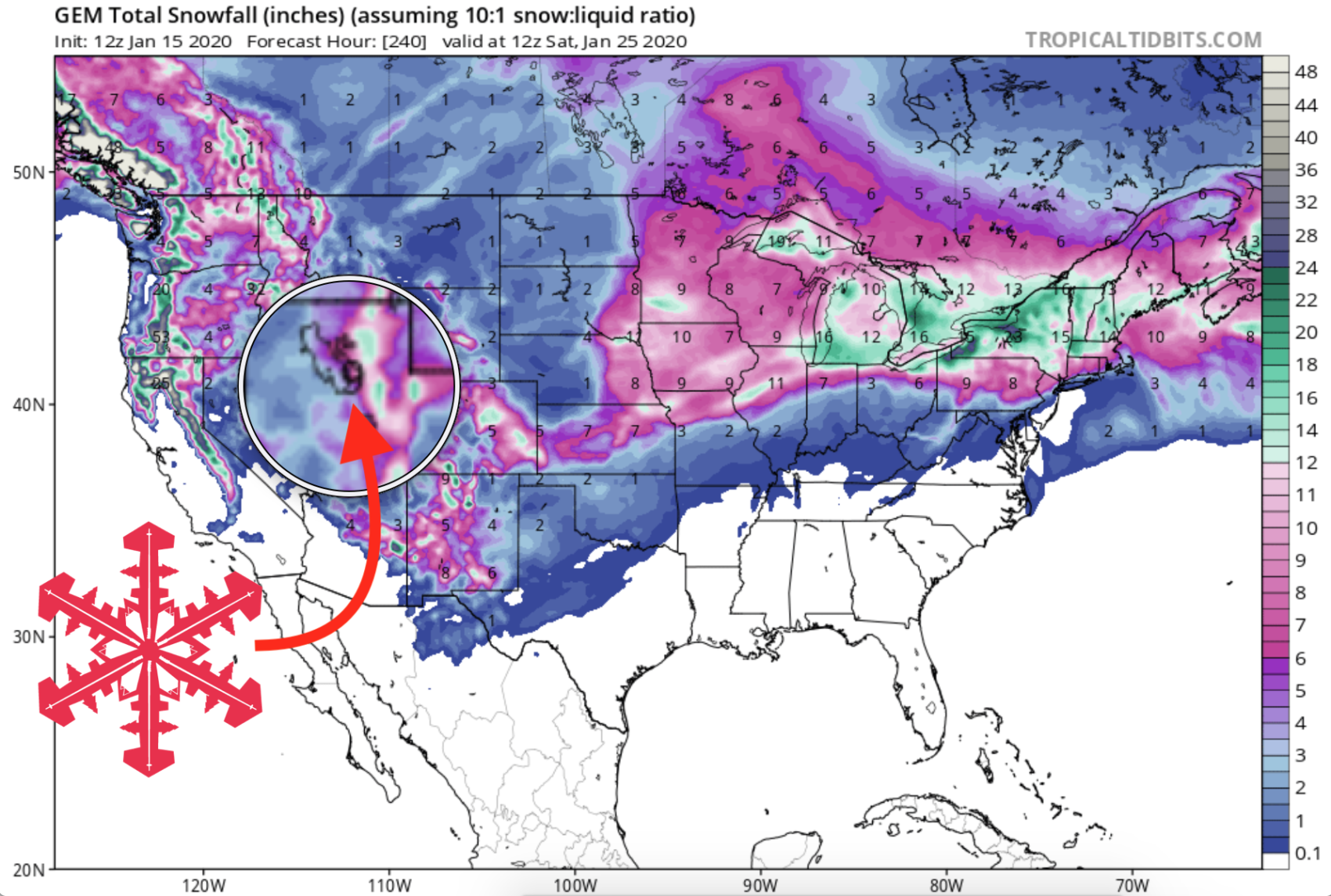
GEM Snowfall Forecast Model: