
NOAA just updated this weather report at 3:51pm today stating that up to 8″ of snow is forecast to fall in Colorado between now and tomorrow at 6pm.
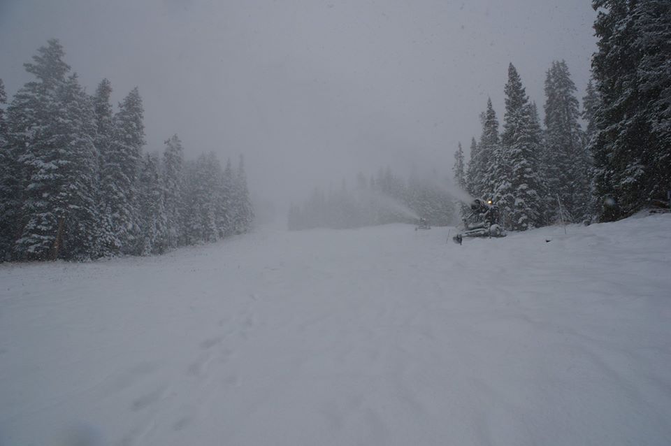
Wolf Creek is claiming that they’ve already gotten 20″ of snow today…
“20″ from the storm thus far! Find Wolf Creek’s snow report” – Wolf Creek today at 4:40pm

It just wont’ stop in Colorado. Loveland ski area has already gotten 8″ of new snow as of this writing and they’re forecasted to get up to 5 more inches of snow tonight.
The Loveland Pass area including Arapahoe Basin has a Hazardous Weather Outlook calling for 2-5″ of snow tonight and the Front Range has a Winter Weather Advisory calling for about the same amounts of snowfall tonight.
This really is going to give Loveland and/or Arapahoe Basin a good chance of getting open this weekend or early next week.
“Winter Weather Advisories are in effect for much of the Colorado mountains above 9000 feet through Friday. Snow accumulations of up to 8 inches are possible. The highest amounts are expected from the I-70 corridor northward. Travel over the mountain passes will be impacted by slick roads and low visibility. In addition, another round of freezing temperatures are possible over some valley locations on the West Slope early Saturday morning.” – NOAA, Denver, CO at 3:51pm today

NOAA’s HAZARDOUS WEATHER OUTLOOK & WINTER WEATHER ADVISORY:
HAZARDOUS WEATHER OUTLOOK
NATIONAL WEATHER SERVICE DENVER/BOULDER CO
1119 AM MDT THU OCT 22 2015

...WINTER WEATHER ADVISORY FOR HIGHER FRONT RANGE FOOTHILLS AND
MOUNTAINS ABOVE 8000 FEET....

THIS HAZARDOUS WEATHER OUTLOOK IS FOR NORTHEAST AND NORTH CENTRAL
COLORADO.

.DAY ONE...TODAY AND TONIGHT

SNOW WILL CONTINUE TO FALL IN THE HIGH COUNTRY OF NORTH CENTRAL
COLORADO THROUGH TONIGHT. EAST FACING SLOPES OF THE FRONT RANGE
WILL LIKELY SEE THEIR HEAVIEST SNOWFALL THROUGH THE MIDDLE OF
THIS AFTERNOON WHERE ANOTHER 3 TO 7 INCHES OF SNOW WILL
ACCUMULATE. SNOWFALL WILL THEN SHIFT TO NORTH AND NORTHWEST
FACING MOUNTAIN SLOPES TONIGHT WITH MOISTURE WRAPPING AROUND THE
BACK SIDE OF THE DEPARTING STORM SYSTEM. THESE MOUNTAIN SLOPES
COULD RECEIVE ANOTHER 2 TO 5 INCHES OF SNOW BEFORE MORNING. ON THE
PLAINS EXPECT PERIODS OF LIGHT TO MODERATE RAINFALL AND AREAS OF
FOG THROUGH MID-AFTERNOON...THEN GRADUAL IMPROVEMENT AS DRIER AIR
SPREADS UP FROM THE SOUTH.