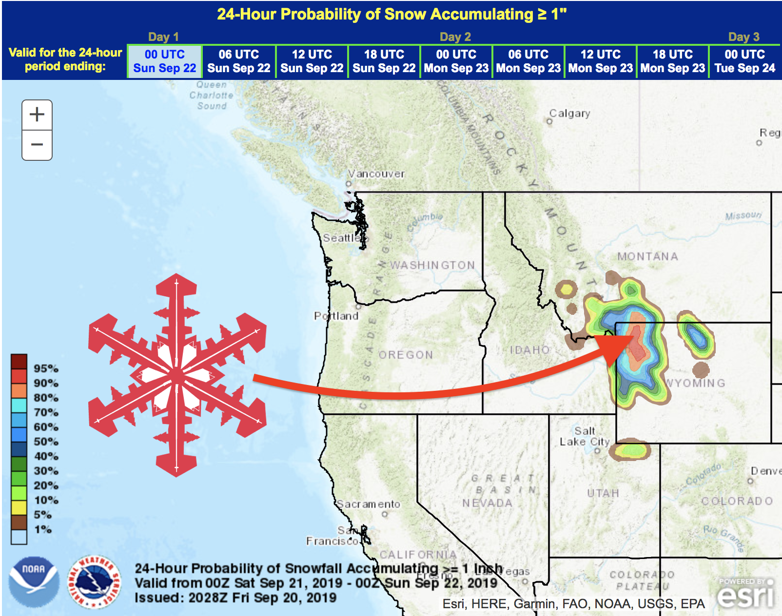
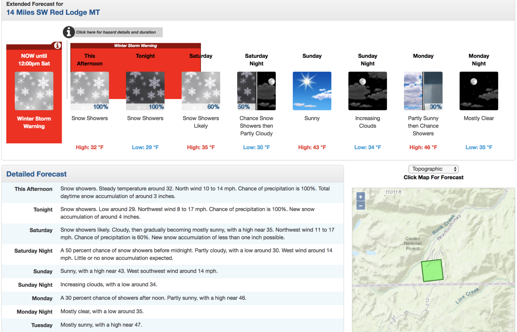
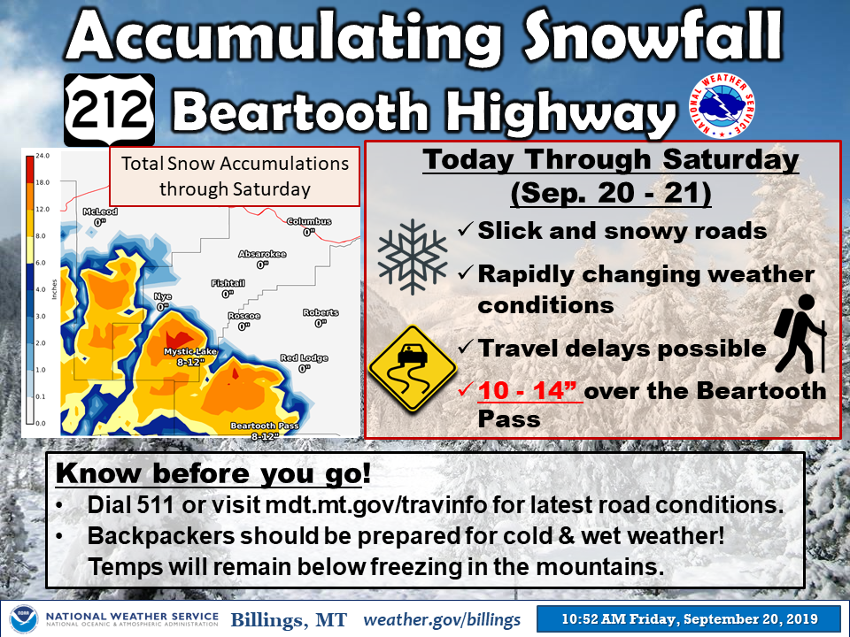
NOAA has issued a Winter Storm Warning for Beartooth Pass, WY/MT (US-212) that is calling for 12-18″ of snow to fall on Friday & Saturday.
This is the first Winter Storm Warning of the 2019/20 season in the Contiguous United States of America
* WHAT...Heavy snow. Total snow accumulations of 12 to 18 inches above 8000 feet,
with locally heavier amounts on the highest peaks. The heaviest snowfall will
be this afternoon through late tonight on north facing slopes.

* ADDITIONAL DETAILS...10 to 14 inches of heavy wet snow is expected
  on the Beartooth Highway.

- NOAA, Billings MT, today
This will likely be enough to close Beartooth Pass for a day or two or more.
* IMPACTS...Travelers on the Beartooth Pass should be prepared
  for rapidly changing weather conditions and possible closures.

- NOAA, Riverton WY, today
A snowstorm shut down Beartooth Pass already this month on September 11th and 12th, 2019.
“09/20 @ 11:00 am -> A Winter Storm Warning is in effect for the Beartooth/Absaroka Mountains until noon Saturday. Elevations above 8000 ft will get snow, and heavy wet snow can be expected on the Beartooth Pass.” – NOAA, Billings MT, today
It is not uncommon for Beartooth Pass to see enough snow to close the pass in August or September.
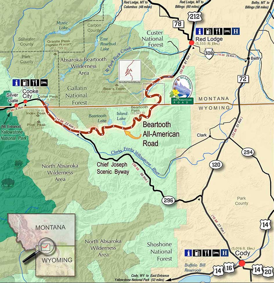
Beartooth Pass road reaches elevations as high as 10,947-feet.
Beartooth Pass Info:
Beartooth Highway is an All-American Road on a section of U.S. Route 212 in Montana and Wyoming between Red Lodge and the Northeast entrance of Yellowstone National Park, passing over the Beartooth Pass in Wyoming at 10,947 feet (3,337 m) above sea level. It has been called “the most beautiful drive in America,” by late CBS correspondent Charles Kuralt. Because of heavy snowfall at the top, the pass is usually open each year only from mid-May through mid-October, weather conditions permitting.- Wikipedia
Winter Storm Warning for Beartooth Pass, WY/MT
Winter Storm Warning
URGENT - WINTER WEATHER MESSAGE
National Weather Service Billings MT
312 PM MDT Fri Sep 20 2019

Absaroka/Beartooth Mountains-
Including the locations of  Cooke City
312 PM MDT Fri Sep 20 2019

...WINTER STORM WARNING REMAINS IN EFFECT UNTIL NOON MDT
SATURDAY...

* WHAT...Heavy snow. Total snow accumulations of 12 to 18 inches
  above 8000 feet, with locally heavier amounts on the highest
  peaks. The heaviest snowfall will be this afternoon through late
  tonight on north facing slopes.

* WHERE...Absaroka/Beartooth Mountains.

* WHEN...Until noon MDT Saturday.

* IMPACTS...Travelers on the Beartooth Pass should be prepared
  for rapidly changing weather conditions and possible closures.
  Backcountry travel will be difficult to impossible.

* ADDITIONAL DETAILS...10 to 14 inches of heavy wet snow is expected
  on the Beartooth Highway.