The National Weather Service has issued Winter Storm Warnings and Winter Weather Advisories for Montana. A strong cold front is expected to persist through Friday, which will turn rain to snow and drop snow levels. Snow is expected to end early Saturday morning.
10-20″ of snow is expected to fall in the Winter Storm Warning region.
6-10″ of snow is expected to fall in the Winter Weather Advisory region.
NOAA Has Issued A Winter Storm Warning For:
Montana
NOAA Has Issued A Winter Weather Advisory For:
Montana
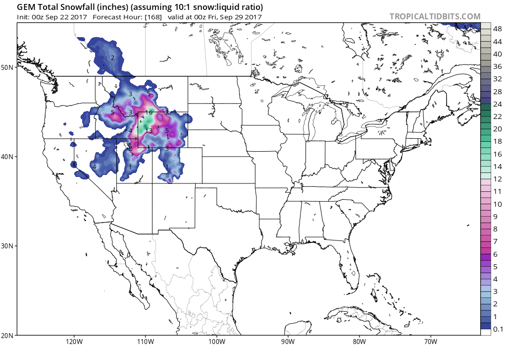
7 day snowfall totals. Image: Tropical Tidbits7 day precipitation totals. Image: NOAA
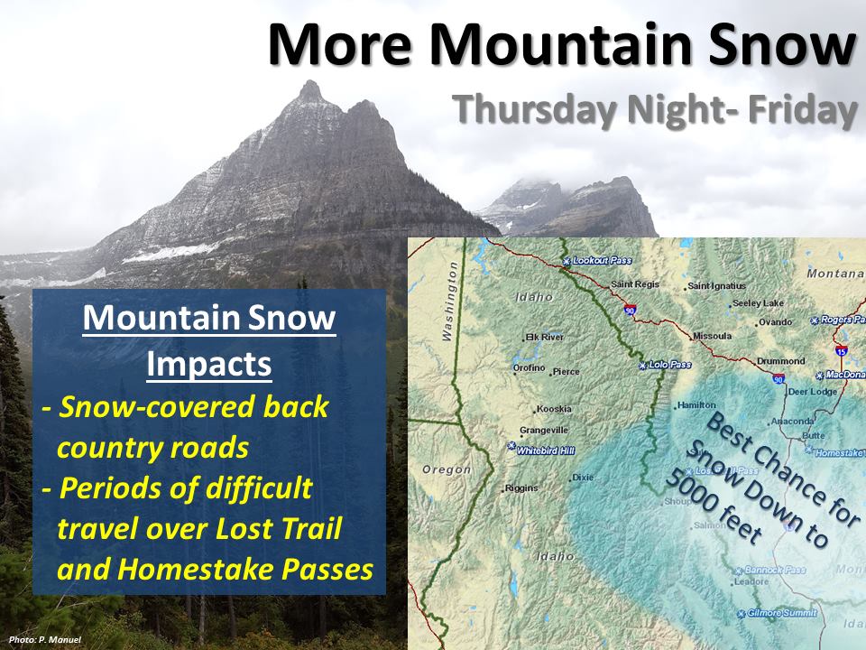
Accumulating snowfall is expected above 4,500ft, but a mix of rain and snow is expected to occur below 4,500ft.
Additional Storm Info:
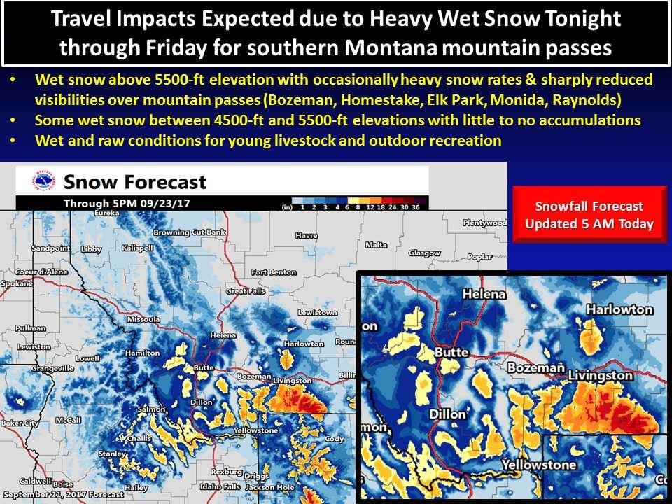
Travel impacts are expected through Friday as an unusually strong low pressure system impacts southern Montana with rain and higher-elevation snow. Image: NOAA Great Falls, MTSnow will continue through today in Montana. Image: NOAA Billings, MT
Montana: 10-20″ of Snow Above 8,000ft Through Friday Night
* TOTAL SNOW ACCUMULATION...10 to 15 inches, greatest on
 eastern slopes above 7000 feet in the Crazy Mountains. 10 to
 20 inches, greatest above 8000 feet in the
 Absaroka/Beartooth Mountains.
- NOAA Billings, MT
One last “winter-like” storm will impact the area, specifically Lemhi County to southwest Montana into Friday. Image: NOAA Missoula, MTFrost is on the way. Image: NOAA Missoula, MT
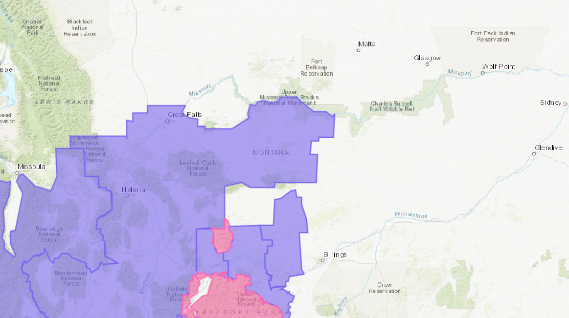
Winter Storm Warning:
URGENT - WINTER WEATHER MESSAGE
National Weather Service Billings MT
229 AM MDT Fri Sep 22 2017
Absaroka/Beartooth Mountains-Crazy Mountains-
...WINTER STORM WARNING REMAINS IN EFFECT UNTIL 6 AM MDTSATURDAY...
* IMPACTS...Travel in the high country will be affected by
periods of heavy snowfall. Hunters and recreationists should
be prepared for dangerous winter conditions.
* TIMING...Through tonight. Heaviest snowfall is expected through
this morning.
* TOTAL SNOW ACCUMULATION...10 to 15 inches, greatest on
eastern slopes above 7000 feet in the Crazy Mountains. 10 to 20 inches, greatest above 8000 feet in the Absaroka/Beartooth Mountains.
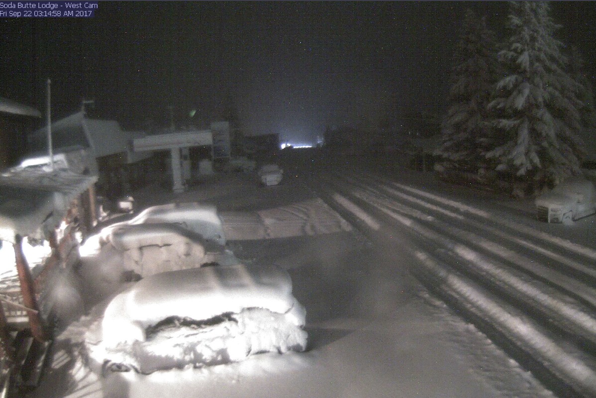
6-10 day temperature outlook. Image: NOAA6-10 day precipitation outlook. Image: NOAACooke City, MT This Morning. Image: NOAA