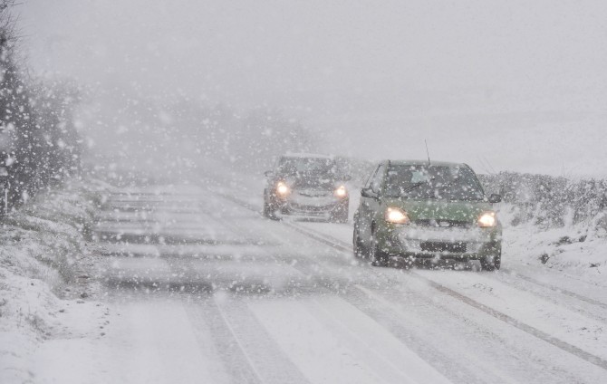
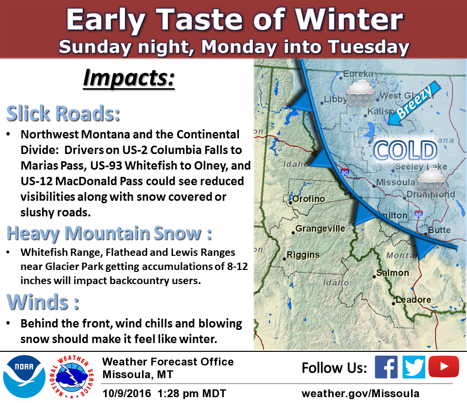
NOAA has issued a Winter Storm Warning for Montana today that began at midnight last night.
This Winter Storm Warning calls for 8-15″ of new snow.
This is the second Winter Storm Warning of winter 2016/17. The first one was also issued in Montana.
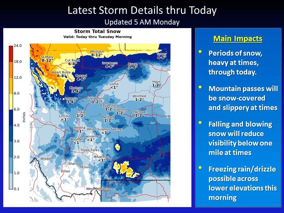
* SNOW ACCUMULATIONS...6 TO 8 INCHES IN EASTERN GLACIER COUNTY
  WITH 8 TO 15 INCHES IN WESTERN PORTIONS OF THE COUNTY. HIGHEST AMOUNTS
  ARE EXPECTED ABOVE 5000 FEET. - NOAA Great Falls, MT today
There are also multiple Winter Storm Watches issued in Montana today that are calling for 4-7″ of snow in the mountains.
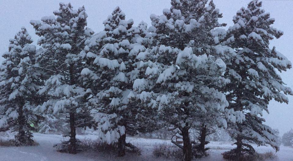
St. Mary in Glacier National Park, MT has already seen 12″ of snow as of 8am MST today!
“No mountains visible this morning, but we have a good foot of snow at St Mary. And it is still coming down. Yahoo!” – Glacier National Park, MT today
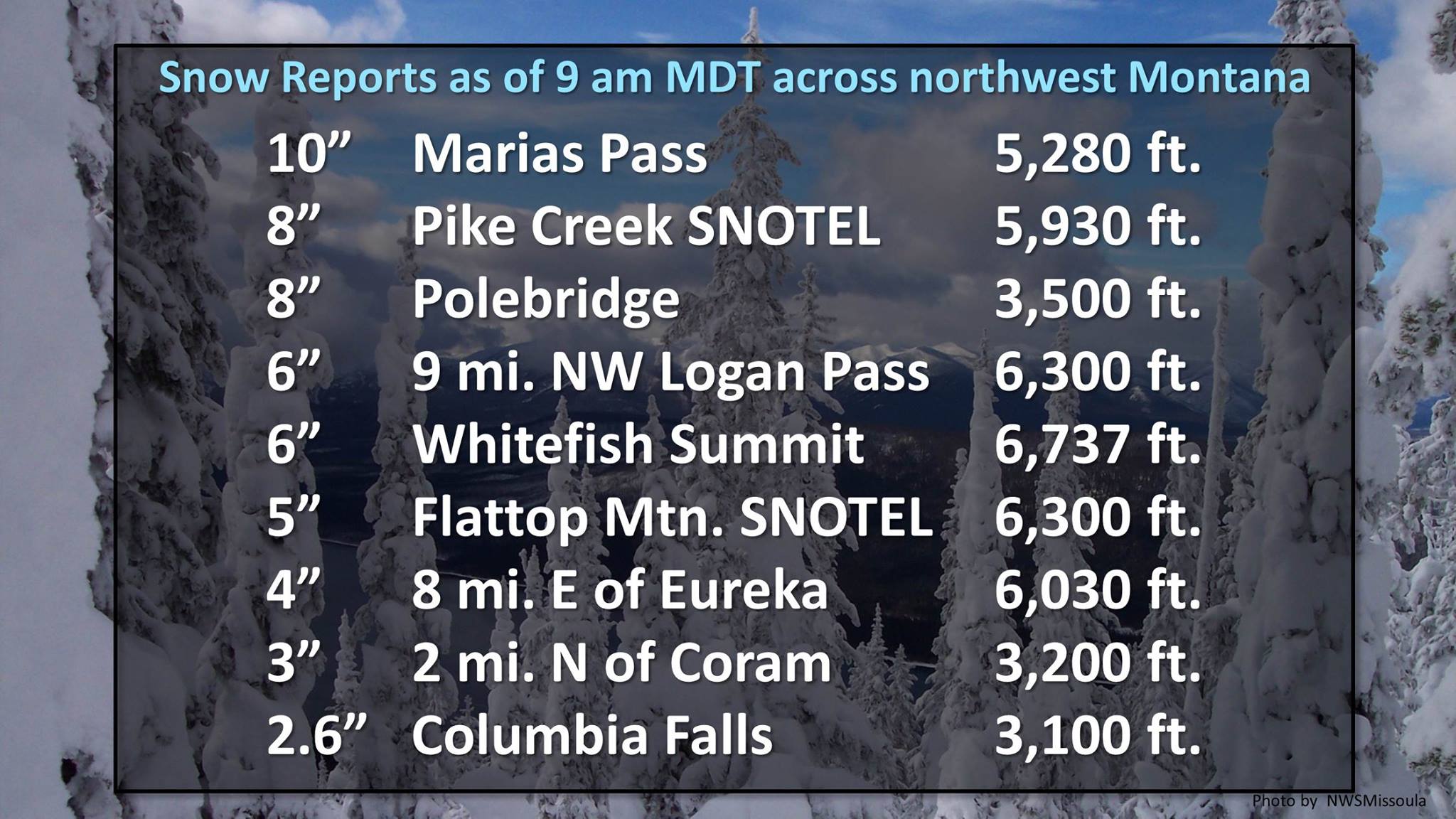
10″ of snow reported at Marias Pass, MT today at 8am MST today.
“Anywhere from 4 to 6 inches has been reported by sensors in the higher elevations across Glacier National Park Up to 10 inches so far near#MariasPass.” – NOAA Missoua, MT today
WINTER STORM WARNING for MONTANA:
URGENT - WINTER WEATHER MESSAGE
NATIONAL WEATHER SERVICE GREAT FALLS MT
343 AM MDT MON OCT 10 2016
NORTHERN ROCKY MOUNTAIN FRONT-EASTERN GLACIER-
INCLUDING THE FOLLOWING LOCATIONS...BROWNING...MARIAS PASS...
LOGAN PASS...CUT BANK
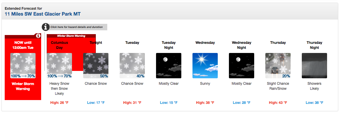
...WINTER STORM WARNING REMAINS IN EFFECT UNTIL MIDNIGHT MDT
TONIGHT...
* LOCATIONS...BROWNING...MARIAS PASS...LOGAN PASS...CUT BANK.
* SNOW ACCUMULATIONS...6 TO 8 INCHES IN EASTERN GLACIER COUNTY
WITH 8 TO 15 INCHES IN WESTERN PORTIONS OF THE COUNTY. HIGHEST AMOUNTS
ARE EXPECTED ABOVE 5000 FEET.
* VISIBILITY...VISIBILITIES WILL BE REDUCED TO LESS THAN ONE
HALF MILE AT TIMES IN AREAS OF FALLING AND BLOWING SNOW.
* TIMING...LIGHT SNOW CONTINUES TODAY WITH OCCASIONAL PERIODS OF
MODERATE TO HEAVY SNOW...ESPECIALLY MONDAY MORNING. THE SNOW
WILL BEGIN TO DIMINISH IN INTENSITY ON MONDAY EVENING.
* IMPACTS...HUNTERS...HIKERS...AND OTHERS WITH OUTDOOR INTERESTS
SHOULD PREPARE FOR WINTER CONDITIONS...OR DELAY OUTDOOR PLANS
UNTIL WEATHER IMPROVES. THOSE DRIVING ON MOUNTAIN PASSES
SHOULD ALSO PREPARE FOR WINTER DRIVING CONDITIONS.
* WINDS...NORTH 10 TO 15 MPH WITH GUSTS UP TO 20 MPH.
One thought on “NOAA: Winter Storm Warning for Montana Today | 8-15″ of Snow Forecast”