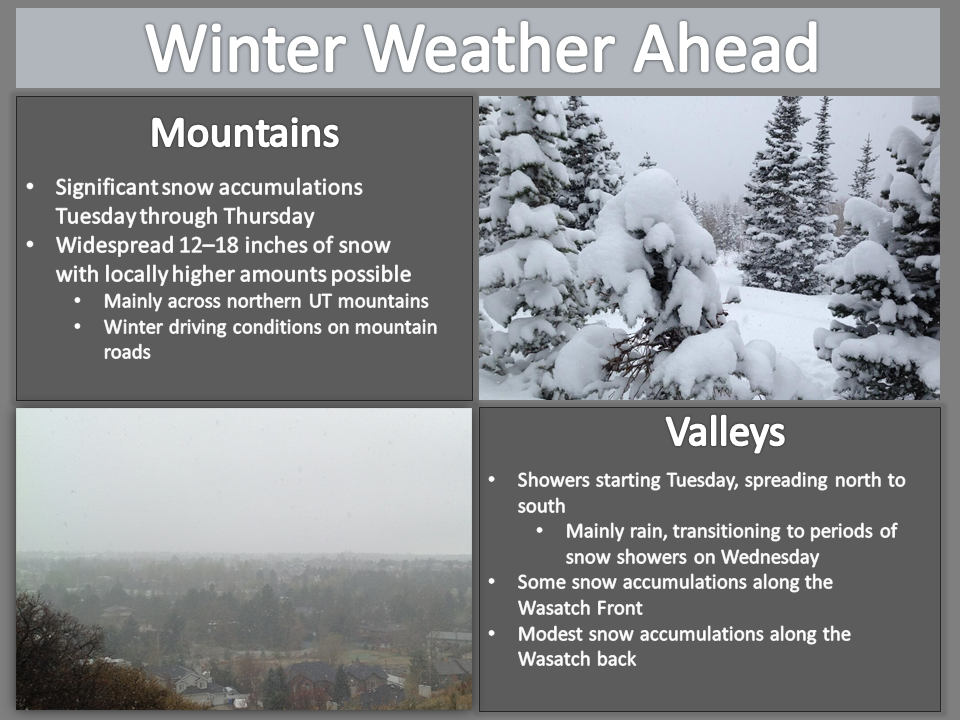
Winter ain’t over yet. The NOAA has issued a winter storm warning for the Wasatch Mountains of Northern Utah from tonight (Tuesday, March 24, 2020) at 6 p.m. until 10 p.m. Thursday night (March 26). Despite the fact that all Utah ski areas are now closed due to COVID-19, this storm looks like its going to be a big one, producing excellent blower powder conditions for the Wasatch backcountry.
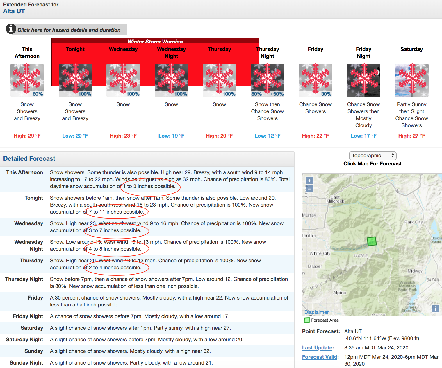
...WINTER STORM WARNING REMAINS IN EFFECT FROM 6 PM THIS EVENING
TO 10 PM MDT THURSDAY...

* WHAT...Heavy snow expected. Total snow accumulations of 1 to 2
  feet.

* WHERE...Wasatch Mountains South of I-80.

* WHEN...From 6 PM this evening to 10 PM MDT Thursday.

* IMPACTS...Travel could be very difficult to impossible.

* ADDITIONAL DETAILS...Occasional snow showers will continue
  today, with heavy snow arriving tonight through Wednesday
  morning. Snow will decrease Wednesday afternoon and evening,
  then turn heavy again late Wednesday night through Thursday.

-NOAA 3/24/20
According to the NOAA’s forecast discussion:
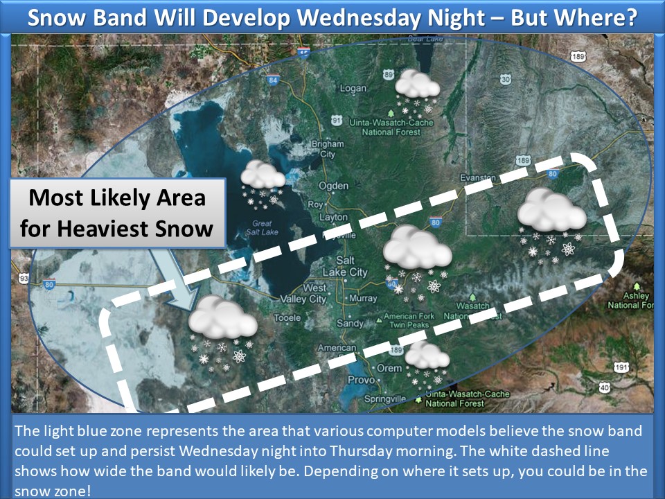
Spring arrived last last week, but winter wants to hang on, and so be it! Be prepared for multiple storms to affect northern Utah Tuesday into Thursday, with the brunt of the storm to occur Wednesday night into Thursday morning. A somewhat narrow band of heavy snow is expected to stretch from Tooele County into southwest Wyoming, during this time resulting in significant accumulations, even in the valleys.
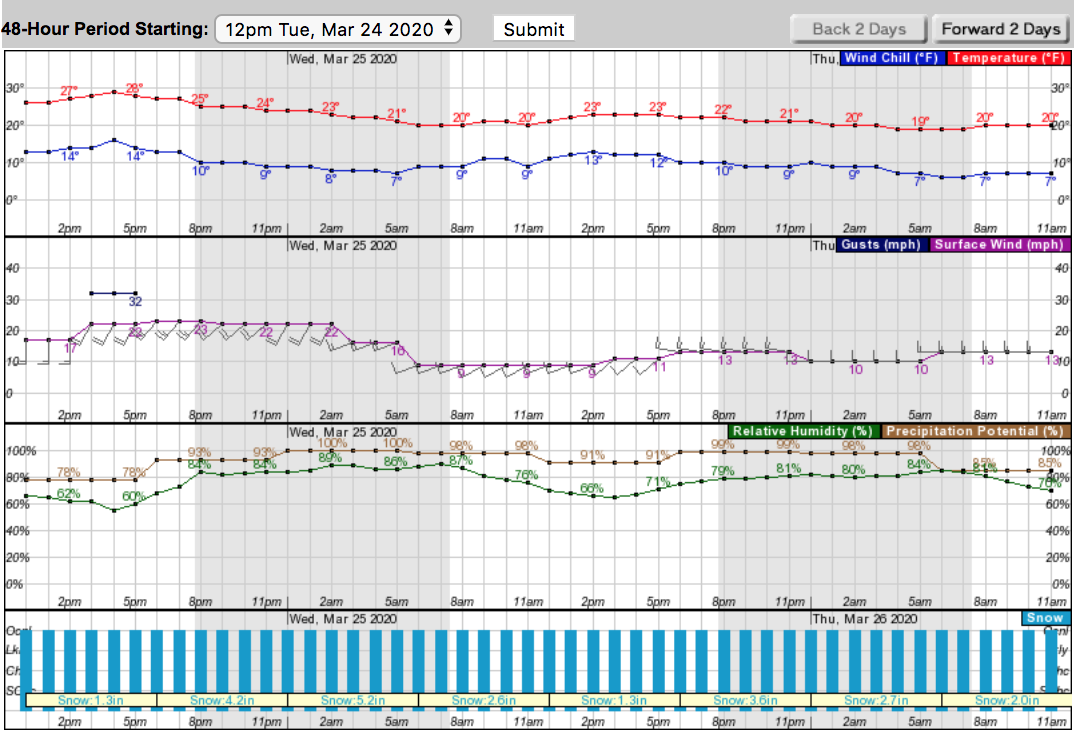
Starting tonight at 6 p.m. it is going to DUMP. Heavy snowfall is expected until late Thursday night, March 26. By Friday morning there could be up to 2 feet or more of fresh snow and this will most likely be the best day to get out for a rip. This is what the Utah Avalanche Center predicts in regards to this storm:
For today, we can expect increasing clouds in the afternoon with some scattered snow showers at times. It’s possible to see 2-4″ of new snow by 6:00 pm tonight. Winds will stay from the westerly direction and will continue to blow 15-25 mph at the upper elevations and may increase later this afternoon. Tonight, the first piece of a long duration storm will move into the northern mountains with heavy snowfall in the overnight hours. This storm will continue through Thursday, bringing mountain snow and colder temperatures. By Friday morning, we could see 18-24″ of new snow. – UAC 3/24/20
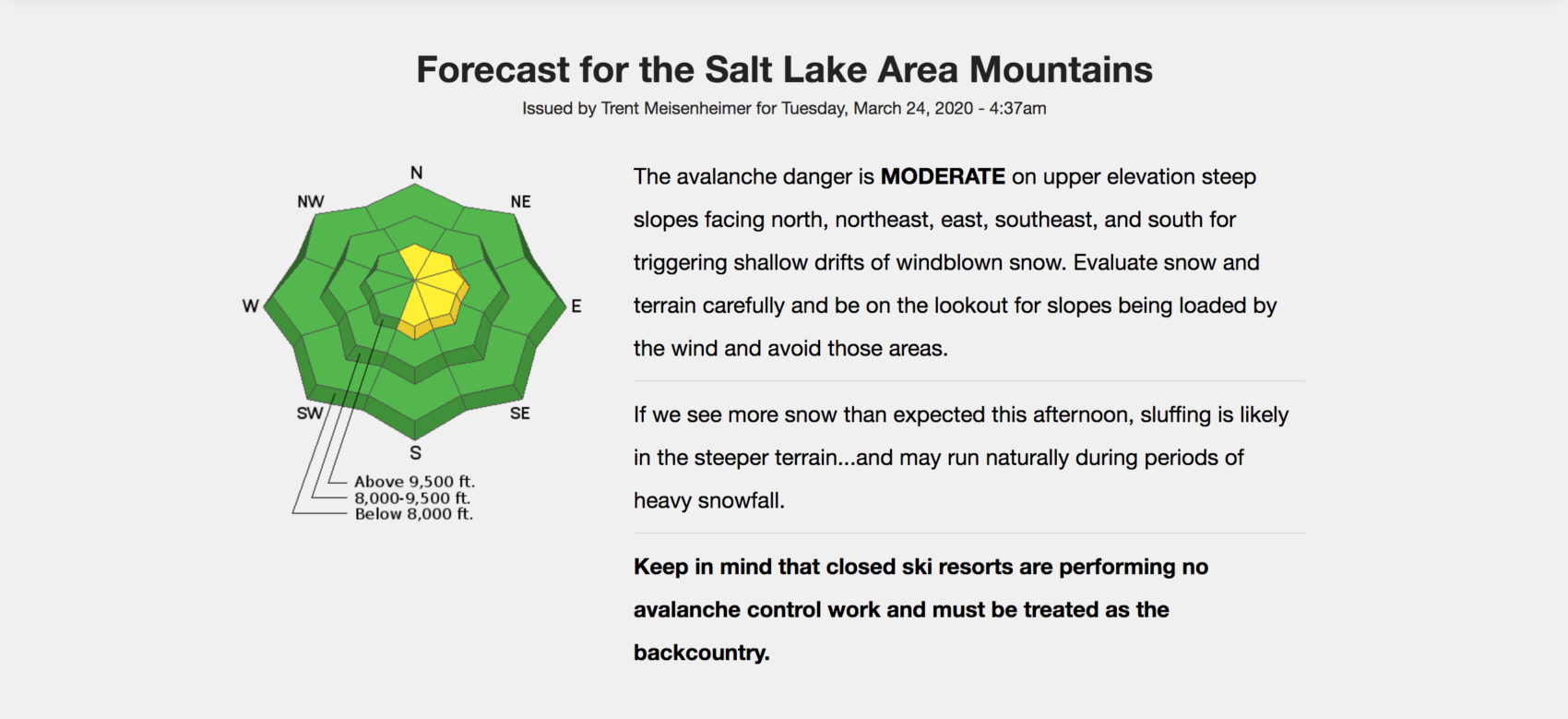
At the time of this writing, avalanche conditions for the Salt Lake area mountains is MODERATE on upper elevation steep slopes facing north, northeast, east, southeast, and south for triggering shallow drifts of windblown snow, according to the UAC. Please evaluate snow and terrain carefully and be on the lookout for slopes being loaded by the wind and avoid those areas.
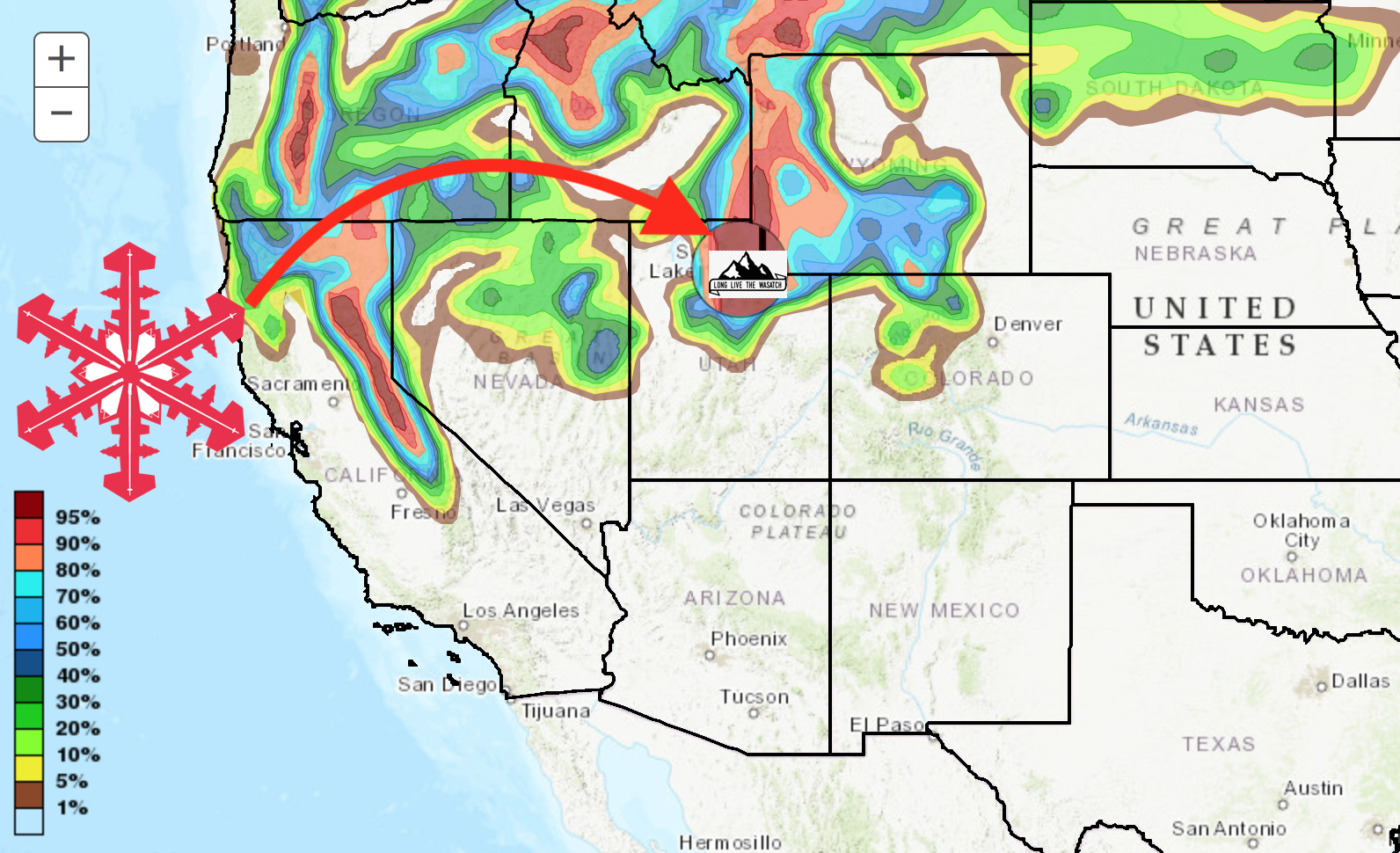
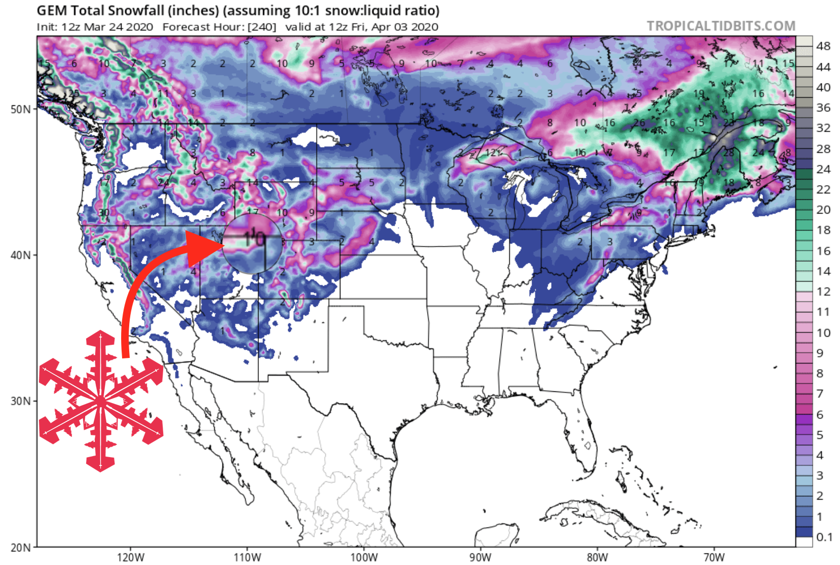
GEM Snowfall Totals Forecast:
Avalanche Danger (Increasing Trend)
Other Info