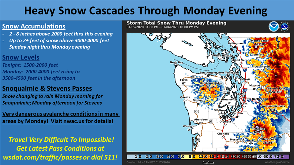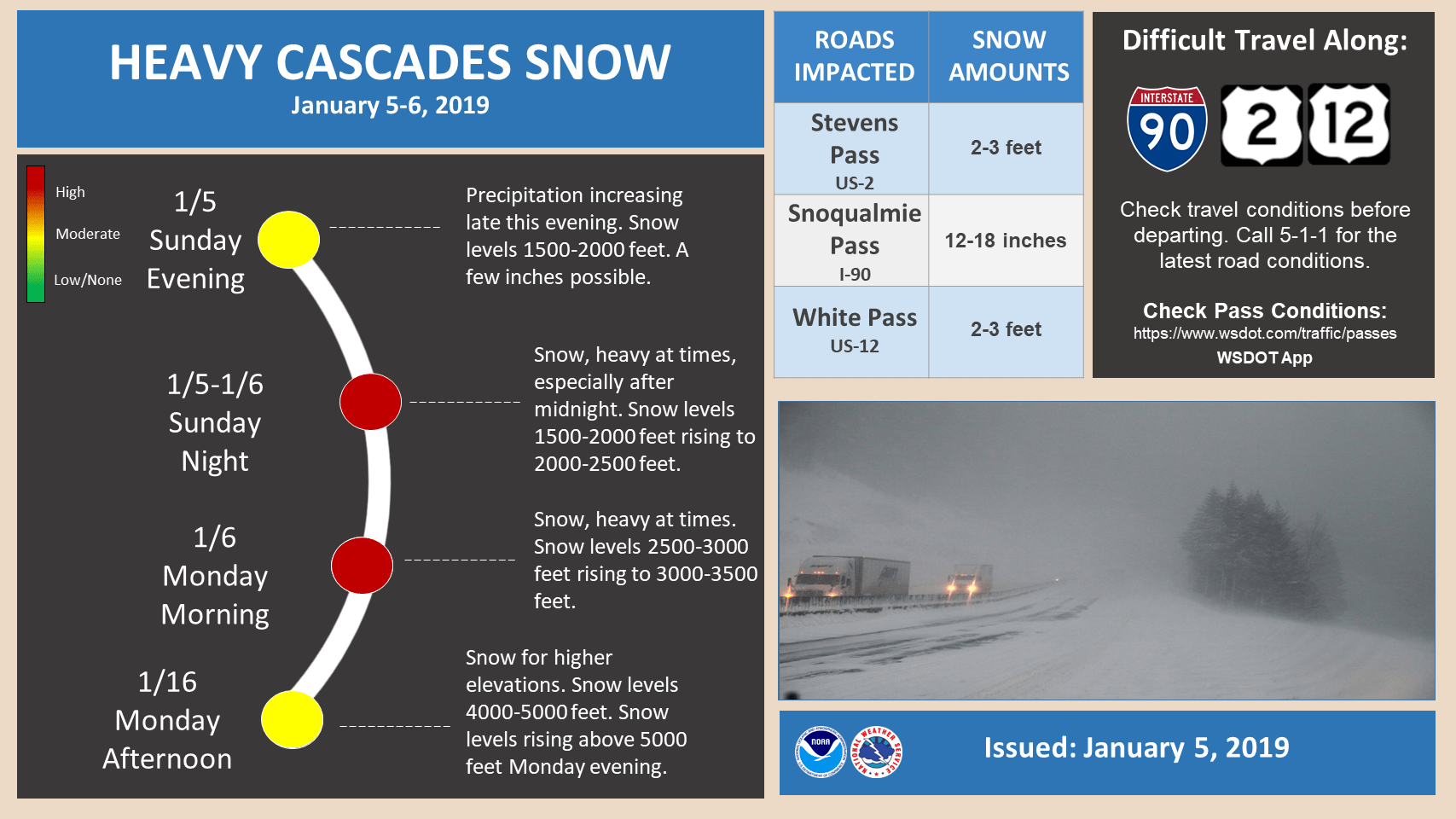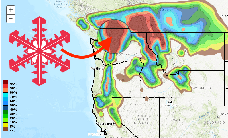
An active period of weather is expected over the next week as the storm track remains focused on the PNW, forecasts the NOAA. A winter storm watch will bring heavy mountain snow, with Mount Baker Ski Area, WA expected to receive 24-36″. Powderchasers are even more optimistic, forecasting up to 6-FEET through Sunday.
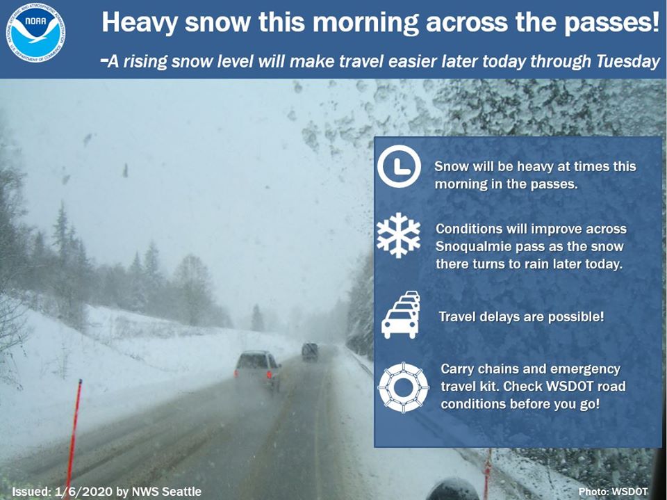
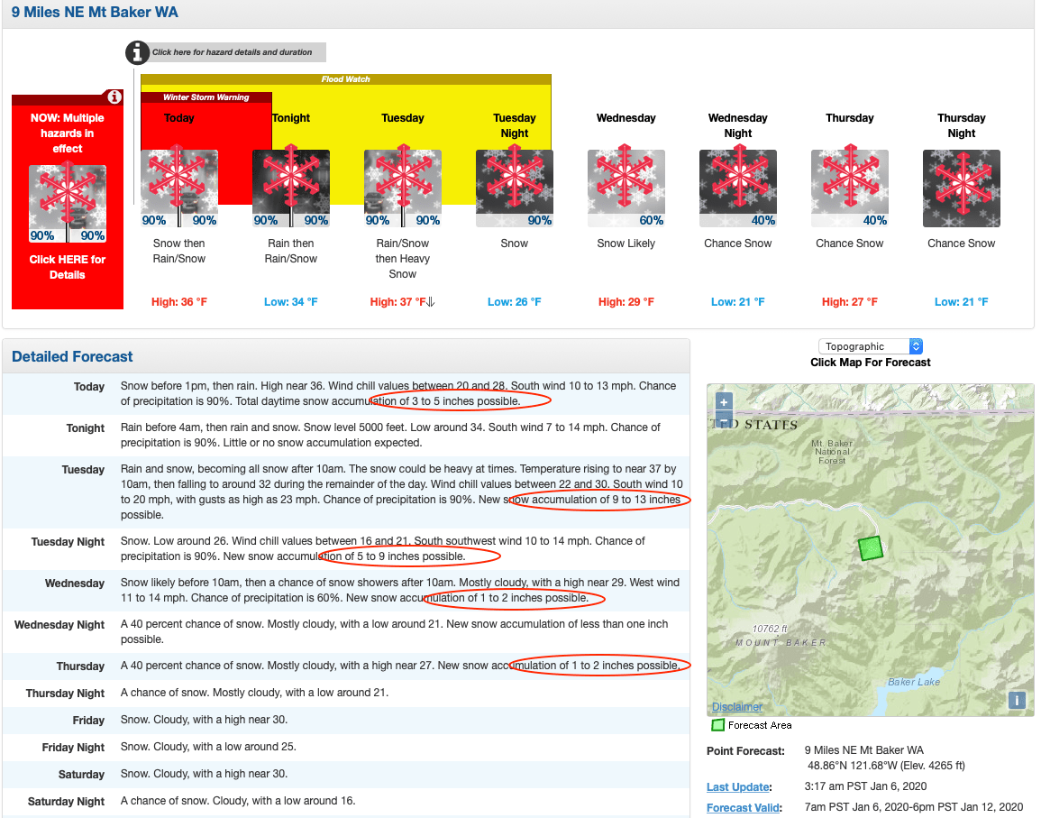
WINTER STORM WARNING REMAINS IN EFFECT UNTIL 10 PM PST THIS
EVENING ABOVE 4000 FEET...
...WINTER WEATHER ADVISORY WILL EXPIRE AT 4 AM PST EARLY THIS
MORNING ABOVE 2000 FEET...

* WHAT...Heavy snow expected above 4000 feet. Additional snow
  accumulations of 10 to 15 inches is possible into the evening
  until snow transitions to rain.

* WHERE...Cascade mountains and valleys of Whatcom and Skagit
  Counties, including Maple Falls, the Mount Baker Ski Area,
  Newhalem, Lyman, and Concrete.

* WHEN...Until 10 PM PST this evening.

* IMPACTS...Travel could be very difficult to impossible.
With 16″ reported already this morning, snow will continue through the week with totals being measured in feet rather than inches!
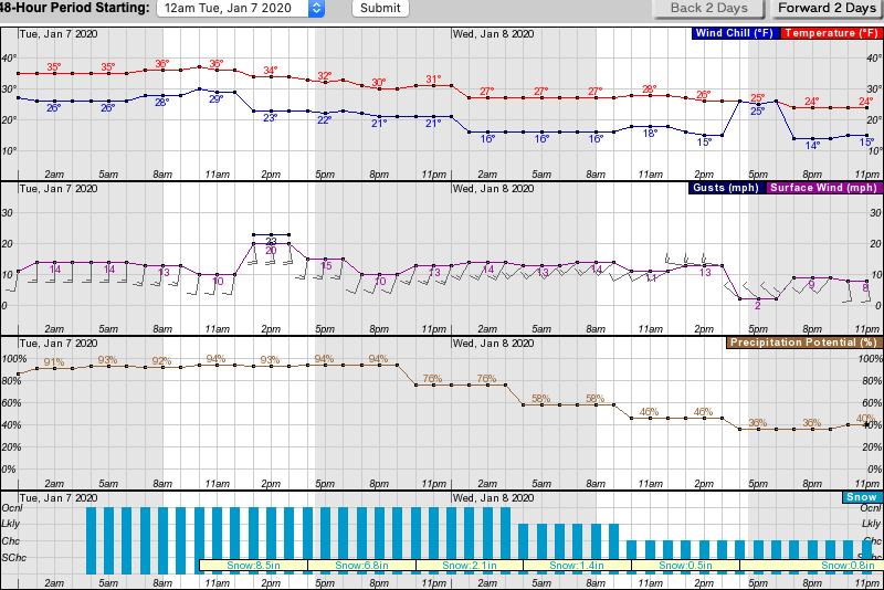
Temperatures will drop to the low 20s, and winds will be breezy, gusting up to 25-mph.
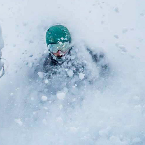
After a slow start to the season in the northwest, it looks like they’re finally getting the goods. Expect powder days all week!
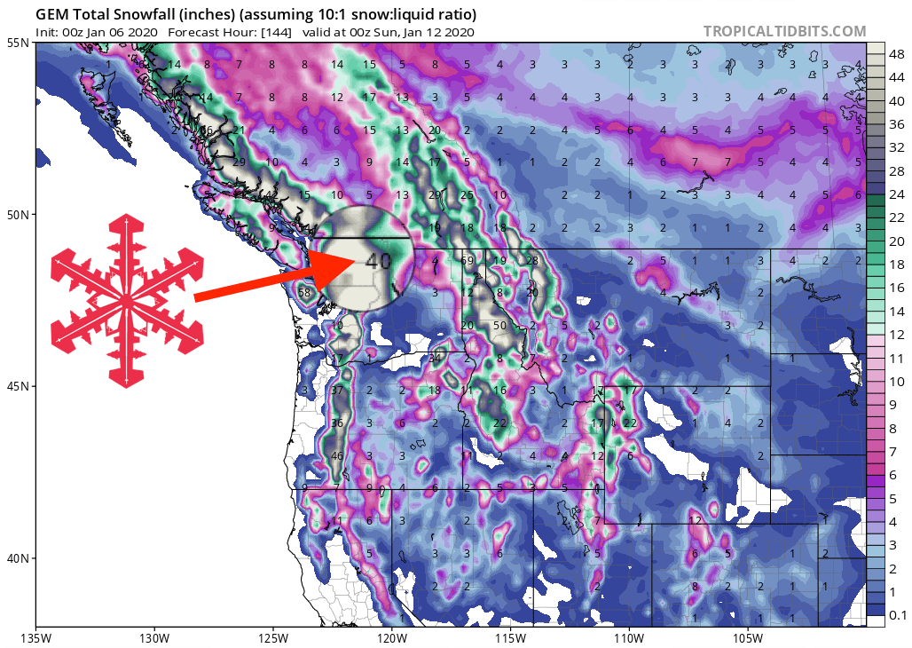
GEM Snowfall Forecast Model
Other Info