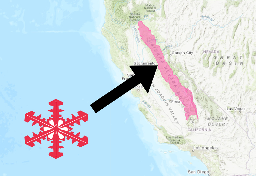
The National Weather Service has issued a Winter Storm Warning for California.
It’s in effect until 6:00am Friday morning.
High winds and heavy snowfall are expected to impact the area throughout that time.
California:
- 16-20+” of Snow Today – Friday Morning
“A storm system will bring significant late season snowfall to the mountains into early Friday. A Winter Storm Warning will remain in effect for locations above 6000 feet. Mountain travel is highly discouraged!”
– NOAA Sacramento, CA
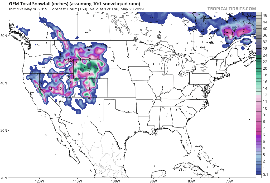
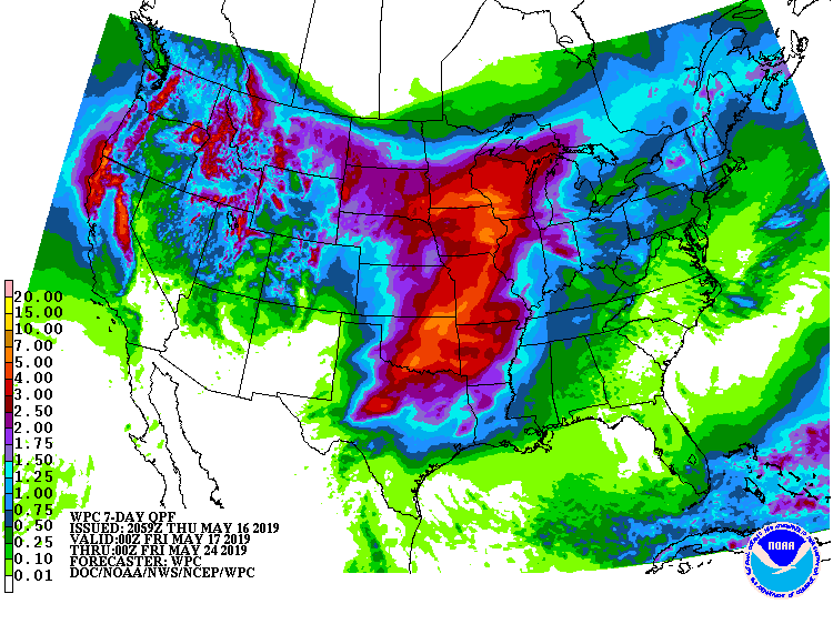
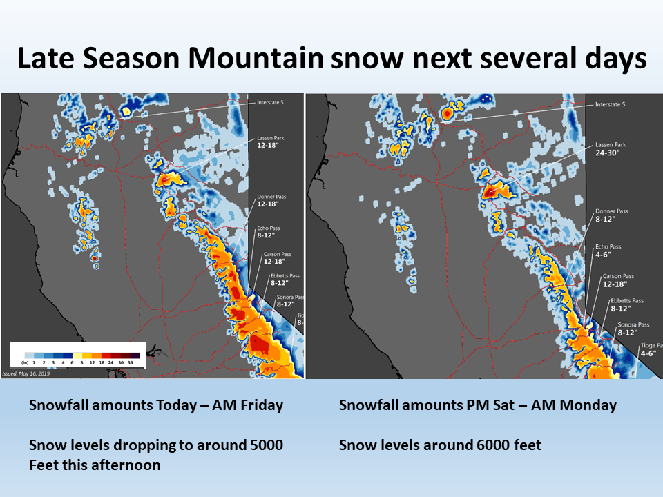
Looking ahead at the forecast, more mountain snow is likely over the weekend and into next week.
Snow levels are expected to drop down to 5,000ft this afternoon.
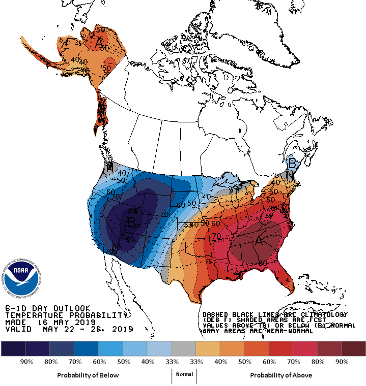
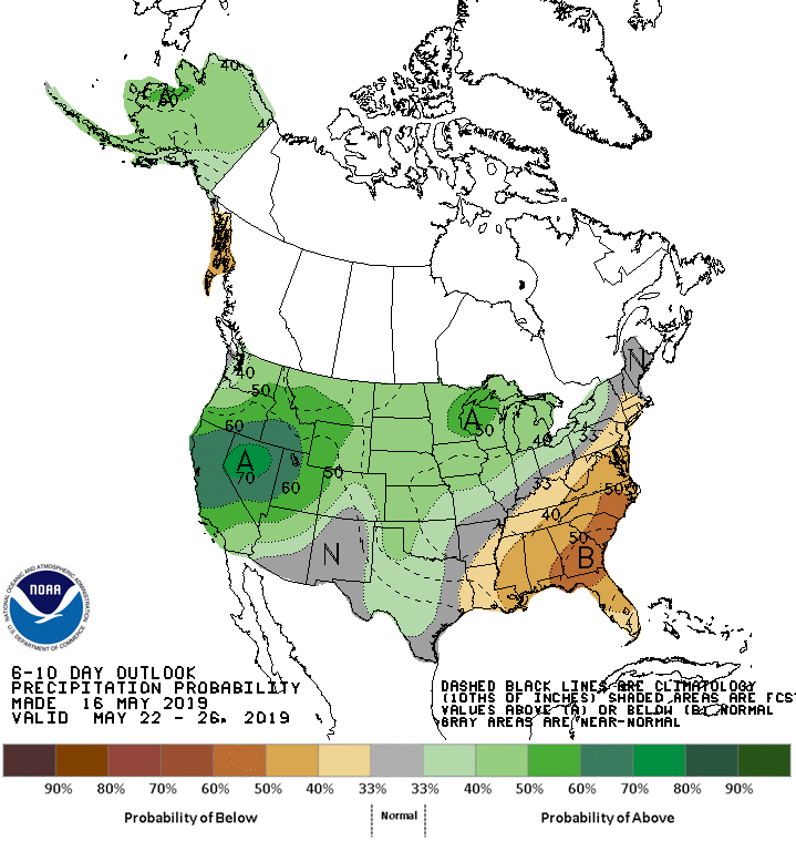
The 6-10 day outlook calls for above average precipitation and below average temperatures in California.
Additional Storm Info:
California: 16-20+” of Snow Today – Friday Morning
* Additional snow accumulations of 16 to 20 inches,
  with localized amounts up to 25 inches, are expected.
- NOAA Sacramento, CA
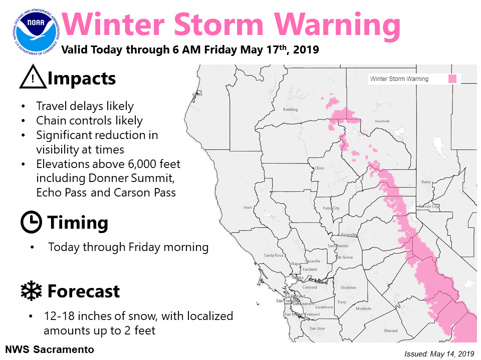
Winter Storm Warning:
URGENT - WINTER WEATHER MESSAGE
National Weather Service Sacramento CA
449 AM PDT Thu May 16 2019

...Late season mountain snows this week...

.A strong, late season storm will bring significant snowfall
accumulations to the higher elevations of the northern Sierra
Nevada and Mt. Lassen area. Expect travel delays and possible
chain controls if going through the higher passes of the northern
Sierra Nevada today through early Friday morning. Once this storm
exits the region late Friday morning, another system is forecast
to impact the mountains over the weekend.

Western Plumas County/Lassen Park-
West Slope Northern Sierra Nevada-

...WINTER STORM WARNING REMAINS IN EFFECT UNTIL 6 AM PDT FRIDAY
ABOVE 6000 FEET...

* WHAT...Heavy snow occurring. Travel will be very difficult to
  impossible, including during the evening commute. Additional
  snow accumulations of 16 to 20 inches, with localized amounts
  up to 25 inches, are expected.

* WHERE...Western Plumas County/Lassen Park and West Slope
  Northern Sierra Nevada.

* WHEN...Until 6 AM Friday.

* ADDITIONAL DETAILS...Be prepared for significant reductions in
  visibility at times as snowfall combines with gusty winds.