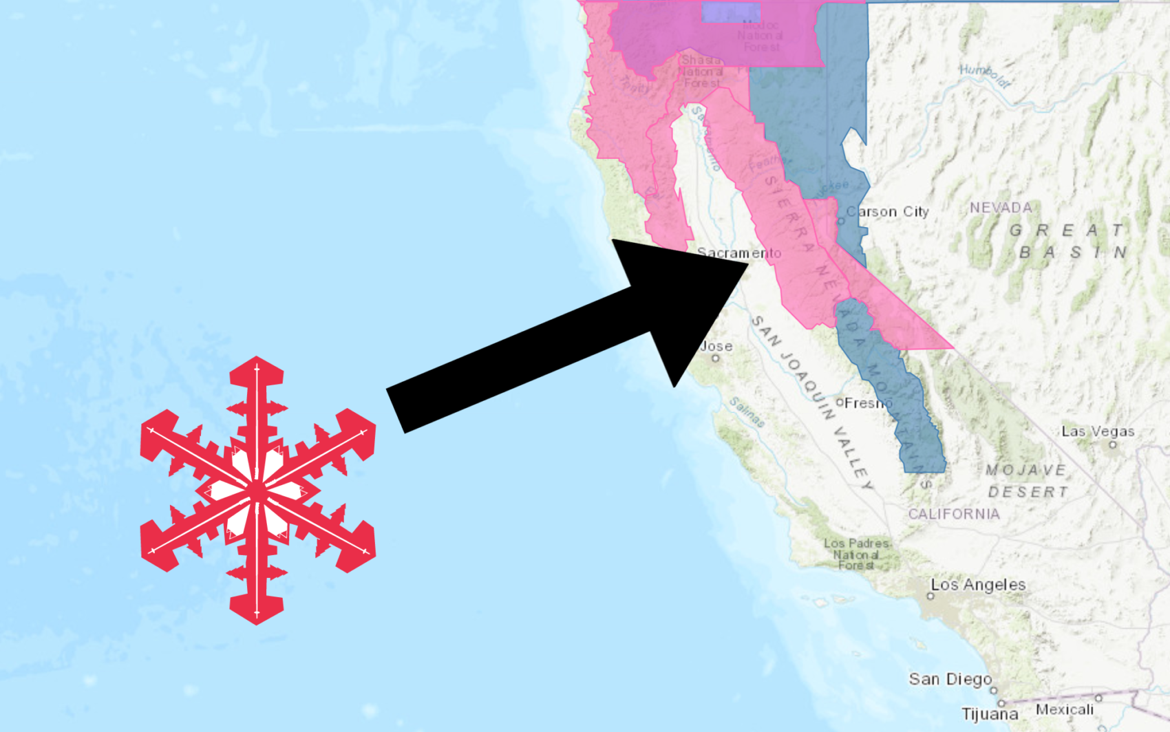
The National Weather Service has issued a Winter Storm Warning for California. It’s in effect from Friday afternoon – Sunday night. High winds and heavy snowfall are forecasted to impact the area throughout this time.
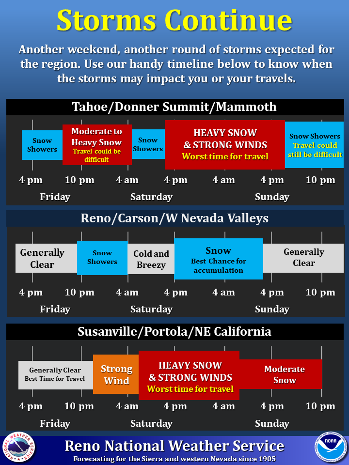
Two rounds of snow are expected to impact the area. The first round will begin tonight and persist through early Saturday. The second round is forecasted to deliver heavy snowfall late Saturday through Sunday.
California:
- 2-4 FEET of Snow Friday – Sunday
“Another weekend, another round storms expected for the region. There will be 2 waves that move through the area that could impact you or your travels, so we have created a handy timeline for you. For more details on the storms, please refer to our Winter Storm Watches and Warnings at weather.gov/Reno. FYI, it’s looking pretty stormy mid to late next week, too. So, if you live somewhere the snow is beginning to pile up, you may want to make preparations now.”
– NOAA Reno, NV
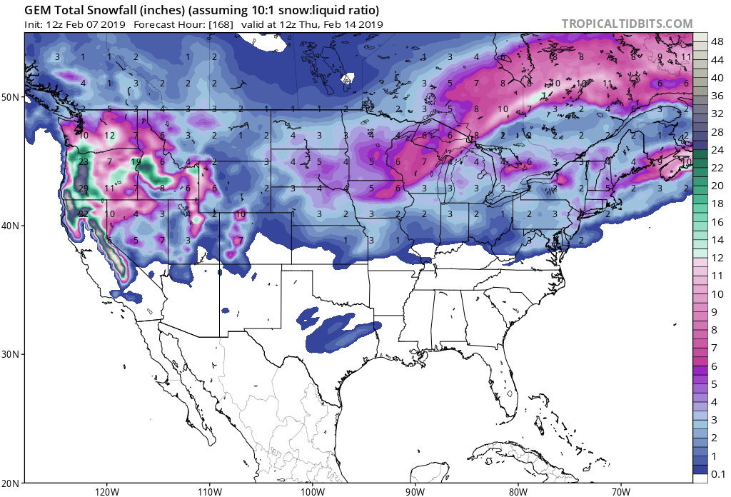
The highest accumulations are expected to occur above 7,000ft.
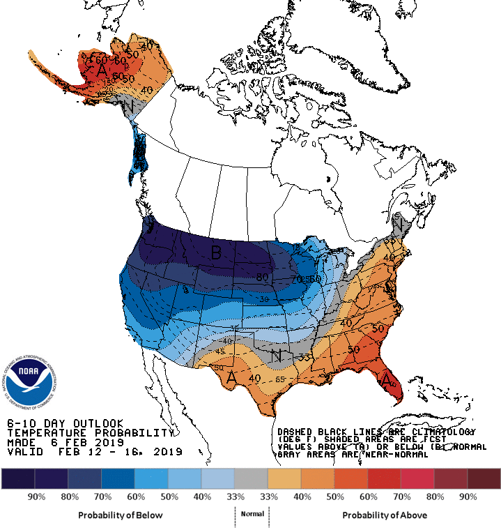
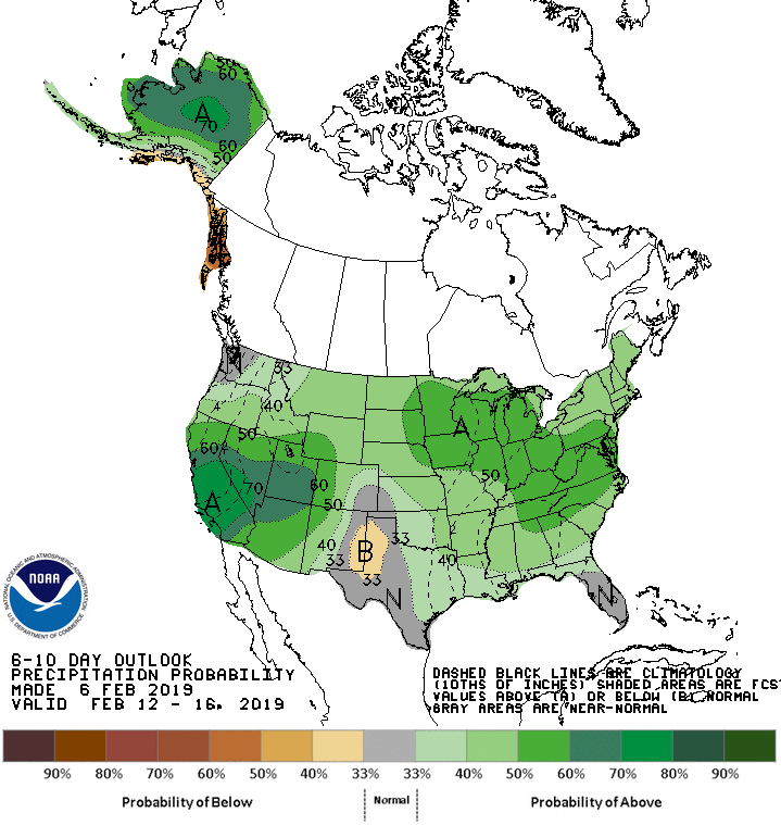
The 6-10 day outlook calls for above average precipitation and below average temperatures in California.
Additional Storm Info:
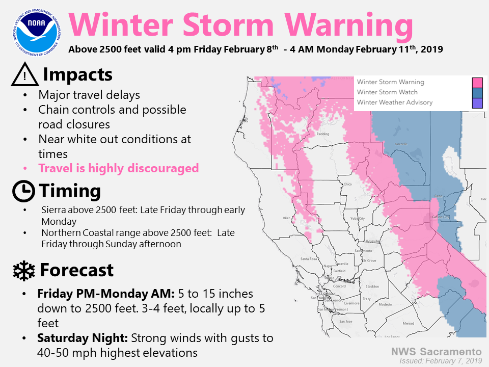
California: 2-4 FEET of Snow Friday – Sunday
* Heavy snow expected. Total snow accumulations of
  12 to 24 inches with the highest totals west of
  Highway 89, except 2 to 4 feet above 7000 feet expected.
- NOAA Reno, NV
Winter Storm Watch:
URGENT - WINTER WEATHER MESSAGE
National Weather Service Reno NV
130 PM PST Thu Feb 7 2019

Greater Lake Tahoe Area-
Including the cities of South Lake Tahoe, Truckee, Stateline,
and Incline Village

...WINTER STORM WARNING IN EFFECT FROM 4 PM FRIDAY TO 10 PM PST
SUNDAY...

* WHAT...Heavy snow expected. Total snow accumulations of 12 to 24
  inches with the highest totals west of Highway 89, except 2 to 4
  feet above 7000 feet expected. Winds gusting as high as 45 mph
  with ridge winds gusting as high as 95 mph.

* WHERE...Greater Lake Tahoe Area.

* WHEN...From 4 PM Friday to 10 PM PST Sunday. Heaviest snow
  expected late Friday night and again Saturday afternoon through
  Sunday morning.

* ADDITIONAL DETAILS...Travel could be very difficult to
  impossible. The hazardous conditions could impact the ski
  commute Friday evening and again Sunday evening. Very strong
  winds could cause extensive tree damage.