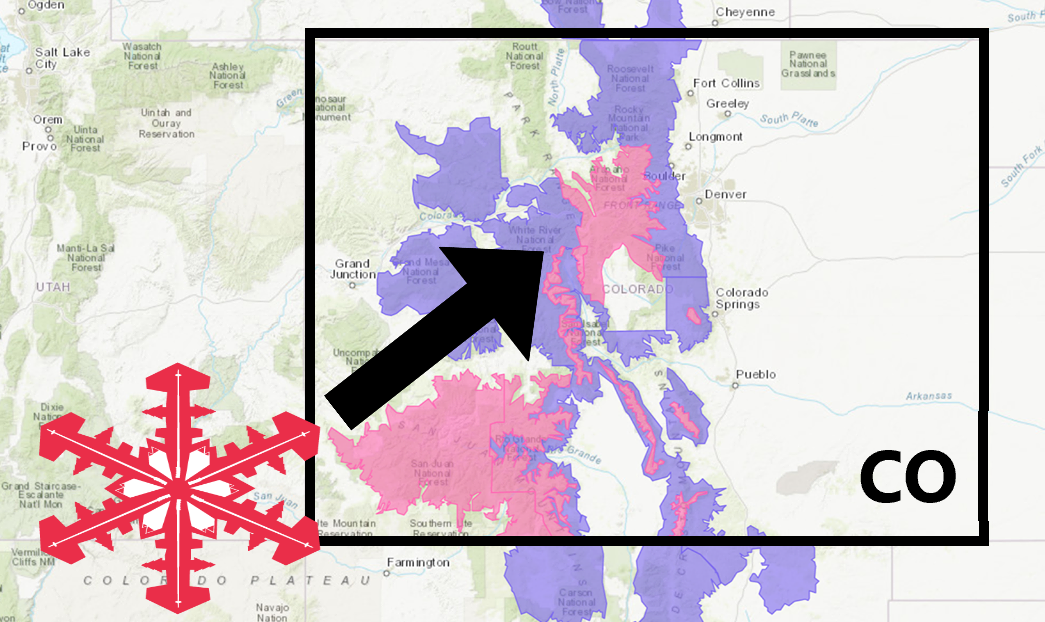
The National Weather Service has issued a Winter Storm Warning for Colorado.
It’s in effect until 6:00pm Thursday night.
Heavy snowfall is expected to impact the area throughout that time.
Colorado:
- 8-16″ Of Snow Through Thursday Night
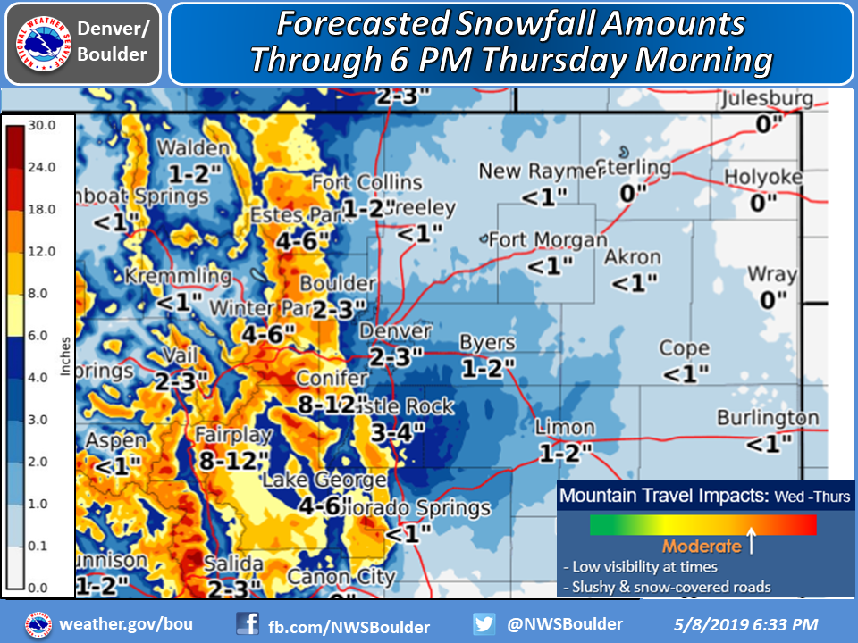
“Snow will increase today across the mountains and foothills with rain changing over to snow on the plains and Palmer Divide later this evening. The snow will be heaviest in the mountains along and south of Interstate 70 where up to 16 inches of accumulation is expected by 6 PM Thursday evening. Roads across the high country will become slick and snow packed this evening and overnight. For the latest road reports from CDOT call 511 or go to their website at cotrip.org.”
– NOAA Denver, CO
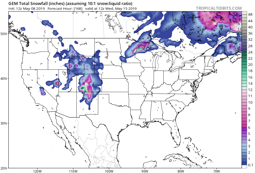
Snow levels are expected to hover around 9,000ft, but they could drop down to 5,500ft.
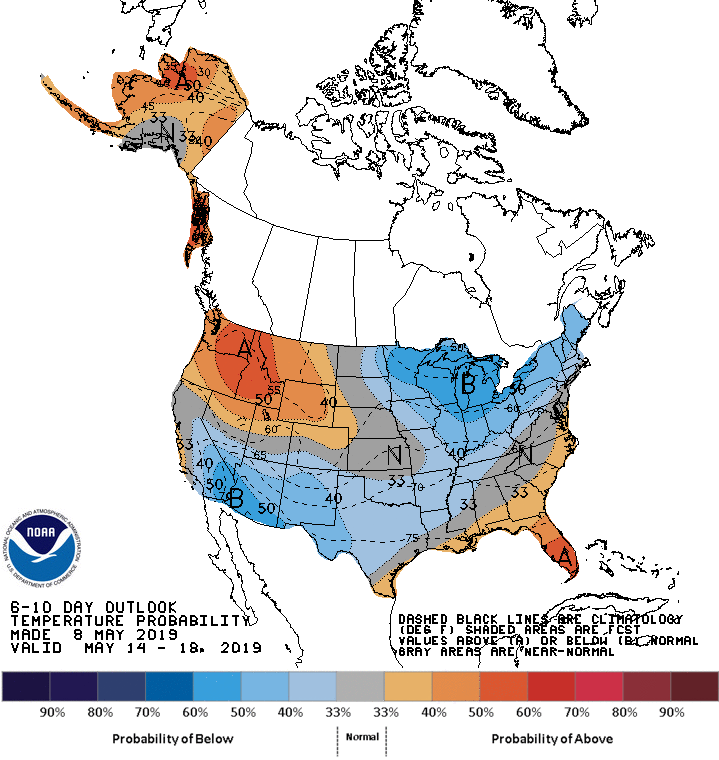
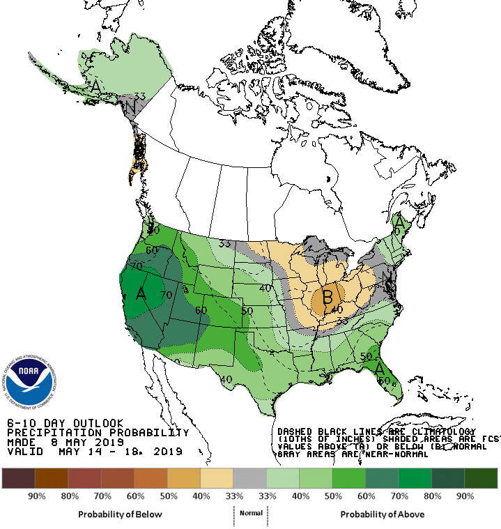
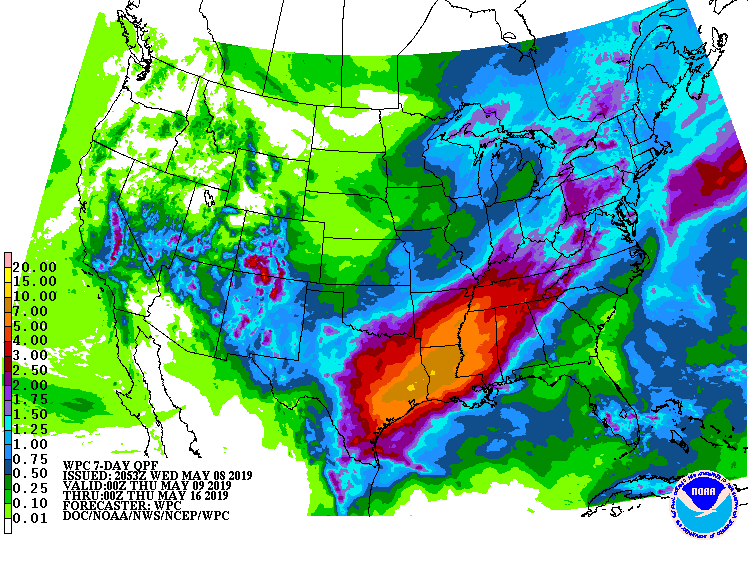
The 6-10 day outlook calls for above average precipitation and average temperatures in Colorado.
Additional Storm Info:
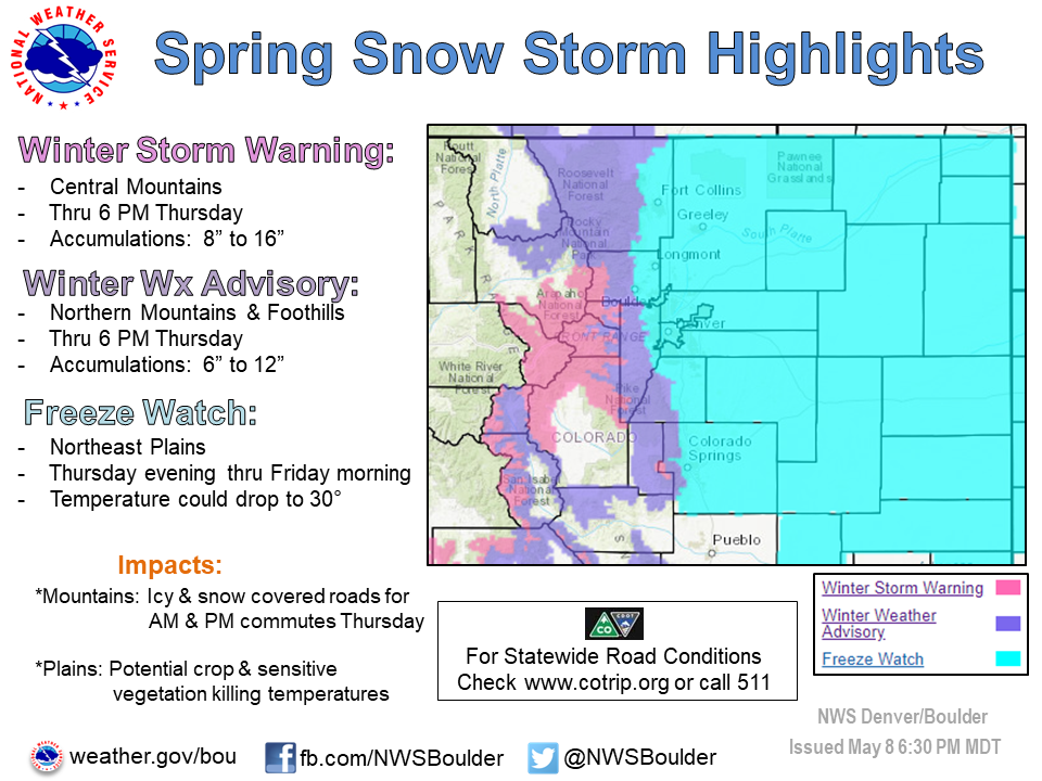
Colorado: 8-16″ of Snow Through Thursday Night
* Heavy snow. Total snow accumulations of 8 to 16 inches expected.
- NOAA Denver, CO
Winter Storm Warning:
URGENT - WINTER WEATHER MESSAGE
National Weather Service Denver CO
422 PM MDT Wed May 8 2019

.Significant snow accumulations are expected over the higher
foothills and north central Colorado mountains through Thursday.
Roads will become snow covered and icy overnight into Thursday
morning.

Roads across the Palmer Divide could become icy and snowpacked
late tonight into Thursday morning, for morning commute, where
2 to 6 inches of accumulation will be possible. Along the urban
corridor, snow amounts from 1 to 4 inches may occur but with
accumulations confined to mainly grassy areas.

The Mountains of Summit County, the Mosquito Range, and the
Indian Peaks-
Including the cities of Berthoud Pass, Breckenridge,
East Slopes Mosquito Range, East Slopes Southern Gore Range,
Eisenhower Tunnel, Indian Peaks, Kenosha Mountains, Mount Evans,
Williams Fork Mountains, and Winter Park

...WINTER STORM WARNING REMAINS IN EFFECT UNTIL 6 PM MDT
THURSDAY...

* WHAT...Heavy snow. Total snow accumulations of 8 to 16 inches
  expected.

* WHERE...The Mountains of Summit County, the Mosquito Range,
  and the Indian Peaks.

* WHEN...Until 6 PM MDT Thursday.

* ADDITIONAL DETAILS...Travel could be very difficult. The
  hazardous conditions could impact the morning or evening
  commute.