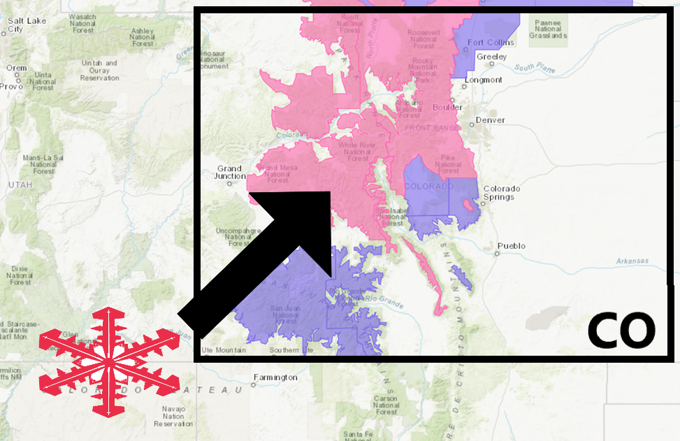
The National Weather Service has issued a Winter Storm Warning for Colorado.
It’s in effect until 6:00am Tuesday morning.
Heavy snowfall is expected to impact the area throughout that time.
Colorado:
- 8-16″ of Snow Today – Tuesday Morning
“A Spring Snow Storm moving into the region this morning will persist into Wednesday with multiple rounds of moderate to heavy snow across the central and north central Colorado. Some snow will also spread onto the plains with accumulations likely. The heaviest snow is expected to occur over northern mountains.”
– NOAA Denver, CO
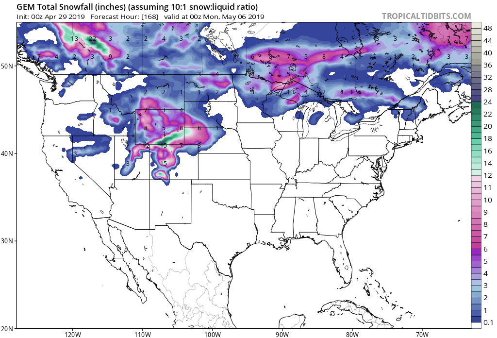
Snow levels are expected to drop well below 8,000ft as the storm progresses.
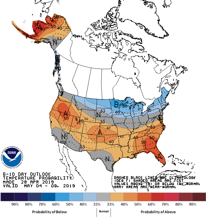
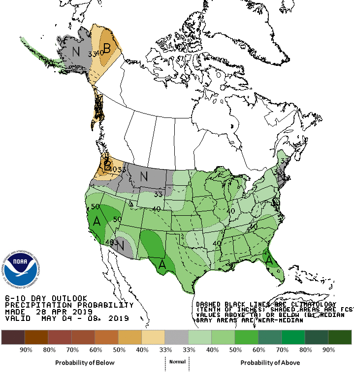
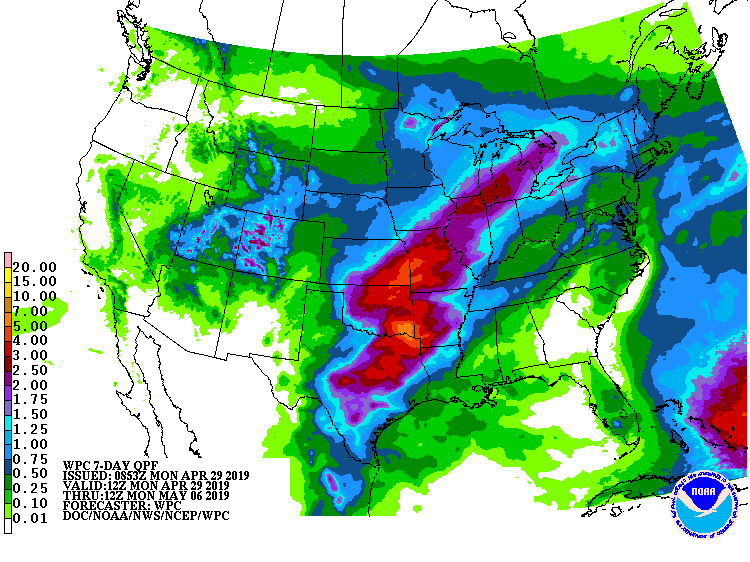
The 6-10 day outlook calls for above average temperatures and above average precipitation in Colorado.
Additional Storm Info:
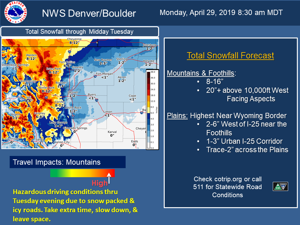
Colorado: 8-16″ of Snow Today – Tuesday Morning
* Heavy snow expected. Total snow accumulations of 8 to 16 inches
  expected, with the heaviest amounts in the mountains above 9000
  feet and foothills north of I-70.
- NOAA Denver, CO
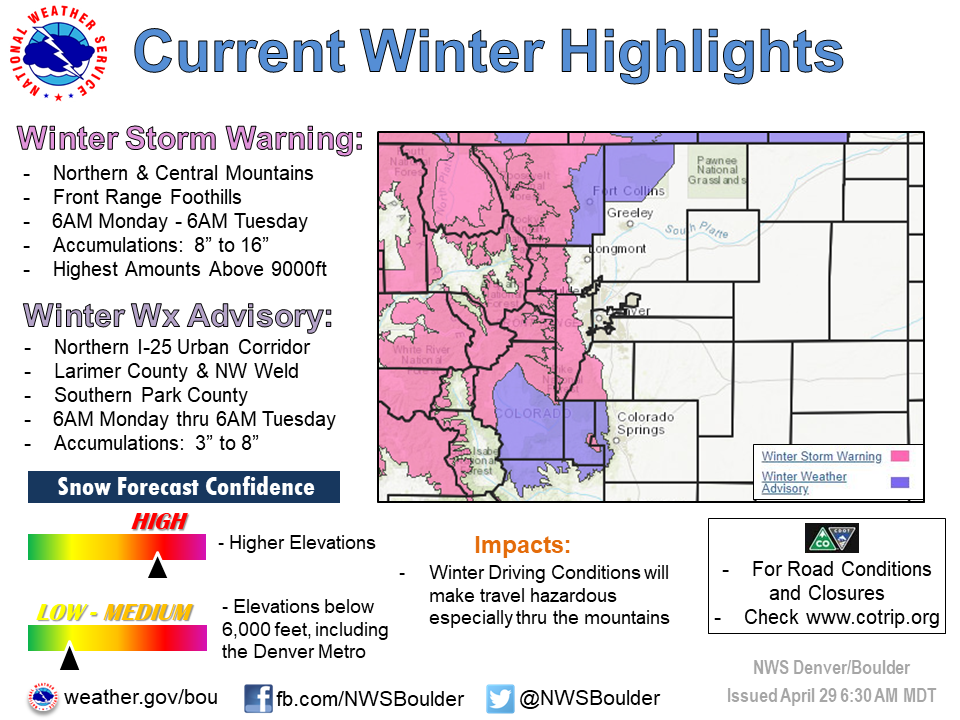
Winter Storm Warning:
URGENT - WINTER WEATHER MESSAGE
National Weather Service Denver CO
457 AM MDT Mon Apr 29 2019

...Heavy Snow Monday and Monday Night for the Mountains,
Foothills, and Lower Elevations near Wyoming...

.A Spring snowstorm will move into the region today and continue
into Wednesday with multiple rounds of moderate to heavy snow at
across central and north central Colorado. Moderate to heavy snow
will begin in the mountains this afternoon and spread east this
evening. The best chance for accumulating snow below 6,000 feet is
across eastern Larimer and western Weld Counties. A final wave of
snow will likely hit the mountains Tuesday night. Travel through
the mountains will be significantly impacted from later this
afternoon into Tuesday.  Stay tuned for additional updates.

Rabbit Ears Pass-
Rocky Mountain National Park and the Medicine Bow Range-
The Mountains of Summit County, the Mosquito Range, and the
Indian Peaks-The Northern Front Range Foothills-
The Southern Front Range Foothills-
Including the cities of East Slopes Park and Northern Gore
Ranges, Gore Pass, Rabbit Ears Pass, Cameron Pass,
Laramie and Medicine Bow Mountains, Rabbit Ears Range,
Rocky Mountain National Park, Willow Creek Pass, Berthoud Pass,
Breckenridge, East Slopes Mosquito Range,
East Slopes Southern Gore Range, Eisenhower Tunnel, Indian Peaks,
Kenosha Mountains, Mount Evans, Williams Fork Mountains,
Winter Park, Estes Park, Glendevey, Nederland, Red Feather Lakes,
Bailey, Central City, Evergreen, Georgetown, Idaho Springs,
and Westcreek

...WINTER STORM WARNING REMAINS IN EFFECT UNTIL 6 AM MDT
TUESDAY...

* WHAT...Heavy snow expected. Total snow accumulations of 8 to
  16 inches expected, with the heaviest amounts in the mountains
  above 9000 feet and foothills north of I-70.

* WHERE...The Southern Front Range Foothills, The Northern Front
  Range Foothills, The Mountains of Summit County, the Mosquito
  Range, and the Indian Peaks, Rocky Mountain National Park and
  the Medicine Bow Range and Rabbit Ears Pass.

* WHEN...From 6 AM Monday to 6 AM MDT Tuesday.

* ADDITIONAL DETAILS...Travel could be difficult. The hazardous
  conditions could impact the morning or evening commute.