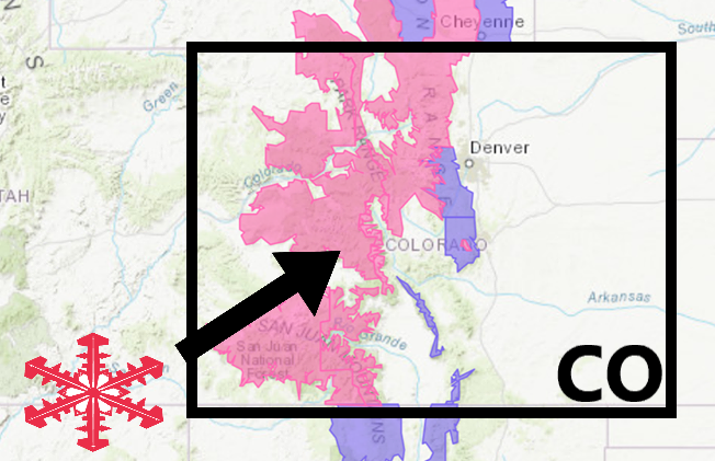
The National Weather Service has issued a Winter Storm Warning for Colorado.
It’s in effect from 12:00pm Today – 12:00am Tuesday night.
High winds and heavy snowfall are expected to impact the area throughout that time.
Colorado:
- 8-18″ Of Snow Today – Tuesday Night
- Winds Gusting As High As 35 MPH
“A strong late season spring storm will bring heavy wet snow to the mountains and northern foothills from Monday afternoon through Midnight Tuesday. Accumulations of 5″-12″ are expected in the northern foothills with 8″ to 18″ in the northern and central mountains.”
– NOAA Denver, CO
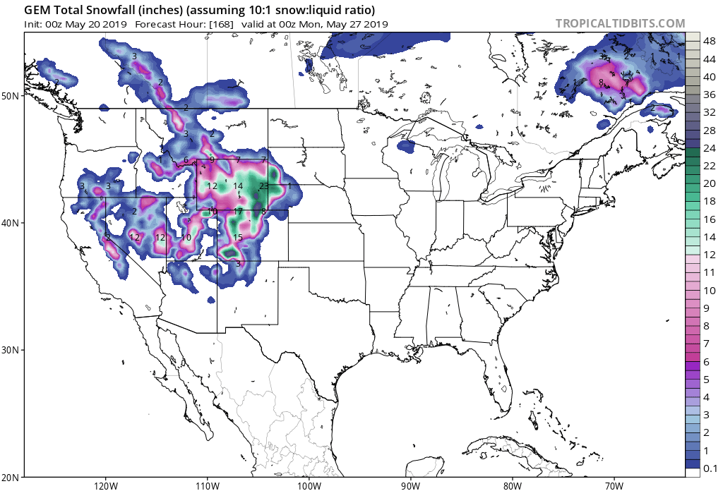
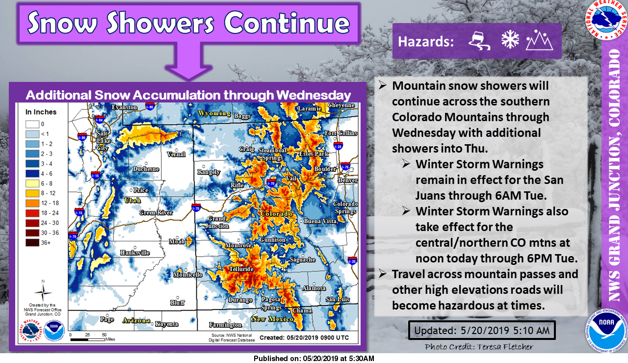
Accumulating snowfall is likely in the mountains and the foothills.
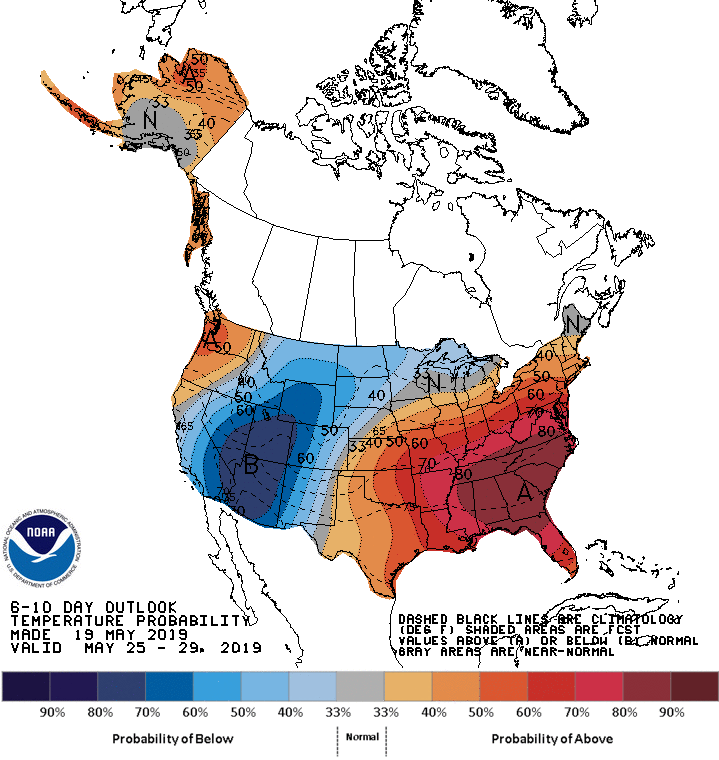
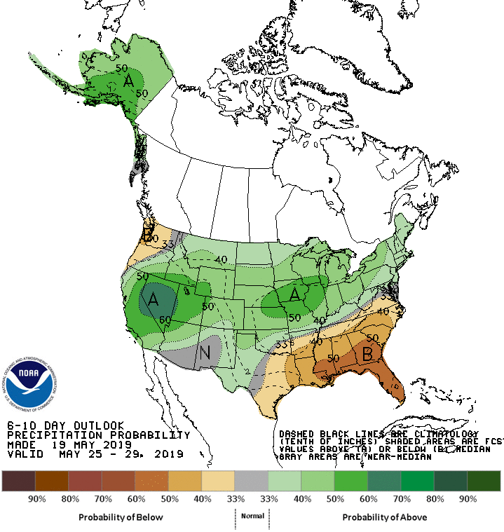
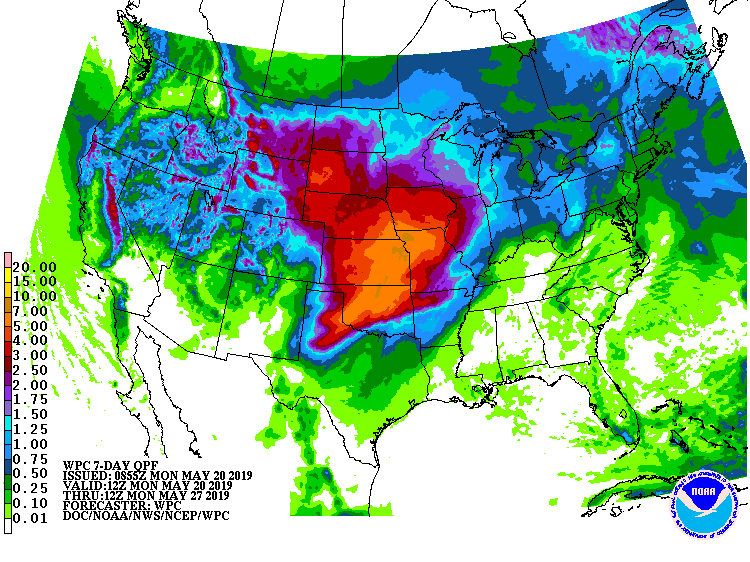
The 6-10 day outlook calls for above average precipitation and below average temperatures in Colorado.
Additional Storm Info:
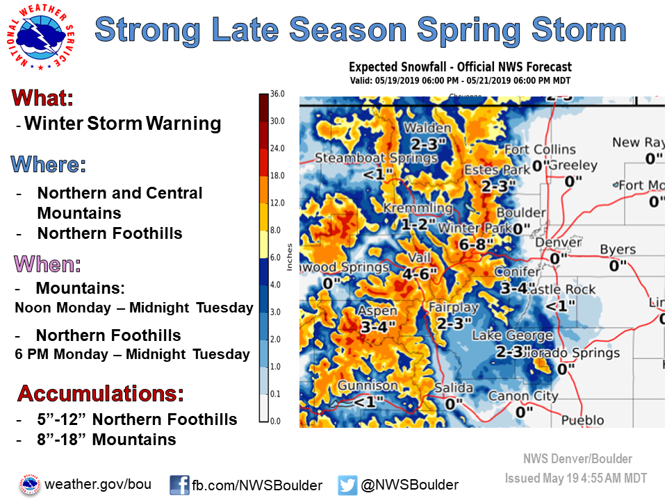
Colorado: 8-18″ Of Snow Today – Tuesday Night
* Heavy snow expected. Total snow accumulations
  of 8 to 18 inches expected.
- NOAA Denver, CO
Winter Storm Warning:
URGENT - WINTER WEATHER MESSAGE
National Weather Service Denver CO
450 AM MDT Mon May 20 2019

...STRONG LATE SEASON SPRING STORM TO AFFECT COLORADO...

.A strong storm system will move into Colorado today and continue
to affect the area through Tuesday night. This system will bring
heavy, wet snow to the mountains and foothills, impacting travel
with snow covered and slushy roads.

Rabbit Ears Pass-
Rocky Mountain National Park and the Medicine Bow Range-
The Mountains of Summit County, the Mosquito Range, and the
Indian Peaks-
Including the cities of East Slopes Park and Northern Gore
Ranges, Gore Pass, Rabbit Ears Pass, Cameron Pass,
Laramie and Medicine Bow Mountains, Rabbit Ears Range,
Rocky Mountain National Park, Willow Creek Pass, Berthoud Pass,
Breckenridge, East Slopes Mosquito Range,
East Slopes Southern Gore Range, Eisenhower Tunnel, Indian Peaks,
Kenosha Mountains, Mount Evans, Williams Fork Mountains,
and Winter Park

...WINTER STORM WARNING REMAINS IN EFFECT FROM NOON TODAY TO
MIDNIGHT MDT TUESDAY NIGHT...

* WHAT...Heavy snow expected. Total snow accumulations of 8 to
  18 inches expected. Winds gusting as high as 35 mph.

* WHERE...Rabbit Ears Pass, Rocky Mountain National Park and the
  Medicine Bow Range and The Mountains of Summit County, the
  Mosquito Range, and the Indian Peaks.

* WHEN...From noon Monday to midnight MDT Tuesday night.

* ADDITIONAL DETAILS...Travel will be hazardous with snow
  covered roads. Secondary roads may see more difficult travel
  conditions due to more significant accumulation of heavy, wet
  snow.