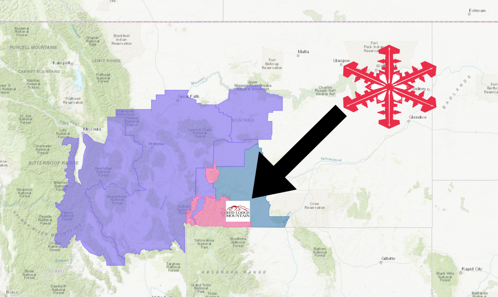
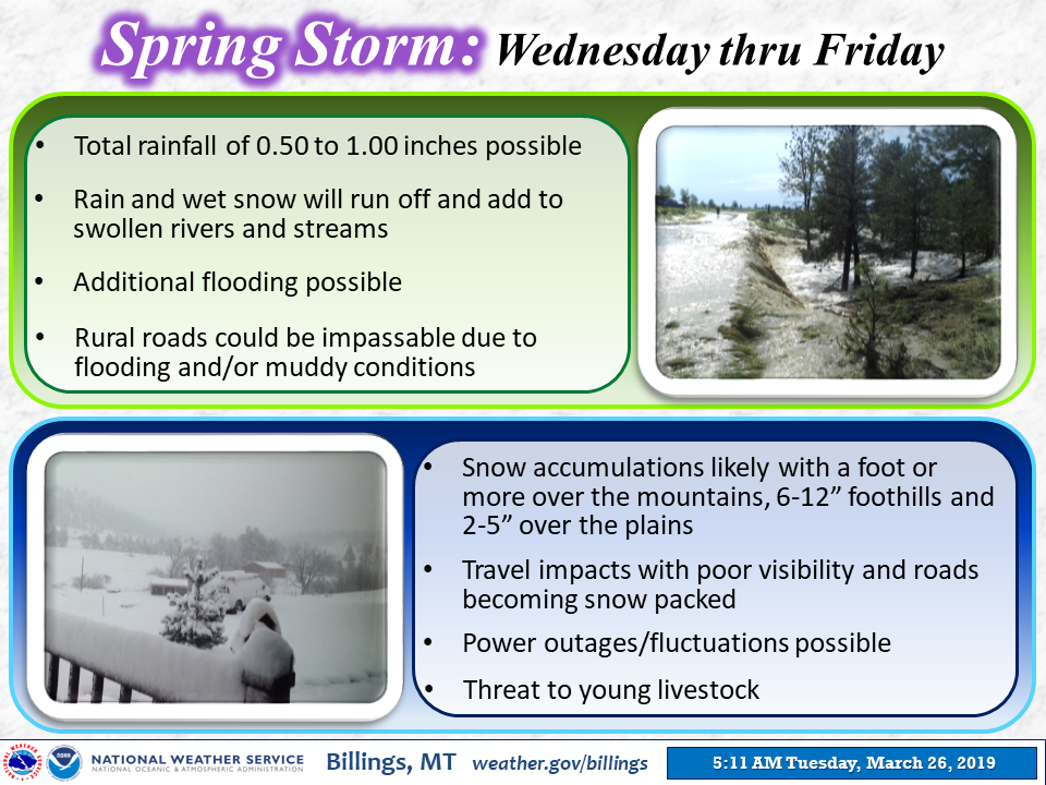
The National Weather Service has issued a Winter Storm Warning for Red Lodge Mountain, MT.
It’s in effect from 12:00pm Today – 6:00pm Friday.
Heavy snowfall is forecasted to impact the area the area throughout that time.
Montana:
- 12-24″ of Snow Today – Friday
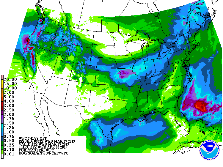
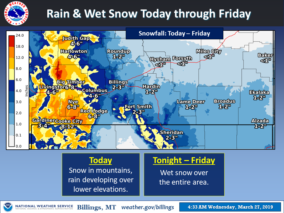
“A wet spring weather system is on the way. Precipitation will develop over the mountains today as snow then expand eastward over the lower elevations as rain late this afternoon-tonight. Rain will change to wet snow later tonight and continue through Friday. The additional precipitation (rain and wet snow) will keep waterways running high. Some snowfall accumulation is expected, with the highest totals west of Billings. Stay tuned for forecast updates!”
– NOAA Billings, MT
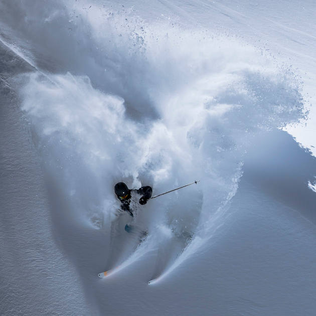
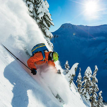
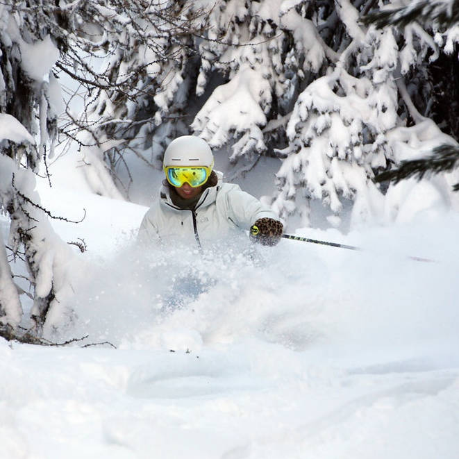
This snow should make for a fun weekend at Red Lodge Mountain.
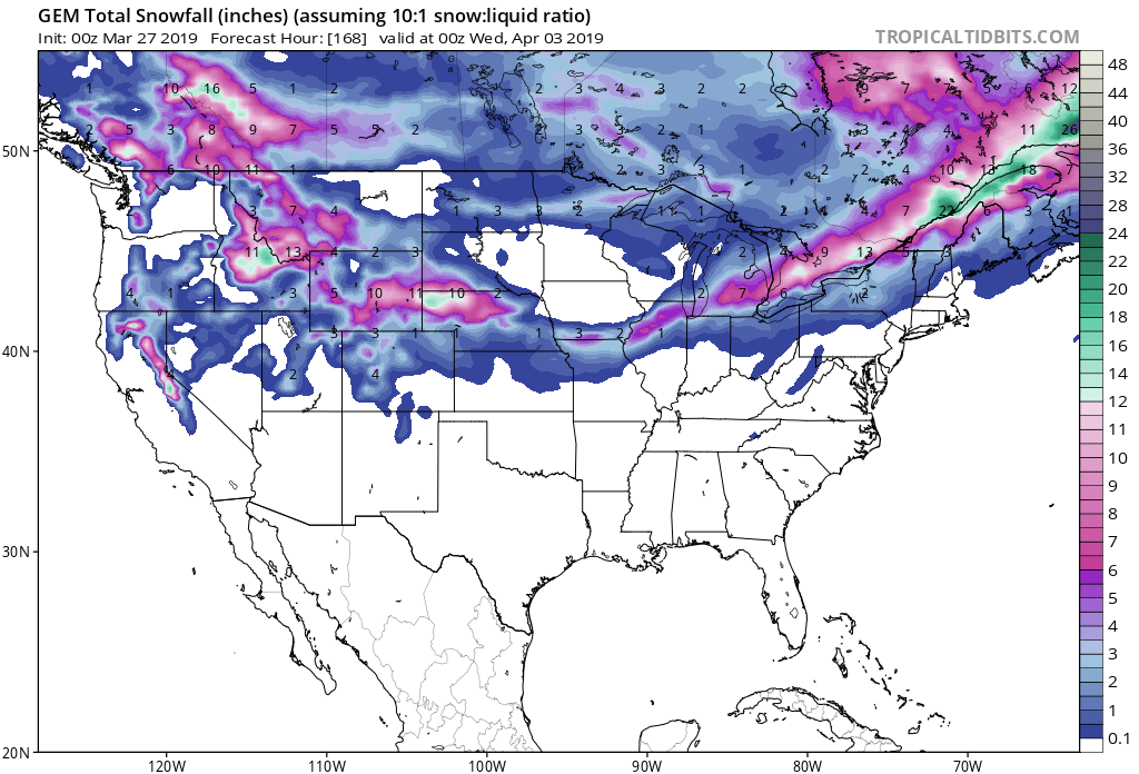
Snow levels are expected to start out around 6,000ft Today, before dropping down to 4,000ft by Friday.
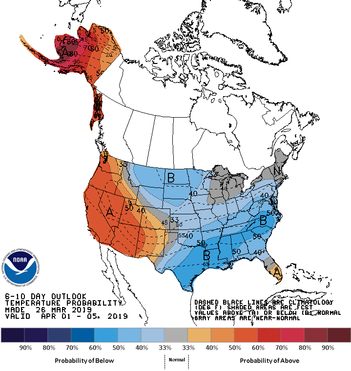
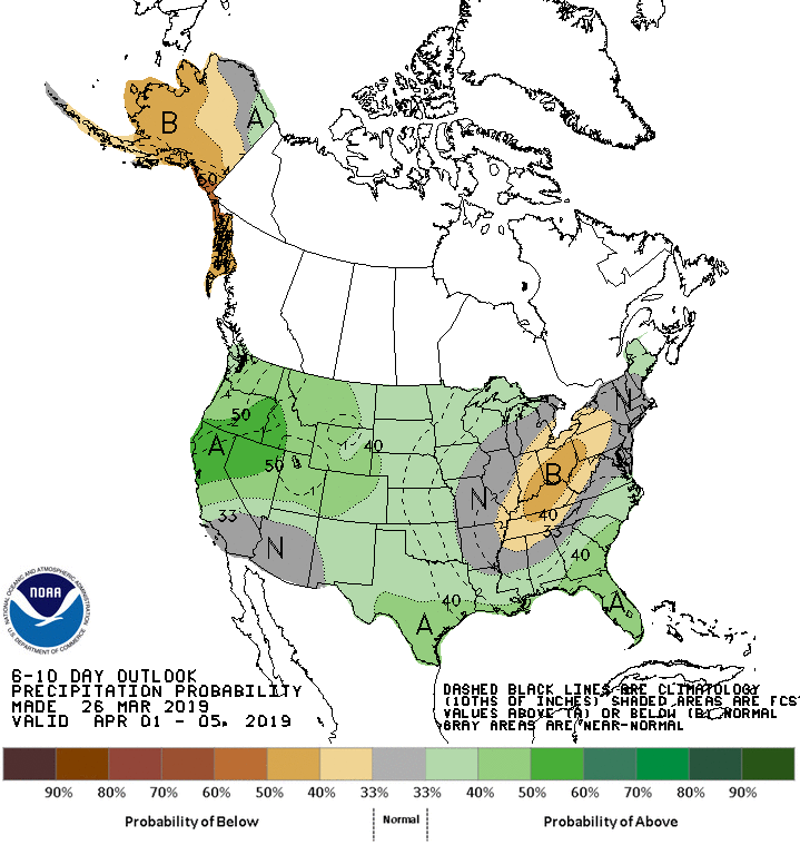
The 6-10 day outlook calls for above average precipitation and below average temperatures in Montana.
Additional Storm Info:
Montana: 12-24″ of Snow Today – Friday
* Heavy snow. Total snow accumulations of 12 to 24 inches
  expected. Greatest snow amounts will be found on northeast
  facing slopes.
- NOAA Billings, MT
Winter Storm Warning:
URGENT - WINTER WEATHER MESSAGE
National Weather Service Billings MT
324 AM MDT Wed Mar 27 2019

Absaroka/Beartooth Mountains-
Including the locations of  Cooke City

...WINTER STORM WARNING REMAINS IN EFFECT FROM NOON TODAY TO 6 PM
MDT FRIDAY...

* WHAT...Heavy snow. Total snow accumulations of 12 to 24 inches
  expected. Greatest snow amounts will be found on northeast
  facing slopes. Winds gusting as high as 40 mph.

* WHERE...Absaroka/Beartooth Mountains.

* WHEN...From noon Wednesday to 6 PM MDT Friday.

* ADDITIONAL DETAILS...Backcountry conditions could become
  dangerous due to poor visibility and deep snow.