The National Weather Service has issued a Winter Storm Warning for Wyoming. It’s in effect until 7:00am Thursday morning. High winds and heavy snowfall are forecasted to impact the area throughout that time.
High winds and heavy snowfall could combine to create whiteout conditions. Along with that, another winter storm is possible Thursday night.
Wyoming:
- Up To 3 FEET of Snow Today – Thursday Morning
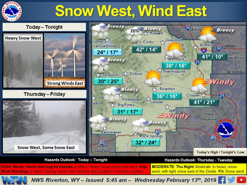
“Heavy snow is expected across the west today, continuing through the overnight hours. East of the Divide, strong winds will become widespread across Natrona and southern Fremont counties this afternoon.”
– NOAA Riverton, WY
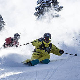
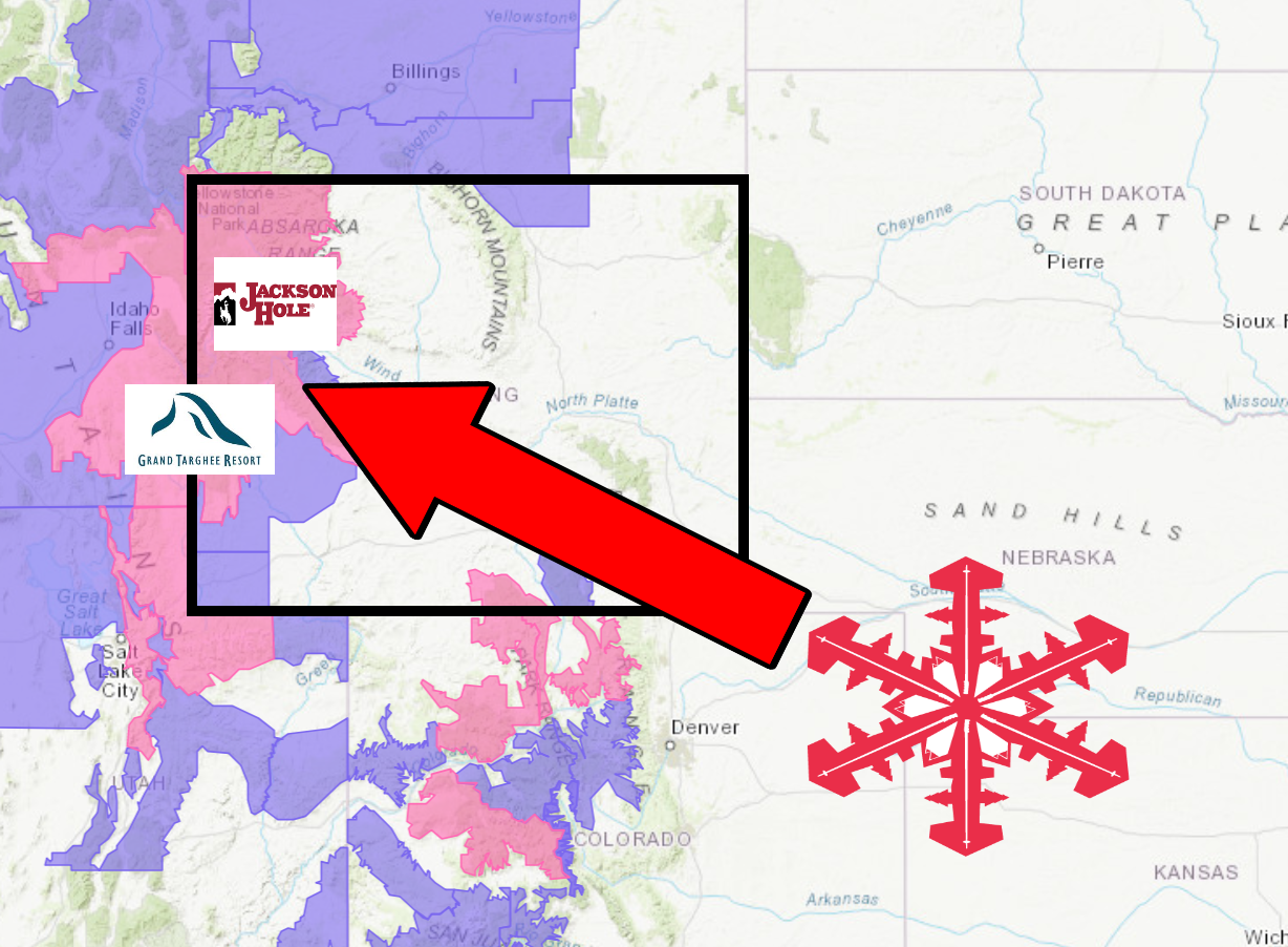
Jackson Hole Mountain Resort & Grand Targhee Resort are set up well for this storm.
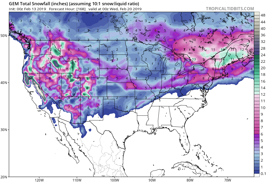
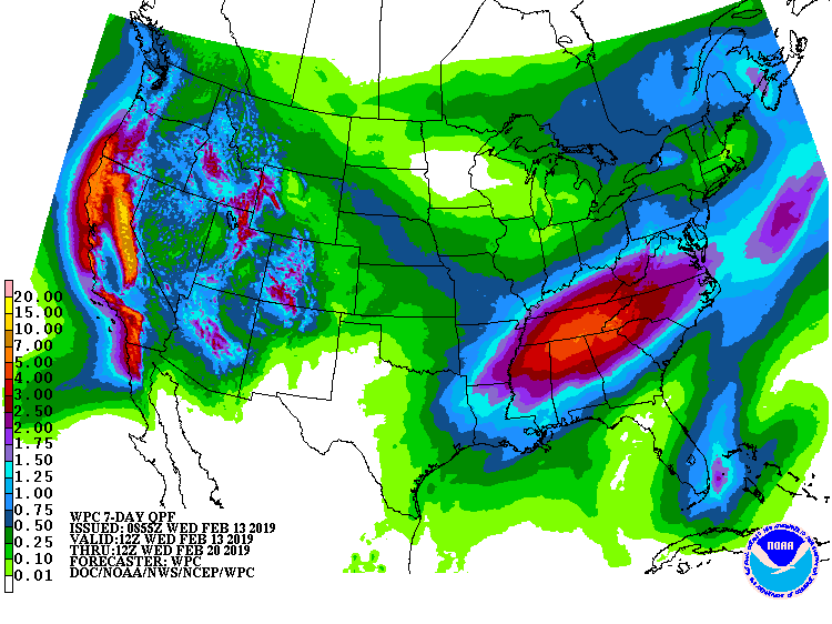
The heaviest snow is expected to fall in the Teton Mountains this afternoon and evening.
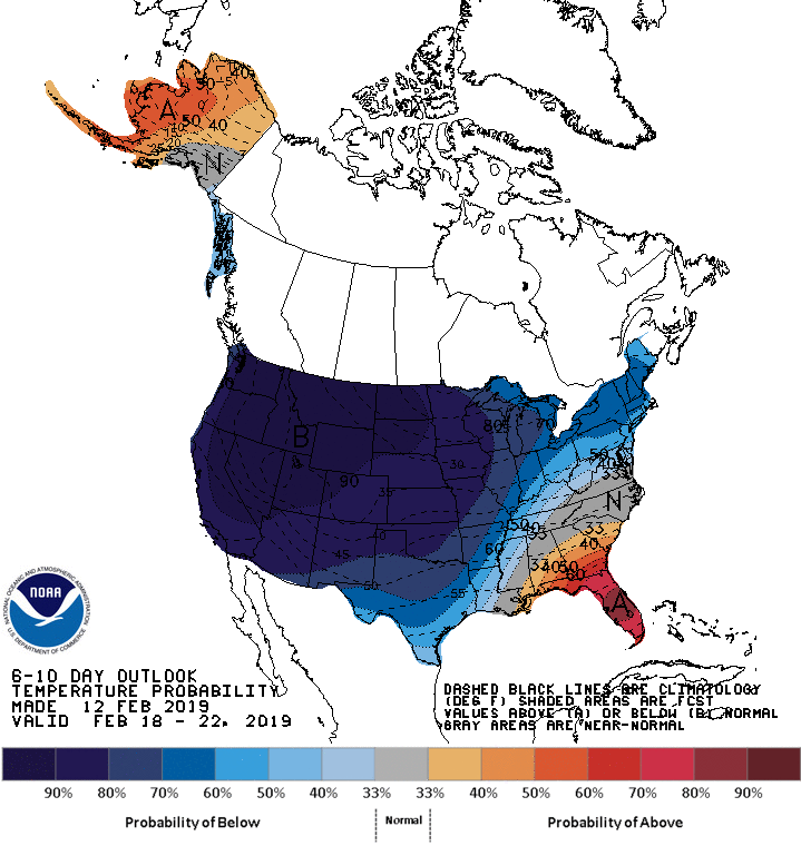
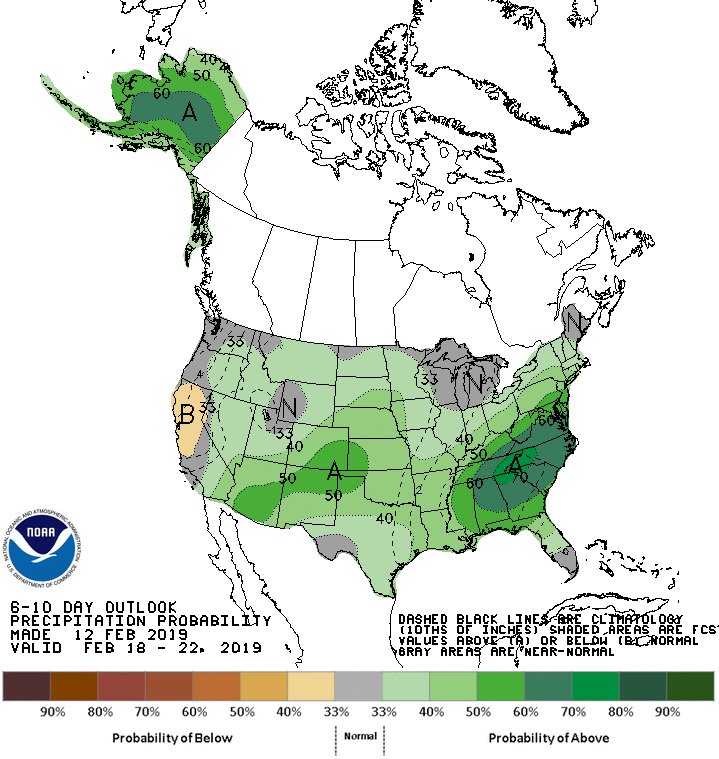
The 6-10 day outlook calls for below average temperatures and average precipitation in Wyoming.
Additional Storm Info:
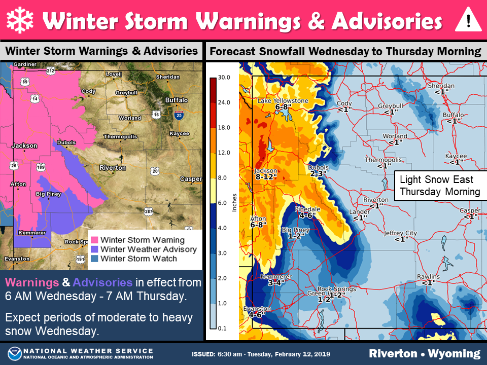
Wyoming: Up To 3 FEET of Snow Today – Thursday Morning
* Heavy snow and blowing snow. Total snow accumulations of
  1 to 2 feet. Locally up to 3 feet in the Teton Mountains.
  Winds gusting as high as 45 mph.
- NOAA Riverton, WY
Winter Storm Warning:
URGENT - WINTER WEATHER MESSAGE
National Weather Service Riverton WY
608 AM MST Wed Feb 13 2019

...Winter Storm across Western Wyoming Today and Tonight...

.Significant snow and blowing snow are expected across much of
western Wyoming today and tonight. The heaviest snowfall is
expected this afternoon and evening. Another winter storm could
impact western Wyoming beginning Thursday night.

Teton and Gros Ventre Mountains-

...WINTER STORM WARNING REMAINS IN EFFECT UNTIL 7 AM MST
THURSDAY...

* WHAT...Heavy snow and blowing snow. Total snow accumulations of
  1 to 2 feet. Locally up to 3 feet in the Teton Mountains. Winds
  gusting as high as 45 mph.

* WHERE...Teton and Gros Ventre Mountains.

* WHEN...Until 7 AM MST Thursday.

* ADDITIONAL DETAILS...Travel will be very difficult over Teton
  and Togwotee mountain passes. Whiteout conditions in snow and
  blowing snow will be very disorientating with fresh tracks in
  the snow quickly becoming obscured.