NOAA has issued a Winter Storm Warning for Wyoming’s Teton and Wind River mountain ranges tonight until Friday.
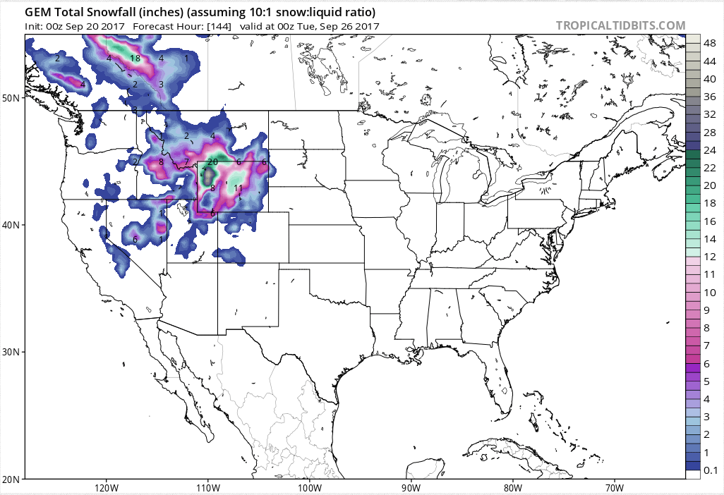
They’re calling for 8-20″ of snowfall through Friday.
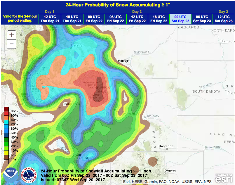
The large, cold, and wet pacific Pacific storm will continue to affect western and
northwestern Wyoming through Friday. Isolated snow showers today will increase to to
numerous across the western and northwestern mountains this evening. Heavier snowfall
is across the Teton, Gros Ventre, and Wind River Mountains above 8500 feet where from
8 to 20 inches of snow can be expected through noon Friday. - NOAA Riverton, WY today
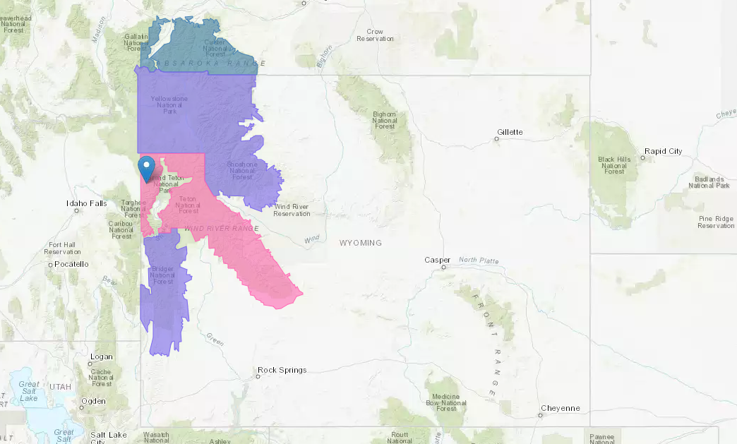
Winter Weather Advisories (Purple areas in map above) are in effect all over northwestern Wyoming today that are calling for 6-12″ of snow today through Friday.
Technically, it’s still summer… at least until Friday.
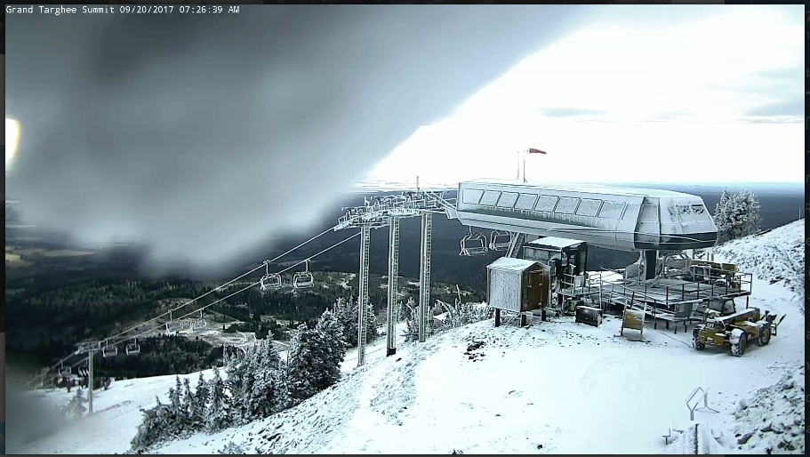
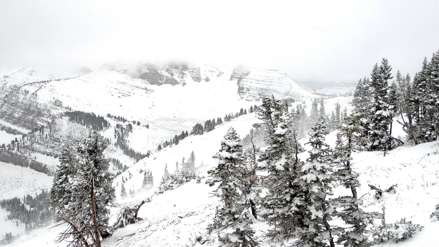
Both Grand Targhee and Jackson Hole ski resorts are under this Winter Storm Warning and will see snow from this storm and they’ve both been seeing snow on and off since Friday night.
Winter Storm Warning for Wyoming:
URGENT - WINTER WEATHER MESSAGE
National Weather Service Riverton WY
1252 AM MDT Wed Sep 20 2017

...A New Storm System Will Take Aim On Western Wyoming Tonight
Into At Least Friday...

.The large, cold, and wet pacific Pacific storm will continue to
affect western and northwestern Wyoming through Friday. Isolated
snow showers today will increase to to numerous across the western
and northwestern mountains this evening. Heavier snowfall is
across the Teton, Gros Ventre, and Wind River Mountains above
8500 feet where from 8 to 20 inches of snow can be expected
through noon Friday.

Teton and Gros Ventre Mountains-
1252 AM MDT Wed Sep 20 2017

...WINTER STORM WARNING IN EFFECT FROM 9 PM THIS EVENING TO NOON
MDT FRIDAY...

The National Weather Service in Riverton has issued a Winter
Storm Warning for heavy snow, which is in effect from 9 PM this
evening to noon MDT Friday.

* TIMING...A few isolated snow showers today will give way to
  moderate to heavy snow tonight over the Teton and Gros Ventre
  Mountains...continuing through Friday morning. Total snowfall
  will range from 8 to 18 inches above 8500 feet with snow
  accumulations of 3 to 8 inches from 7500 to 8500 feet.

* SNOWFALL...8 to 18 inches above 8500 feet with 3 to 8 inches
  down to 7500 feet.

* MAIN IMPACT...Heavy snow will make travel difficult at times.

* OTHER IMPACTS...Campers and hunters should be prepared for
  cold snowy and windy conditions.