The National Weather Service has issued a Winter Storm Warning for California. It’s in effect until 4:00pm Tuesday afternoon. High winds and heavy snowfall are being forecast to impact the area throughout that time. Blizzard conditions are possible Sunday night into Tuesday morning.
Storm Summary:
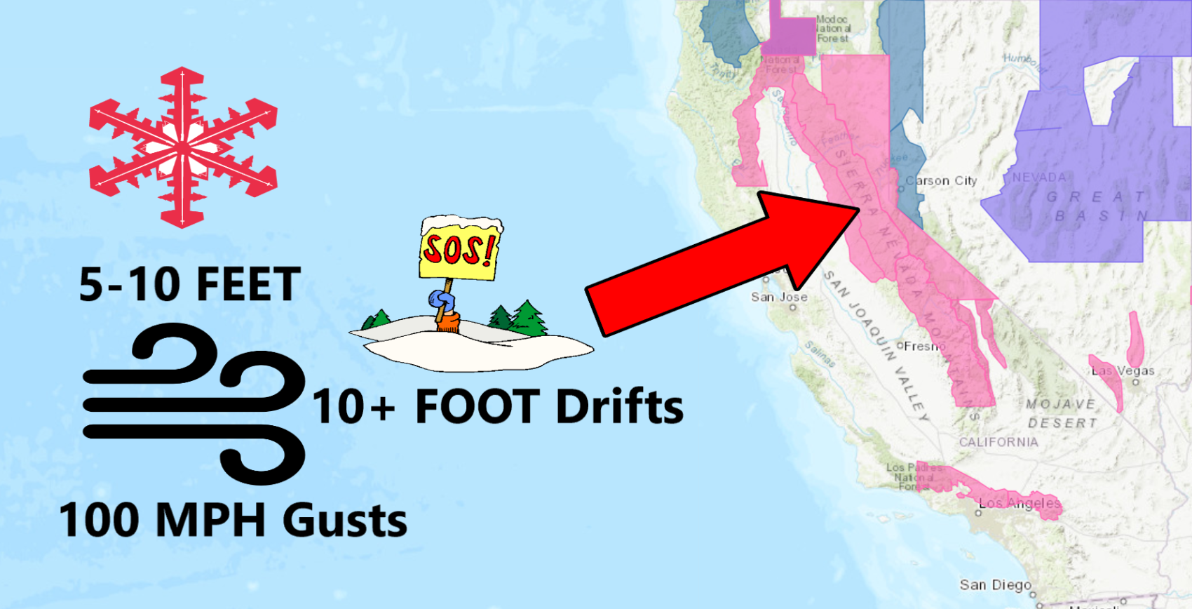
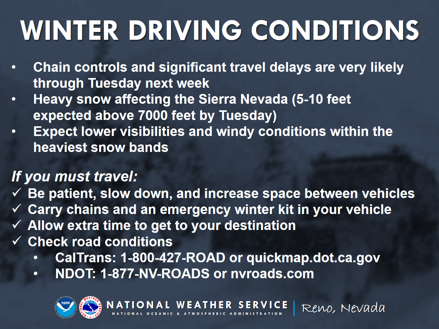
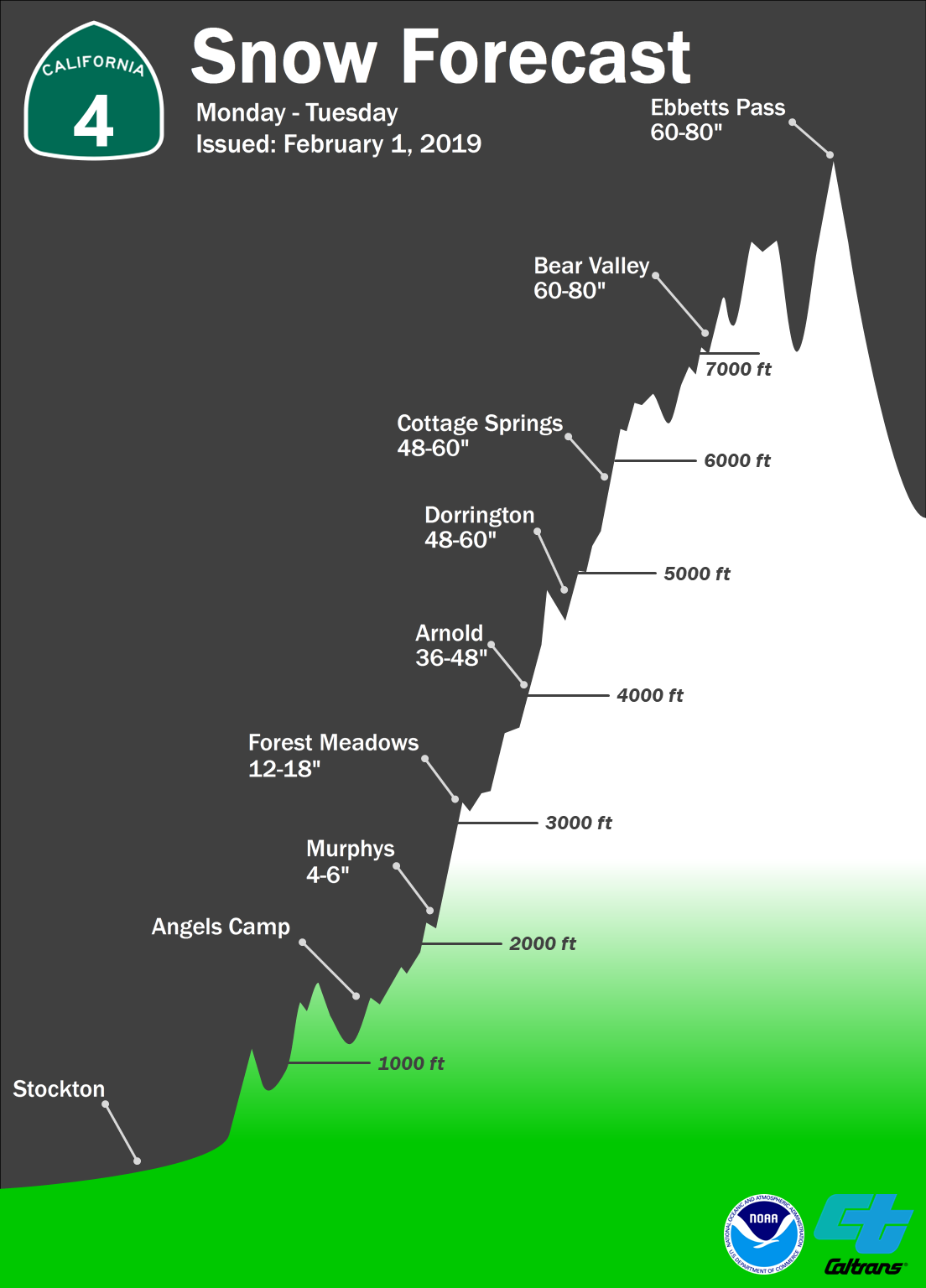
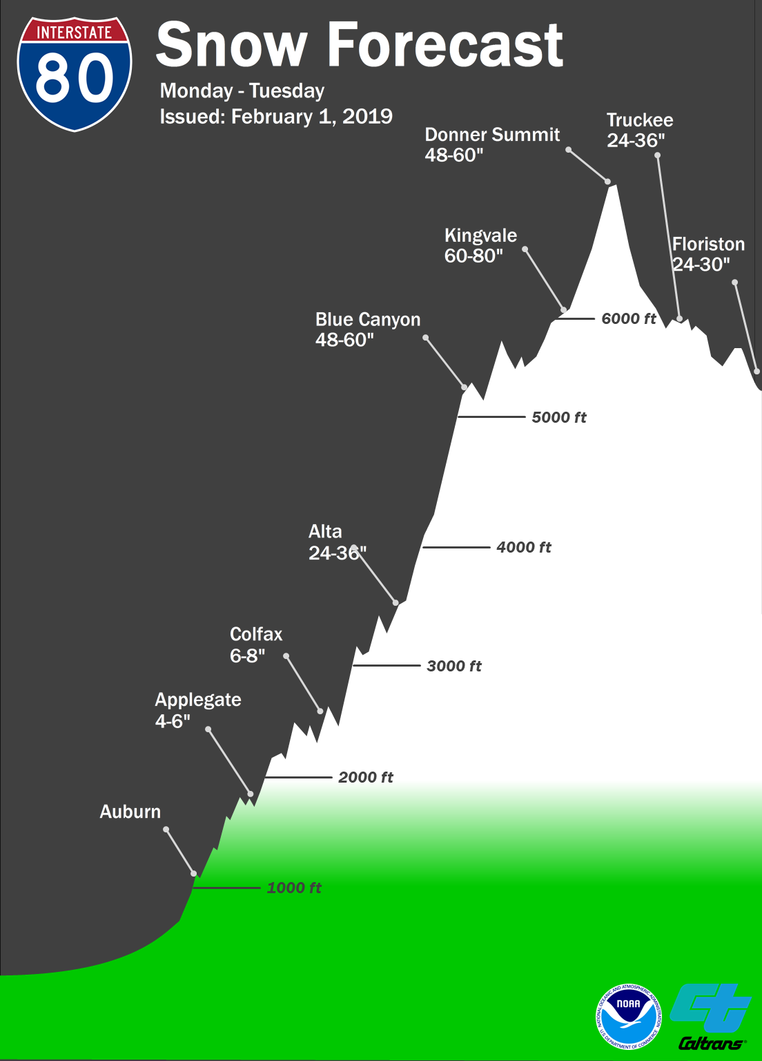
- 5-10 FEET Of Snow Above 7,000ft Today – Tuesday
- Blizzard Conditions Possible Sunday Night – Tuesday Morning
- Snow Drifts Could Be Deeper Than 10 Feet
- Wind Gusts Of Up To 100mph On Ridge Tops
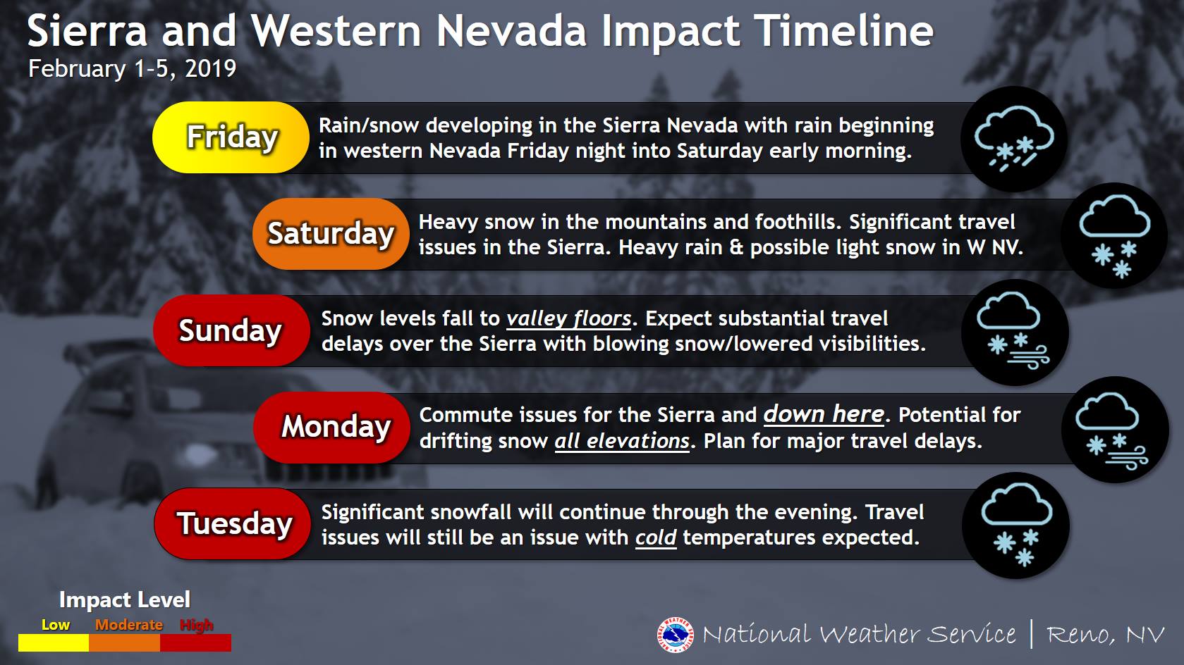
“A series of strong winter storms will impact the Sierra Nevada and western Nevada this evening through Tuesday.
Expect increased winds, mountain snow, and valley rain later Friday through Saturday with possible light snow in western Nevada. A colder/more significant storm will affect the region late Sunday into Tuesday, bringing the possibility for heavy snow to all elevations, even down to western Nevada valley floors.
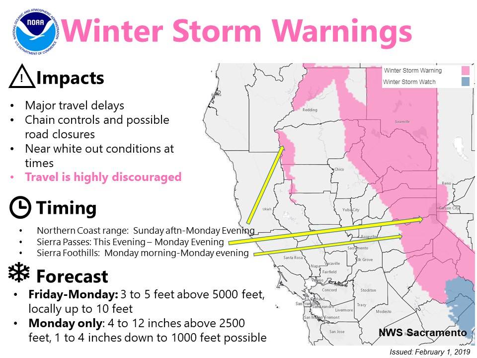
Major travel impacts are expected in the Sierra and in western Nevada valleys Sunday evening through Tuesday afternoon. Avoid travel over the Sierra this weekend if possible. In addition, expect difficult commutes both Monday and Tuesday in the Sierra and western Nevada. Aviation travel could also be affected at regional terminals.”
– NOAA Reno, NV
Snow levels will lower to 3,500ft – 4,500ft over the weekend, before dropping down to 1,000ft – 2000ft on Monday.
The 6-10 day outlook calls for below average temperatures and below average precipitation in California.
Additional Storm Info:
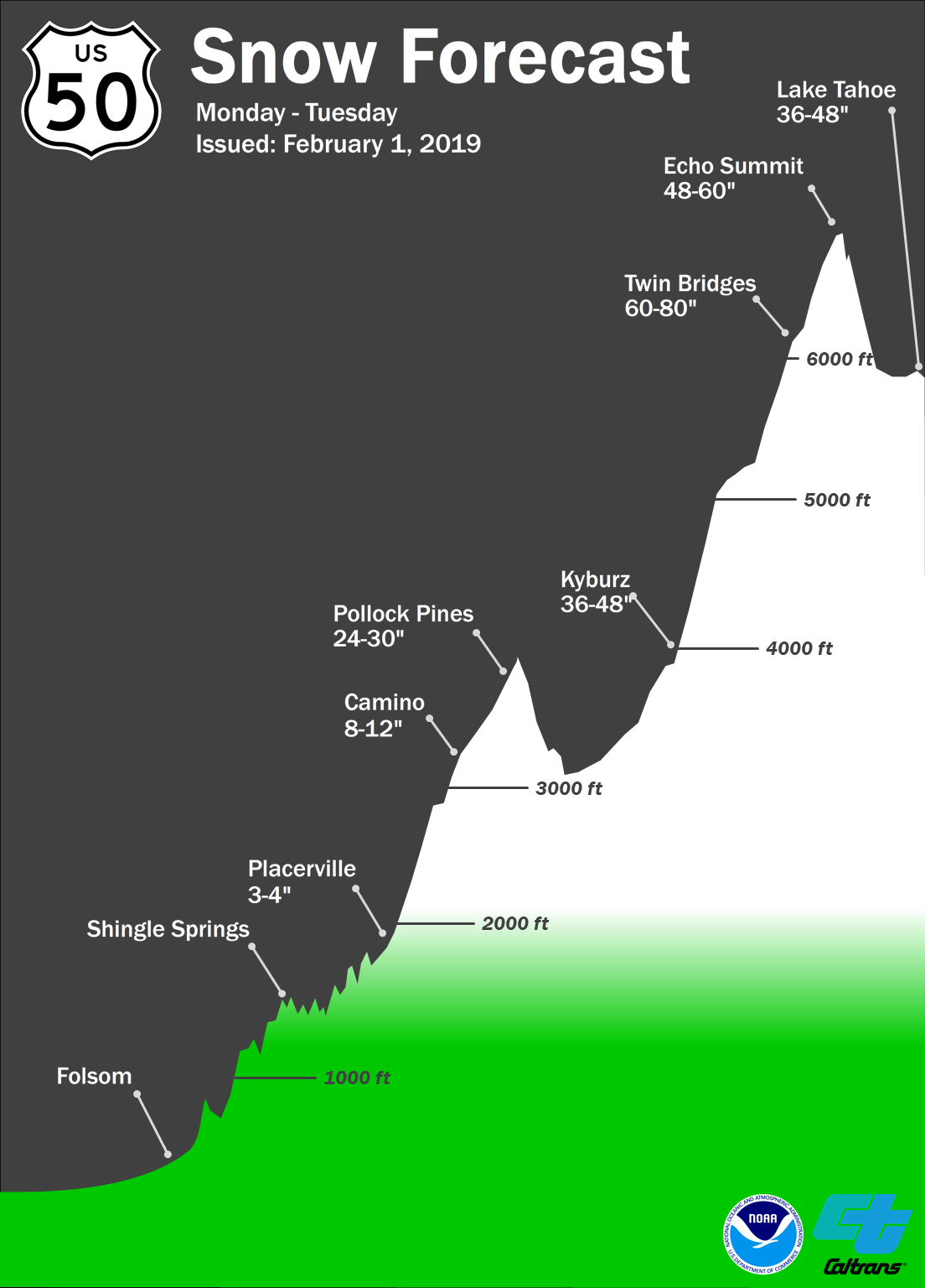
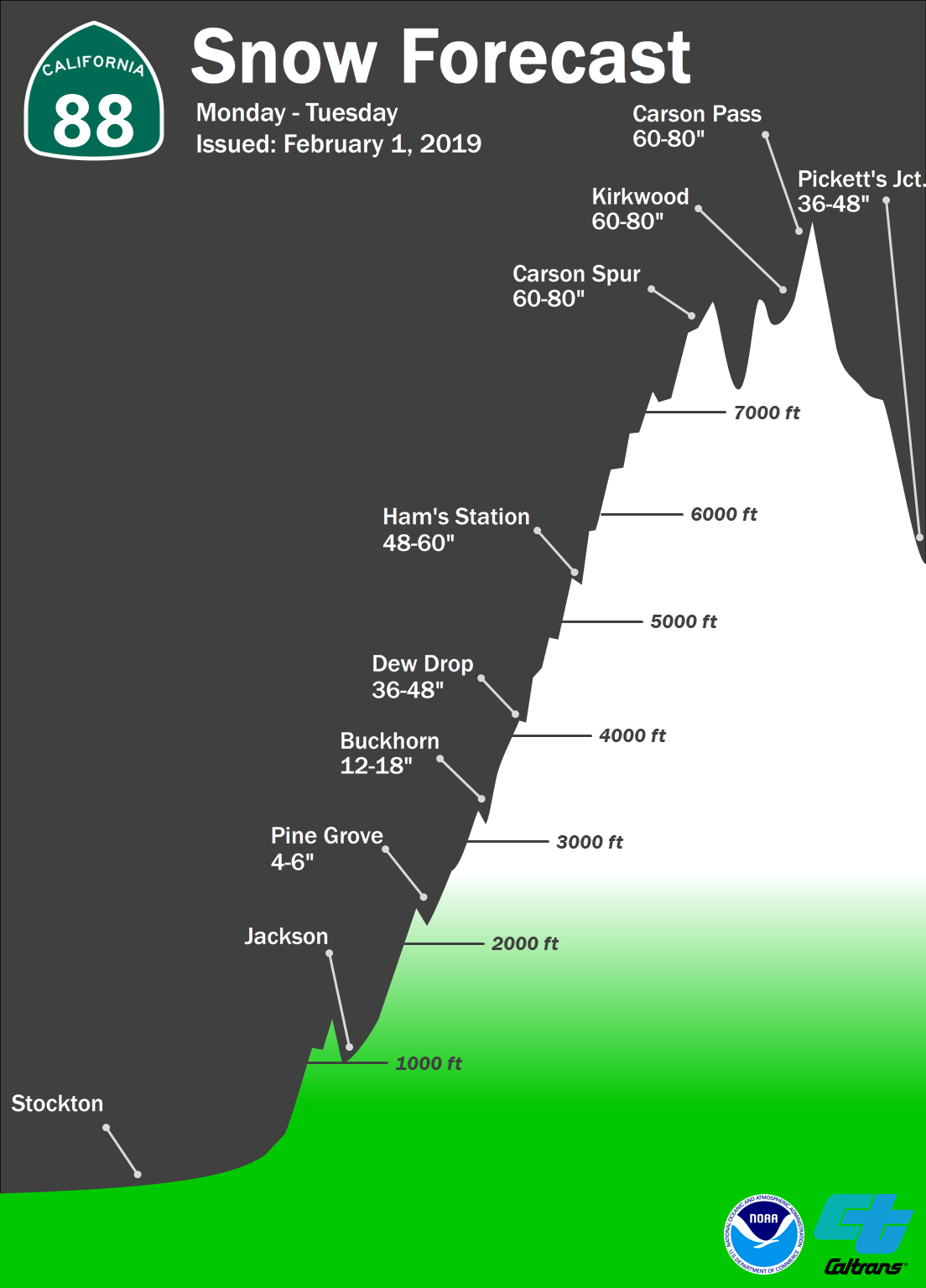
California: 5-10 FEET Of Snow Above 7,000ft Today – Tuesday
* Heavy snow and gusty winds expected. Total snow accumulations
  of 2 to 6 feet at lake level, except 5 to 10 feet above 7000
  feet expected.
- NOAA Reno, NV
Winter Storm Warning:
URGENT - WINTER WEATHER MESSAGE
National Weather Service Reno NV
1044 AM PST Fri Feb 1 2019

Greater Lake Tahoe Area-
Including the cities of South Lake Tahoe, Truckee, Stateline,
and Incline Village

...WINTER STORM WARNING NOW IN EFFECT FROM 4 PM THIS AFTERNOON TO
4 PM PST TUESDAY...

* CHANGES...Extended through Tuesday afternoon, increased amounts,
  and added mention of drifts.

* WHAT...Heavy snow and gusty winds expected. Total snow
  accumulations of 2 to 6 feet at lake level, except 5 to 10 feet
  above 7000 feet expected. Snow drifts could be deeper than 10
  feet. Winds gusting as high as 50 mph Sunday afternoon into
  Monday with gusts to 100 mph over ridges. A period of blizzard
  conditions is possible Sunday night into Tuesday morning.

* WHERE...Greater Lake Tahoe Area.

* WHEN...From 4 PM this afternoon to 4 PM PST Tuesday.

* ADDITIONAL DETAILS...Travel could be very difficult to
  impossible. The hazardous conditions will impact commuting and
  ski resort travel. Very strong winds could cause extensive tree
  damage and near zero visibility.
I like this page.