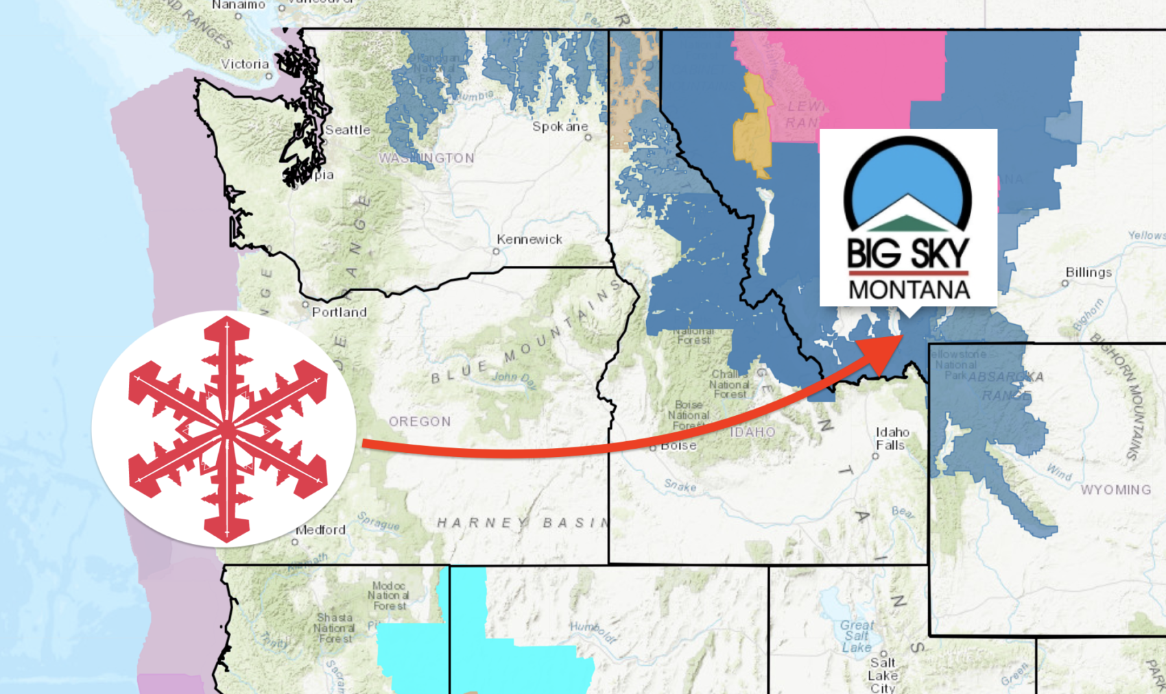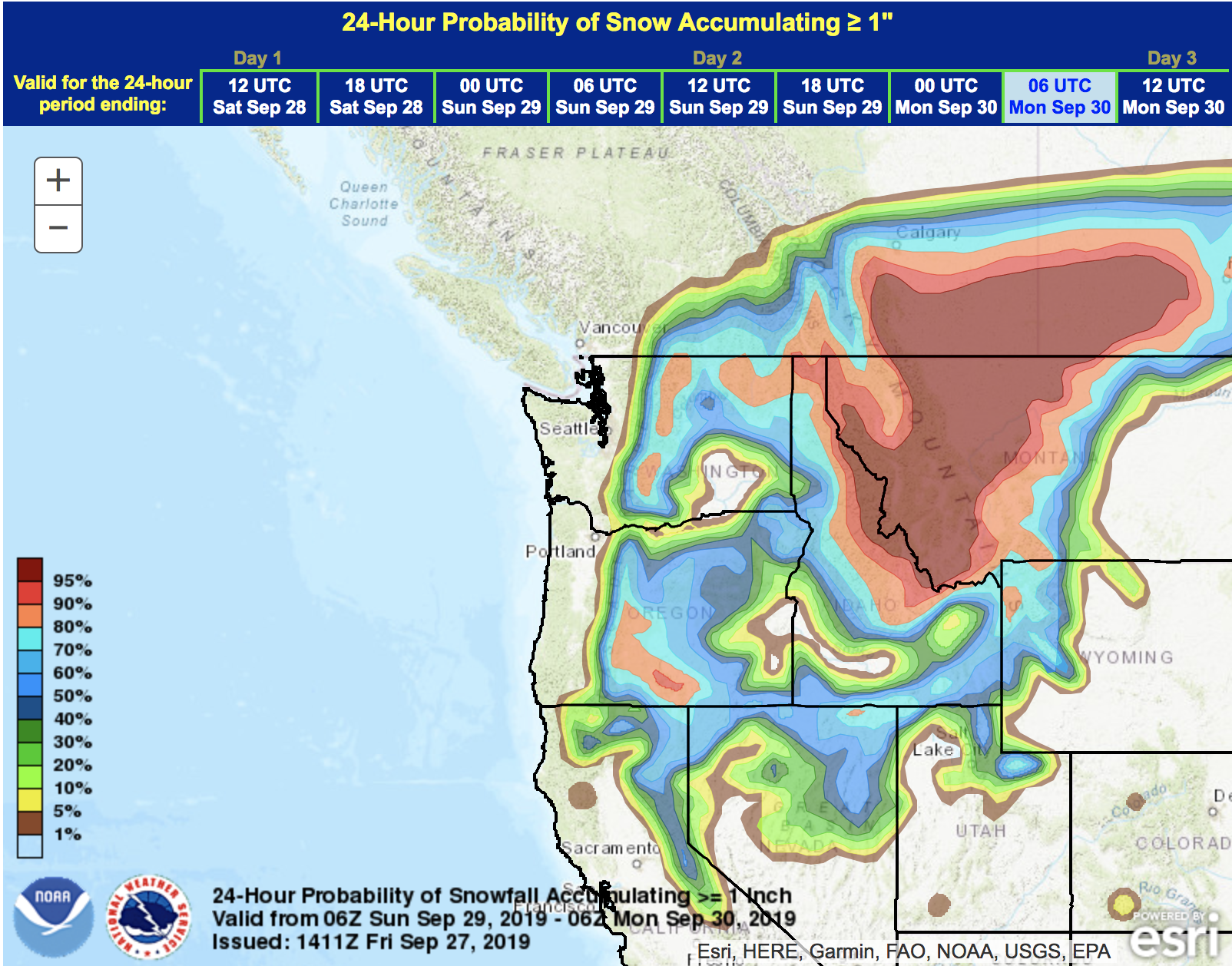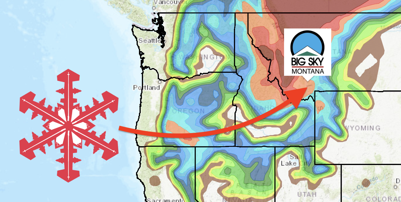
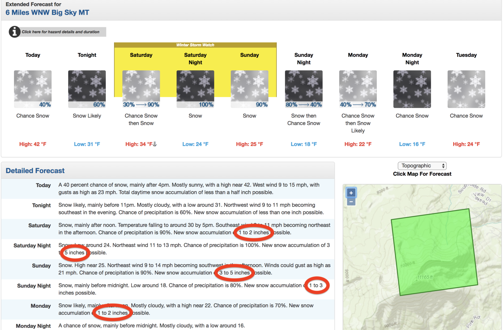
NOAA has issued a Winter Storm Watch for Big Sky ski resort in Montana that is calling for “Heavy Snow” resulting in 6-16+” of snow to fall on Saturday & Sunday.
* WHAT...Heavy snow possible above 6000 feet. Total snow
  accumulations of mostly 6 to 16 inches possible, but even
  higher amounts possible in the mountains. Lesser amounts of 2
  to 6 inches possible below 6000 feet.

- NOAA, Great Falls MT, 9/27/19
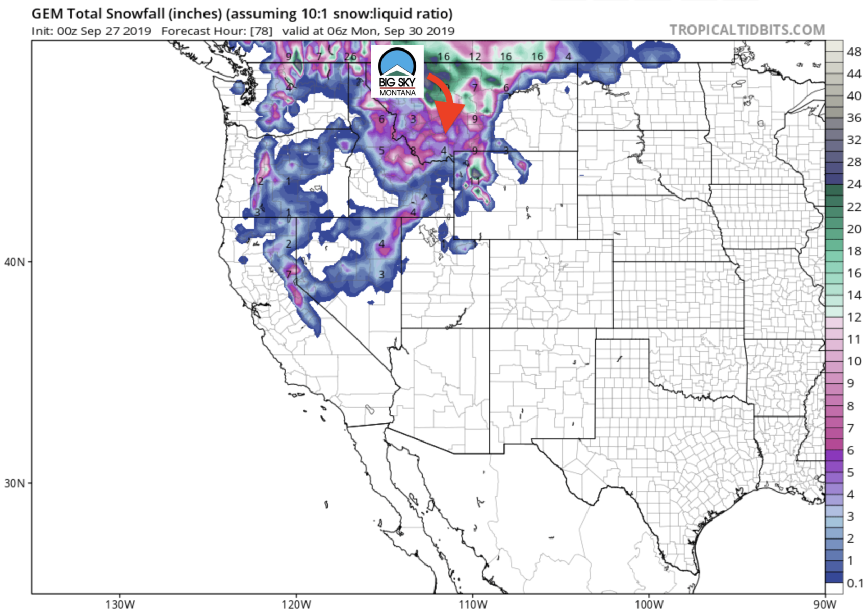
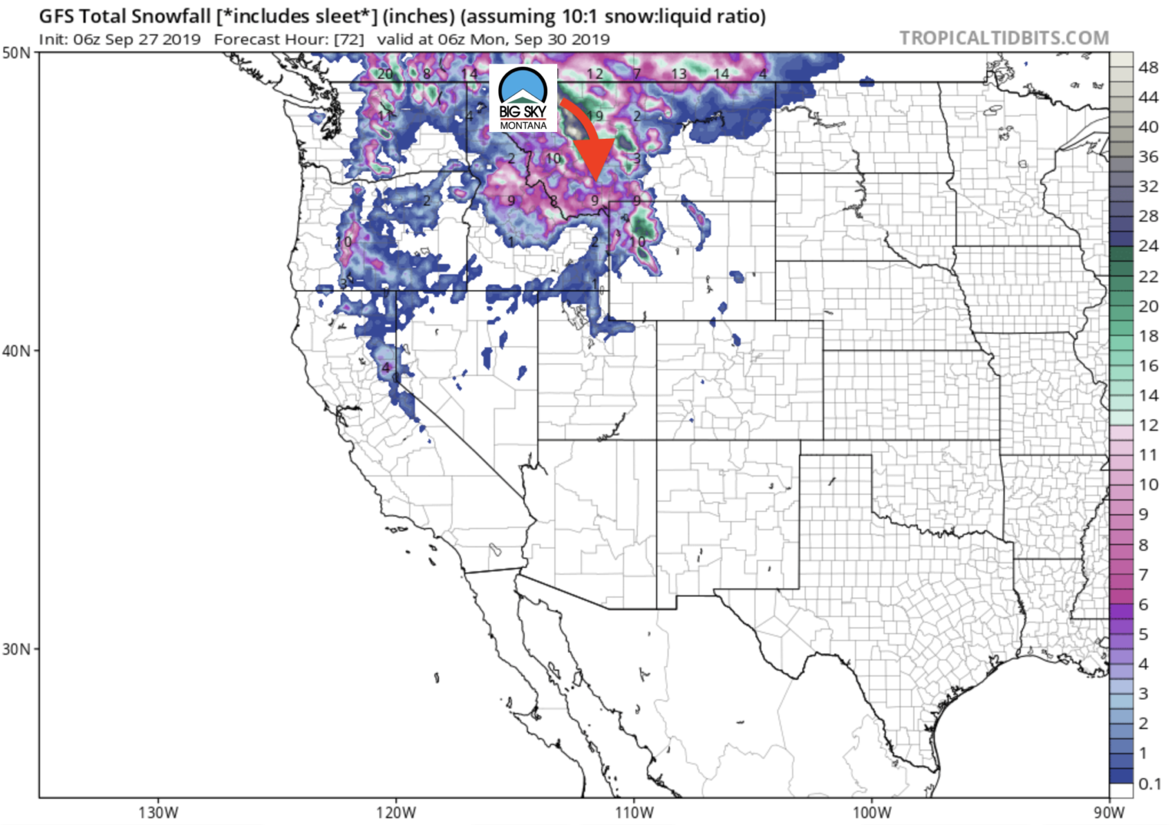
Big Sky has gotten a few smaller snowstorms this season but this is forecast to be the first significant snowstorm of the season.
We have heard rumors that the Big Sky snow safety team thinks this storm will be the beginning of the 2019/20 snowpack – ie this snow may not melt and may be the start of the 2019/20 snow base for Big Sky.
3-DAY GEM WEATHER MODEL:
3-DAY GFS WEATHER MODEL:
VIDEO HIGHLIGHTS OF WEEKEND STORM:
Winter Storm Watch for Big Sky, MT
URGENT - WINTER WEATHER MESSAGE
National Weather Service Great Falls MT
1034 AM MDT Fri Sep 27 2019

Beaverhead-Madison-Gallatin-
Including Big Hole Pass, Wisdom, Chief Joseph Pass, Monida Pass,
Raynolds Pass, Virginia City, West Yellowstone,
Battle Ridge Pass, and Targhee Pass
1034 AM MDT Fri Sep 27 2019

...WINTER STORM WATCH REMAINS IN EFFECT FROM SATURDAY MORNING
THROUGH SUNDAY AFTERNOON ABOVE 6000 FEET...

* WHAT...Heavy snow possible above 6000 feet. Total snow
  accumulations of mostly 6 to 16 inches possible, but even
  higher amounts possible in the mountains. Lesser amounts of 2
  to 6 inches possible below 6000 feet. North to northeast winds
  could gust between 25 and 35 mph at times. Cold wind chill
  temperatures of 10 to 20 degrees above zero are possible.

* WHERE...Elevations above 6000 feet in Beaverhead, Madison and
  Gallatin Counties. This does not include the cities of
  Bozeman, Ennis, and Dillon.

* WHEN...From Saturday morning through Sunday afternoon.

* IMPACTS...Travel could be very difficult, especially over
  mountain passes. Patchy blowing snow could reduce visibility
  at times.

* ADDITIONAL DETAILS...This has the potential to be a significant
  early-season snow event for the mountains. Now is the time to
  prepare for the winter-like weather!

* CONFIDENCE...Moderate confidence in accumulations, winds,
  associated impacts, and timing of onset and end of this winter
  storm event.