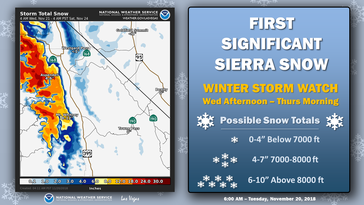
The National Weather Service has issued a Winter Storm Watch for California. It’s in effect from 3:00pm on Wednesday through 4:00am Thursday Morning. Heavy snow and high winds are forecasted to impact the area throughout that time.
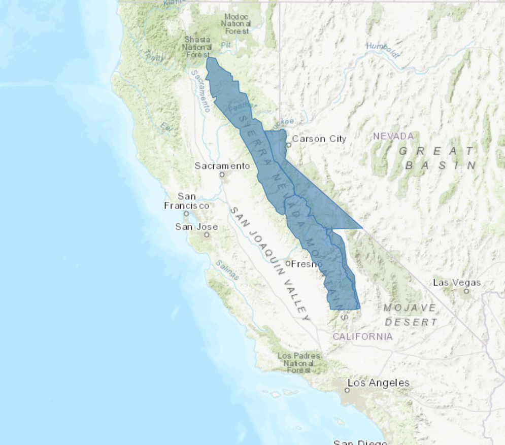
California:
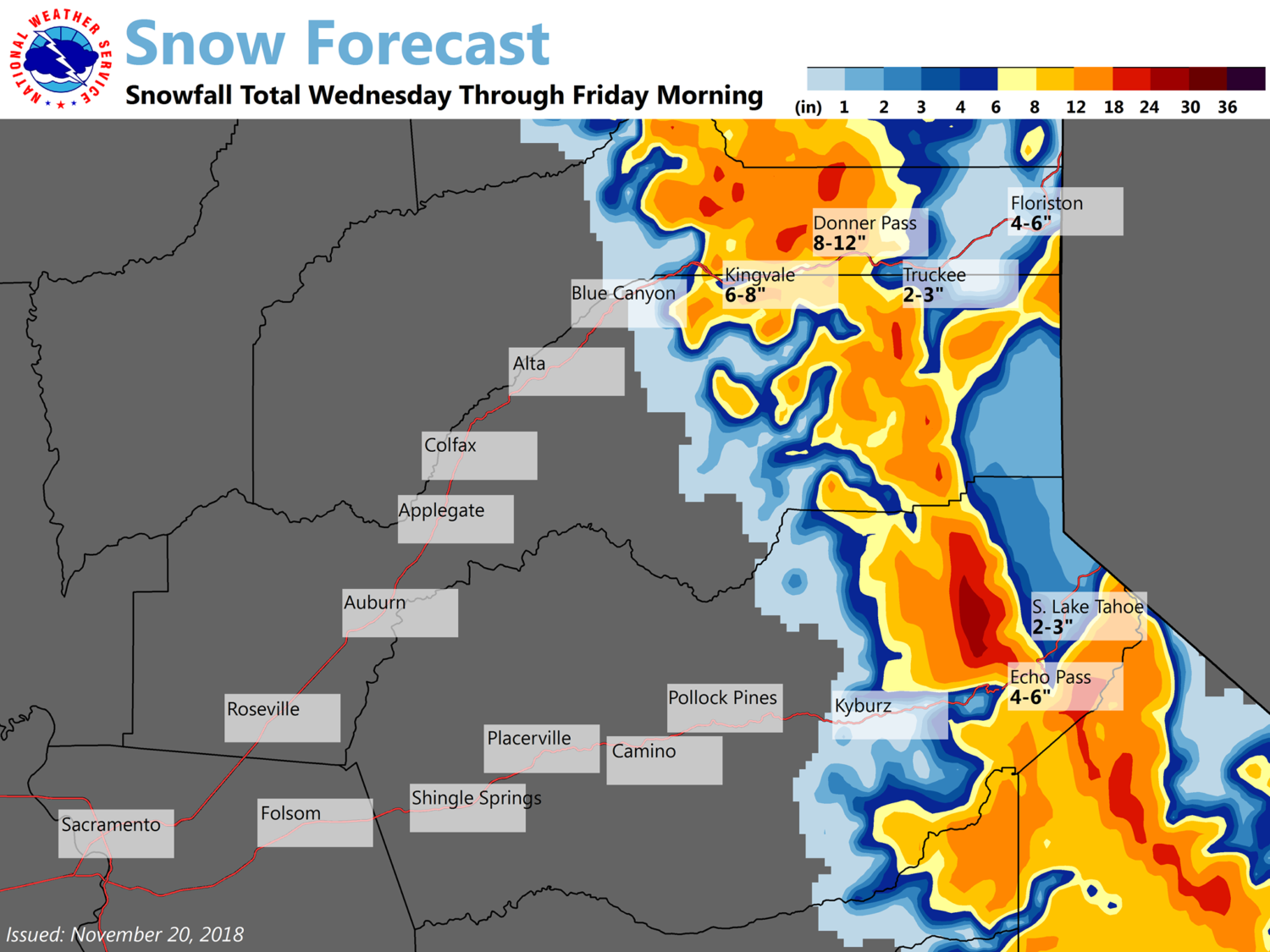
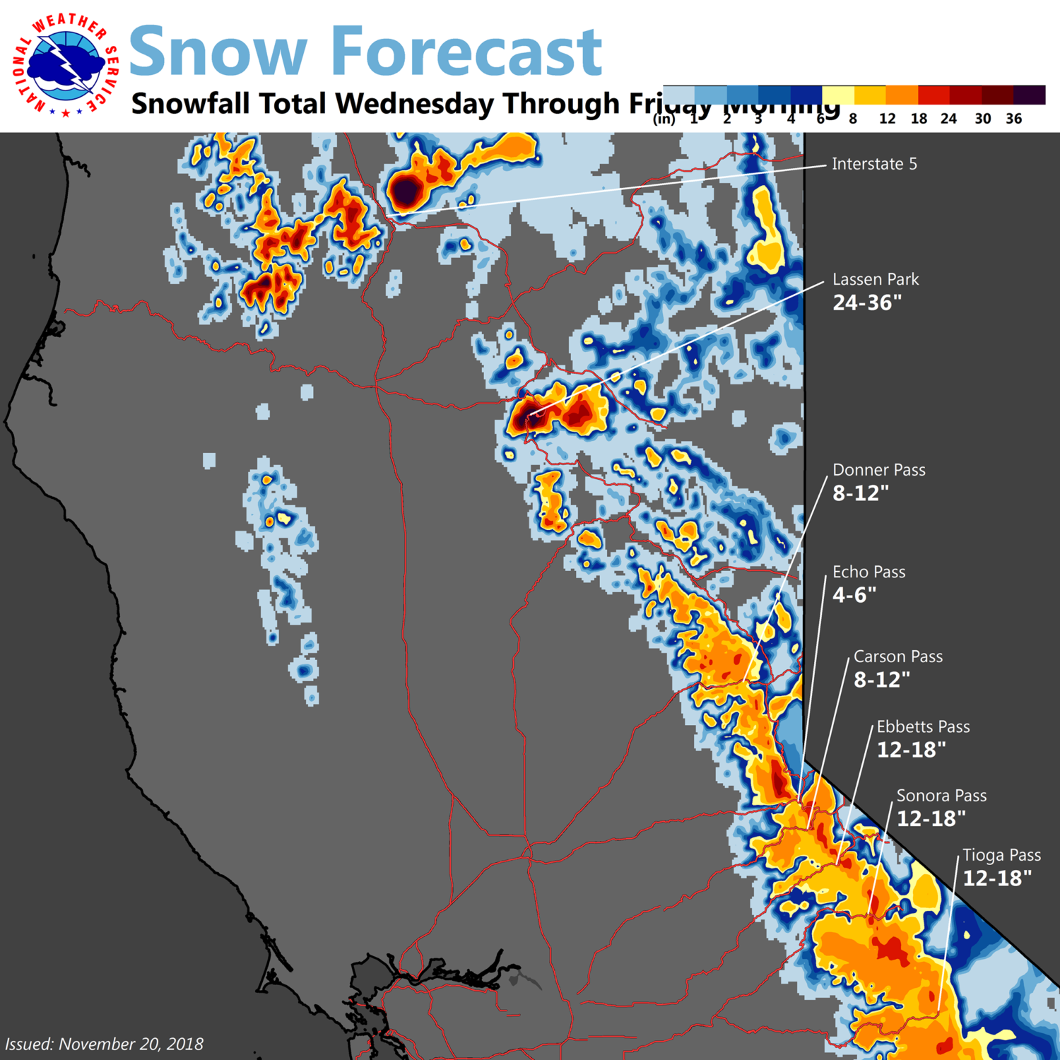
- 6-12″ of Snow Wednesday – Wednesday Night
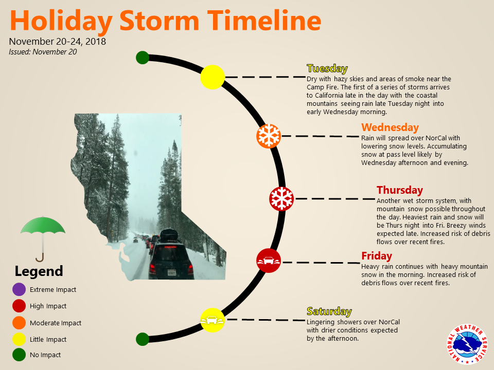
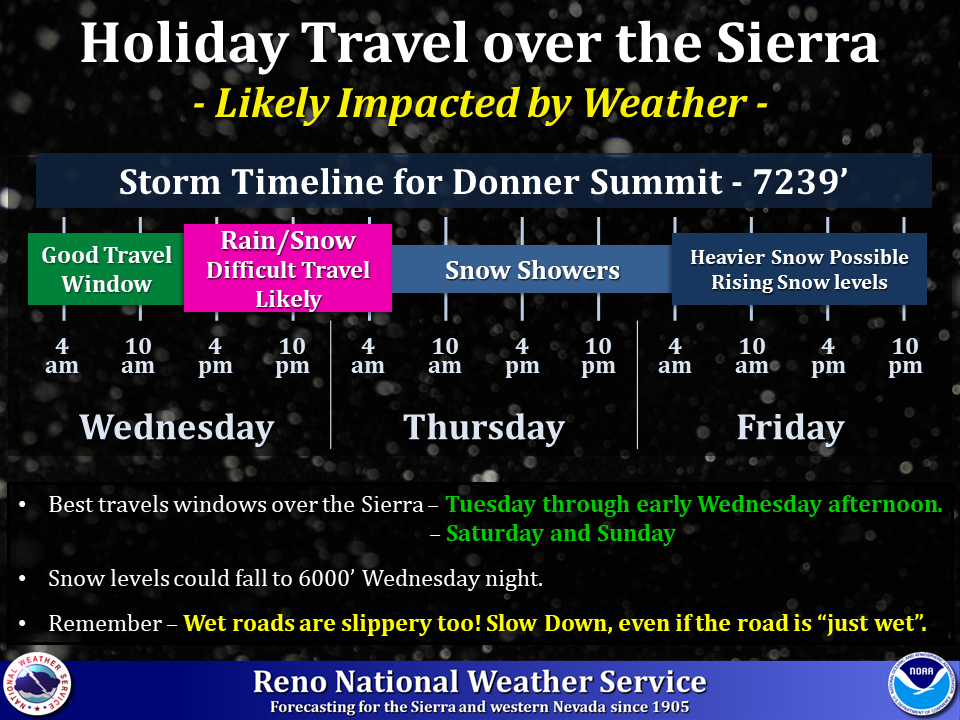
“Two waves of weather are expected to move through the Sierra this week, likely impacting travel in the mountains.”
– NOAA Reno, NV
A second round of heavier snow is forecasted to hit California Friday into Saturday, so plan ahead for holiday travel.
Look for Squaw Valley Alpine Meadows, CA to get dumped on by this storm, so if you’re looking for some holiday powder turns, you know where to go.
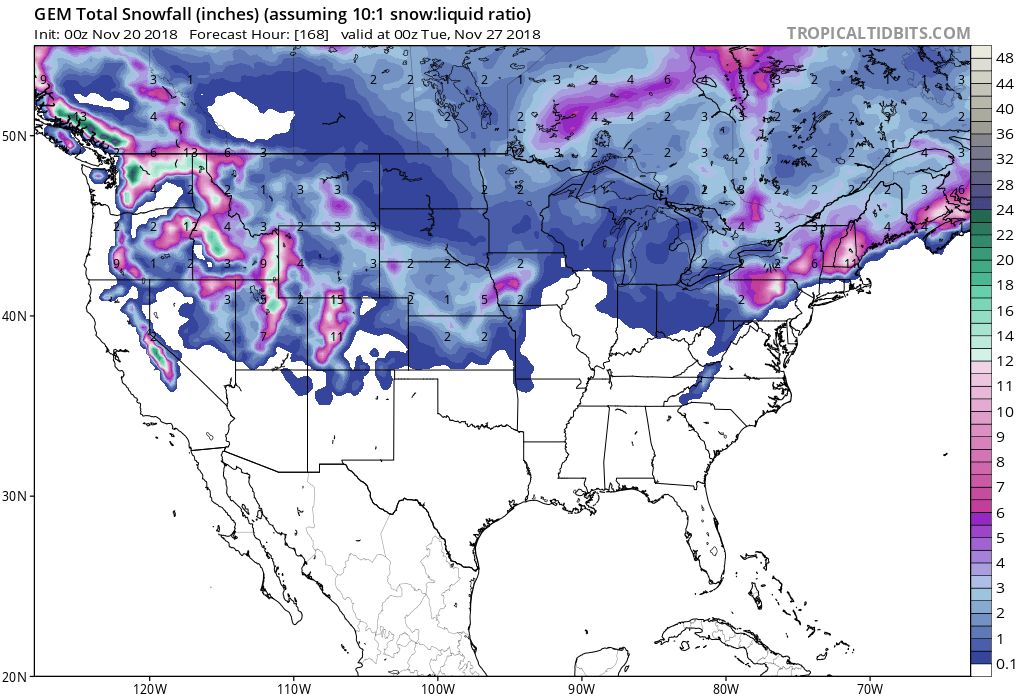
Snow levels may drop down to 6,000ft on Wednesday night, but the heaviest accumulations are forecasted to occur above 8,000ft.
The 6-10 day forecast is calling for above average temperatures and below average precipitation in California.
Additional Storm Info:
California: 6-12″ of Snow Above 8,000ft On Wednesday
* Heavy snow possible above 7000 feet. Total snow accumulations
  of 6 to 12 inches above 8000 feet. Between 7000 and 8000 feet
  4 to 8 inches are possible with 4 inches or less below 7000 feet.
  Winds could gust as high as 60 mph through passes and over ridge lines.
Winter Storm Watch:
URGENT - WINTER WEATHER MESSAGE
National Weather Service Reno NV
1114 AM PST Mon Nov 19 2018

Greater Lake Tahoe Area-Mono County-
Including the city of Mammoth Lakes

...WINTER STORM WATCH IN EFFECT FROM WEDNESDAY AFTERNOON THROUGH
LATE WEDNESDAY NIGHT ABOVE 7000 FEET...

* WHAT...Heavy snow possible above 7000 feet. Total snow
  accumulations of 6 to 12 inches above 8000 feet. Between 7000
  and 8000 feet 4 to 8 inches are possible with 4 inches or less
  below 7000 feet. Winds could gust as high as 60 mph through
  passes and over ridge lines.

* WHERE...Greater Lake Tahoe Area and Mono County.

* WHEN...From Wednesday afternoon through late Wednesday night.

* ADDITIONAL DETAILS...Travel could be very difficult over the Mt
  Rose Highway, Carson Pass and Monitor Pass. Expect Ebbetts Pass,
  Sonora Pass and Tioga Pass to close. Holiday travelers should be
  prepared for long delays on Interstate 80 and Highway 50.