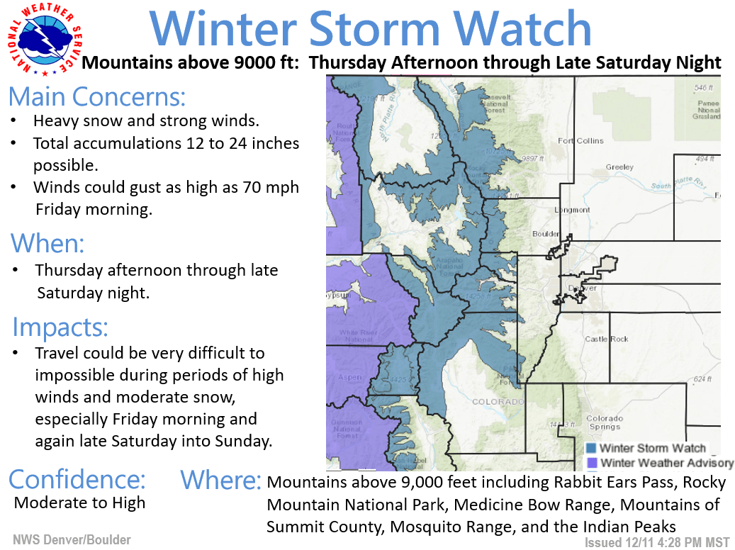
A prolonged atmospheric river event will bring moderate snow to the northern and central Colorado mountains beginning Thursday. A winter weather advisory from Thursday 11 am, will upgrade to a winter storm watch Friday afternoon and last through Saturday afternoon. From Thursday through Saturday night, resorts could see in excess of 24″.
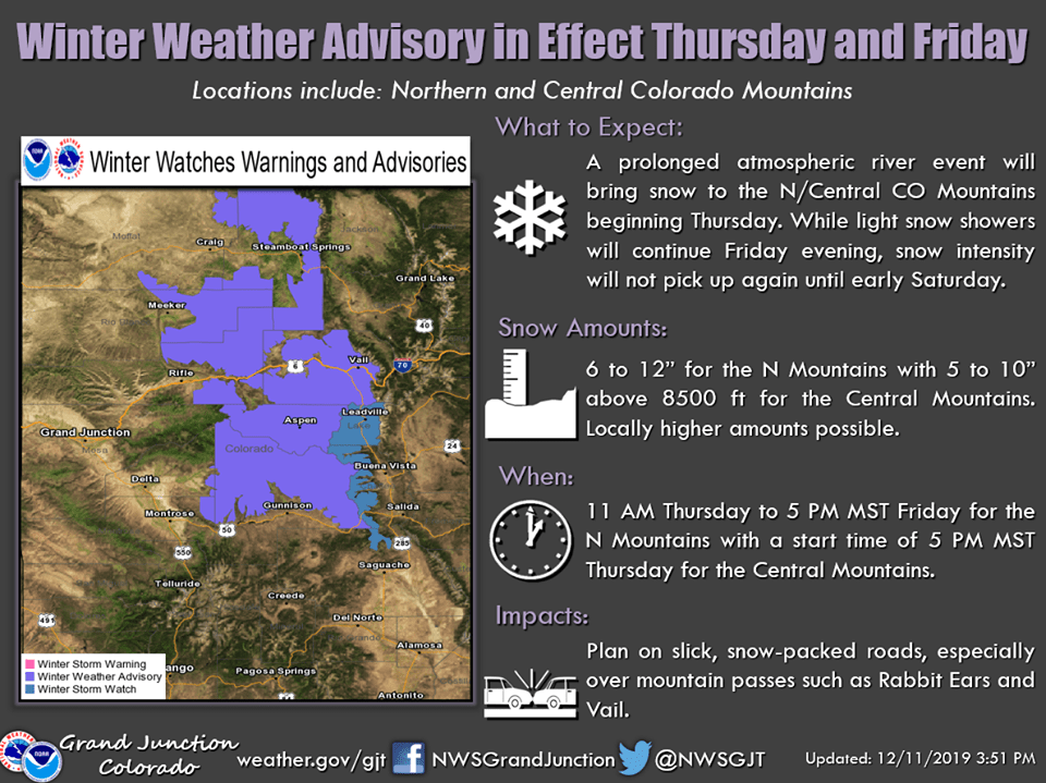
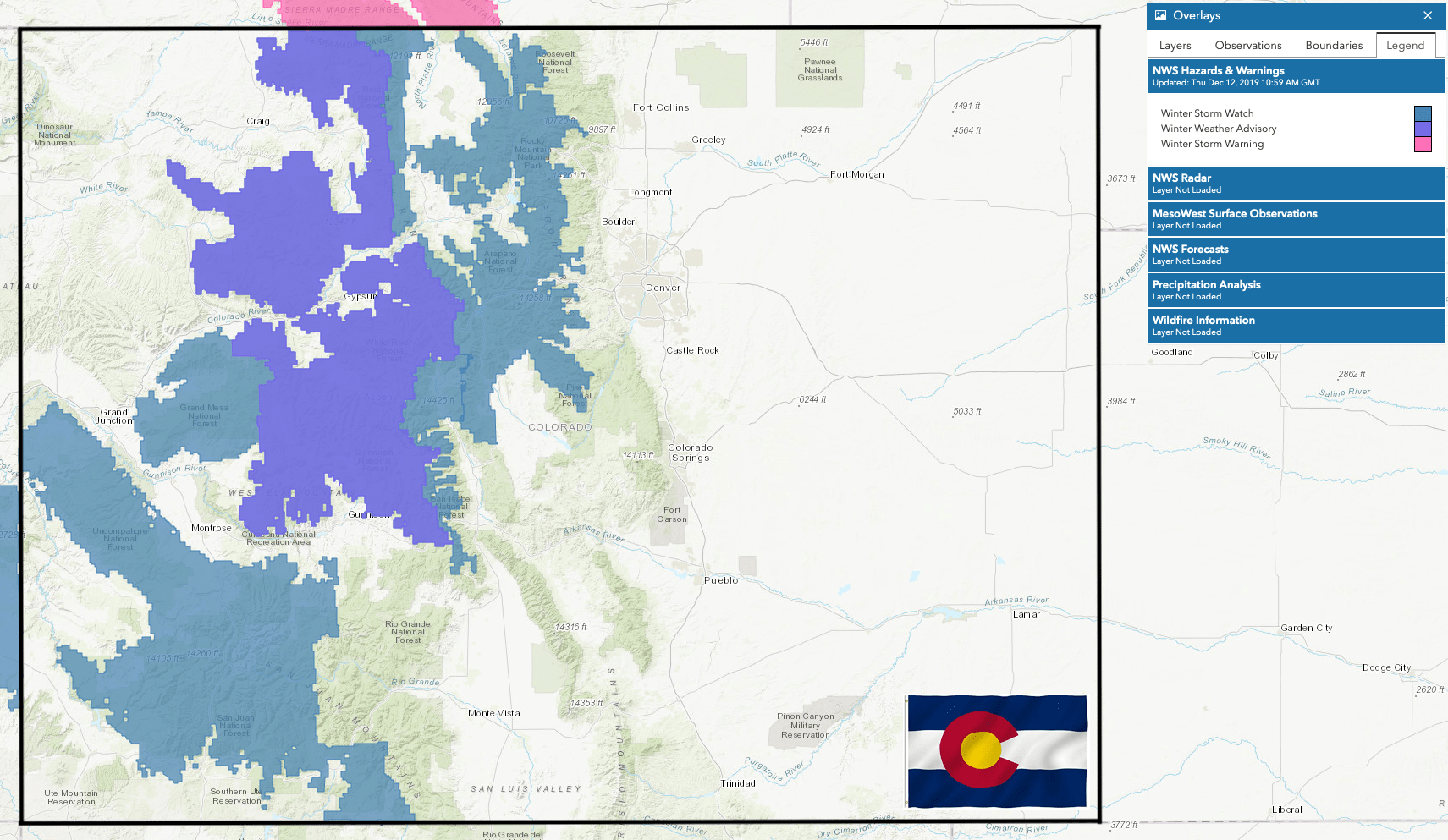
...WINTER WEATHER ADVISORY REMAINS IN EFFECT FROM 11 AM THURSDAY
TO 5 PM MST FRIDAY...
...WINTER STORM WATCH IN EFFECT FROM LATE FRIDAY NIGHT THROUGH
LATE SATURDAY NIGHT...

* WHAT...Snow, moderate to heavy at times, expected. For the
  Winter Weather Advisory, total snow accumulations of 6 to 12
  inches with locally higher amounts up to 15 inches. For the
  Winter Storm Watch, total snow accumulations of 5 to 10 inches
  possible. Winds gusting up to 45 to 50 mph.

* WHERE...Elkhead and Park Mountains, including Rabbit Ears Pass,
  and Flat Tops.

* WHEN...For the Winter Weather Advisory, from 11 AM Thursday to 5
  PM MST Friday. For the Winter Storm Watch, from late Friday
  night through late Saturday night.
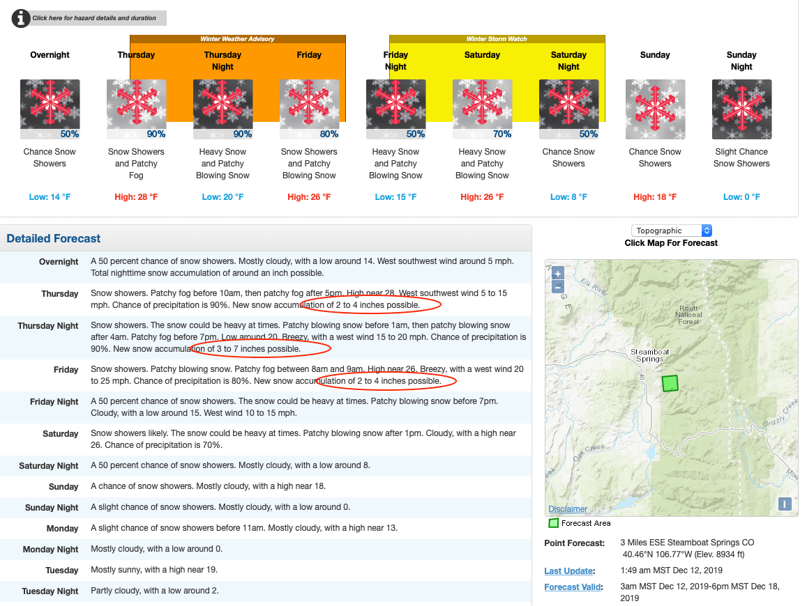
Generally, 6 to 12 inches of snow is likely for these areas with locally higher amounts possible through Friday afternoon. While light snow showers will continue Friday evening, snow intensity will not pick up again until midnight Friday night as showers spread into the southern mountains.
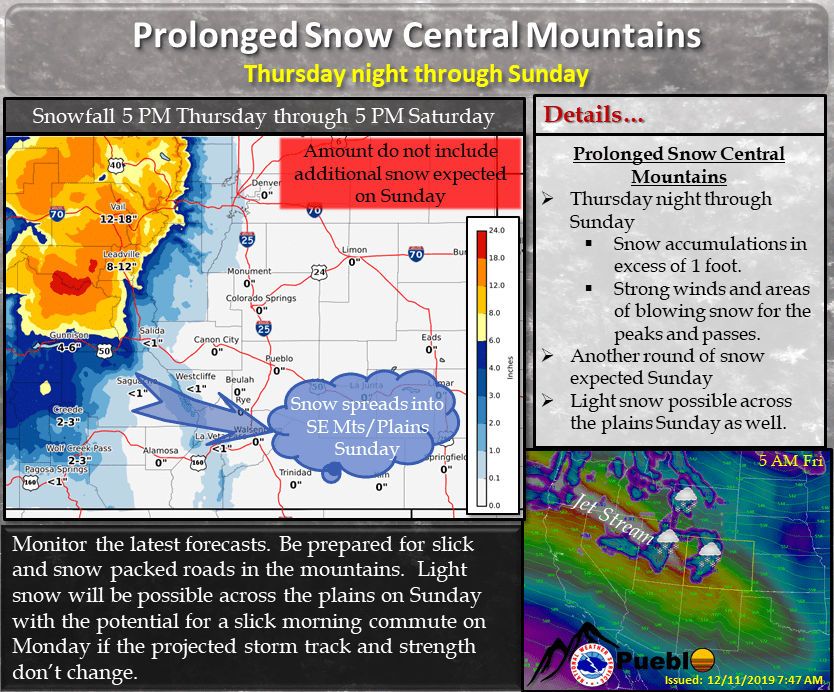
All the mountains of western Colorado will see periods of moderate snow through Sunday before showers taper off from north to south. Additional accumulations of 5 to 10 inches across the northern mountains and generally 6 to 14 inches is possible for the central and southern mountains with locally higher amounts likely.
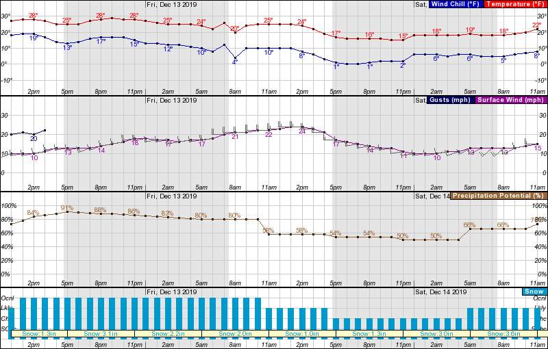
Conditions will be breezy with gusts up to 70-mph, and temperatures will drop into the low teens as the storm progresses.
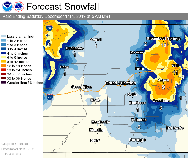
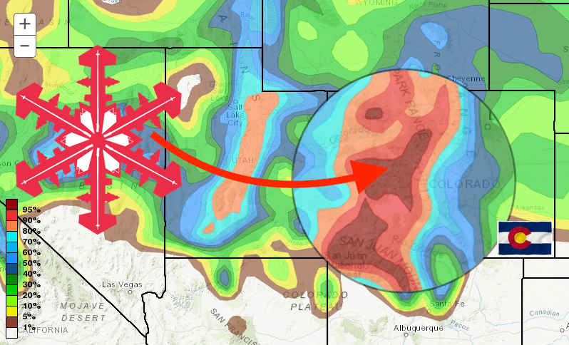
Steamboat will be the biggest winner here and should see more than 24″ of fresh snow Thursday through Saturday. Elsewhere, A-Basin, Beaver Creek, Breckenridge, Copper, Keystone, Loveland, Vail, Winter Park will see up to 20″, Aspen up to 14”, and as the storm tracks south it will lose strength, with Crested Butte, Monarch, Telluride, and Wolf Creek seeing 8-15″.
Wherever you are in Colorado though, this weekend will definitely feature powder for you!
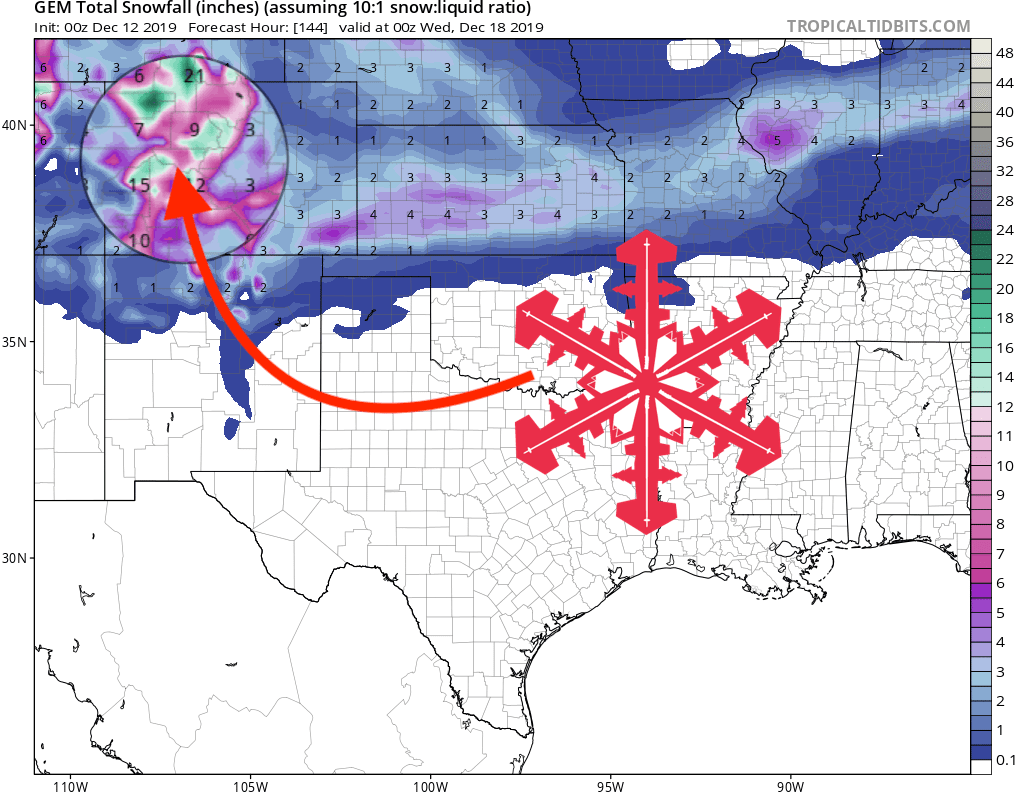
GEM Snowfall Total Forecast
Other Info