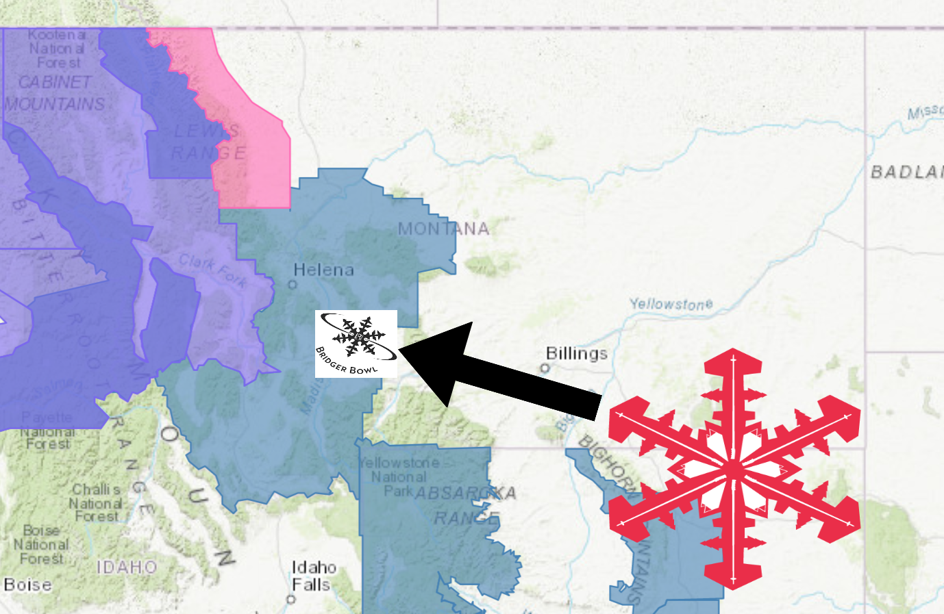
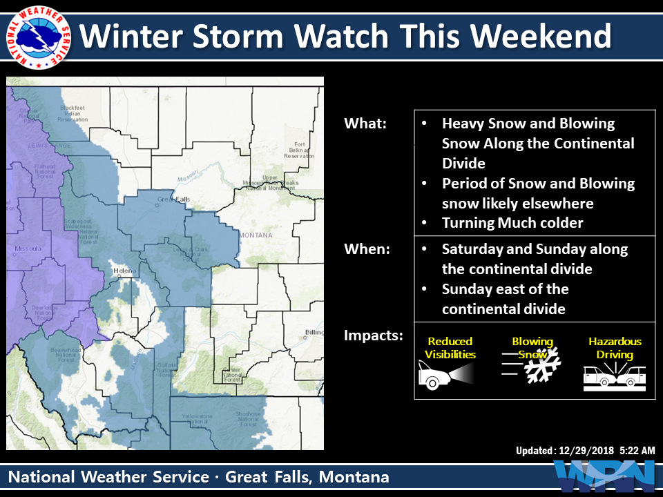
The National Weather Service has issued a Winter Storm Watch for Bridger Bowl Ski Area, MT. It’s in effect from 5:00pm this evening through 5:00pm Sunday evening. High winds and heavy snowfall are forecasted to impact the area throughout this time.
“Winter weather arrives first along the higher elevations of the Rocky Mountain Front, including Marias Pass today as Pacific moisture increases and snow develops. Snow will spread south along the Continental divide tonight and across additional mountainous areas of central and southwest Montana by Sunday morning. Snow may be heavy at times in these areas and a winter storm watch is in effect, primarily for elevations above 5000 ft, where impacts from snow and wind could lead to difficult driving conditions over mountain passes.”
– NOAA Great Falls, MT
SnowBrains had a blast at Bridger Bowl yesterday.
Snow levels are forecasted to start out around 3,500ft before dropping down below 1,000ft by the end of the storm.
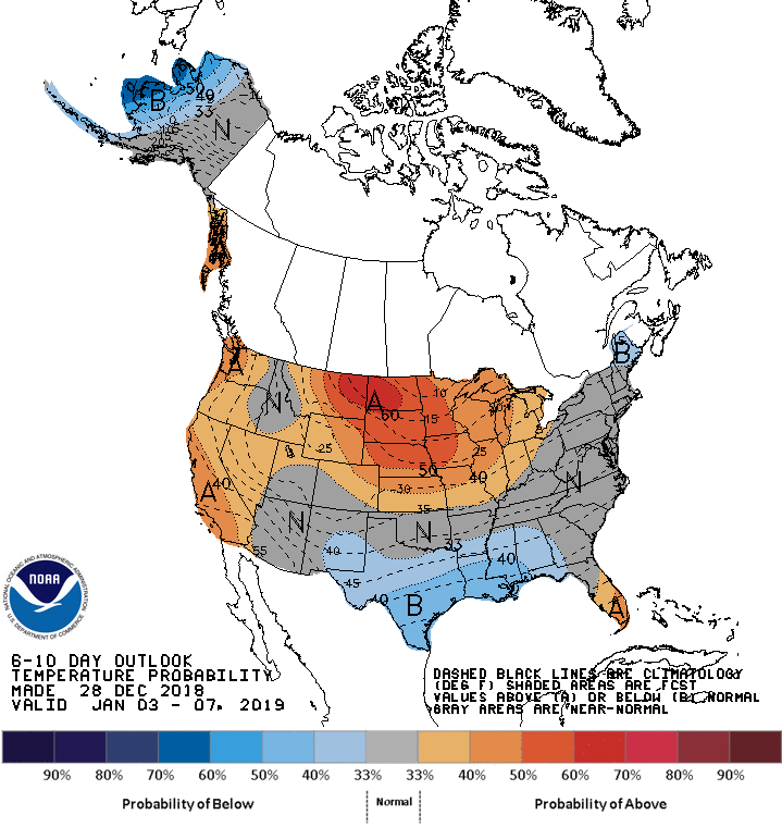
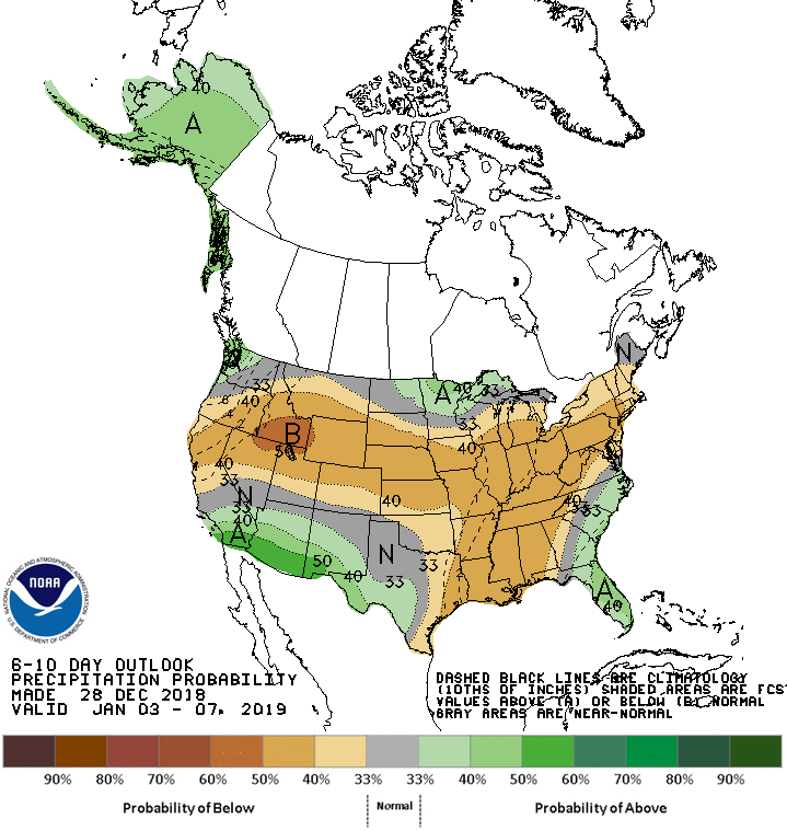
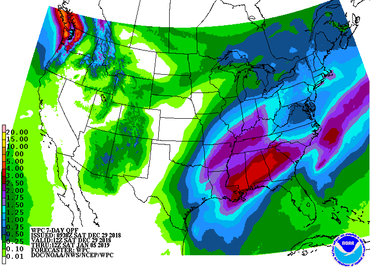
The 6-10 day outlook calls for below average precipitation and above average temperatures in Montana.
Additional Storm Info:
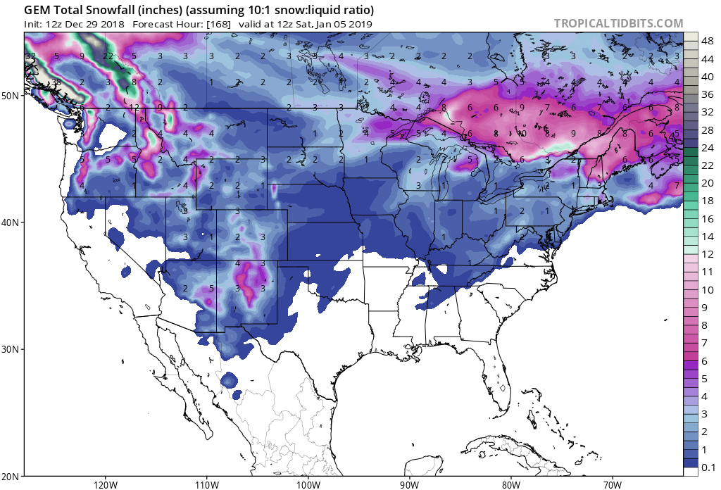
Montana: 4-8″ of Snow Tonight – Sunday
* Total snow accumulations of 4 to 8 inches possible
  at pass level, with 1 to 4 inches in the valleys.
- NOAA Great Falls, MT
Winter Storm Watch:
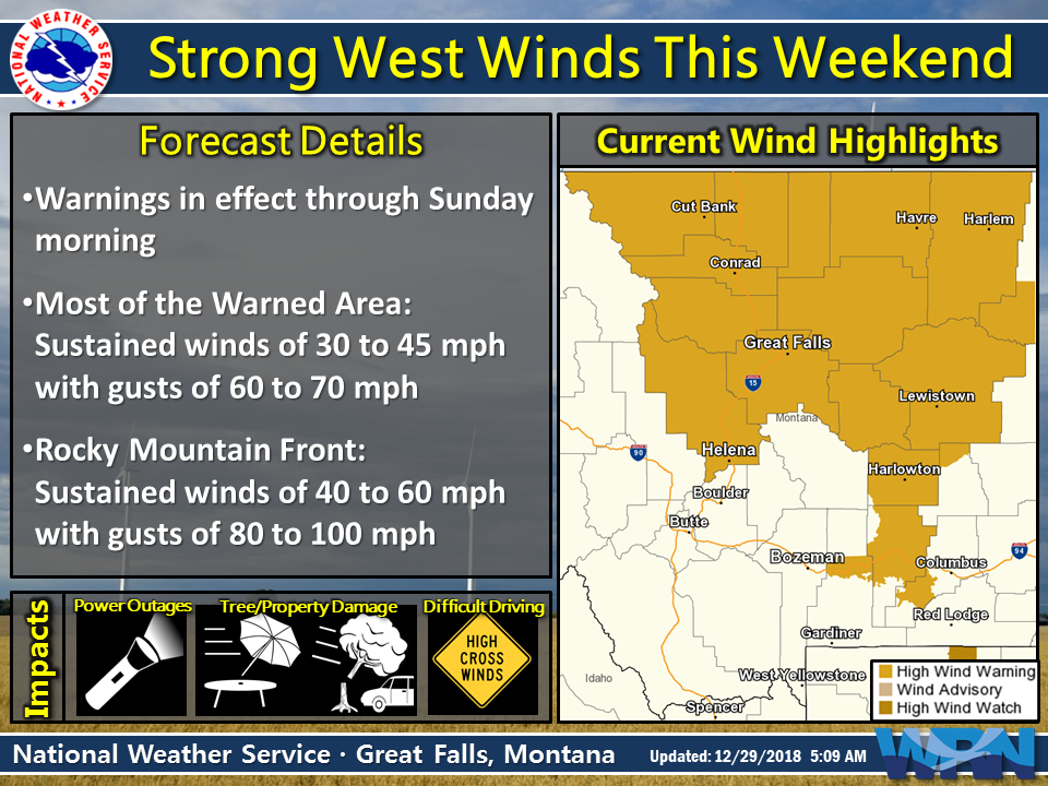
URGENT - WINTER WEATHER MESSAGE
National Weather Service Great Falls MT
839 AM MST Sat Dec 29 2018

Including Big Hole Pass, Wisdom, Chief Joseph Pass, Wise River,
Ennis, Norris Hill, Raynolds Pass, Virginia City, Bozeman,
West Yellowstone, Battle Ridge Pass, Bozeman Pass,
and Targhee Pass

...WINTER STORM WATCH REMAINS IN EFFECT FROM 5 PM MST THIS
AFTERNOON THROUGH SUNDAY AFTERNOON...

* WHAT...Heavy snow and blowing snow possible. Total snow
  accumulations of 4 to 8 inches possible at pass level, with 1 to
  4 inches in the valleys. Winds could gust as high as 45 mph.

* WHERE...Gallatin, Beaverhead and Madison.

* WHEN...From this afternoon through Sunday afternoon.

* ADDITIONAL DETAILS...Plan on slippery road conditions. Strong
  winds could cause blowing snow, poor visibility, and hazardous
  travel conditions.