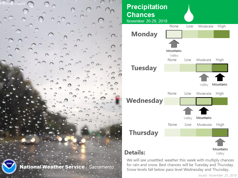
The National Weather Service has issued a Winter Storm Watch for California. It’s in effect from Wednesday Afternoon – Thursday. High winds and heavy snow are forecasted to impact the area throughout that time.
California:
-
1-3 FEET of Snow Above 7,000ft Wednesday – Thursday
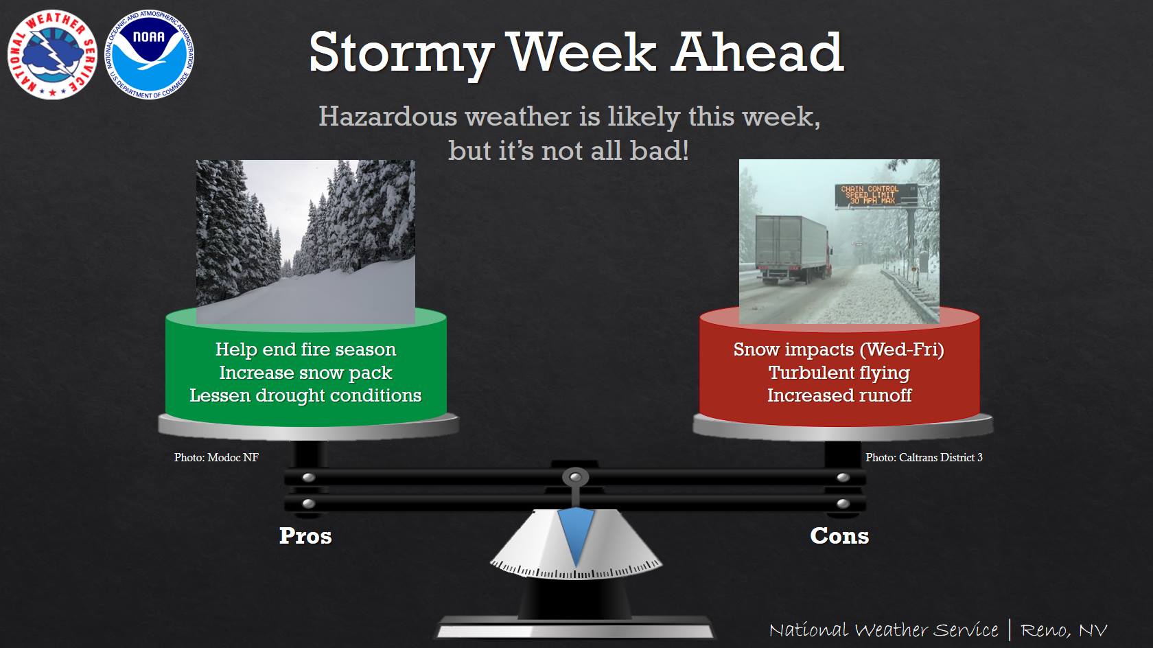
“Several systems will move through our area this week, bringing beneficial rain and snow. However, conditions may cause turbulent flying and travel impacts are possible, especially Wednesday through Friday.”
– NOAA Reno, NV
Squaw Valley, CA has received 25″ of snow in the past 7 days, so this storm system should set them up well for some DEEP powder days.
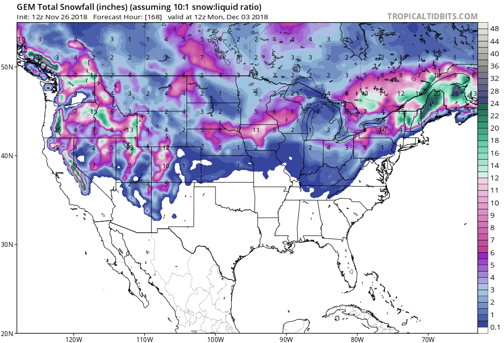
Snow levels are forecasted to hover between 5,000ft and 6,000ft throughout the storm, but the heaviest accumulations will occur above 7,000ft.
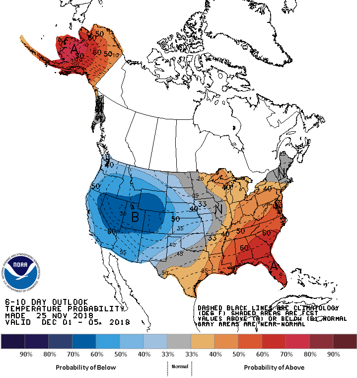
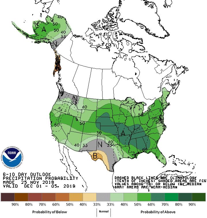
The 6-10 day outlook is calling for above average precipitation and below average temperatures in California.
Additional Storm Info:
California: 1-3 FEET of Snow Above 7,000ft Wednesday – Thursday
* Heavy snow possible. Total snow accumulations 6 to 12 inches,
  except 1 to 3 feet above 7000 feet possible. Winds could gust
  as high as 65 mph over the higher terrain of the Sierra.
- NOAA Reno, NV
Winter Storm Watch:
URGENT - WINTER WEATHER MESSAGE
National Weather Service Reno NV
914 AM PST Mon Nov 26 2018

Greater Lake Tahoe Area-Mono County-
Including the cities of South Lake Tahoe, Truckee, Bridgeport,
Coleville, Mammoth Lakes, Stateline, and Incline Village
...WINTER STORM WATCH IN EFFECT FROM WEDNESDAY EVENING THROUGH
LATE THURSDAY NIGHT...

* WHAT...Heavy snow possible. Total snow accumulations 6 to 12
  inches, except 1 to 3 feet above 7000 feet possible. Winds could
  gust as high as 65 mph over the higher terrain of the Sierra.

* WHERE...Greater Lake Tahoe Area and Mono County.

* WHEN...From Wednesday evening through late Thursday night.

* ADDITIONAL DETAILS...Travel could be very difficult to
  impossible with long delays possible. Heavy wet snow could cause
  tree branches to break.