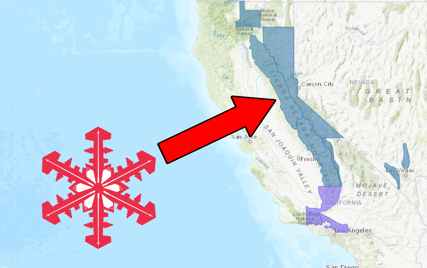
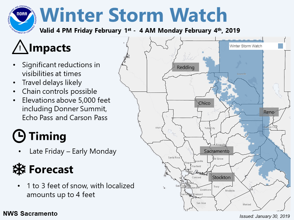
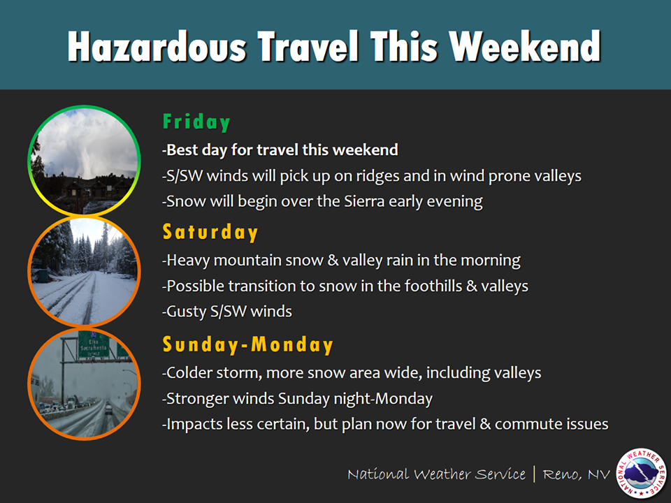
The National Weather Service has issued a Winter Storm Watch for California. It’s in effect from 4:00pm Friday afternoon – 4:00am Sunday morning. High winds and heavy snowfall are forecasted to impact the area throughout that time.
California:
- 15-30″ of Snow Friday Afternoon – Saturday Night
“A Winter Storm Watch is in effect for Friday evening through early Monday. A winter storm will bring heavy snow to elevations above 5000 feet this weekend, with lighter snow amounts possible down to 3000-4500 feet. Significant travel impacts expected.”
– NOAA Sacramento, CA
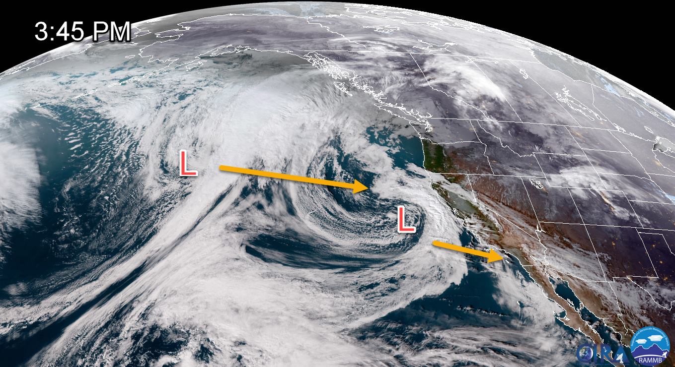
Oh and that’s not it, as there’s another storm that’s forecasted to hit California Sunday – Monday. This storm is expected to be colder and deliver widespread snowfall.
It looks like next week should be a good one to get out in the backcountry with Alpenglow Expeditions to take advantage of all this fresh snow.
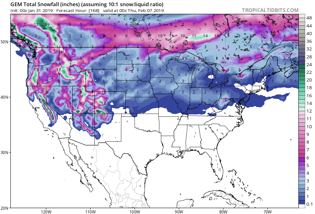
The Winter Storm Watch is in effect for areas above 5,000ft.
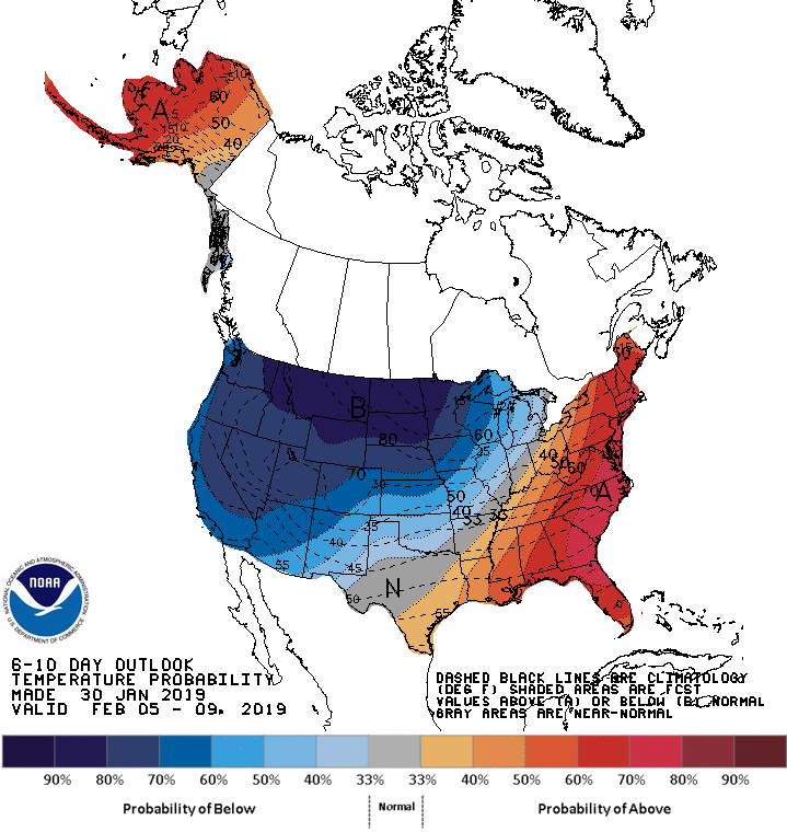
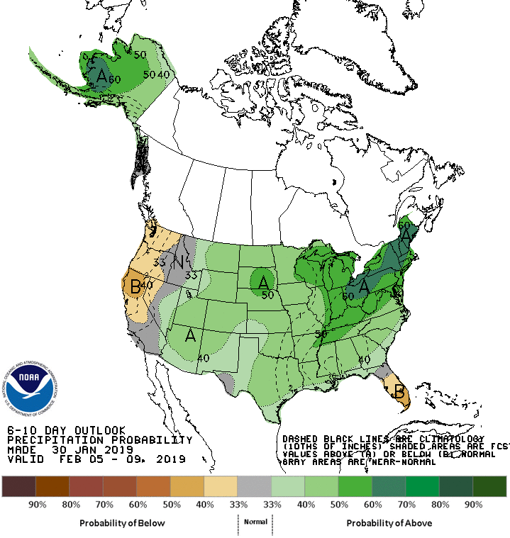
The 6-10 day outlook calls for below average precipitation and below average temperatures in California.
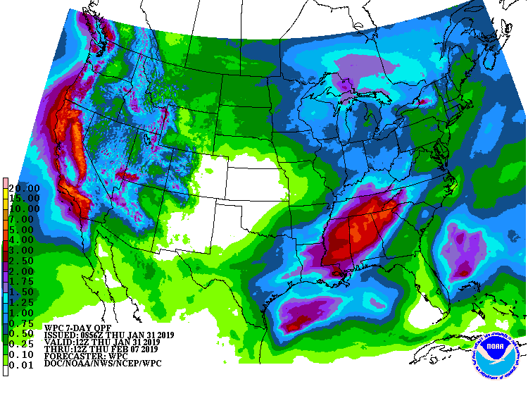
Additional Storm Info:
California: 15-30″ of Snow Friday Afternoon – Saturday Night
* Heavy snow possible. Potential accumulations 15 to 30 inches
  above 7000 feet and west of Highway 395. Up to 1 foot possible
  down to 6000 feet. Winds could gust as high as 70 mph over ridges.
- NOAA Reno, NV
Winter Storm Watch:
URGENT - WINTER WEATHER MESSAGE
National Weather Service Reno NV
212 PM PST Wed Jan 30 2019

Greater Lake Tahoe Area-Mono County-
Including the cities of South Lake Tahoe, Truckee, Bridgeport,
Coleville, Mammoth Lakes, Stateline, and Incline Village

...WINTER STORM WATCH IN EFFECT FROM FRIDAY AFTERNOON THROUGH
LATE SATURDAY NIGHT...

* WHAT...Heavy snow possible. Potential accumulations 15 to 30
  inches above 7000 feet and west of Highway 395. Up to 1 foot
  possible down to 6000 feet. Winds could gust as high as 70 mph
  over ridges.

* WHERE...Greater Lake Tahoe Area and Mono County.

* WHEN...From Friday afternoon through late Saturday night.

* ADDITIONAL DETAILS...Travel could be very difficult. The
  hazardous conditions could impact the Friday evening commute and
  skier traffic into the resorts. An additional storm Sunday into
  Monday could bring another round of heavy snows and travel
  issues.