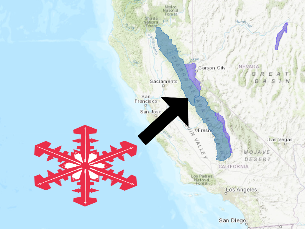
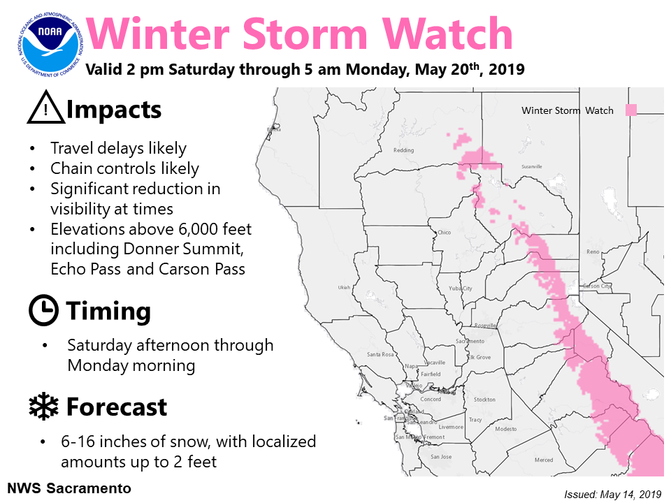
The National Weather Service has issued a Winter Storm Watch for California.
It’s in effect from 2:00pm Saturday afternoon – 5:00am Monday morning.
Heavy snowfall is expected to impact the area throughout that time.
California:
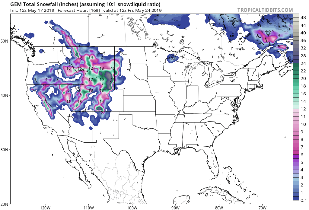
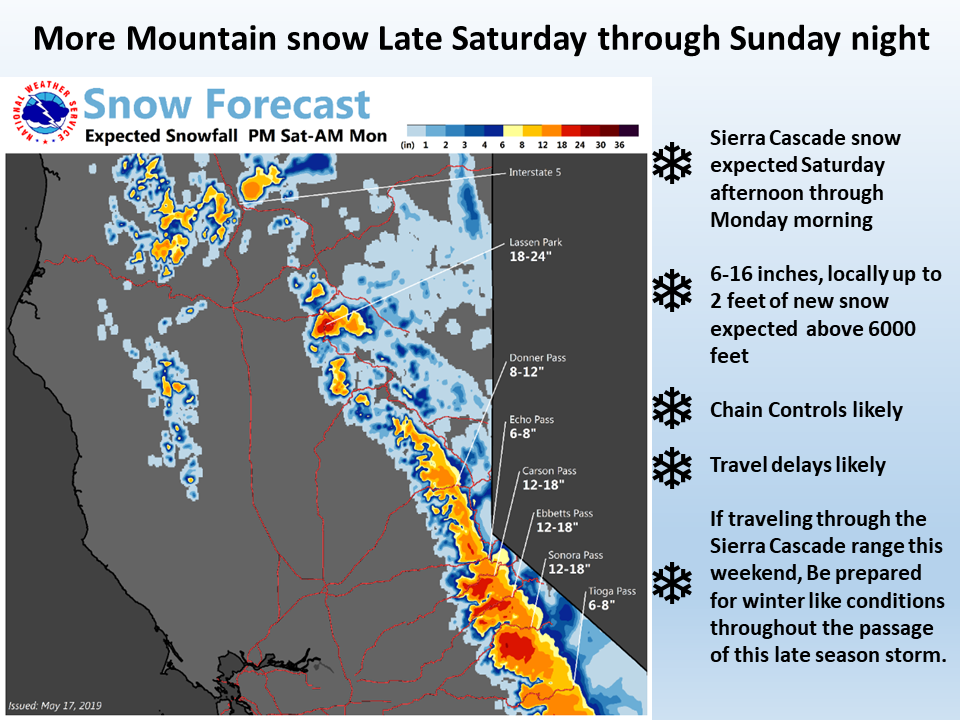
- 6-12+” of Snow Saturday – Sunday Night
“A storm system will bring significant late season snowfall to the mountains Saturday afternoon into early Monday. A winter Storm Watch is now in effect for locations above 6000 feet. Mountain travel is highly discouraged during this time.”
– NOAA Sacramento, CA
The Winter Storm Watch is in effect for areas above 6,000ft.
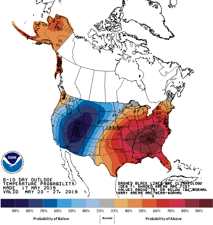
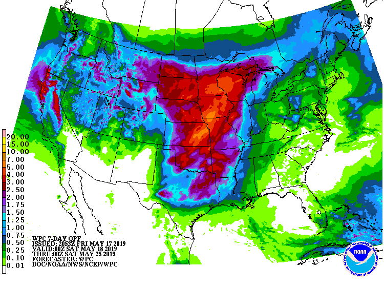
The 6-10 day outlook calls for above average precipitation and below average temperatures in California.
Additional Storm Info:
California: 6-12+” of Snow Saturday – Sunday Night
* Heavy snow possible. Plan on difficult travel conditions.
  Total snow accumulations of 6 to 12 inches at pass levels
  on Interstate 80 and Highway 50, and 3 to 6 inches at lower
  elevations. Localized amounts up to 20 inches, are possible
  over higher peaks.
- NOAA Sacramento, CA
Winter Storm Watch:
URGENT - WINTER WEATHER MESSAGE
National Weather Service Sacramento CA
346 PM PDT Fri May 17 2019

...More late season mountain snow this weekend...

.The next in a series of winter like weather systems will move
through northern California over the weekend. The resulting
mountain snow will bring travel impacts to the Sierra Cascade
range. Expect travel impacts to the northern Sierra and Mt.
Lassen area to begin Saturday afternoon and continue through
early Monday. Weekend mountain travel will likely be hampered by
travel delays and chain controls as snow levels will again drop
below pass levels.

If traveling through the Sierra Cascade range this weekend, be
prepared for winter like conditions. Carry tire chains and check
the latest road and weather reports before departure. More
mountain snowfall will be possible next week.

Western Plumas County/Lassen Park-
West Slope Northern Sierra Nevada-

...WINTER STORM WATCH REMAINS IN EFFECT FROM SATURDAY AFTERNOON
THROUGH LATE SUNDAY NIGHT...

* WHAT...Heavy snow possible. Plan on difficult travel conditions.
  Total snow accumulations of 6 to 12 inches at pass levels on
  Interstate 80 and Highway 50, and 3 to 6 inches at lower
  elevations. Localized amounts up to 20 inches, are possible over
  higher peaks.

* WHERE...Western Plumas County/Lassen Park and West Slope
  Northern Sierra Nevada.

* WHEN...From Saturday afternoon through late Sunday night.

* ADDITIONAL DETAILS...Significant reductions in visibility are
  possible.