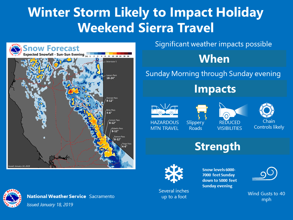
The National Weather Service has issued a Winter Storm Watch for California. It’s in effect from 10:00am Sunday morning – 4:00am Monday morning. High winds and heavy snowfall is forecasted to impact the area throughout that time.
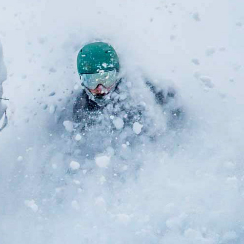
It just won’t stop snowing in California, as some resorts have received 6+ FEET of snow in the past 4 days.
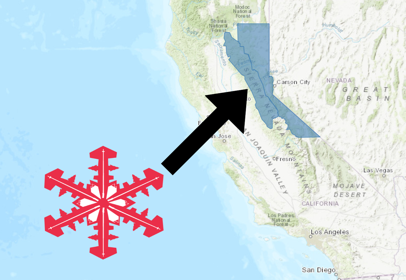
California:
- 8-18+” of Snow Above 7,000ft On Sunday
“A moderately strong weather system will be moving through northern California on Sunday. This system will bring several inches of snowfall to the Sierra passes right in the middle of the MLK JR holiday weekend. Be prepared for winter travel if going through the Sierra on Sunday.”
– NOAA Sacramento, CA
Snow levels will hover between 6,000ft -7,000ft on Sunday, before dropping down to 5,000ft Sunday evening.
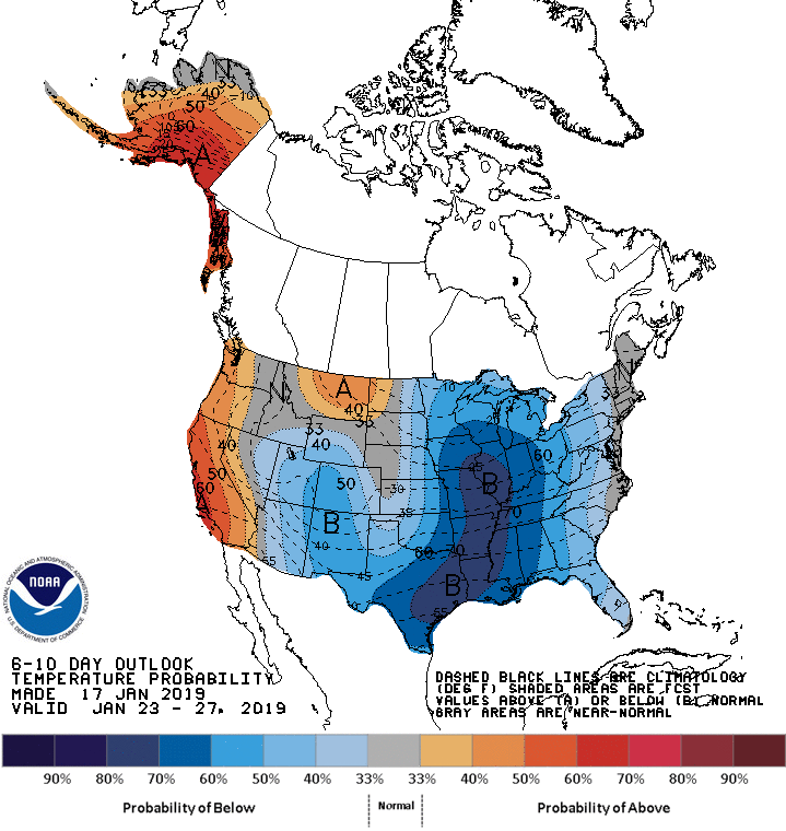
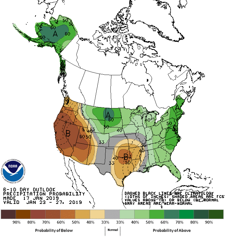
The 6-10 day outlook calls for above average temperatures and below average precipitation in California.
Additional Storm Info:
California: 8-18+” of Snow Above 7,000ft On Sunday
* Heavy snow possible, especially above 7000 feet. Total snow
  accumulations of 3 to 8 inches, except 8 to 18 inches above
  7000 feet possible. Some localized areas could see amounts up
  to 2 feet along the Sierra Crest. Winds could gust as high as
  80 mph over the ridges.
- NOAA Reno, NV
Winter Storm Watch:
URGENT - WINTER WEATHER MESSAGE
National Weather Service Reno NV
1204 PM PST Fri Jan 18 2019

Greater Lake Tahoe Area-
Including the cities of South Lake Tahoe, Truckee, Stateline,
and Incline Village

...WINTER STORM WATCH IN EFFECT FROM SUNDAY MORNING THROUGH LATE
SUNDAY NIGHT...

* WHAT...Heavy snow possible, especially above 7000 feet. Total
  snow accumulations of 3 to 8 inches, except 8 to 18 inches above
  7000 feet possible. Some localized areas could see amounts up
  to 2 feet along the Sierra Crest. Winds could gust as high as 80
  mph over the ridges.

* WHERE...Greater Lake Tahoe Area.

* WHEN...From Sunday morning through late Sunday night.

* ADDITIONAL DETAILS...Travel could be difficult at times. Strong
  winds could cause damage to snow laden trees.