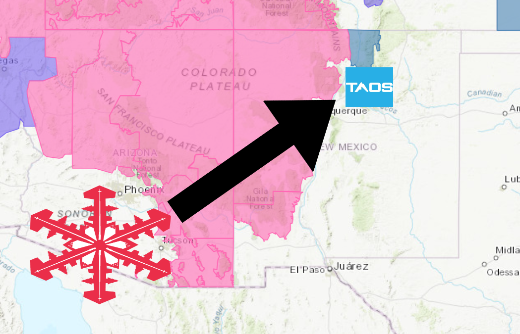
The National Weather Service has issued a Winter Storm Watch for Taos Ski Valley, NM. It’s in effect Today – early Saturday morning. High winds and heavy snowfall are forecasted to impact the area throughout that time.
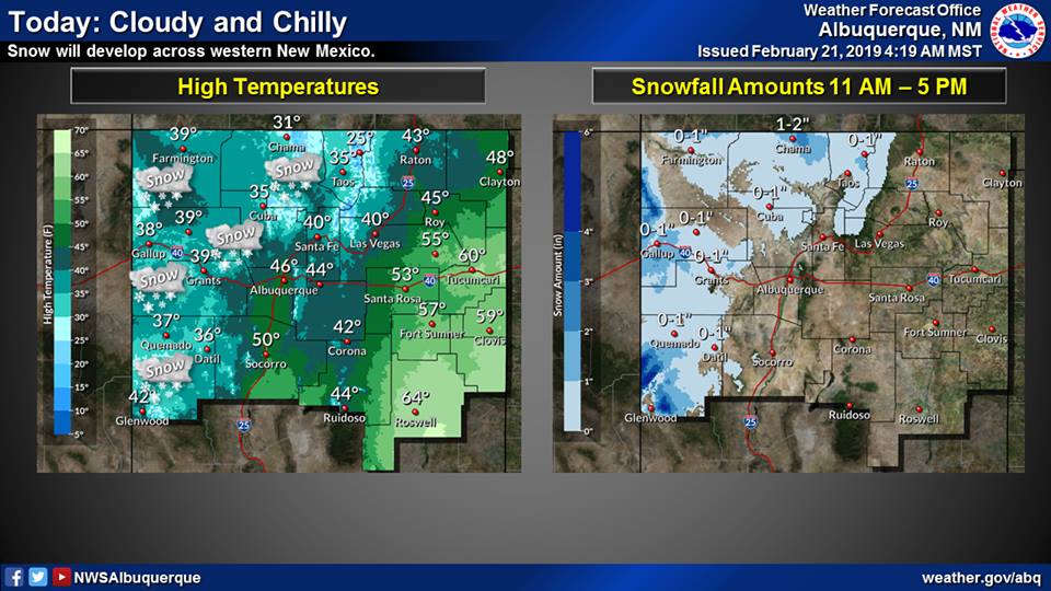
“The second winter storm of the week will begin impacting western New Mexico today, and then will slowly progress eastward across the state Friday night through Saturday morning. Moderate to heavy snowfall accumulations are expected across western and north central New Mexico with lighter amounts across the rest of northern and central New Mexico. The highest accumulations are expected in the higher elevations of western and north central New Mexico with totals ranging between 10 and 20 inches and locally higher amounts possible.”
– NOAA Albuquerque, NM
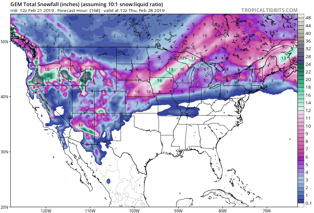
The highest accumulations are forecasted to occur at elevations greater than 7,500ft.
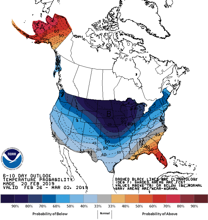
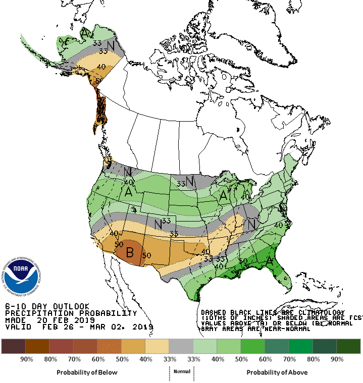
The 6-10 day outlook calls for below average temperatures and below average precipitation in New Mexico.
Additional Storm Info:

New Mexico: 8-16″ of Snow Today – Friday Night
* Heavy snow possible. Total snow accumulations of 4 to 8 inches
  possible with 8 to 16 inches above 7500 feet.
- NOAA Albuquerque, NM
Winter Storm Watch:
URGENT - WINTER WEATHER MESSAGE
National Weather Service Albuquerque NM
310 AM MST Thu Feb 21 2019

...MAJOR WINTER STORM TODAY THROUGH FRIDAY NIGHT...

.A major winter storm will begin impacting western New Mexico
today, then move east across the state Friday night. Significant
snowfall totals are likely, especially along the Continental
Divide and in the Tusas, Jemez, Sangre de Cristos and Southwest
Mountains. This storm will likely cause significant travel impacts
Thursday night through Friday night across central and western
New Mexico.

West Slopes Sangre de Cristo Mountains-
Northern Sangre de Cristos above 9500 feet/Red River-
Southern Sangre de Cristos above 9500 feet-
Upper Rio Grande Valley-

...WINTER STORM WATCH IN EFFECT FROM THIS AFTERNOON THROUGH LATE
FRIDAY NIGHT...

* WHAT...Heavy snow possible. Total snow accumulations of 4 to 8
  inches possible with 8 to 16 inches above 7500 feet. Winds
  could gust as high as 35 mph.

* WHERE...West Slopes Sangre de Cristo Mountains, Northern
  Sangre de Cristos above 9500 feet including Red River,
  Southern Sangre de Cristos above 9500 feet and Upper Rio
  Grande Valley.

* WHEN...From this late this afternoon through late Friday night.

* ADDITIONAL DETAILS...Travel could be very difficult to
  impossible on snowpacked and icy roadways. Periods of low
  visibility are likely in falling and blowing snow.