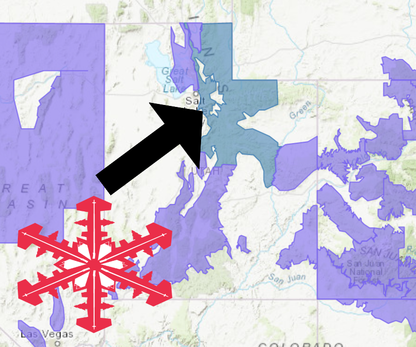
The National Weather Service has issued a Winter Storm Watch for Utah. It’s in effect from Thursday morning – Friday afternoon. High winds and heavy snowfall are forecasted to impact the area throughout this time.
Utah:
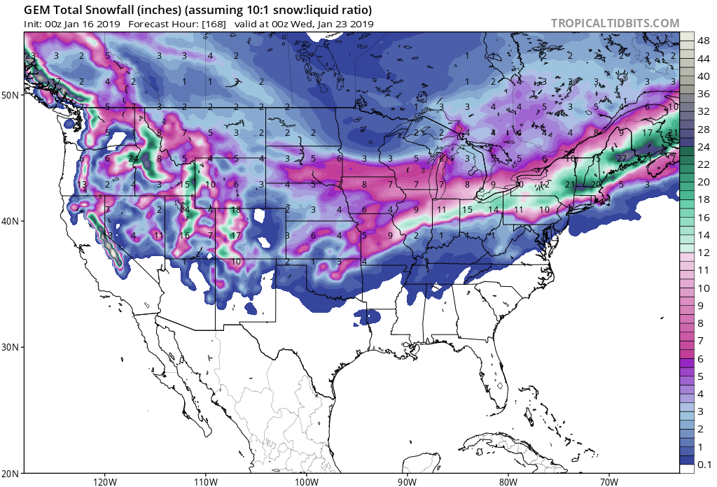
- 1-2+ FEET of Snow Thursday – Friday
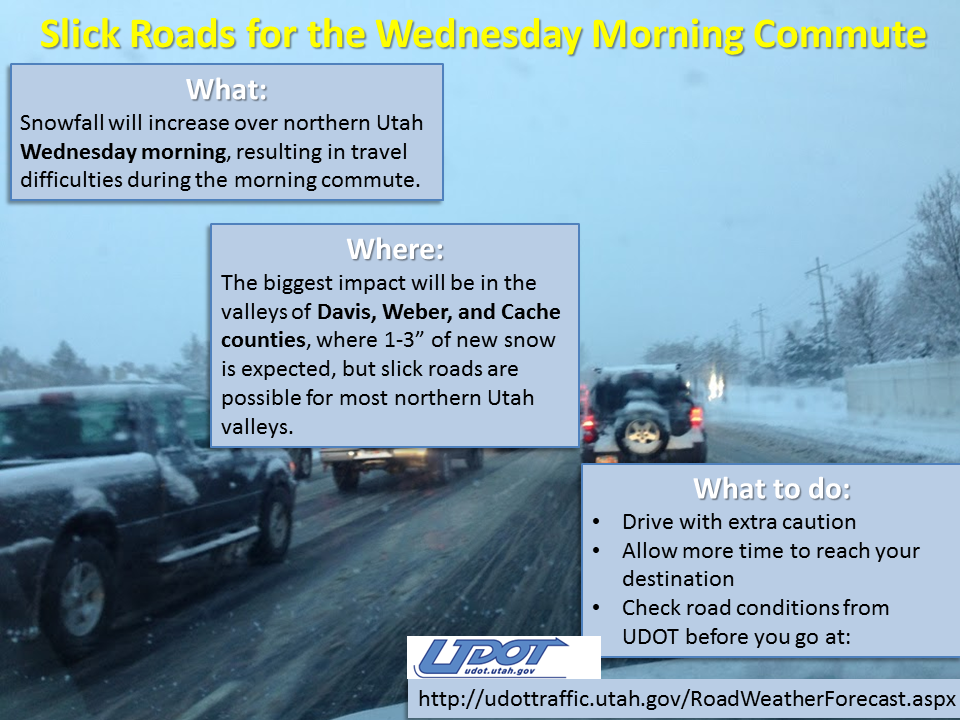
“A weather system moving through the area early this morning will continue to bring snow to portions of the area, and will have an impact on the morning commute along the Wasatch Front. The next stronger storm system will then begin to impact northern Utah beginning with valley rain and mountain snow on Thursday. Significant snowfall is expected across the northern mountains through Friday with this storm.”
– NOAA Salt Lake City, UT
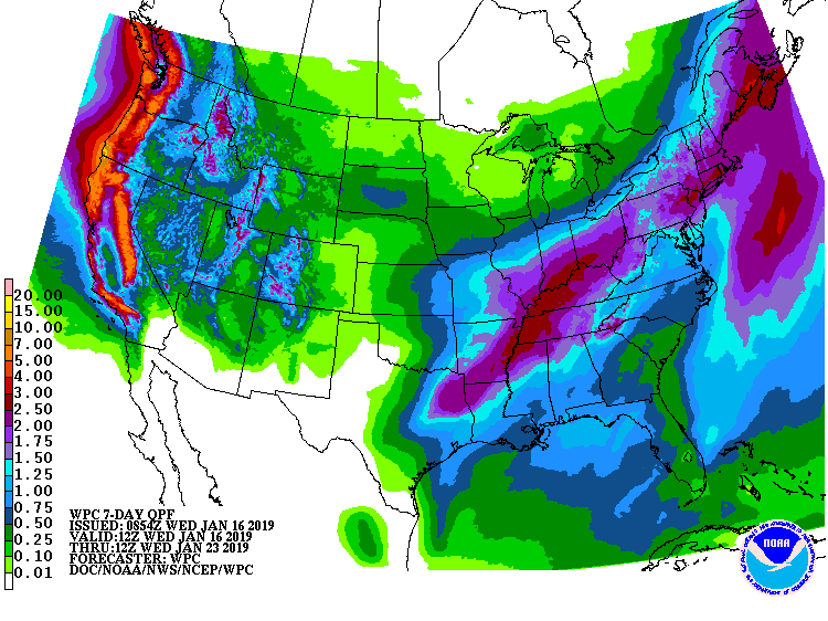
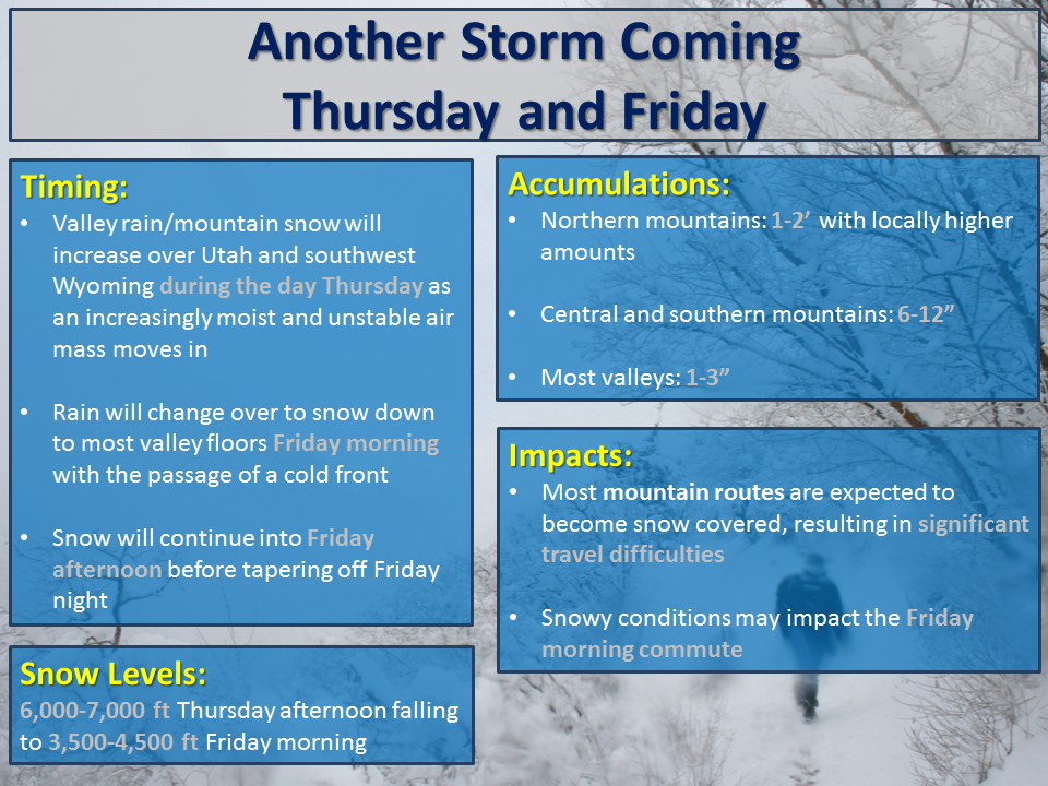
Snow levels are forecasted to start out around 6,000ft – 7,000ft before dropping down to 3,500 – 4,500ft on Friday morning.
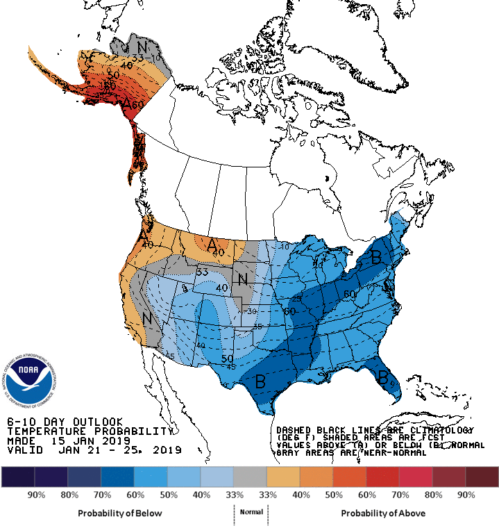
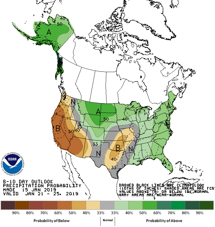
The 6-10 day outlook calls for below average temperatures and below average precipitation in Utah.
Additional Storm Info:
Utah: 1-2+ FEET of Snow Thursday – Friday
* Total snow accumulations of 1 to 2 feet
  with locally higher amounts possible.
- NOAA Salt Lake City, UT
Winter Storm Watch:
URGENT - WINTER WEATHER MESSAGE
National Weather Service Salt Lake City UT
419 AM MST Wed Jan 16 2019

...A SERIES OF STORM SYSTEMS WILL CONTINUE TO IMPACT THE AREA
THROUGH FRIDAY...

.A weather system moving through the area early this morning will
continue to bring snow to portions of the area, and will have an
impact on the morning commute along the Wasatch Front. The next
stronger storm system will then begin to impact northern Utah
beginning with valley rain and mountain snow on Thursday.
Significant snowfall is expected across the northern mountains
through Friday with this storm.

Wasatch Mountains I-80 North-Wasatch Mountains South of I-80-
Western Uinta Mountains-Wasatch Plateau/Book Cliffs-
Including the cities of Woodruff, Randolph, Alta, Brighton,
Mirror Lake Highway, and Scofield
...WINTER STORM WATCH REMAINS IN EFFECT FROM THURSDAY MORNING
THROUGH FRIDAY AFTERNOON...

* WHAT...Heavy snow possible. Total snow accumulations of 1 to 2
  feet with locally higher amounts possible. Winds could gust as
  high as 45 mph.

* WHERE...The Wasatch and western Uinta Mountains and the
  Wasatch Plateau and Book Cliffs.

* WHEN...From Thursday morning through Friday afternoon.

* ADDITIONAL DETAILS...Travel could be very difficult. Roads
  across the northern mountains of Utah may become snow-packed.
  Gusty winds may cause blowing and drifting of snow.