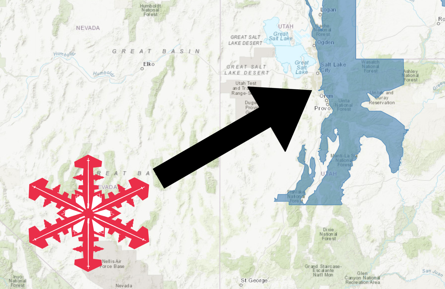
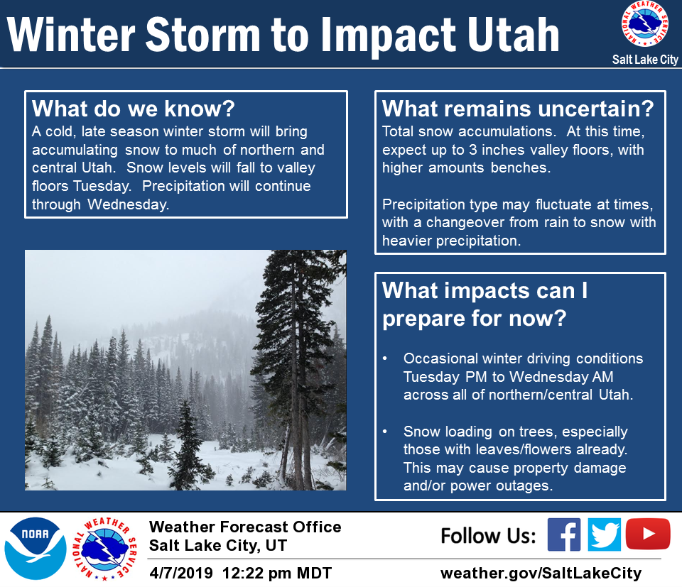
The National Weather Service has issued a Winter Storm Watch for Utah.
It’s in effect from 12:00pm Tuesday – 10:00am Thursday.
Heavy snowfall is expected to impact the area throughout that time.
Utah:
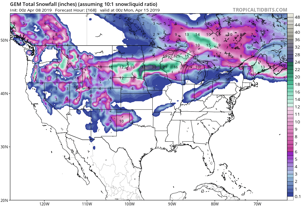
- 1-2 FEET Of Snow Tuesday – Thursday Morning
“*Return of Winter Alert* A late season winter storm is expected to impact portions of northern and central Utah later Tuesday into early Thursday. Snow levels are expected to fall to valley floors”
– NOAA Salt Lake City, UT
Snow levels are expected to fall to valley floors.
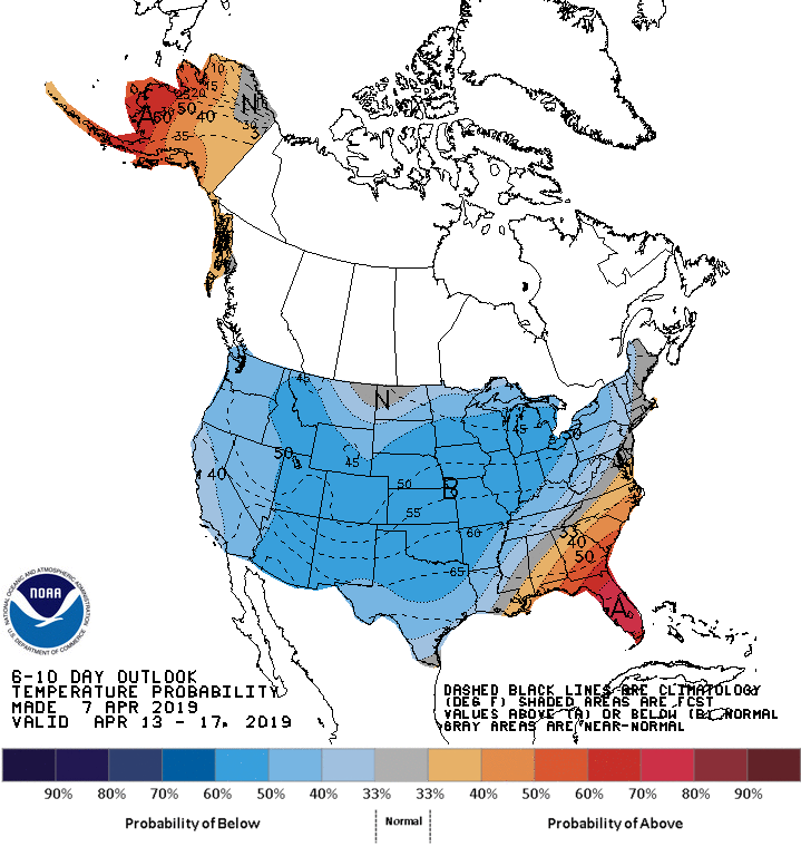
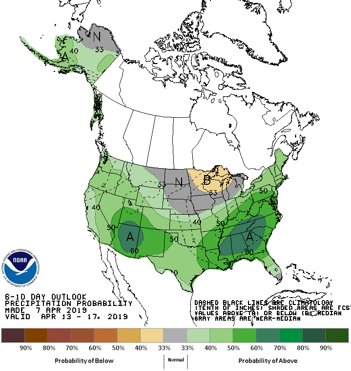
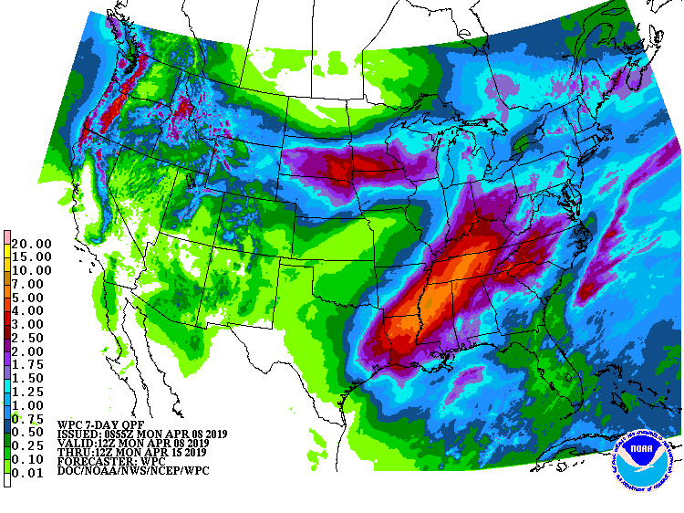
The 6-10 day outlook calls for above average precipitation and below average temperatures in Utah.
Additional Storm Info:
Utah: 1-2 FEET Possible Tuesday – Thursday Morning
* Heavy snow possible. Total snow accumulations of 1 to 2 feet
  possible in the mountains and 4 to 9 inches in the Wasatch
  Mountain Valleys.
- NOAA Salt Lake City, UT
Winter Storm Watch:
URGENT - WINTER WEATHER MESSAGE
National Weather Service Salt Lake City UT
446 AM MDT Mon Apr 8 2019

...STRONG COLD FRONT MOVING THROUGH UTAH MID WEEK...

.A strong cold front will enter northwest Utah Tuesday and sweep
east across the state Tuesday night and Wednesday. Intense snow
showers will develop along the frontal boundary followed by a
prolonged period of steady snow across northern and central
Utah`s mountains. The heaviest snows are expected across the
central and southern Wasatch Mountains and the central Utah
mountains.

Wasatch Mountain Valleys-Wasatch Mountains I-80 North-
Wasatch Mountains South of I-80-Western Uinta Mountains-
Wasatch Plateau/Book Cliffs-Central Mountains-
Including the cities of Huntsville, Park City, Heber City,
Woodruff, Randolph, Alta, Brighton, Mirror Lake Highway,
Scofield, Cove Fort, Koosharem, and Fish Lake

...WINTER STORM WATCH REMAINS IN EFFECT FROM TUESDAY AFTERNOON
THROUGH THURSDAY MORNING...

* WHAT...Heavy snow possible. Total snow accumulations of 1 to 2
  feet possible in the mountains and 4 to 9 inches in the Wasatch
  Mountain Valleys.

* WHERE...Wasatch Mountain Valleys, Wasatch Mountains I-80
  North, Wasatch Mountains South of I-80, Western Uinta
  Mountains, Wasatch Plateau/Book Cliffs and Central Mountains.

* WHEN...From Tuesday afternoon through Thursday morning.

* ADDITIONAL DETAILS...Travel could be very difficult through
  mountain passes and routes.