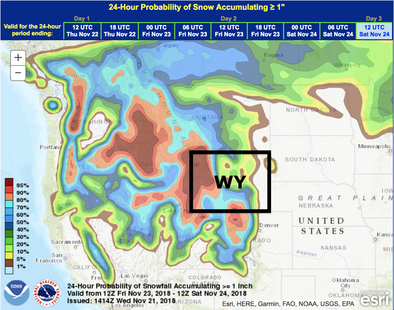
The National Weather Service has issued a Winter Storm Watch for Wyoming. It’s in effect from early Friday morning through Saturday. High winds and heavy snowfall are forecasted to impact the area throughout that time.
Wyoming:
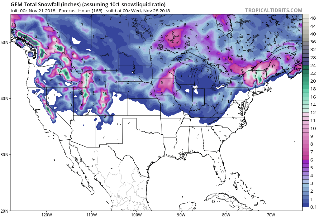
- 12-24″ of Snow Friday – Saturday
“A strong winter storm will impact western portions of Wyoming Friday and Saturday. This storm is expected to produce significant snowfall, especially Friday night.”
– NOAA Riverton, WY
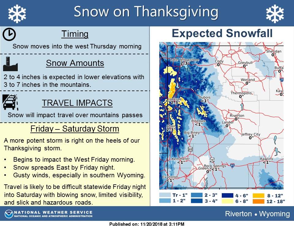
Grand Targhee Resort, WY opened for the season on Friday, November 16th, 2018.
Jackson Hole Mountain Resort, WY opens for the season on Saturday, November 24th, 2018.
Snow levels will start out around 5,000ft on Friday before dropping below 2,000ft on Saturday.
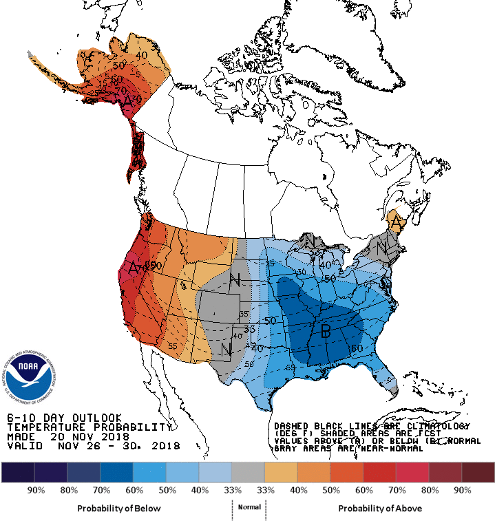
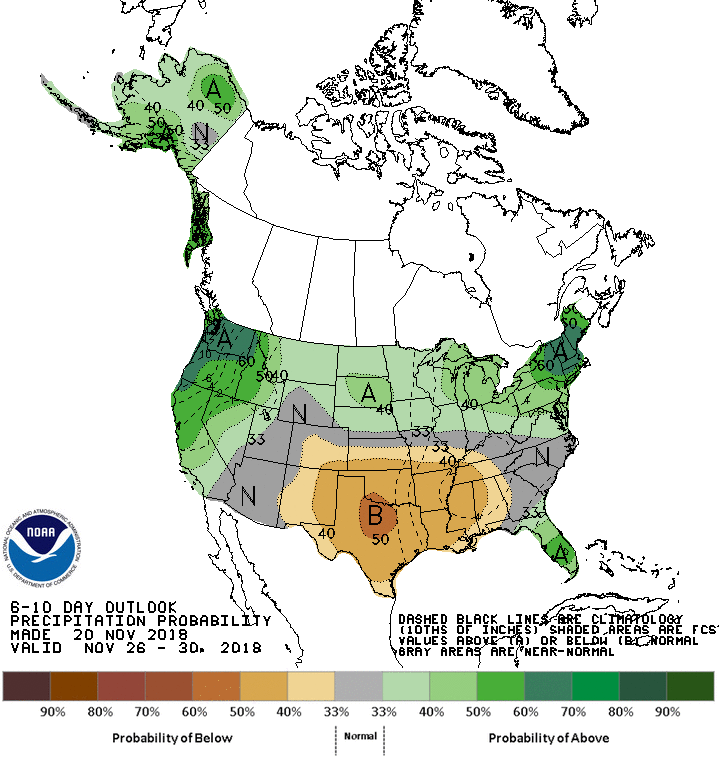
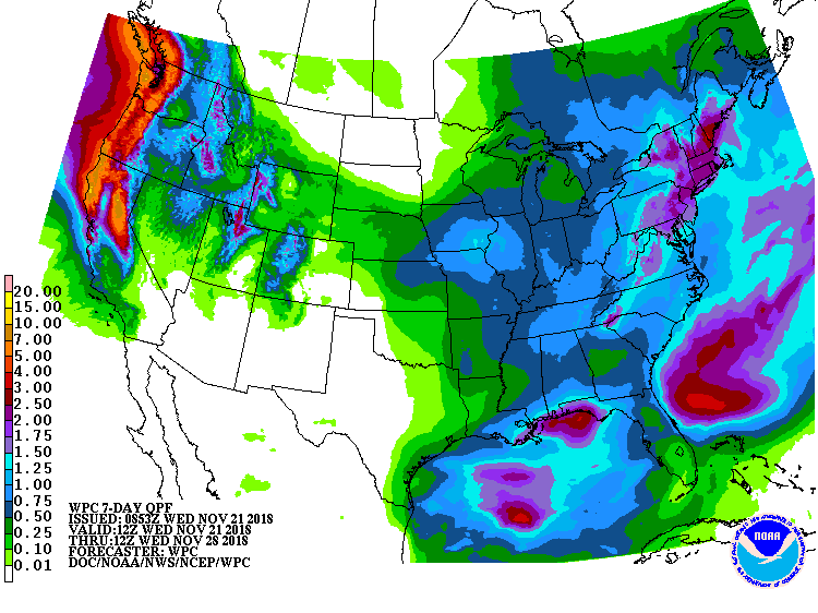
The 6-10 day outlook calls for above average precipitation and above average temperatures in Wyoming.
Additional Storm Info:
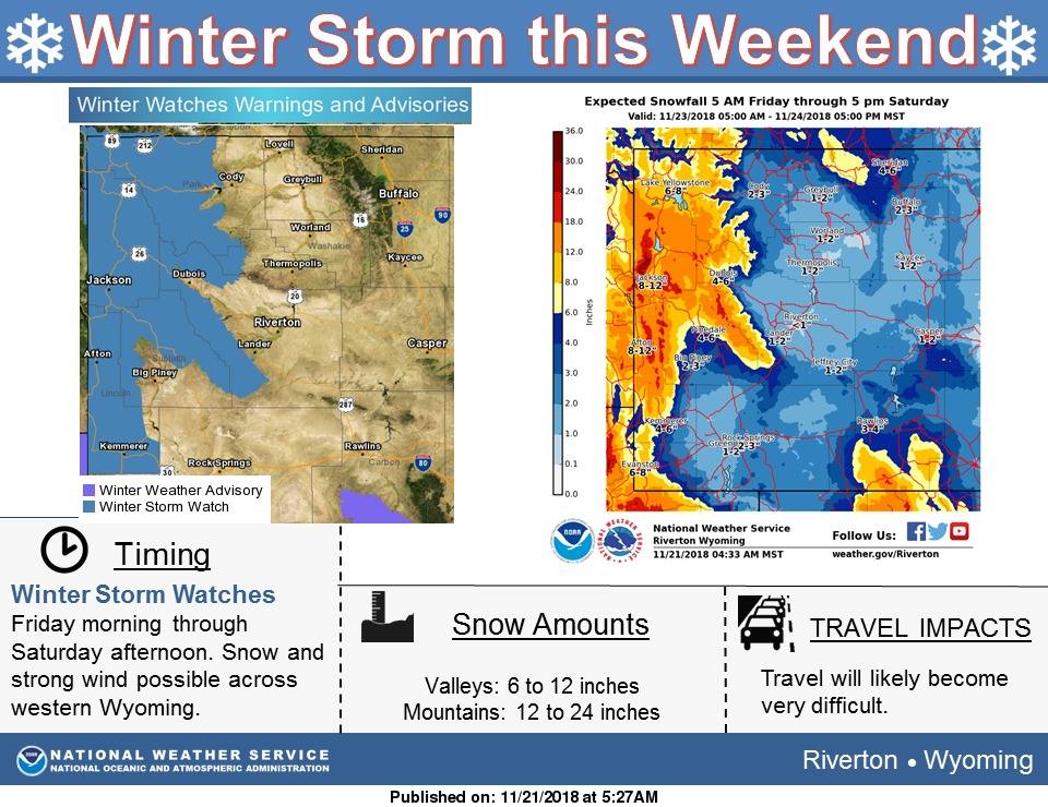
Wyoming: 12-24″ of Snow Friday – Saturday
* Heavy snow possible. Total snow accumulations of
  12 to 24 inches possible. Winds could gust as high
  as 35 mph Friday night.
- NOAA Riverton, WY Today
Winter Storm Watch:
URGENT - WINTER WEATHER MESSAGE
National Weather Service Riverton WY
242 AM MST Wed Nov 21 2018

...A Major Winter Storm to impact western Wyoming for the holiday
weekend...

.A strong winter storm will impact western portions of Wyoming
Friday and Saturday. This storm is expected to produce
significant snowfall, especially Friday night.

Teton and Gros Ventre Mountains-Salt River and Wyoming Ranges-
Including the cities of Alta and Fossil Butte National Monument

...WINTER STORM WATCH IN EFFECT FROM LATE THURSDAY NIGHT THROUGH
SATURDAY MORNING...

* WHAT...Heavy snow possible. Total snow accumulations of 12 to 24
  inches possible. Winds could gust as high as 35 mph Friday night.

* WHERE...Teton and Gros Ventre Mountains and Salt River and
  Wyoming Ranges.

* WHEN...From early Friday morning through Saturday morning.

* ADDITIONAL DETAILS...Travel could be very difficult to
  impossible. Patchy blowing snow could significantly reduce
  visibility. The hazardous conditions could impact the morning
  and evening commutes.