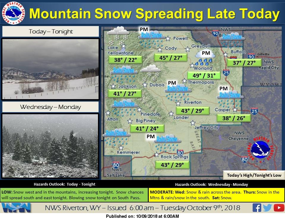
The National Weather Service has issued a Winter Storm Watch for Wyoming. It’s in effect Tonight – Wednesday Night. High winds and persistent snowfall is forecasted to impact the area. After this storm passes, there’s additional chances for snow through the weekend.
“A rapidly moving, potent winter storm will follow on the heels of the rain and snow event that impacted Western and Central Wyoming during the last few days. This weather system has colder air with it than the last weather system and will likely contain stronger winds.“
– NOAA Riverton, WY Today
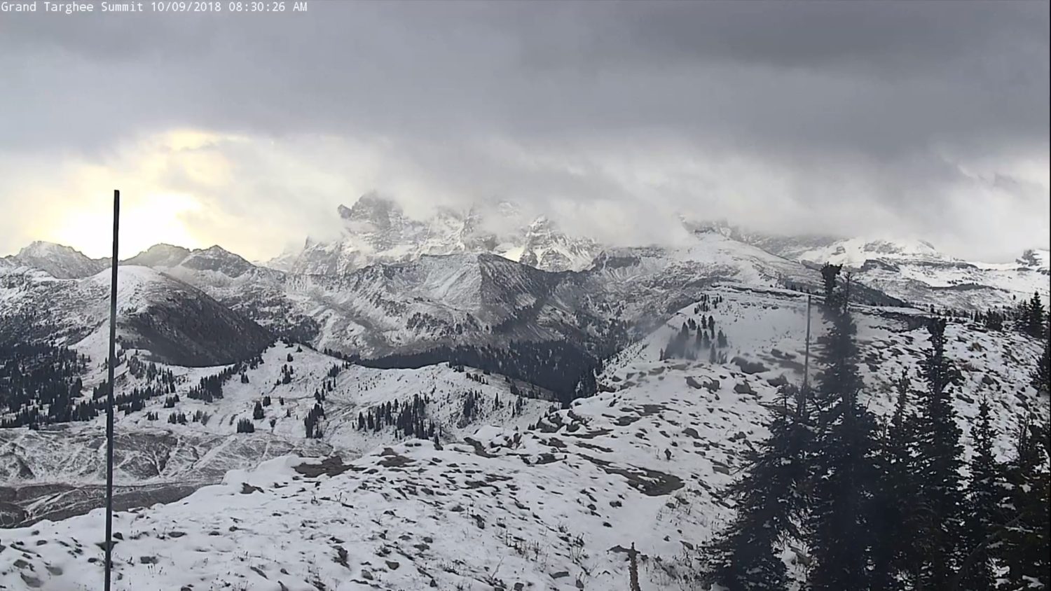
Snow is expected to fall in the mountain valleys, but the highest accumulations are forecasted to be in the mountains.
Additional Storm Info:
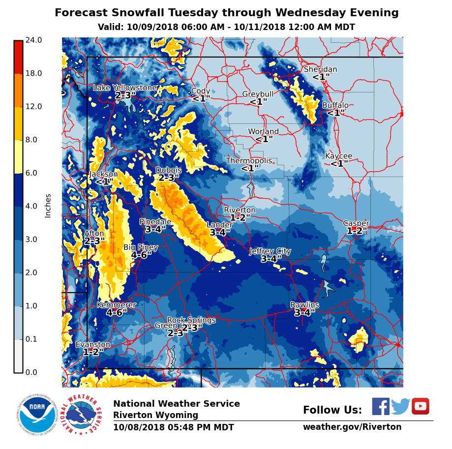
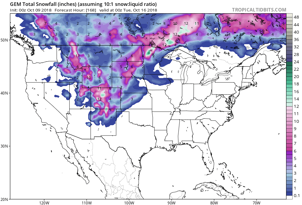
Wyoming: 3-6+” of Snow Tonight – Wednesday Night
* Total snow accumulations of 3 to 6 inches,
  with localized amounts up to 9 inches, possible.
- NOAA Riverton, WY
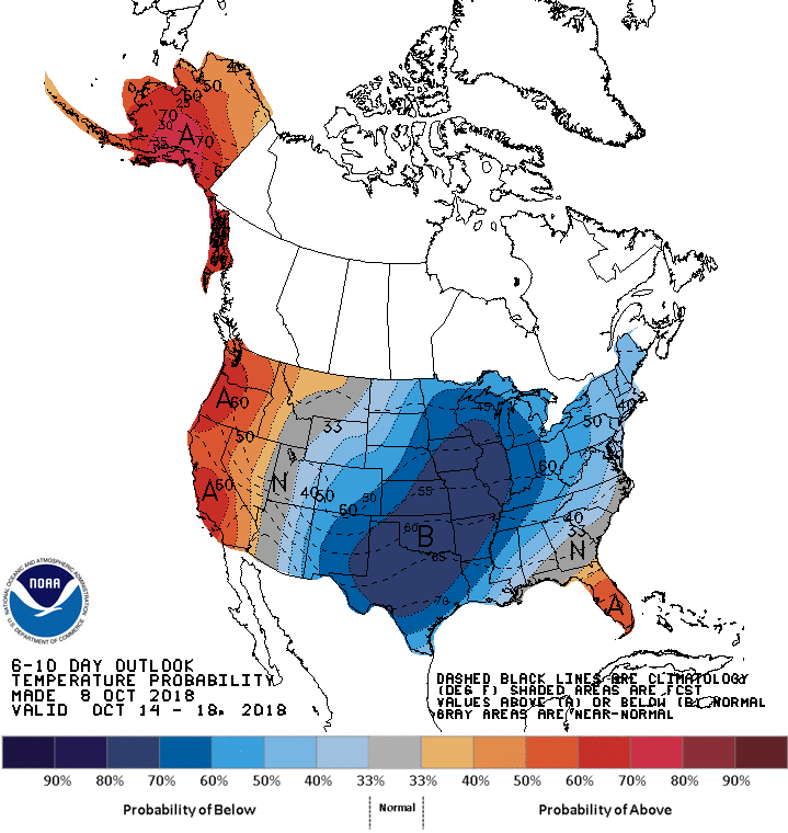
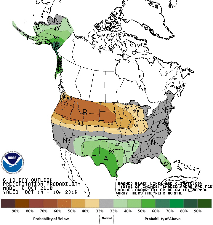
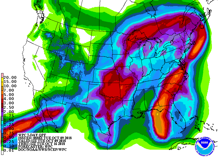
The 6-10 day outlook calls for below average temperatures and below average precipitation in Wyoming.
WY Winter Storm Watch:
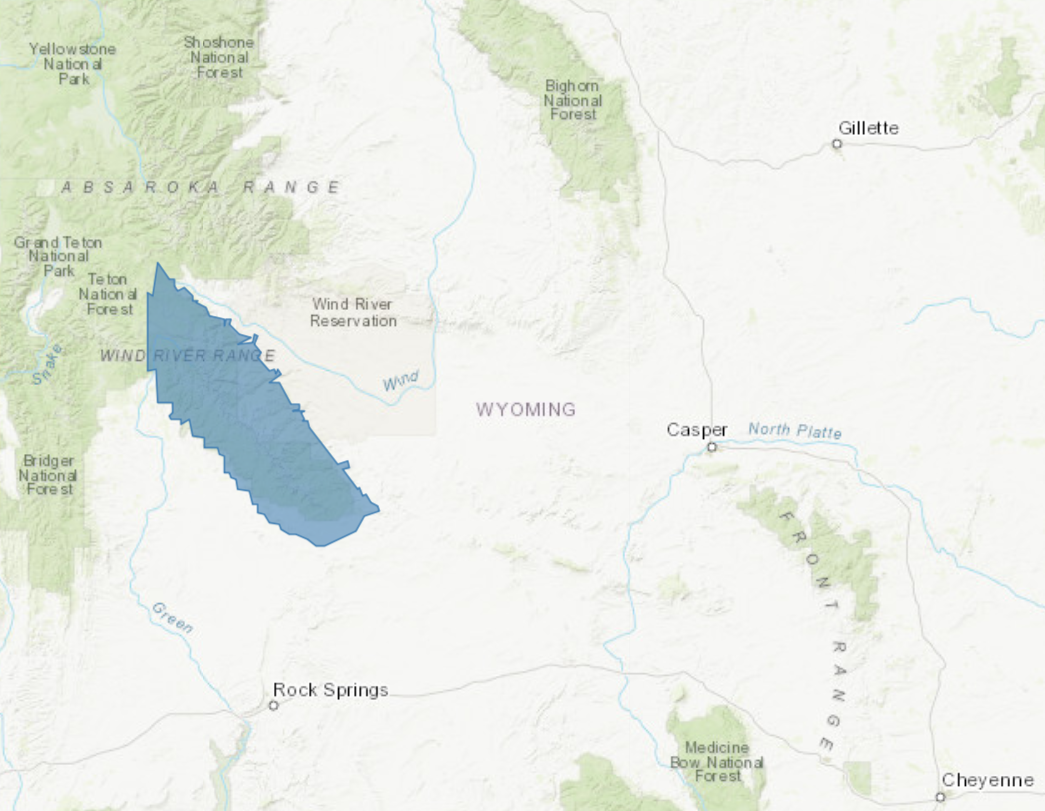
URGENT - WINTER WEATHER MESSAGE
National Weather Service Riverton WY
247 AM MDT Tue Oct 9 2018

...ANOTHER EARLY WINTER STORM IS MAY IMPACT THE WIND RIVER
MOUNTAINS INCLUDING SOUTH PASS LATE TONIGHT THROUGH WEDNESDAY
EVENING...

.A rapidly moving, potent winter storm will follow on the heels
of the rain and snow event that impacted Western and Central
Wyoming during the last few days. This weather system has colder
air with it than the last weather system and will likely contain
stronger winds.

Wind River Mountains West-Wind River Mountains East-
Including the city of Atlantic City

...WINTER STORM WATCH IN EFFECT FROM LATE TONIGHT THROUGH
WEDNESDAY EVENING...

* WHAT...Heavy snow possible. Total snow accumulations of 3 to 6
  inches, with localized amounts up to 9 inches, possible.

* WHERE...Wind River Mountains West and Wind River Mountains East
  including South Pass.

* WHEN...From late tonight through Wednesday evening.

* ADDITIONAL DETAILS...Plan on difficult travel conditions,
  including during the morning commute on Wednesday. Significant
  reductions in visibility are possible due to significant blowing
  and drifting snow on South Pass with northeast winds of 40 mph
  possible.