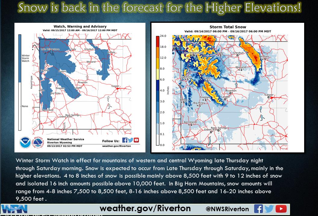
NOAA has issued a Winter Storm Watch for Wyoming’s Tetons and more WY locations for Thursday night through Saturday morning.
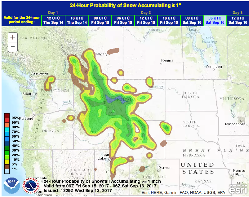
Up to 20″ of snowfall is forecast above 9,500′ (see map above).
* SNOW AMOUNTS...4 to 8 inches possible above 8500 feet and 8 to
  12 inches above 10000 feet, along with local amounts of 16
  inches possible."
- NOAA Riverton, WY today
Sounds like it’ll be a helluva good storm!
An unseasonably cold weather system will swing southeast from
British Columbia toward Wyoming at the end of this week. A
moisture laden stream of Pacific moisture will feed this storm
system which may result in very abundant snowfall amounts for the
mountains of Western and Central Wyoming from late Thursday night
through Saturday morning.
- NOAA Riverton, WY today
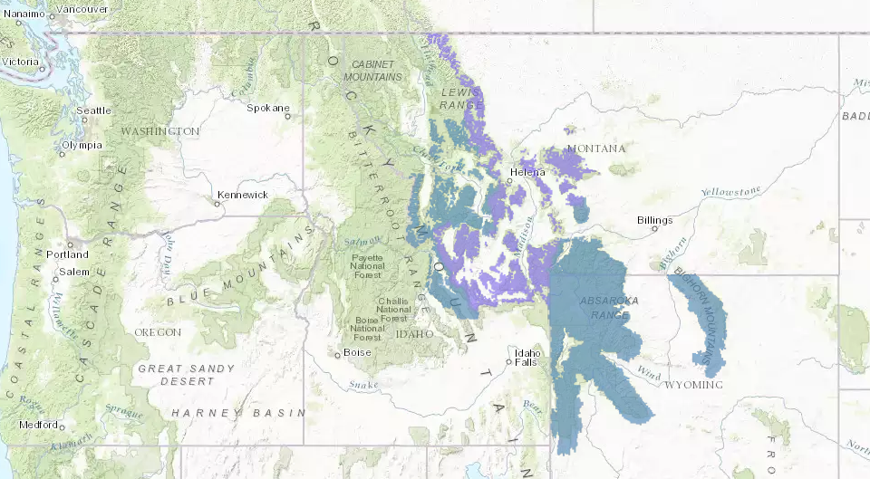
Winter advisories have also been issued for Montana and Idaho.
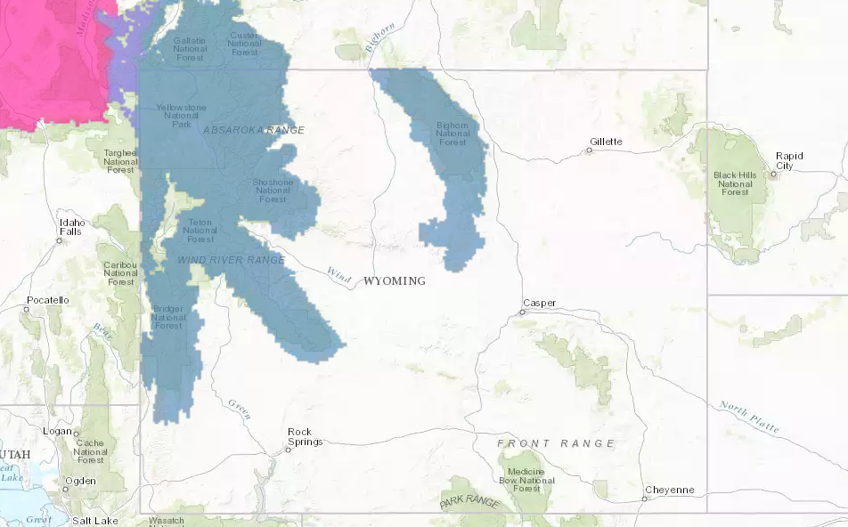
Winter Storm Watch for Wyoming:
URGENT - WINTER WEATHER MESSAGE
National Weather Service Riverton WY
321 PM MDT Wed Sep 13 2017

...Early season snowstorm poised for the Western and Central
Wyoming Mountains from late Thursday night through Saturday
morning...

.An unseasonably cold weather system will swing southeast from
British Columbia toward Wyoming at the end of this week. A
moisture laden stream of Pacific moisture will feed this storm
system which may result in very abundant snowfall amounts for the
mountains of Western and Central Wyoming from late Thursday night
through Saturday morning.

Yellowstone National Park-Teton and Gros Ventre Mountains-
Including the cities of Lake, Mammoth, and Old Faithful
321 PM MDT Wed Sep 13 2017

...WINTER STORM WATCH IN EFFECT FROM LATE THURSDAY NIGHT THROUGH
SATURDAY MORNING...

The National Weather Service in Riverton has issued a Winter
Storm Watch, which is in effect from late Thursday night through
Saturday morning.

* TIMING...Rainfall along and behind a strong cold front will turn
  to snowfall at elevations above 8000 feet after midnight
  Thursday night, with the snow level gradually lowering to 6000
  feet by late Friday. The snowfall will be heavy at times through
  Saturday morning.

* SNOW AMOUNTS...4 to 8 inches possible above 8500 feet and 8 to
  12 inches above 10000 feet, along with local amounts of 16
  inches possible.

* MAIN IMPACT...Togwotee and Teton Pass as well some elevated
  roads in Yellowstone Park may become slick and snow covered
  making travel difficult.

* OTHER IMPACTS...Hikers and campers should prepare for sharply
  colder weather along with potentially significant snow
  accumulations on hiking trails.