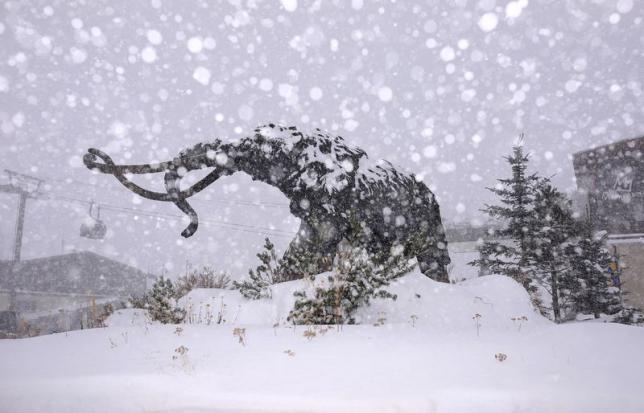
This is hard to believe… It’s June and NOAA has issued a Winter Weather Advisory for the High Sierra with up to 8″ of snowfall forecast tomorrow.
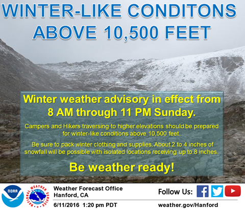
* SNOW ACCUMULATION...2-4 INCHES ABOVE 10,500 FEET. ISOLATED
  LOCATIONS COULD SEE AS MUCH AS 8 INCHES OF SNOW. A DUSTING OF
  SNOW WILL BE POSSIBLE JUST BELOW 10,000 FEET. - NOAA Hanford, CA today
We’ve still got our fingers crossed for a mini powder day at Mammoth in the coming days. Mammoth is one of only 3 ski resorts still open in North America and they won’t close until the 4th of July.
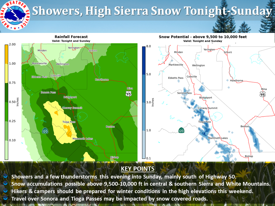
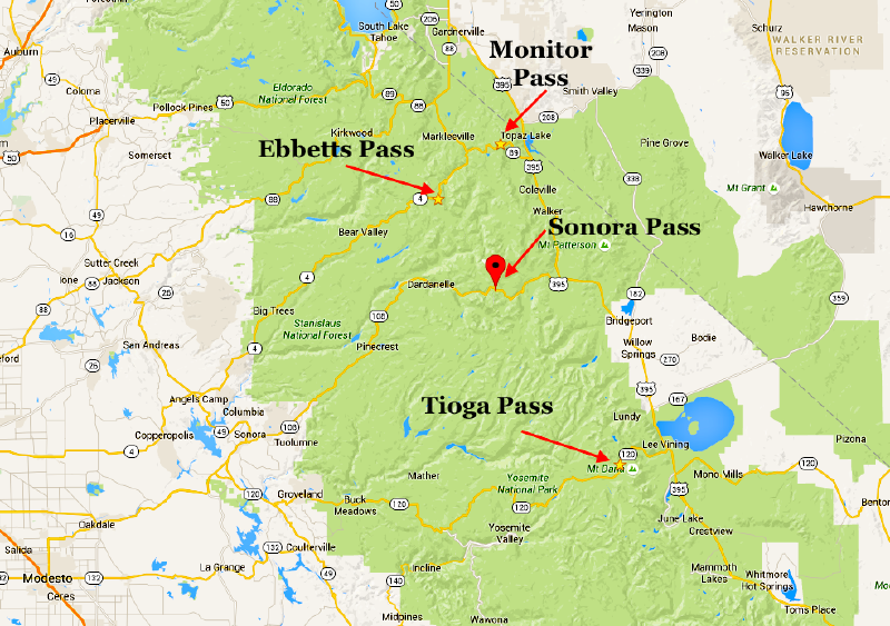
This could also mean a great backcountry powder day off the High Sierra passes: 9,624′ Sonora Pass and 9,943′ Tioga Pass. Heads up for avalanches, people!
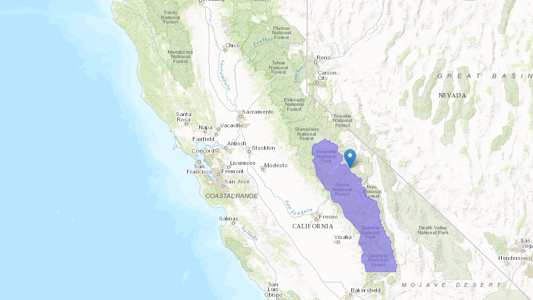
“Winter Weather Advisory has been issued for locations above 10,500 feet along the southern Sierra Nevada especially north of Sequoia National Park. Snowfall of 2 to 4 inches will be possible in many locations and could be as high as 8 inches in a few isolated locations. If camping and hiking in these areas be sure to properly prepare for winter-like conditions by bringing winter clothing and supplies.” – NOAA Hanford, CA today
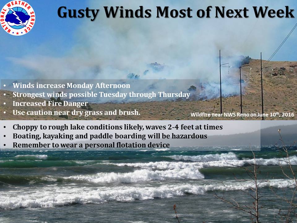
Lake Tahoe should also have some surfable waves as it did earlier this week. Very rare for June.
WINTER WEATHER ADVISORY for CALIFORNIA:
URGENT - WINTER WEATHER MESSAGE
NATIONAL WEATHER SERVICE HANFORD CA
114 PM PDT SAT JUN 11 2016

SIERRA NEVADA FROM YOSEMITE TO KINGS CANYON-
TULARE COUNTY MOUNTAINS-
INCLUDING THE CITIES OF...DEVILS POSTPILE...FLORENCE LAKE...
LAKE THOMAS EDISON...TUOLUMNE MEADOWS...BASS LAKE...FISH CAMP...
WAWONA...CAMP NELSON...GIANT FOREST...LODGEPOLE...GRANT GROVE...
JOHNSONDALE

...WINTER WEATHER ADVISORY IN EFFECT FROM 8 AM TO 11 PM PDT
SUNDAY...

THE NATIONAL WEATHER SERVICE IN HANFORD HAS ISSUED A WINTER
WEATHER ADVISORY FOR SNOW ABOVE 10,500 FEET...WHICH IS IN EFFECT
FROM 8 AM TO 11 PM PDT SUNDAY.

* TIMING...8 AM THROUGH 11 PM SUNDAY.

* SNOW ACCUMULATION...2-4 INCHES ABOVE 10,500 FEET. ISOLATED
  LOCATIONS COULD SEE AS MUCH AS 8 INCHES OF SNOW. A DUSTING OF
  SNOW WILL BE POSSIBLE JUST BELOW 10,000 FEET.

* MAIN IMPACT...RAPIDLY CHANGING WEATHER CONDITIONS FOR HIKERS IN
  THE SIERRA NEVADA ABOVE 10,500 FEET MAINLY FROM SEQUOIA NATIONAL
  PARK NORTHWARD. HIKERS SHOULD PREPARE FOR WINTER LIKE
  CONDITIONS.
hey snow, whoever. california has snow potential in teh sierras at anytime . had you any actual snow acumen you would know that we can get sudden snow flurries any time of year normally. NOW whenyou factor in that my state CAN get 50 feet a year and will snow first in the season and LAST in the season you would know this. come on. do your homework. it isnt a big deal except to you , it seems. any halfway seasoned hiker around here carries snow provision, regardless of our drought. it could also be sleet, or cold freezing rain. but come on , quit that. quit that right now and be snow savvy.
Hey Jim, what upset you about this post? Which words? thanks