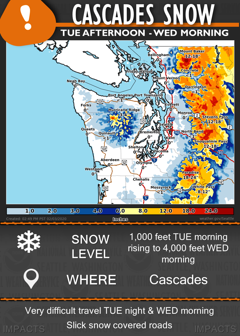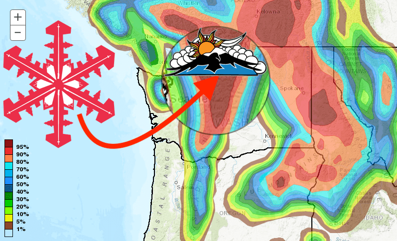
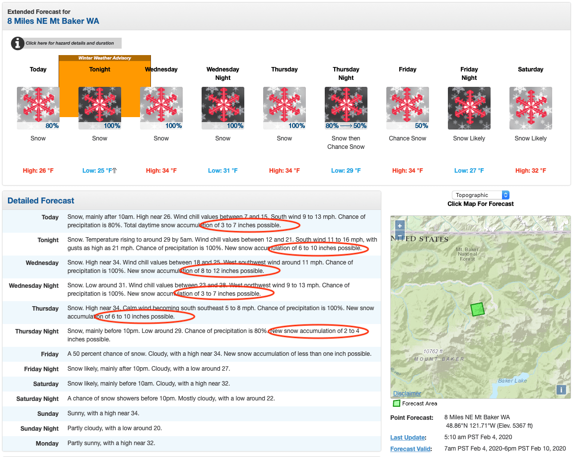
The NOAA has issued a winter weather advisory, beginning tonight and running through Wednesday morning, for the Cascade Mountains. Mount Baker Ski Area, WA could see up to 4-FEET of fresh snow, with other resorts also seeing over 2-FEET. The summit of Mount Baker mountain could see over 7-FEET of snow!
...WINTER WEATHER ADVISORY REMAINS IN EFFECT FROM 4 PM THIS
AFTERNOON TO 10 AM PST WEDNESDAY...

* WHAT...Snow expected. Total snow accumulation of 10 to 18
  inches Tuesday night and Wednesday morning.

* WHERE...Cascade mountains including the Mount Baker Ski Area,
  Stevens Pass, and Snoqualmie Pass, the Crystal Mountain Ski
  Area, and Paradise on Mount Rainier.

* WHEN...From 4 PM today to 10 AM PST Wednesday.

* IMPACTS...Travel could be very difficult Tuesday night and
  Wednesday morning before the snow level rises above the passes.

* ADDITIONAL DETAILS...The snow level will rise from below 1000
  feet Tuesday morning to around 4000 feet Wednesday morning and
  will further rise to around 5000 to 6000 feet in the central and
  southern Cascades Wednesday night and Thursday.
With temperatures dropping into the mid-20s to lower 30s precipitation could start as snow in most places with levels in the 500 to 1000 foot range. Places with a little elevation like North Bend/Snoqualmie Ridge could see a wet inch of snow before the precipitation turns over to rain. Precipitation will be light to start so will keep the start time of the winter weather advisory for the Cascades at 4 pm.
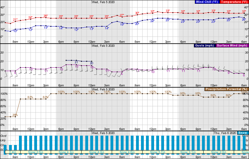
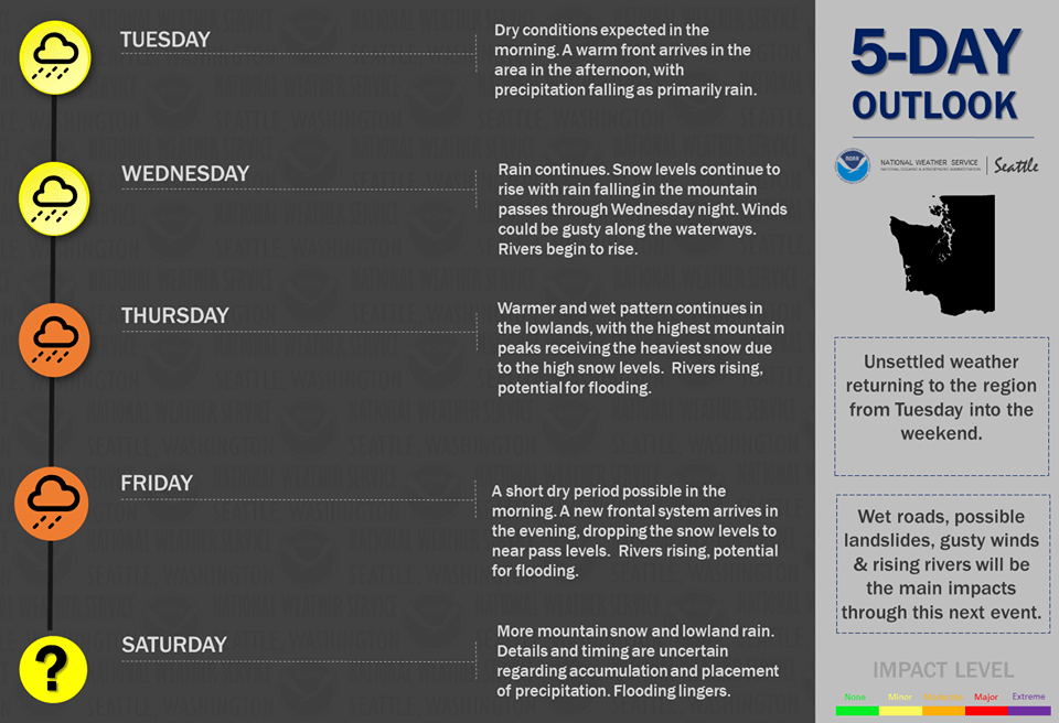
There will be a warm front stalling over western Washington tonight into Wednesday as another atmospheric river event hits western Washington. Snow levels will rise quickly tonight into Wednesday and by Wednesday afternoon will be above all of the passes. In general, expecting 10 to 18 inches in the Cascades between late this afternoon and late Wednesday morning. For the lowlands, rain continuing tonight through Wednesday.
As well as 4-feet for Mount Baker, Crystal Mountain will see over a foot, Stevens Pass and Summit at Snoqualmie Alpental almost 2-feet, and White Pass in excess of 2-feet. Wanna ski DEEP powder? A sick day Wednesday and/or Thursday might be in order…
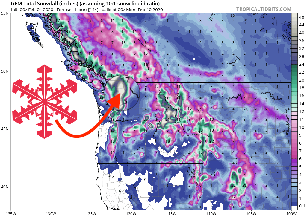
GEM Snowfall Forecast Model:
Other Info: