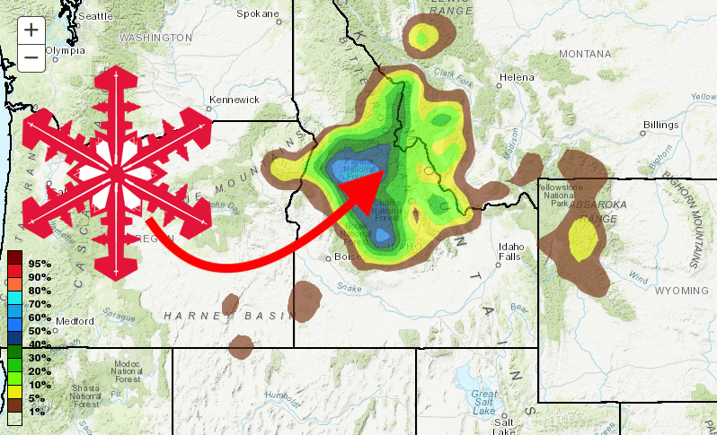
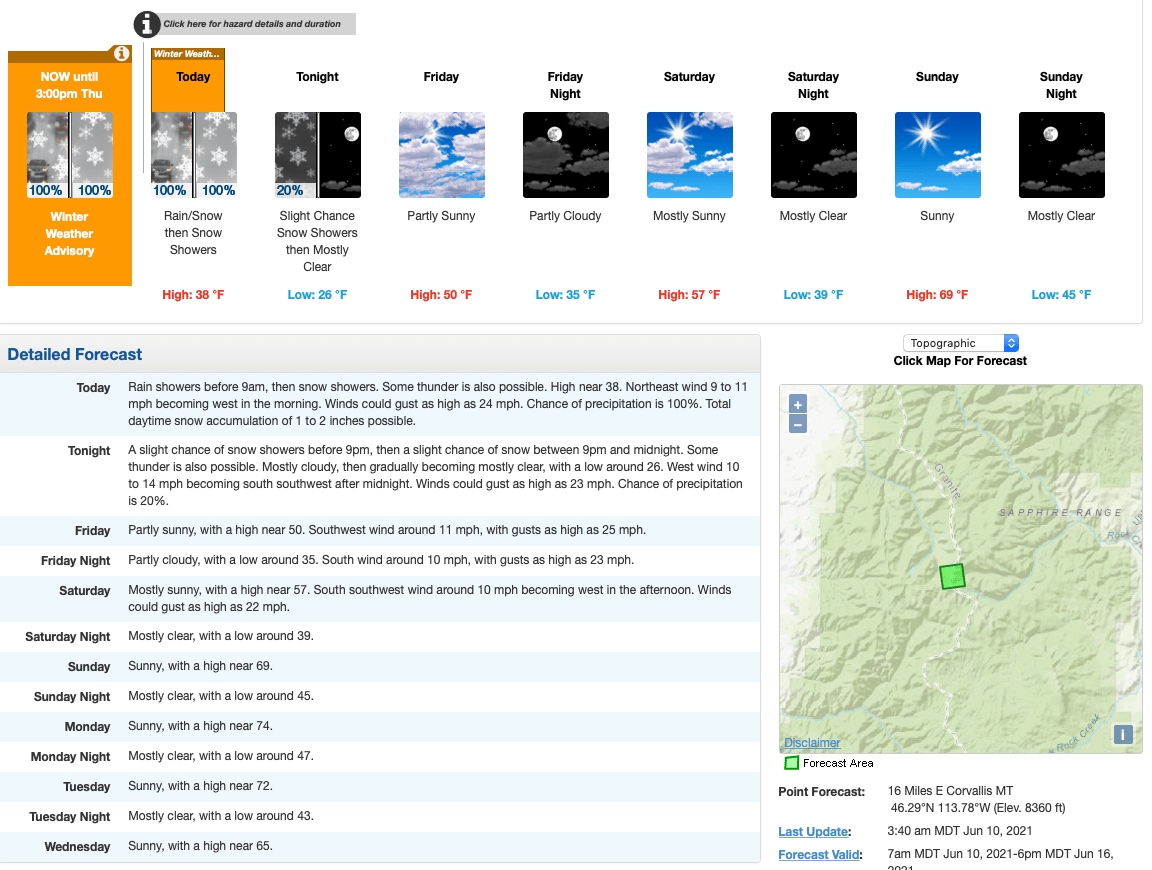
With summer officially less than two weeks away, it’s great to see old man winter still hanging in there. A winter weather advisory was issued for higher elevation areas of north central Idaho and west central Montana yesterday, with the potential of a foot of fresh snow.
* WHAT...Wet snow expected above 5000 feet. Total snow
accumulations of 1 to 5 inches.

* WHERE...Dixie, Highway 93 Sula to Lost Trail Pass, Skalkaho Pass and
Lolo Pass.

* WHEN...From 6 AM MDT /5 AM PDT/ to 3 PM MDT /2 PM PDT/
Thursday.

* IMPACTS...High elevation forest service roads could be impacted
by accumulating snowfall. Plan on wintry conditions if planning
to recreate at these elevations in the backcountry.
The NOAA discussion explains:
A trough of low pressure over the Pacific Northwest
is causing southwesterly flow over the Northern Rockies today.
This flow pattern is streaming in a significant plume of moisture
causing widespread precipitation. Snow levels appear to be
lowering to around 6000 feet over portions of north central Idaho
into northwest Montana, especially under the heavier
precipitation. The higher terrain under this band of precipitation
could experience up to a foot of new snow. While the valleys could
receive up to 1.50" of rainfall by this evening.

The trough will move over the region throughout the afternoon and
evening causing the precipitation to move off to the east. The
cold air associated with this through will settle over the region.
The sky is anticipate to start to clear Thursday night into Friday
morning allowing temperatures to drop to freezing or near freezing
for many locations throughout the Northern Rockies. People with
sensitive plants should be prepared for the possibility of frost
by Friday morning.