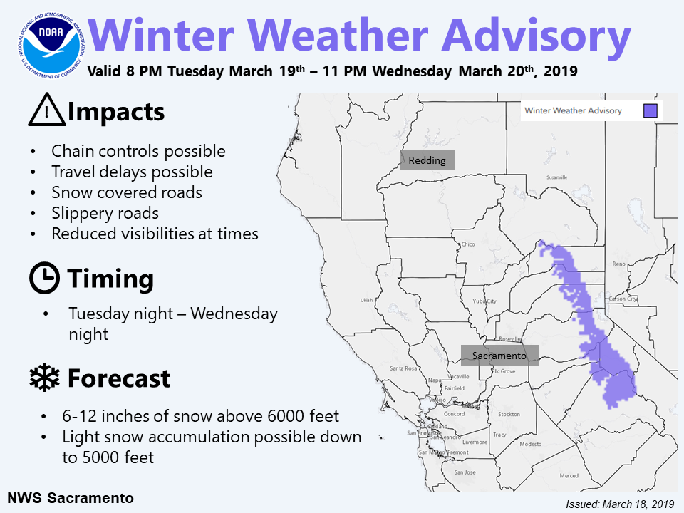
The National Weather Service has issued a Winter Weather Advisory for California.
It’s in effect from 8:00pm this evening – 11:00pm Wednesday night.
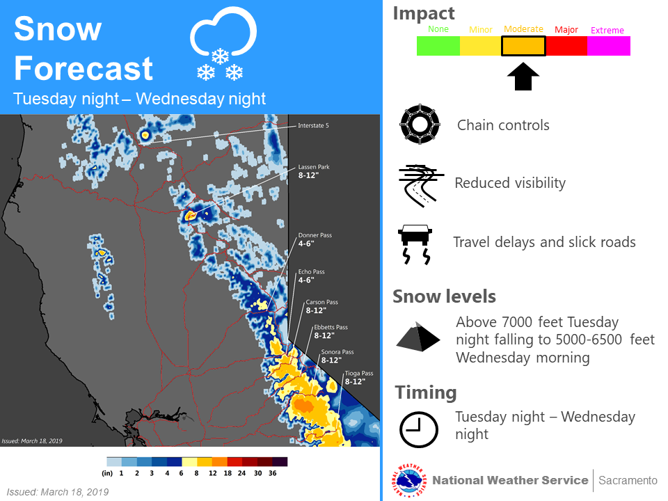
Persistent snowfall is forecasted to impact the area, which is expected to make travel difficult.
California:
- 4-8+” of Snow Tonight – Wednesday Night
“Moderate mountain snowfall is expected Tuesday night – early Thursday with heaviest snowfall south of Highway 50. Chain controls & travel delays are possible with this storm.”
– NOAA Sacramento, CA
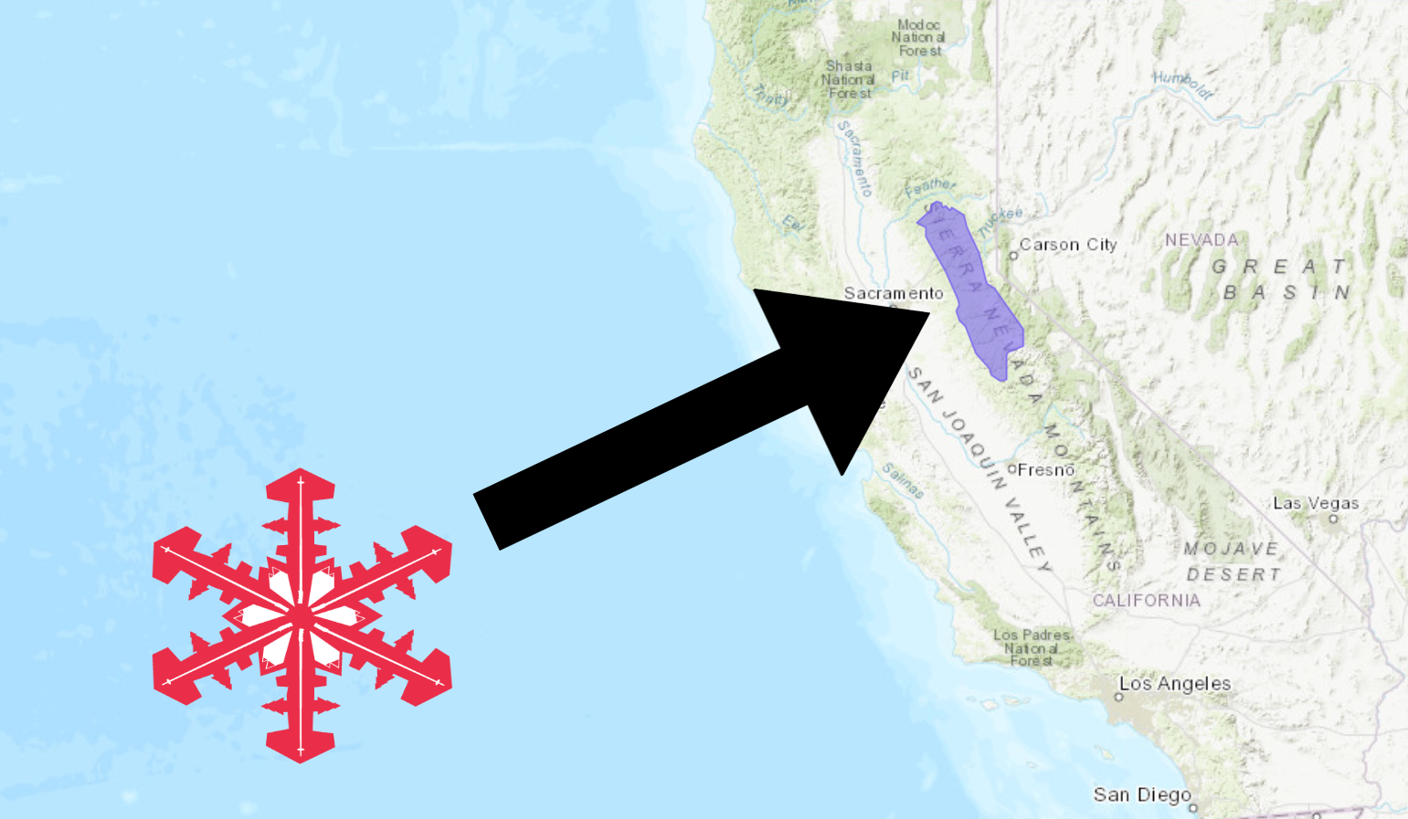
Sierra-at-Tahoe, CA is set up well for this storm, so you might want to head that way tomorrow.
Snow levels will start out around 7,000ft tonight, before dropping down to 5,000ft – 6,500ft Wednesday morning.
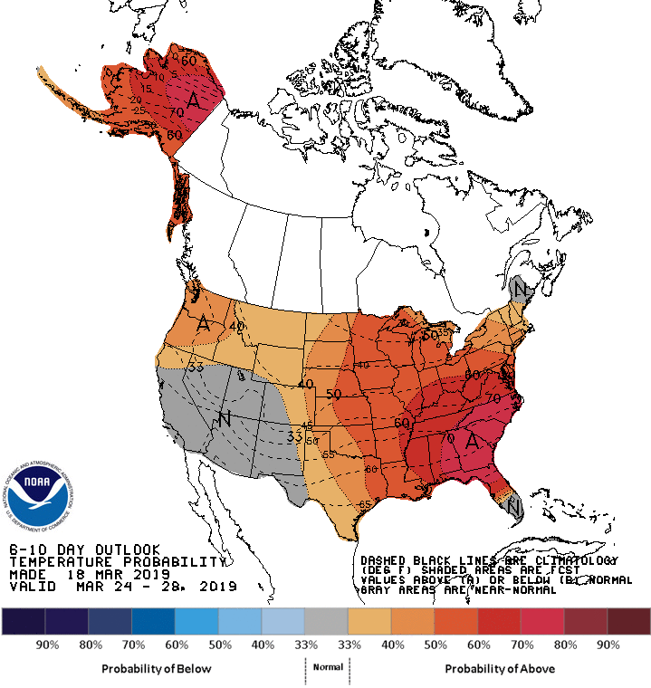
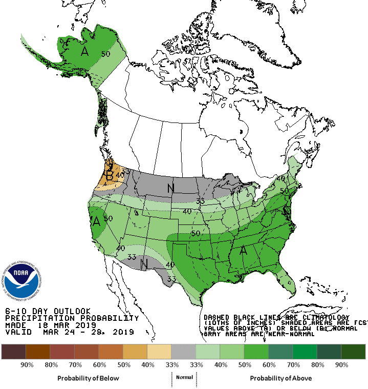
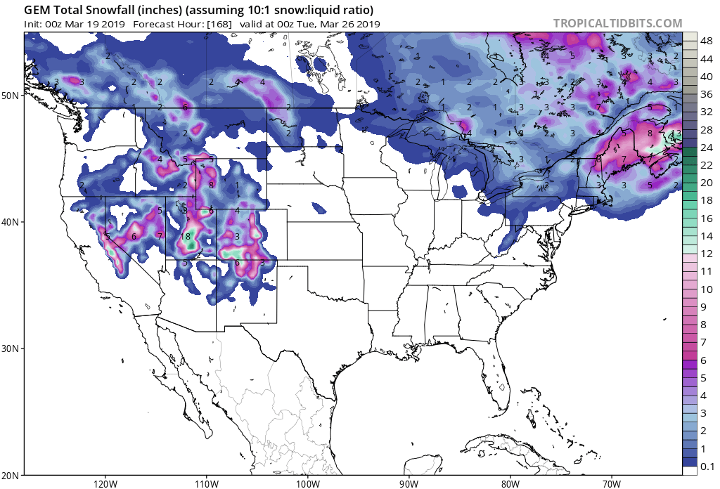
The 6-10 day outlook calls for above average precipitation and average temperatures in California.
Additional Storm Info:
California: 4-8+” of Snow Tonight – Wednesday Night
* Snow expected. Plan on difficult travel conditions. Total
  snow accumulations of 4 to 8 inches, with localized amounts
  up to 12 inches, are expected.
- NOAA Sacramento, CA
Winter Weather Advisory:
URGENT - WINTER WEATHER MESSAGE
National Weather Service Sacramento CA
300 AM PDT Tue Mar 19 2019

...Mountain Snow Tuesday Night into Wednesday Night...

.A Pacific storm will bring snow to the Sierra, impacting travel
over passes. Light to moderate snow amounts are expected, which
could bring travel delays due to slippery, snow covered roads.
Lighter snow shower activity continues into early Thursday with
little additional accumulation.

West Slope Northern Sierra Nevada-

...WINTER WEATHER ADVISORY REMAINS IN EFFECT FROM 8 PM THIS
EVENING TO 11 PM PDT WEDNESDAY ABOVE 6000 FEET...

* WHAT...Snow expected. Plan on difficult travel conditions. Total
  snow accumulations of 4 to 8 inches, with localized amounts up
  to 12 inches, are expected.

* WHERE...West Slope Northern Sierra Nevada including Donner Pass
  on Interstate 80, Echo Summit on Highway 50 and Carson Pass on
  Highway 88.

* WHEN...8 PM this evening to 11 PM Wednesday.

* ADDITIONAL DETAILS...Be prepared for reduced visibilities at
  times.