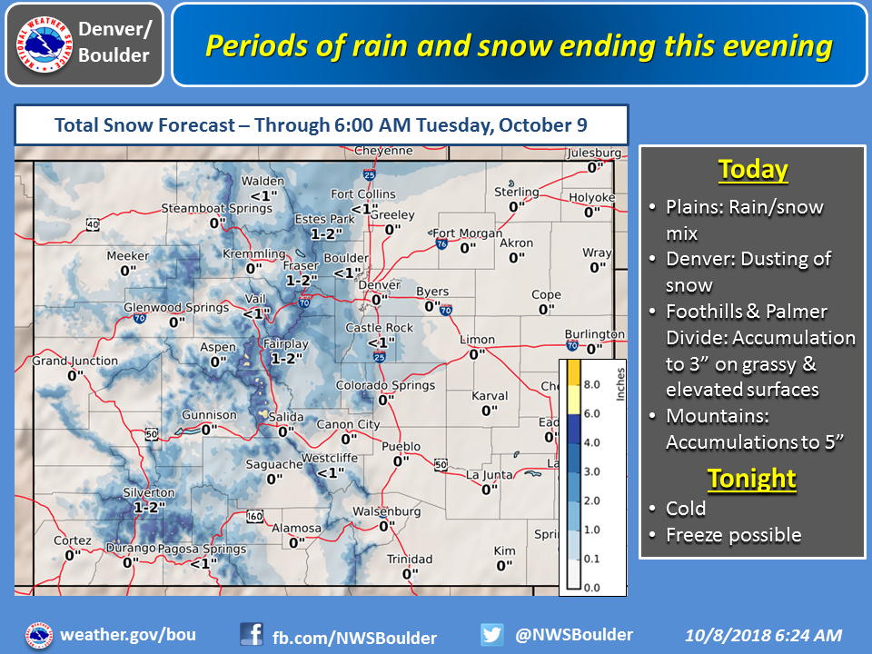
The National Weather Service has issued a Winter Weather Advisory for Colorado. It’s in effect until Tuesday Morning. Accumulating snowfall is forecasted to impact the mountains throughout this time. Travel may be difficult, so check the forecast before you travel on mountain roads.
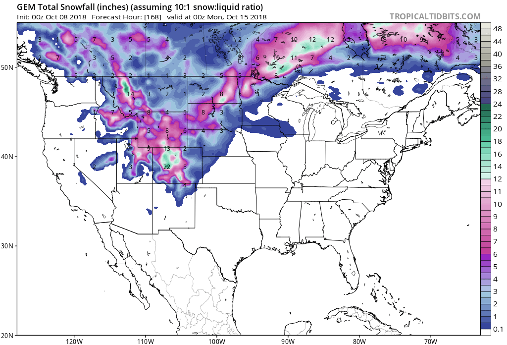
3-8+” of Snow Through Tuesday Morning In Colorado.
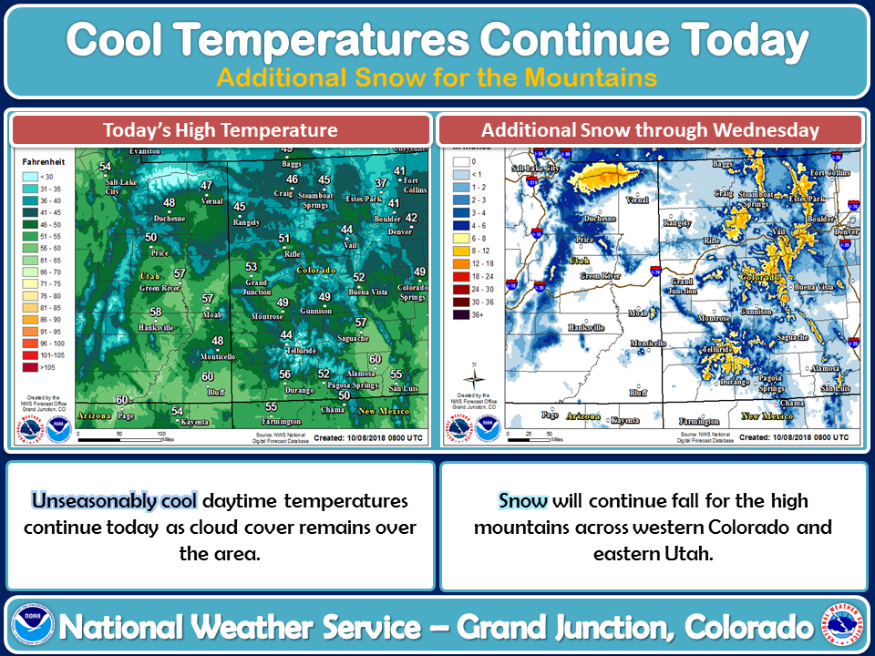
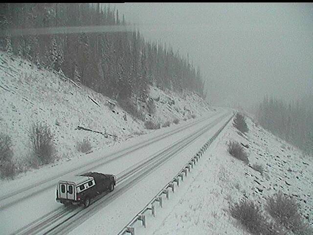
Snow levels will start out around 9,500ft, but are forecasted to drop all the way down to 8,500ft this morning.
Additional Storm Info:

Colorado: 3-8+” of Snow Through Tuesday Morning
* Total snow accumulations of 3 to 8 inches,
  with localized amounts up to 12 inches,
  are expected.
- NOAA Grand Junction, CO
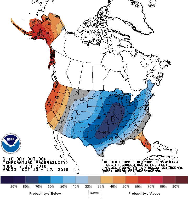
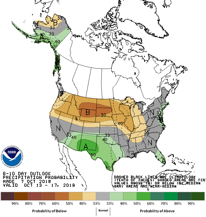
The 6-10 day outlook calls for below average temperatures and near-average precipitation in Colorado.
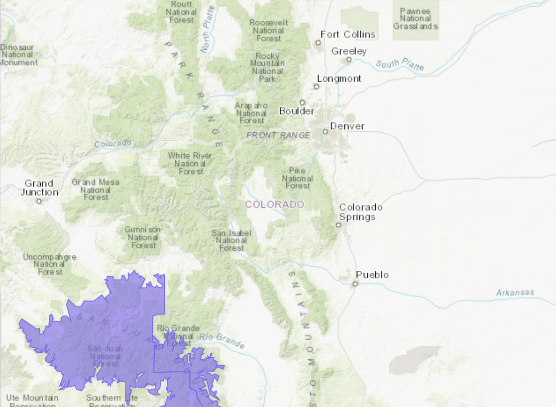
CO Winter Weather Advisory:
URGENT - WINTER WEATHER MESSAGE
National Weather Service Grand Junction CO
413 AM MDT Mon Oct 8 2018

Northwest San Juan Mountains-Southwest San Juan Mountains-
Including the cities of Telluride, Silverton, and Rico

...WINTER WEATHER ADVISORY REMAINS IN EFFECT UNTIL 9 AM MDT
TUESDAY ABOVE 9500 FEET...

* WHAT...Occasional snow showers. Total snow accumulations of 3
  to 8 inches, with localized amounts up to 12 inches, are
  expected.

* WHERE...Northwest San Juan Mountains and Southwest San Juan
  Mountains, including Lizard Head, Red Mountain, Coal Bank,
  Molas, and Slumgullion Passes.

* WHEN...Until 9 AM MDT Tuesday.

* ADDITIONAL DETAILS...Plan on slippery road conditions and
  reduced visibilities at times as rounds of show showers and
  isolated embedded thunderstorms move across the area. Snow
  levels will drop to around 8500 feet by morning.